v4 a2 II
2h35
1h
1h30
5min
880m
605m
275m
40m
8
1400m
on Foot
Rating:
★★★★★
2.8 (6)
Info:
★★★
2.7 (3)
Belay:
★★★
1.8 (4)
Summary:
machine translated
➜
Original language
Kurze, offene und der Sonne zugewandte Schlucht
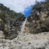
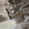
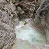
Short canyon open and facing the sun
Summary:
machine translated
➜
Original language
Kurze, offene und der Sonne zugewandte Schlucht
Short canyon open and facing the sun
Access:
machine translated
➜
Original language
Die italienische Autobahn bei Pontebba verlassen, nach der Mautstation die SS13 queren und man befindet sich nach ca. einem Kilometer Fahrt im Talort San Leopoldo.Dort findet man am Nordufer der Fella, am östlichen Ende des Dorfes einen Schotterparkplatz direkt unter der Autobahn.
Leave the Italian freeway at Pontebba, cross the SS13 after the toll station and after about a kilometer of driving you will find yourself in the valley town of San Leopoldo.\nThere you will find a gravel parking place directly under the freeway on the north bank of the Fella, at the eastern exit of the village.
Approach (1 h):
machine translated
➜
Original language
Unter der Autobahn hindurch auf den Damm des Radweges. Auf der orographisch linken Seite des Canyons beginnt direkt ab dem Radweg ein Pfad über den Gittern der Hangsicherung. Bei der Abzweigung nach etwa 40hm rechts halten. Sollte man diesen nicht finden, so versucht man "querfeldein" auf der Lichtung der alten Seilbahntrasse an Höhe zu gewinnen. Spätestens am Grat des bezwungenen Hügels findet man alte Schützengräben von denen ein erkennbarer Weg nach Nordwest verlaufend wieder in die Schlucht hinabführt. Historischer Hintergrund: dieses Gebiet war bis 2003 militärisches Sperrgebiet der Nato. Vom Zustiegsweg aus kann man die Bergstation der Seilbahn gut erkennen.
Pass under the highway onto the embankment of the bike path. On the orographic left side of the canyon begins directly from the bike path a path over the grids of the slope protection. At the fork, after about 40hm, keep to the right. If you don't find it, try to gain altitude "cross-country" on the clearing of the old cable car route. At the latest at the ridge of the conquered hill you will find old trenches from which a recognizable path to the northwest leads back down into the canyon.\nYou could also ascend orographically to the right via the hiking trail shown in red on the Tabacco map and walk the drilled right side arm.\nHowever, the access is extended by at least another hour, you would have to do without 2 beautiful, high rappels and find a mostly dry streambed. For canyoning, the tour described here is much more rewarding.\nHistorical background: this area was a restricted NATO military area until 2003. From the access path you can easily see the mountain station of the cable car.
Tour (1 h 30):
machine translated
➜
Original language
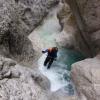
Die Tour beginnt mit einem 40m Abseiler, im Anschluss wechseln sich weitere 7 Abseilstellen < 25m ab. Sprünge und Rutschen gibt es kaum und auch Schwimmstrecken sucht man hier vergebens. Auf Grund der südlichen Ausrichtung und der Offenheit kann diese Schlucht sicher schon früh im Jahr begangen werden.
The tour starts with a 40m rappel, followed by 7 more rappels < 25m.\nThere are hardly any jumps and slides and also swimming sections are not to be found here.\nBecause of the southern orientation and the openness, this canyon can be safely visited early in the year.
Return (5 min):
machine translated
➜
Original language
Am Ende der Tour ist man wieder unter der Autobahn angekommen und es sind keine 5 min zum abgestellten PKW zurück.
At the exit of the tour you are back under the highway and it is not 5 min back to the parked car.
Coordinates:
Canyon Start
Parking Entry and Exit
Canyon End
Literatures:
Map
Tabacco Nr. 18; Alpi Carniche Orientali - Canal del Ferro; 1/25 000
Map
IGMI 25/V, 14 Malborghetto I-SE, 1:25 000
Cwiki Canyon Info
Descente Canyon Info
Ropewiki Canyon Info
15.12.2024
Horst Lambauer
⭐
★★★★★
📖
★★★
⚓
★★★
💧
Normal
Completed ✔
machine translated
➜
Original language
Schöner offener Canyon, ideal in der Übergangszeit oder nach regenfällen. Haben das seil beim 3. Abseiler erneuert. Alle Stände ok
Beautiful open canyon, ideal in the transition period or after rainfall. We renewed the rope on the 3rd rappel. All stands ok
09.06.2024
Friedl Martin
⭐
★★★★★
📖
★★★
⚓
★★★
💧
Normal
Completed ✔
machine translated
➜
Original language
Other users were: Friedrich Mathi
Das erste mal in dieser Schlucht und ich muss sagen sie hat mir als kurze Tour recht gut gefallen. Viele kleine Becken wären mit Sprüngen möglich gewesen, teilweise trügt der helle Schotter mit der Wassertiefe etwas. Wir sind auf Nummer Sicher runter und haben uns nur abgeseilt. Wie gesagt der 3. Stand würde eine neue Lasche vertragen.
First time in this canyon and I have to say I quite liked it as a short tour. Many small pools would have been possible with jumps, sometimes the light gravel with the water depth is a bit deceptive. We played it safe and just rappelled down. As I said, the 3rd belay could do with a new one.
Other users were: Friedrich Mathi
18.05.2024
Wolfgang
⭐
★★★★★
📖
★★★
⚓
★★★
💧
Normal
Completed ✔
machine translated
➜
Original language
Other users were: Martina Brunner
Zum Dritten mal hier. Ich finde die Tour ideal an einem sonnigen Frühjahrestag (oder nach viel Regen).Zustieg ist nicht so das Thema; irgendwie/wo treffen sich alle Pfade immer wieder > einfach in Richtung oben ;-)
Stände soweit alle OK; den dritten Stand (ca.25M) könnte man mal erneuern falls wer eine Bohrmaschine mit hat (4 Haken , einer wackelt, alle mit alten Bändern verbunden).
Heute sogar 2-3 Sprünge möglich
Here for the third time. I find the tour ideal on a sunny spring day (or after a lot of rain); access is not such an issue; somehow/where all paths meet again and again > just head upwards ;-)
Stands so far all OK; the third stand (about 25M) could be renewed if someone has a drill with him (4 anchors, one wobbles, all connected with old tapes).
Today even 2-3 jumps possible
Other users were: Martina Brunner
01.04.2023
Horst Lambauer
⭐
★★★★★
📖
★★★
⚓
★★★
💧
Normal
Completed ✔
machine translated
➜
Original language
Tour am 1.4.2023 begangen. Sehr schön vor allem im Frühjahr. Südausrichtung. Höchster Abseiler 35m. Stände soweit in Ordnung
Tour committed on 1.4.2023. Very beautiful especially in spring. South orientation. Highest rappel 35m. Stands so far in order
09.03.2023
System User
⭐
★★★★★
📖
★★★
⚓
★★★
no translation available
Info: Teile der Canyonbeschreibung wurden automatisiert übernommen. Konkret die Felder Weblinks, Koordinaten, Rating, Länge des Canyon, Einfachseil Mindestens von https://www.descente-canyon.com/canyoning/canyon/23812
09.03.2023
System User
⭐
★★★★★
📖
★★★
⚓
★★★
no translation available
Daten importiert von https://canyon.carto.net/cwiki/bin/view/Canyons/ScinauzCanyon.html
Hydrology:
