Country:
Italia / Italy
Region: Friuli Venezia Giulia
Subregion: ente di decentramento regionale di Udine
Town: Venzone
v4 a3 III
1h35
15min
1h15
5min
605m
460m
145m
35m
2x60
6
on Foot
Rating:
★★★★★
4 (1)
Info:
★★★
0 ()
Belay:
★★★
2 (1)
Summary:
machine translated
➜
Original language
Oberer offener Teil des bekannten Rio Lavarie
Upper open part of the famous Rio Lavarie
Parts
Name
Difficulty
Approach
Tour
Return
Summary:
machine translated
➜
Original language
Oberer offener Teil des bekannten Rio Lavarie
Upper open part of the famous Rio Lavarie
Access:
machine translated
➜
Original language
Zufahrt wie Lavarie inferior aber bereits in Tugliezzo parken (große Freifläche)
Access as Lavarie inferior but already park in Tugliezzo (large open space)
Approach (15 min):
machine translated
➜
Original language
Nach ein paar Metern bergab zweigt rechts Wanderweg ab (anfangs asphaltiert).Diesem folgen bis man nach ca 10min links den Weg zum Rio Lavarie folgt.
Weg ist auf OSM gut eingezeichnet.
After a few meters downhill, a hiking trail branches off to the right (initially asphalted), which you follow until after about 10 minutes you turn left onto the path to Rio Lavarie.
The path is well marked on OSM.
Tour (1 h 15):
machine translated
➜
Original language
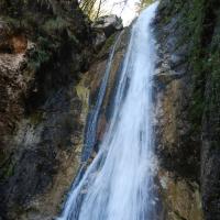
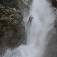
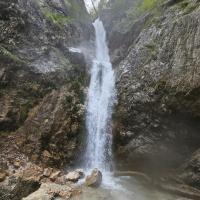
Es folgen 6 Abseilstellen in einer offenen Umgebung (der höchste ist geteilt)
Mittlerweile sind alle höheren Abseiler mit 2 Haken versehen. Die Tour beginnt mit C20 & C 10 rechts ; nach einigen kleineren Stellen kommen wir zum großen Abburch. Eigentlich ein C55 der ca 35m / 20m aufgeteilt ist (beide Stände links) ; wobei beim Umhängeplatz max. Platz für 2 Personen ist.
Die nächste Kante rechts umgehen. Danach entweder rechts zur Straße aufsteigen und dann den gewöhnten Zustiegsweg für den unteren Teil nehmen ; oder dem Bachbett folgen.
This is followed by 6 abseils in an open area (the highest is split)
By now all higher rappels are equipped with 2 anchors. The tour starts with C20 & C10 on the right; after a few smaller sections we come to the big abseil. This is actually a C55 which is split approx. 35m / 20m (both belays on the left); there is room for a maximum of 2 people at the hanging place.
Bypass the next edge on the right. Then either climb up to the right to the road and then take the usual access path for the lower part; or follow the streambed.
Return (5 min):
machine translated
➜
Original language
Weiter zum Inferior Teil (oder die Straße rauf zum Auto)
Continue to the Inferior part (or up the road to the car)
Coordinates:
Parking at Entry
Parking at Exit
Canyon Start
Canyon End
Waypoint
Hier von der Straße zum Wanderweg abzweigen
06.10.2024
Wolfgang
⭐
★★★★★
📖
★★★
⚓
★★★
💧
High
Completed ✔
machine translated
➜
Original language
Other users were: Horst Lambauer
Zum erstenmal auch den oberen Teil begangen und sicher nicht zum letzten mal.
Wir haben bei den alten Einzelhaken immer einen zweiten dazugebohrt. Den Zwischenstand beim c55 könnten man bei Niedrigwasser mal verbessern.
Wir hatten hohen Wasserstand und da war es echt lohnend die 15min raufzugehen.
This is the first time we have climbed the upper part and certainly not the last.
We always added a second bolt to the old single hooks. The intermediate level at c55 could be improved at low water.
We had a high water level and it was really worthwhile to walk up the 15 minutes.
Other users were: Horst Lambauer
Hydrology:

