v5 a3 IV
3h50
40min
3h
10min
790m
590m
200m
170m
2x 70m
7
zu Fuß
Bewertung:
★★★★★
3 (1)
Beschreibung:
★★★
1 (2)
Verankerung:
★★★
2 (1)
Charakteristik:
Hoher Wasserfall zum Abseilen
Charakteristik:
Hoher Wasserfall zum Abseilen
Anfahrt:
Zustieg (40 min):
Tour (3 h):
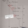
Drei kleine Abseiler, dann ein c31, danach c170 geteilt in 3 Teile max 65m.
Setzzeug mitnehmen.
Rückweg (10 min):
Koordinaten:
Parkplatz Zustieg und Ausstieg
46.98407°, 8.72394°
↓↑
DMS: 46° 59" 2.65', 8° 43" 26.18'
DM: 46° 59.044", 8° 43.436"
Google Maps
SwissTopo
DMS: 46° 59" 2.65', 8° 43" 26.18'
DM: 46° 59.044", 8° 43.436"
Google Maps
SwissTopo
Canyon Ende
46.9865°, 8.72037°
↓↑
DMS: 46° 59" 11.4', 8° 43" 13.33'
DM: 46° 59.19", 8° 43.222"
Google Maps
SwissTopo
DMS: 46° 59" 11.4', 8° 43" 13.33'
DM: 46° 59.19", 8° 43.222"
Google Maps
SwissTopo
Canyon Start
46.98758°, 8.72137°
↓↑
DMS: 46° 59" 15.29', 8° 43" 16.93'
DM: 46° 59.255", 8° 43.282"
Google Maps
SwissTopo
DMS: 46° 59" 15.29', 8° 43" 16.93'
DM: 46° 59.255", 8° 43.282"
Google Maps
SwissTopo
Literatur:
Canyoning Buch
Swiss Alps - Canyoning - Alpes Suisses
Emmanuel Belut / Laurence Boyé / Thomas Guigon
Association Openbach
2015
9782746679450
13.04.2024
Alex Arnold
⭐
★★★★★
📖
★★★
⚓
★★★
💧
Normal
Begangen ✔
Many anchors and possible ways in the wall. We added one redundant anchor on a nose in the middle of the wall because it seems to be the logical way.
28.09.2023
Daniel Sturm
⭐
★★★★★
📖
★★★
⚓
★★★
Basisdaten übernommen mit freundlicher Genehmigung durch Matthias Holzinger aus "Swiss Alps Canyoning VOL. 1.0"
Hydrologie:
