v5 a5 III
5h20
5min
5h
15min
910m
450m
460m
30m
Auto benötigt
Bewertung:
★★★★★
3.6 (2)
Beschreibung:
★★★
1 (1)
Verankerung:
★★★
3 (1)
Charakteristik:
Bachwanderung mit einer "kernigen" Engstelle
Abschnitte
Name
Schwierigkeit
Zustieg
Tour
Rückweg
Charakteristik:
Bachwanderung mit einer "kernigen" Engstelle
Anfahrt:
siehe Google-Luftbild in "Fotogalerie", ebenso zur Umsetzung (dazu auch https://www.wikiloc.com/canyoneering-trails/barranco-del-rio-poio-en-vila-real-portugal-2873695 )
Zustieg (5 min):
Von P1 direkt hinunter in die Bachsohle unterhalb der Wasserableitung. Zum "Schnelleinstieg" E2 siehe Google-Luftbild in "Fotogalerie".
Tour (5 h):
Siehe topo-Zeichnung, Fotos und Videos; Schlüsselpassage ist die Engstelle
Rückweg (15 min):
Noch vor Ende des Taleinschnitts links hinauf zur Straße und zu P2
Koordinaten:
Canyon Start
Parkplatz Ausstieg
P2 für Ausstieg
Parkplatz Zustieg
P1 für Zustieg
Canyon Ende
Literatur:
Karte
CIGEOE M888 87, Vilar de Ferreiros (Mondim de Basto), 1/25000
Canyoning Buch
Le tour de l´Europe en Canyon. Les plus belles descentes
Stéphane Coté / Caracal et les Sancho Panza
2007
124 Canyon-Beschreibungen
Cwiki Canyon Info
Descente Canyon Info
Ropewiki Canyon Info
Unbekannt
Andere Canyon Info
22.08.2024
Marosffy Dániel
⭐
★★★★★
📖
★★★
⚓
★★★
💧
Niedrig
Begangen ✔
maschinell übersetzt
➜
Originalsprache
The entire canyon was done comfortably in 8 hours, including 40 minutes walk back to the car (along the pipe, one person only without pack). However, we saw hardly any option the quit in the middle. There might have been a path, but concerning the height of the valley, and the amount of bushes, I would not count on that, so all or nothing.
The other problem: the climb up from the big pool. This we estimated cca 15m, there was a just enough length of fixed rope, but if the water level was 1 meter lower, we'd probably still be floating there... Take it seriously, there's no dry spot to escape to, absolutely out of question the climb out anywhere else, and no signal either. If got stuck, your only hope is someone waiting for the group outside.
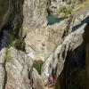
Picture 1: The climb seen in the distance. It's more scary from here than at the bottom.
Picture 2: Back from the top. No dry land down there.
Otherwise amusing, not counted the long walking sections.
Die gesamte Schlucht wurde bequem in 8 Stunden, einschließlich 40 Minuten zu Fuß zurück zum Auto (entlang der Röhre, nur eine Person ohne Rucksack). Allerdings sahen wir kaum eine Option die Beendigung in der Mitte. Es könnte ein Weg gewesen sein, aber in Bezug auf die Höhe des Tals, und die Menge der Büsche, würde ich nicht auf das zählen, so alles oder nichts.
Das andere Problem: der Aufstieg vom großen Pool. Das haben wir auf ca. 15m geschätzt, das Fixseil war gerade lang genug, aber wenn der Wasserstand 1 Meter niedriger wäre, würden wir wahrscheinlich immer noch dort schwimmen... Nehmt es ernst, es gibt keine trockene Stelle, zu der man flüchten könnte, es ist völlig ausgeschlossen, irgendwo anders herauszuklettern, und es gibt auch kein Signal. Wenn du feststeckst, ist deine einzige Hoffnung, dass draußen jemand auf die Gruppe wartet.
Bild 1: Der Klettersteig in der Ferne gesehen. Von hier aus ist es noch unheimlicher als unten.
Bild 2: Zurück vom Gipfel. Dort unten gibt es kein trockenes Land.
Ansonsten amüsant, die langen Wanderabschnitte nicht mitgezählt.
09.03.2023
System User
⭐
★★★★★
📖
★★★
⚓
★★★
Daten importiert von https://canyon.carto.net/cwiki/bin/view/Canyons/PoioCanyon.html
Hydrologie:

