v3 a2 IV
4h55
45min
4h
10min
800m
605m
195m
12m
1x30m
10
3100m
Rating:
★★★★★
3.5 (3)
Info:
★★★
2.5 (2)
Belay:
★★★
3 (1)
Summary:
machine translated
➜
Original language
Langer, komplexer und abwechslungsreicher Wander- und Abseilcanyon.
Long, complex and varied hike and rappel canyon.
South
Summary:
machine translated
➜
Original language
Langer, komplexer und abwechslungsreicher Wander- und Abseilcanyon.
Long, complex and varied hike and rappel canyon.
Access:
machine translated
➜
Original language
Von Barbastro in Richtung Alquézar. Nach etwa 20 km auf der neu ausgebauten A 1232 bei der Verzweigung vor der Brücke des Rio Vero (rechterhand alte Bogenbrücke - jenseits der Brücke Camping Rio Vero) rechts ab und auf der A 2205 über Colungo weiter in Richtung Arcusa, Ainsa. Die Straße windet sich nun kurvenreich nordwärts. Man überquert den Bco Palomeras Fornocal (8,1 km ab Rio Vero - Brücke) und erreicht einige hundert Meter weiter die Puente de las Gargantas über den Rio Fornocal. Hier können wir vor der Brücke links unser erstes Auto abstellen.
Mit dem Zweiten geht es in vielen Kurven weiter. Nach 15,7 km (ab Rio Vero) erreichen wir die Stelle, wo rechts eine Forststraße abzweigt. Am Beginn der Forststraße können wir unser zweites Auto abstellen.
* http://www.wikiloc.com/wikiloc/view.do?id=4917385
From Barbastro in the direction of Alquézar. After about 20 km on the newly expanded A 1232 at the junction before the bridge of the Rio Vero (righthand side old arch bridge - beyond the bridge Camping Rio Vero) turn right and continue on the A 2205 via Colungo in the direction of Arcusa, Ainsa. The road now winds curvaceously northward. You cross the Bco Palomeras Fornocal (8.1 km from Rio Vero - bridge) and a few hundred meters further you reach the Puente de las Gargantas over the Rio Fornocal. Here we can park our first car on the left before the bridge.\n\nWith the second one we continue in many bends... After 15.7 km (from Rio Vero) we reach the place where a dirt road branches off to the right. At the beginning of the track we can park our second car.\n\n * http://www.wikiloc.com/wikiloc/view.do?id=4917385
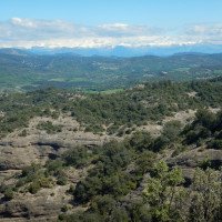
Approach (45 min):
machine translated
➜
Original language
Wir gehen die Forststraße aufwärts, nach 900 m mündet von rechts eine weitere Piste ein. 600 m weiter ignorieren wir eine hier halblinks abgehende Forststraße. Unsere Forststraße beschreibt nun einen langgezogenen Rechtsbogen. Noch einmal etwa 900 m weiter macht die hier abfallende Forststraße eine scharfe Linkskurve (in rechtem Winkel).
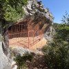
Hier kann von der Piste aus in südlicher Richtung in oder neben einem kleinen Bachbett (trocken - bei Salamero, Kartenskizze S. 290 als "torrentera" bezeichnet) auf kurzem Wege in den Fornocal genau dort zusteigen, wo er aus einer Ost-West-Richtung in rechtem Winkel nach Süden knickt, vgl.: * http://www.wikiloc.com/wikiloc/view.do?id=2807615 . Man folgt den Steig bis zu einem trockenen Bachbett, wo der deutliche Steig nach rechts aufwärts zu der Cueva de Muriecho einer Höhlenniese mit Felszeichnungen führt (lohender 5min-Abstecher). Weiterer Abstieg auf Steigspuren durchs teilweise dornige Trockenbett bis man mit drei Abseilstellen (10m, 5m, 8m) den Fornocal erreicht.
Um zum üblichen Zustieg zu kommen, gehen wir die Piste weiter und kommen nach wiederum etwa 250 m an ein unscheinbares Trocken-Bachbett, dem wir bis zum Bachbett des Fornocal folgen, vgl.: * http://www.wikiloc.com/wikiloc/view.do?id=130094
We go up the slope, after 900 m another slope joins from the right. 600 m further on, we ignore a track that leaves here half-left. Our track now describes a long right curve. Again, about 900 m further on, the here descending slope makes a sharp left turn (at a right angle).\n\nYou can join the Fornocal from the slope in a southerly direction in or next to a small streambed (dry - called "torrentera" in Salamero, map sketch p. 290) on a short way exactly where it bends from an east-west direction at a right angle to the south, cf.:\n * http://www.wikiloc.com/wikiloc/view.do?id=2807615\n\nTo get to the usual access, we continue along the slope and after again about 250 m we come to an inconspicuous dry streambed, which we follow to the streambed of the Fornocal, cf.:\n * http://www.wikiloc.com/wikiloc/view.do?id=130094
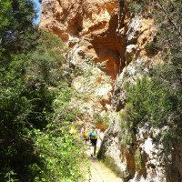
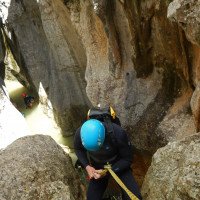
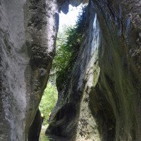
Tour (4 h):
machine translated
➜
Original language
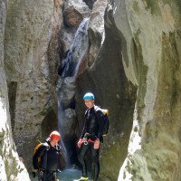
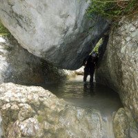
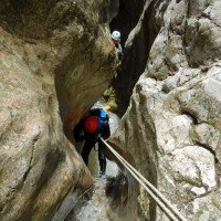
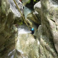
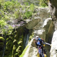
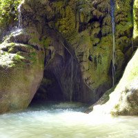
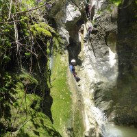
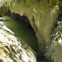
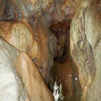
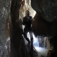
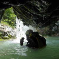
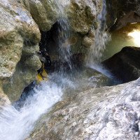
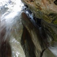
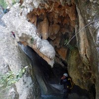
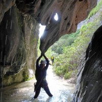
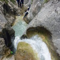
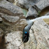
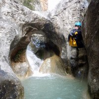
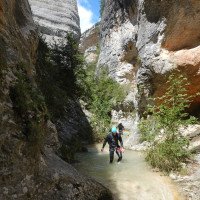
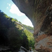
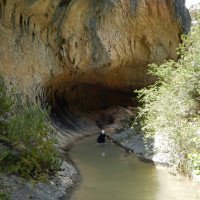
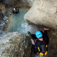
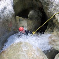
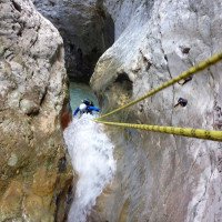
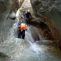
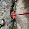
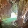
Zuerst geht es geraume Zeit im weitgehend ebenen Bachbett dahin, bis wir zum ersten Abseiler unter dem großen Felsblock kommen. Ab hier starten wir eine abwechslungsreiche Tour mit Engstellen, Klemmblöcken, kleinen Abseilern, einer Grotte, einer Quelle, Sinterüberhängen, einem Naturbogen, um nur einige der interessanten Momente aufzulisten. Gegen Ende erwarten uns dann auch längere Laufstrecken, bis hoch über uns der Brückenbogen sichtbar wird.
First we walk along the mostly flat streambed for quite some time until we reach the first rappel under the big boulder. From here we start a varied tour with narrows, clamping blocks, small rappel, a grotto, a spring, sinter overhangs, a natural arch, to list just a few of the interesting moments. Towards the exit, longer runs await us, until high above and the bridge arch we visible.\n
Return (10 min):
machine translated
➜
Original language
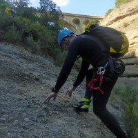
50 m nach der Brücke klimmen wir den Spuren folgend rechts hinauf zur Brücke und zum Auto.
50 m after the bridge we climb following the tracks on the right up to the bridge and the car.
Coordinates:
Canyon Start
Canyon End
Parking at Exit
Parking at Entry
Alternative Canyon Start
Literatures:
Map
Map
1:50000
Map
Canyoning Book
Roger Büdeler / Gabriele Flitner
Rother
1997
3-7633-3014-3
88 Abstiege in den Pyrenäen und der Sierra de Guara
Canyoning Book
Canyoning Book
John Bull
2008
Canyoning Book
Patrick Gimat
Eigenverlag
2005
2-9524376-0-2
120 Beschreibungen von Canyons und Wanderungen
Canyoning Book
Enrique Salamero
2009
Canyoning Book
Eduardo Gómez - Laura Tejero
Barrabes
2002
84-95744-21-X
Umfassende Beschreibung der Canyons im Gebiet
Canyoning Book
Eduardo Gomez
Barrabes
2001
Map
José Luis Añaños
Pirineo
1988
978-84-87997-49-5
30 Abstiege in einer Karte
Canyoning Book
Canyoning Book
Patrick Gimat / Jean Paul Pontroué
Edisud
1995
2-85744-812-0
Abstiege mit Topo-Zeichnung
Canyoning Book
Alfons Zaunhuber
Berg im Südwest Verlag
1994
978-3763411078
Canyoning Book
Canyoning Book
Fernando Biarge / Enrique Salamero
1992
978-2905521514
Canyoning Book
Jean Paul Pontroué
Foehn Editions
1992
978-2909694009
Canyoning Book
Fernando Biarge / Enrique Salamero
Eigenverlag
1991
84-404-8831-9
61 Abstiege in der Provinz Huesca (Aragon)
Canyoning Book
J.P. Pontroué - F. Biarge
1987
2-95033199-1-2
Sierra de Guara + Massiv Mont Perdu (vorwiegend historisches Interesse) (2.A.)
Canyoning Book
Canyoning Book
Jean-Paul Pontroué
1985
Canyoning Book
Canyoning Book
Canyoning Book
Canyoning Book
Cwiki Canyon Info
Descente Canyon Info
Ropewiki Canyon Info
Ropewiki Canyon Info
Gallery
Gallery
Gallery
Video
Other Canyon Info
Other Canyon Info
Trip Report (e.g. Blogpost)
Other Canyon Info
19.03.2024
Rok
⭐
★★★★★
📖
★★★
⚓
★★★
💧
Normal
Completed ✔
machine translated
➜
Original language
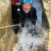
Absolut genialer Canyon, wenn er Wasser hat. Zurzeit wird er schön gespült. Wir haben den alternativen Zustieg mit Höhlenmalereibesichtigung gewählt. Hat uns sehr gut gefallen, da er gut Wasser hat. Stände sind ok. Teilweise sehr eng eingeschnitten.
Absolutely brilliant canyon when it has water. It is currently being flushed. We chose the alternative access with cave painting tour. We liked it very much as it has good water. The stands are ok. Very narrow in places.
09.03.2023
System User
⭐
★★★★★
📖
★★★
⚓
★★★
no translation available
Daten importiert von https://canyon.carto.net/cwiki/bin/view/Canyons/FornocalCanyon.html
28.04.2019
Christian Balla
⭐
★★★★★
📖
★★★
⚓
★★★
💧
Low
Completed ✔
machine translated
➜
Original language
Beeindruckender, Abwechslungsreicher Canyon
Fotos:
https://www.christian-balla.de/Fornocal
Video:
https://www.youtube.com/watch?v=pflDTgP_vHc
Impressive, varied canyon
Photos:
https://www.christian-balla.de/Fornocal
Video:
https://www.youtube.com/watch?v=pflDTgP_vHc
New Report
Please briefly and concisely the most important information of the last tour or important current information about the canyon. If necessary with links to videos, photos, etc..
*
*
*
Esc
Del
Hydrology: