Country:
Bolivia
Region: La Paz
Subregion: Provincia de Nor Yungas
Town: Municipio de Coroico / Municipio Coroico
v3 a3 III
3h20
45min
2h30
5min
1280m
1130m
150m
20m
1x25m+1x20m
15
750m
Car required
Rating:
★★★★★
0 ()
Info:
★★★
0 ()
Belay:
★★★
0 ()
Summary:
machine translated
➜
Original language
Enge und ästhetische Schlucht. Teilweise fast Oscuros-Charakter. Sprung- und Rutschmöglichkeiten. Gewisse technische Anforderungen.
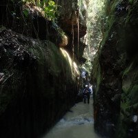
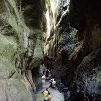
Narrow and aesthetic canyon. Almost Oscuros-like in places. Jumps and slides. Certain technical requirements.
Northeast
Slate
Summary:
machine translated
➜
Original language
Enge und ästhetische Schlucht. Teilweise fast Oscuros-Charakter. Sprung- und Rutschmöglichkeiten. Gewisse technische Anforderungen.
Narrow and aesthetic canyon. Almost Oscuros-like in places. Jumps and slides. Certain technical requirements.
Access:
machine translated
➜
Original language
siehe Google Earth-Kartenskizze: lila
see Google Earth map sketch: purple
Approach (45 min):
machine translated
➜
Original language
siehe https://ropewiki.com/index.php/Map?pagename=Garganta_del_Diablo_%28Coroico%29 grün
see https://ropewiki.com/index.php/Map?pagename=Garganta_del_Diablo_%28Coroico%29 green
Tour (2 h 30):
machine translated
➜
Original language
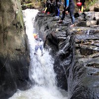
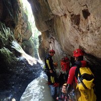
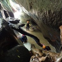
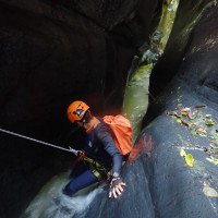
siehe Video und Fotos in Gallery
see video and photos in Gallery
Return (5 min):
machine translated
➜
Original language
siehe Google Earth-Kartenskizze: blaugrün
see Google Earth map sketch: blue-green
Coordinates:
Parking at Entry
-16.18265°, -67.69891°
↓↑
DMS: -17° 49" 2.46', -68° 18" 3.92'
DM: -17° 49.041", -68° 18.065"
Google Maps
DMS: -17° 49" 2.46', -68° 18" 3.92'
DM: -17° 49.041", -68° 18.065"
Google Maps
ziemlich am Ende des Forstweges
Canyon Start
-16.181537°, -67.695186°
↓↑
DMS: -17° 49" 6.47', -68° 18" 17.33'
DM: -17° 49.108", -68° 18.289"
Google Maps
DMS: -17° 49" 6.47', -68° 18" 17.33'
DM: -17° 49.108", -68° 18.289"
Google Maps
Canyon End
-16.178422°, -67.69057°
↓↑
DMS: -17° 49" 17.68', -68° 18" 33.95'
DM: -17° 49.295", -68° 18.566"
Google Maps
DMS: -17° 49" 17.68', -68° 18" 33.95'
DM: -17° 49.295", -68° 18.566"
Google Maps
Ausstieg links hinauf zur Piste (30m)
Parking at Exit
-16.178471°, -67.690731°
↓↑
DMS: -17° 49" 17.5', -68° 18" 33.37'
DM: -17° 49.292", -68° 18.556"
Google Maps
DMS: -17° 49" 17.5', -68° 18" 33.37'
DM: -17° 49.292", -68° 18.556"
Google Maps
Literatures:
Something else
1er ENCUENTRO DE CANYONING NACIONAL E INTERNACIONAL DEL 13 AL 22 De SEPTEMBRIE COROICO-BOLIVIA 2019
Eduardo Gomez
Eigenverlag
2019
8 Canyons
Hydrology:


