a little difficult
Rio Nero di Ora
v4 a3 III
3h
20min
2h30
10min
480m
280m
200m
18m
1200m
Specialities:
Retention basin, water drainage without automatic
Retention basin, water drainage without automatic
Rating:
★★★★★
3.5 (4)
Info:
★★★
2 (2)
Belay:
★★★
2 (2)
Summary:
machine translated
➜
Original language
Sehr schöne Schlucht, tief eingeschnitten. Tolle Atmosphäre aber sandiges und trübes Wasser. Kleinere Rutschen und Sprünge, großteils Abseilstellen. Langer Zustieg entlang des Flusslaufes bis zur ersten Abseilstelle.
Very beautiful canyon, deeply cut. Great atmosphere but sandy and murky water. Smaller slides and jumps, mostly rappels. Long access along the course of the river to the first rappel point.
Access:
machine translated
➜
Original language
Auto im Gewerbegebiet Kalditsch abstellen (Parkplätze bei der Straßengabelung).
Park your car in the Kalditsch industrial park (parking spaces at the fork in the road).
Approach (20 min):
machine translated
➜
Original language
Es gibt einen Einstieg auf Höhe 750m, vgl.http://www.ctgernstein.com/schluchten/Auerbach. Hier muss lange im offenen Bachbett gelaufen werden, bis man zum interessanten Abschnitt kommt.
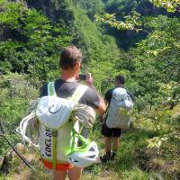
Deshalb empfiehlt sich der Zustieg, wie er im Buch von P.v.Duin beschrieben ist. Dazu nimmt man den aufgelassenen Forstweg, der an der nordöstlichen Ecke des Gewerbegebiets Kalditsch beginnt und in einem leichten Linksbogen nicht ganz 10 Min. abwärtsführt. Vor einen steilen Abfall endet er endgültig. Hier gehen wir weglos horizontal etwa 50m nach rechts und treffen auf einen deutlichen Steig, der von rechts oben kommt. Diesem folgen wir nach unten bis zum Fluss. Einige Meter über dem Fluss noch flussab, dann können wir - vorsichtig - in's Bachbett absteigen.
* There is an entry at altitude 750m, cf.http://www.ctgernstein.com/schluchten/Auerbach. Here you have to walk for a long time in the open streambed until you get to the interesting part.\n\nThis is why the access as described in the book by P.v.Duin is recommended. To do this, take the abandoned forest road that starts at the northeast corner of the Kalditsch industrial park and descends in a slight left turn for not quite 10 min. Before a steep exit it ends for good. Here we go without a path horizontally about 50m to the right and meet a clear path that comes from the right above. Follow it down to the river. A few meters above the river still downstream, then we can - carefully - descend into the streambed.
Tour (2 h 30):
machine translated
➜
Original language
100m vom Einstieg flussabwärts kommen wir zum ersten Abseiler (links). Wenig später der 2. Abseiler mit "Progetto"-Plakette. Der 3. u. 4. Abseiler bringt uns in die Bachbettaufweitung, wo die Wasserableitung erfolgt. Hier erfolgt in kontinuierlichen Abständen ein kurzfristiger Wasserablass in den Unterlauf, wenn jeweils der Rechen am Kanaleinlass automatisch gereinigt wird.
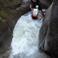
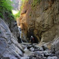
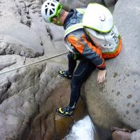
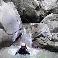
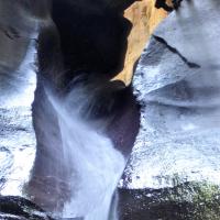
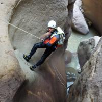
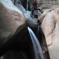
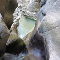
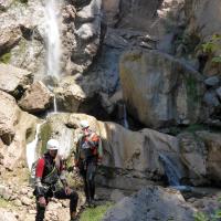
Über den Damm hinunter der 5. Abseiler, wenig später der kurze 6. Abseiler. Dann der 7. Abseiler rechts von der wasserführenden Rinne (18m). Der nächste kurze 8. Abseiler wäre eine wunderbare Rutsche, wenn uns im viel zu flächen Gumpen nicht einige Felsblöcke erwarten würden. Dann beginnt wieder ein echter Schluchtabschnitt. Es folgen Abseiler 9, der 10. über den Felspodest nach links und von dort der 11. und 12.. hinunter in die Schluchtsohle. Hier bieten sich 2 Sprungmöglichkeiten - nach vorheriger Prüfung - an. Am Ende der relativ flachen Schluchtsohle kommen wir zu dem (13.) Abseiler an der rechten Felswand, wenige Meter, vor der Wasserfall (Überschuss aus der Wasserableitung ?) die hohe Wand herabprasselt. Hier ist der Haken nur schwer erreichbar, da offenbar ein herabgerutschte Felsplatte den Stand etwas "umstrukturiert" hat. Links hinauf findet sich eine Umgehungsmöglichkeit. Schließlich ist das Ende der Tour erreicht und wir suchen rechtsufrig Weg und Ausstieg auf den Metallsteg.
100m from the entry downstream we come to the first rappel (left). A little later the 2nd rappel with "Progetto" plaque. The 3rd and 4th rappel brings us to the widening of the streambed, where the water drainage takes place. Here, at continuous intervals, there is a short water discharge into the lower reaches, when each time the rake at the canal inlet is automatically cleaned.\nOn top of the dam down the 5th rappel, a little later the short 6th rappel. Then the 7th rappel to the right of the water-bearing chute (18m). The next short 8th rappel would be a wonderful slide if some boulders were not waiting for us in the much too shallow pool. Then a real canyon section begins again. Rappels 9 follow, the 10th over the rock platform to the left and from there the 11th and 12th down into the canyon floor. Here there are 2 possible jumps - after prior testing. At the exit of the relatively flat canyon bottom we come to the (13th) rappel on the right rock wall, a few meters, before the waterfall (excess from the water drainage ?) comes rushing down the high wall. Here the anchor is difficult to reach, since apparently a slab of rock that slid down has somewhat "restructured" the belay. Up to the left there is a bypass possibility. Finally, the end of the tour is reached and we look for the way and exit to the metal bridge on the right bank.
Return (10 min):
machine translated
➜
Original language
An der Brücke links hinaus und zum rechterhand etwas Straßenabwärts geparkten unteren Fahrzeug.
Out to the left at the bridge. And to the righthand side slightly down the road parked lower vehicle.
Coordinates:
Canyon Start
Canyon End
Parking at Entry
(descente_3)
Parking at Exit
(descente_4)
Literatures:
Map
1:25000
Map
1:50000
Map
1:25000
Map
1:25000
Canyoning Book
Pascal van Duin
2011
Canyoning Book
Pascal van Duin
Edizioni TopCanyon
2009
100 Beschreibungen
Cwiki Canyon Info
Descente Canyon Info
Ropewiki Canyon Info
AIC Catasto
Other Canyon Info
Ropewiki Canyon Info
12.08.2024
PeterAlbertini
⭐
★★★★★
📖
★★★
⚓
★★★
💧
Normal
Completed ✔
machine translated
➜
Original language
tolle Schlucht im Porphyr, schade, dass sie so kurz ist!
excellent canyon in porphyry, fell both short!
11.08.2024
LeTrolle
⭐
★★★★★
📖
★★★
⚓
★★★
💧
Normal
Completed ✔
no translation available
Automatisch importiert von Descente-Canyon.com für Canyon Nero
(Quelle: https://www.descente-canyon.com/canyoning/canyon-debit/23880/observations.html)
10.08.2024
Peisen
⭐
★★★★★
📖
★★★
⚓
★★★
💧
Normal
Completed ✔
machine translated
➜
Original language
Other users were: Simone Steffke Daniela Rossi DaRaph
Der Zustiegsweg ist steil, Steinschlag gefährdet, nicht leicht zu finden.
Das erste Drittel ist recht aquatisch, dieser teil kann bei mehr Wasser sportlich bis ungemütlich werden.
Der menschengemachte Wasserabfluss nach dem ersten Drittel der Schlucht öffnet sich alle 5minuten für 2 Minuten, lässt aber auch dann nicht viel mehr Wasser durch.
Nach dem Wasserabfluss nimmt die Wassermenge deutlich ab.
Sprünge und rutschen müssen immer überprüft werden.
The access path is steep, at risk of falling rocks and not easy to find.
The first third is quite aquatic, this part can be sporty to uncomfortable with more water.
The man-made water drain after the first third of the canyon opens every 5 minutes for 2 minutes, but does not let much more water through even then.
After the water drain, the amount of water decreases significantly.
Jumps and slides must always be checked.
Other users were: Simone Steffke Daniela Rossi DaRaph
09.08.2024
Fabrizio Cavazzuti
⭐
★★★★★
📖
★★★
⚓
★★★
💧
Normal
Completed ✔
no translation available
Automatisch importiert von Descente-Canyon.com für Canyon Nero
(Quelle: https://www.descente-canyon.com/canyoning/canyon-debit/23880/observations.html)
03.08.2024
Daniel Sturm
⭐
★★★★★
📖
★★★
⚓
★★★
🌊
Crazy
Completed ✕
machine translated
➜
Original language
Other users were: Patrick Klarner Michael Geier Tim Schuster
Da wir noch nie in dem Bach waren, war uns das zu viel Wasser. Am Tag danach waren wohl einheimische drin und sind an/nach der ersten Abseilstelle umgekehrt, weil zu viel Wasser im Bach war.
As we'd never been in the stream before, it was too much water for us. The next day, some locals were probably in it and turned back at/after the first abseil point because there was too much water in the stream.
Other users were: Patrick Klarner Michael Geier Tim Schuster
09.03.2023
System User
⭐
★★★★★
📖
★★★
⚓
★★★
no translation available
Info: Teile der Canyonbeschreibung wurden automatisiert übernommen. Konkret die Felder Weblinks, Koordinaten, Rating, Länge des Canyon, Einfachseil Mindestens von https://www.descente-canyon.com/canyoning/canyon/23880
09.03.2023
System User
⭐
★★★★★
📖
★★★
⚓
★★★
no translation available
Daten importiert von https://canyon.carto.net/cwiki/bin/view/Canyons/RioNerodiOraCanyon.html
New Report
Please briefly and concisely the most important information of the last tour or important current information about the canyon. If necessary with links to videos, photos, etc..
*
*
*
Esc
Del
Hydrology:
no translation available
Das erste Drittel ist recht aquatisch, dieser teil kann bei mehr Wasser sportlich bis ungemütlich werden.
Der menschengemachte Wasserabfluss nach dem ersten Drittel der Schlucht öffnet sich alle 5minuten für 2 Minuten, lässt aber auch dann nicht viel mehr Wasser durch.
Nach dem Wasserabfluss nimmt die Wassermenge deutlich ab.
01 von der Ortschaft Rio N...

02 am Einstieg

03 erster Abseiler

04 zweiter Abseiler
05

06

07

08 dritter Abseiler

09 dito

10 vierter Abseiler

11 dritter und vierter Abs...

12 vor der Wasserableitung

13 fünfter Abseiler über d...
14
15

16
17

18

19

20

21

22
23
24
25

26 Blick auf den Wasserfal...
27

28

29
30 am Schluchtauagang
