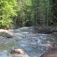
not as difficult
Ostertaltobel
Country:
Deutschland / Germany
Region: Schwaben / Swabia
Subregion: Landkreis Oberallgäu
Town: Gunzesried-Säge
v2 a3 I
1h15
25min
45min
5min
990m
970m
20m
12m
1x30m
3
600m
Specialities:
§ Proscription
§ Proscription
Rating:
★★★★★
1.5 (2)
Info:
★★★
0 ()
Belay:
★★★
0 ()
Summary:
machine translated
➜
Original language
Offener, leichter Canyon; überall Ausstieg möglich;mehrere Sprungmöglichkeiten.\nAuch bei viel Wasser machbar.
Verbot - Details bei Descente Canyon
Open, easy canyon; exit possible everywhere; several possible jumps.\nEven with a lot of water.
Prohibition - Details at Descente Canyon
North
Summary:
machine translated
➜
Original language
Offener, leichter Canyon; überall Ausstieg möglich;mehrere Sprungmöglichkeiten.\nAuch bei viel Wasser machbar.
Verbot - Details bei Descente Canyon
Open, easy canyon; exit possible everywhere; several possible jumps.\nEven with a lot of water.
Prohibition - Details at Descente Canyon
Access:
machine translated
➜
Original language
B19 nach Immenstadt -> Gunzesried -> Gunzesried-Säge. Großer Parkplatz vor Brücke.
B19 to Immenstadt -> Gunzesried -> Gunzesried-Säge. Large parking lot in front of the bridge.
Approach (25 min):
machine translated
➜
Original language
Auf Wanderweg Bach folgen bis ein Holzpavillon kommt. (22.08.2018) Direkter Zustieg zum Bach und damit Querung zum Wanderweg ist nun mit einem Holzzaun gesperrt! Aus Respekt vor den Anwohnern und der angespannten Situation bitte nicht hinübersteigen, auch wenn der Weg kurz und gut ist! Stattdessen zur Straße zurück, links über die Brücke und gleich wieder links abbiegen, um zu dem Wanderweg auf der orograpisch linken Bachseite zu gelangen. Ab da wie gehabt.
Follow the hiking trail along the stream until you reach a wooden pavilion. (22.08.2018) Direct access to the stream and thus crossing to the hiking trail is now blocked by a wooden fence! Out of respect for the residents and the tense situation, please do not climb over, even if the path is short and good! Instead, return to the road, turn left over the bridge and immediately left again to reach the hiking trail on the orographic left side of the stream. From there as before.
Tour (45 min):
machine translated
➜
Original language
3 Abseilstellen. 1. Abseilstelle kann manchmal (!) von oben oder von dem Sims in der Mitte der Wand gesprungen werden (10 m).
3 abseiling points. The 1st abseil point can sometimes (!) be jumped from above or from the ledge in the middle of the wall (10 m).
Return (5 min):
machine translated
➜
Original language
Auf Wanderweg zurück
Back on the hiking trail
Coordinates:
Canyon Start
Parking Entry and Exit
Canyon End
Literatures:
Map
Kompass WK 3 Allgäuer Alpen 1:50 000
Cwiki Canyon Info
Descente Canyon Info
Ropewiki Canyon Info
09.03.2023
System User
⭐
★★★★★
📖
★★★
⚓
★★★
no translation available
Info: Teile der Canyonbeschreibung wurden automatisiert übernommen. Konkret die Felder Weblinks, Koordinaten, Rating, Länge des Canyon, Einfachseil Mindestens von https://www.descente-canyon.com/canyoning/canyon/23119
09.03.2023
System User
⭐
★★★★★
📖
★★★
⚓
★★★
no translation available
Daten importiert von https://canyon.carto.net/cwiki/bin/view/Canyons/OstertaltobelCanyon.html
Hydrology:


