v3 a1 VI
8h20
15min
8h
5min
450m
-320m
770m
20m
2x25m
7
15000m
Car required
Rating:
★★★★★
3.4 (2)
Info:
★★★
0 ()
Belay:
★★★
0 ()
Summary:
machine translated
➜
Original language
Sehr langer Wandercanyon mit einigen Abseilern
Very long hiking canyon with several rappels
Northwest
Sandstone
Summary:
machine translated
➜
Original language
Sehr langer Wandercanyon mit einigen Abseilern
Very long hiking canyon with several rappels
Access:
machine translated
➜
Original language
Zunächst müssen wir ein Auto zum Ausstieg bringen. Dazu fahren wir von der Stadt Karak auf der "50" hinunter zum Toten Meer (Dead Sea). Nach 26,2 km kommen wir zur zur T-Kreuzung "Mazra Junction" und fahren dort nach links weiter auf der "65" Richtung Aqaba. Nach 6,2 km queren wir das Wadi Assal und biegen wenig später links ab auf eine Pistenspur, die uns zu einigen Häuserruinen bringt. Hier stellen wir das Auto für den Ausstieg ab.
Mit dem zweiten geht es wieder zurück zur "65", dann zur Masra Junction und dort wieder rechts hinauf nach Karak. Wir umrunden den Stadtkern und nehmen dann die Straße in südlicher Richtung nach Mote. Nach einer Fahrt von gut 10 km sind wir in Mote angekommen. An der zentralen Kreuzung in der Ortsmitte biegen wir rechts ab und fahren nach Kathrabba (ca. 6 km). Wir fahren durch den Ort zum nordwestlichen Ortsausgang und suchen dort die Straße, die in nördlicher Richtung in Serpentinen abwärts führt. Wir fahren hinab bis zu ihrem Ende jenseits eines Grabens bei einer oasenhaften Anpflanzung. Hier stellen wir das Auto ab (P1). Vgl. zu Anfahrt, Zustieg und Ausstieg: https://photos.google.com/share/AF1QipMvZekedlzsT6o7oSxVMtBmwfTshJPXW2pA2DtSIu9JONnrQJl9ndhl0T_6uN56mg?key=blJaaEJrWG4wTFQwN0haSmtsVlViZGdLSHlsRzdB
First we have to get a car to the exit. To do this, we drive from the town of Karak on the "50" down to the Dead Sea. After 26.2 km we come to the T-junction "Mazra Junction" and continue left on the "65" towards Aqaba. After 6.2 km we cross the Wadi Assal and a little later turn left onto a dirt road that takes us to some ruined houses. Here we park the car for the exit.
The second car takes us back to "65", then to Masra Junction and right again up to Karak. We circle the town center and then take the road south to Mote. After a good 10 km we arrive in Mote. At the central crossroads in the middle of the village, we turn right and drive to Kathrabba (approx. 6 km). We drive through the village to the north-western end of the village and look for the road that descends in a northerly direction in serpentines. We drive down to the exit of the road beyond a ditch near an oasis-like plantation. Park the car here (P1). Cf. for approach, access and exit: https://photos.google.com/share/AF1QipMvZekedlzsT6o7oSxVMtBmwfTshJPXW2pA2DtSIu9JONnrQJl9ndhl0T_6uN56mg?key=blJaaEJrWG4wTFQwN0haSmtsVlViZGdLSHlsRzdB
Approach (15 min):
machine translated
➜
Original language
Vom Parkplatz an besagter Stelle (P1) in Richtung NNO hinunter in das Bachbett.
From the parking lot at the aforementioned point (P1) head NNE down into the streambed.
Tour (8 h):
machine translated
➜
Original language
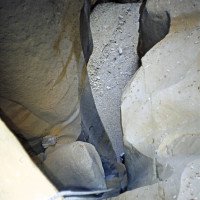
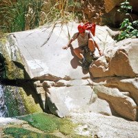
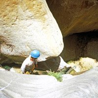
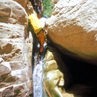
Zuerst ein längerer "Anlauf" bis zum ersten Abfall. Hier muss damit gerechnet werden, dass keine Haken vorzufinden sind. Nach einigen Abseilern folgen längere Laufstrecken, dann treffen wir auf Wasserdurchsatz und dadurch bedingtes Grün. Und dann heißt es laufen, laufen, laufen, bis die Sohlen kochen. Schließlich kommen wir an das Ende der Tour.
First a longer "run-up" to the first drop. Here you have to reckon with the fact that there are no anchors to be found. A few rappels are followed by longer runs, then we encounter water flow and the resulting greenery. And then it's walk, walk, walk until your soles boil. Finally, we reach the exit of the tour.
Return (5 min):
machine translated
➜
Original language
Links hinaus aus dem Wadi und direkt zum Auto bei P2.
Left out of the wadi and directly to the car at P2.
Coordinates:
Canyon Start
Parking at Entry
P1 (Zustieg)
Parking at Exit
P2 für Ausstieg
Canyon End
Literatures:
Map
https://goo.gl/photos/U7QaBnK5u7MHWezVA (Kartenskizze Zu-, Abstieg)
Map
http://wikimapia.org/#lang=de&lat=31.185123&lon=35.563345&z=14&m=b&show=/31311913/Wadi-Isal
Canyoning Book
Trekking and Canyoning in the Jordanian Dead Sea Rift
Itai Haviv
2000
Cwiki Canyon Info
Descente Canyon Info
Ropewiki Canyon Info
Other Weblink
09.03.2023
System User
⭐
★★★★★
📖
★★★
⚓
★★★
no translation available
Info: Teile der Canyonbeschreibung wurden automatisiert übernommen. Konkret die Felder Weblinks, Koordinaten, Rating, Länge des Canyon, Einfachseil Mindestens von https://www.descente-canyon.com/canyoning/canyon/21809
09.03.2023
System User
⭐
★★★★★
📖
★★★
⚓
★★★
no translation available
Daten importiert von https://canyon.carto.net/cwiki/bin/view/Canyons/AssalCanyon.html
Hydrology:


