v3 a4 II
2h50
40min
2h
10min
300m
235m
65m
18m
2x25m
4
750m
on Foot
Specialities:
§ Proscription
§ Proscription
Rating:
★★★★★
3.7 (4)
Info:
★★★
2 (2)
Belay:
★★★
2 (2)
Summary:
machine translated
➜
Original language
Kurze aber lohnende Schlucht die alle Spielarten des Canyonings anbietet - Sprünge, Rutschen, Abseiler im und neben dem Wasser.\nEntgegen anderslautender [[http://www.aic-canyoning.it/forum/topic.asp?TOPIC_ID=2132&whichpage=2][Info auf aic-canyoning.it]] ist diese Schlucht *nicht* vom Begehungsverbot im Nationalpark Triglav betroffen.
Inzwischen trotzdem verboten, da "Naturschutzgebiet".
Short but rewarding canyon that offers all kinds of canyoning - jumps, slides, rappel in and next to the water.\nContrary to [[http://www.aic-canyoning.it/forum/topic.asp?TOPIC_ID=2132&whichpage=2][info on aic-canyoning.it]], this canyon is *not* affected by the access ban in the Triglav National Park.
In the meantime nevertheless forbidden, since "nature reserve".
Access:
machine translated
➜
Original language
Der Strasse 203 bis nach Kobarid folgen. Kommt man von Norden, am Ortseingang nach rechts Richtung Dreznica abzweigen, die Soca mittels der Napoleonbrücke überqueren und danach noch etwa 300m weit in Richtung 'Kamp Koren' fahren.\nGroßer Parkplatz rechts. Alternativ kann man auch im Bereich vom Campingplatz Lazar am gegenüber liegenden Soca-Ufer parken.
Follow the road 203 to Kobarid. Coming from the north, turn right at the entrance to the town in the direction of Dreznica, cross the Soca by means of the Napoleon Bridge and then continue for about 300m in the direction of 'Kamp Koren'.\nLarge parking lot on the right. Alternatively, you can park in the area of camping Lazar on the opposite bank of the Soca.
Approach (40 min):
machine translated
➜
Original language
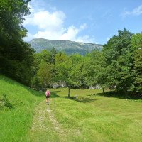
Dem markierten Weg Richtung Kozjak Wasserfall folgen. Einige Meter nach einer Steinbrücke über den Kozjak zweigt man nach links ab und folgt einen schönen Karrenweg bergauf. Nach einer ersten kleinen Alm folgen ein paar steilere Kurven bevor man eine zweite, grössere Weidefläche erreicht. Zunächst noch auf dem breiten Weg an den Almhäusern vorbei bis man eine Linkskurve unter einer niederen Felswand erreicht. Hier Steigspuren nach rechts folgen (im Sommer sind die ersten Meter ziemlich verwachsen, der Pfad wird allerdings bald besser). Über diesen Pfad erst waagrecht, dann fallend zum Bachbett eines Nebenbaches dem man bis zur Mündung in den Kozjak folgt. Man kann auch schon im Nebenbach einsteigen - ein paar Rutschen und ein Baumabseiler ca. 5m.
Follow the marked path towards Kozjak waterfall. A few meters after a stone bridge over the Kozjak, turn left and follow a beautiful cart track uphill. After a first small pasture, a few steeper bends follow before you reach a second, larger pasture area. At first still on the wide path past the alpine houses until you reach a left turn under a low rock wall. Here follow the tracks to the right (in summer the first meters are quite overgrown, but the path soon improves). Follow this path, first horizontally, then descending, to the streambed of a side stream, which you follow to the confluence with the Kozjak. You can also enter the side stream - a few slides and a tree rappel about 5m.
Tour (2 h):
machine translated
➜
Original language
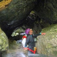
Der erste Wasserfall kann gerutscht oder gesprungen werden (bis 10m). Knapp danach folgen eine kleine Rutsche und ein 12m Abseiler - Haken auf Felskopf in Flussmitte. Nach etwas Blockkletterei steht man vor einen 15m Abbruch der von rechts (alte Haken) oder links abgeseilt werden kann - nach Kontrolle des Beckens wahrscheinlich auch springbar. Unmittelbar danach steht man vor einen 6m Wasserfall der abgeseilt oder gesprungen werden kann. Bis zum großem Wasserfall wechseln sich Schwimmpassagen mit Sprüngen bis 6m ab - landschaftlich hat die enge Klamm mit ihren schönen Gesteinsfaltungen auch einiges zu bieten. \nDer letzte Wassefall ist etwa 18m hoch, nach Kontrolle springbar und stürzt in ein riesiges grünes Becken. Hier endet auch der gut besuchte Touristensteig - Zuseher sind also garantiert. Nach einigen 100m Wanderstrecke gibts unter der Steinbrücke noch eine schöne 9m Sprungmöglichkeit - der Reststrecke bis zur Soca ist uninteressant und sollte am Wanderweg umgangen werden.
The first waterfall can be slid or jumped (up to 10m). Shortly after a small slide and a 12m rappel - anchor on rock head in the middle of the river. After a bit of boulder climbing, you are faced with a 15m rappel that can be done from the right (old anchors) or from the left - probably also jumpable after checking the pool. Immediately after that you will find a 6m waterfall that can be rappelled or jumped. Up to the big waterfall swimming passages alternate with jumps up to 6m - scenically the narrow gorge with its beautiful rock folds also has a lot to offer. \The last waterfall is about 18m high, jumpable after control and falls into a huge green basin. Here also ends the well-visited tourist trail - so spectators are guaranteed. After a few 100m of hiking there is a nice 9m possible jumps under the stone bridge - the rest of the way to the Soca is uninteresting and should be bypassed on the hiking trail.
Return (10 min):
machine translated
➜
Original language
Wie Zustieg
Like access
Coordinates:
Canyon Start
Parking Entry and Exit
Canyon End
Literatures:
Map
1:25000
Canyoning Book
Stéphane Coté / Caracal et les Sancho Panza
2008
Canyoning Book
Franck Jourdan / Jean-François Fiorina
2003
Cwiki Canyon Info
Descente Canyon Info
Ropewiki Canyon Info
Gallery
09.03.2023
System User
⭐
★★★★★
📖
★★★
⚓
★★★
no translation available
Info: Teile der Canyonbeschreibung wurden automatisiert übernommen. Konkret die Felder Weblinks, Koordinaten, Rating, Länge des Canyon, Einfachseil Mindestens von https://www.descente-canyon.com/canyoning/canyon/2706
09.03.2023
System User
⭐
★★★★★
📖
★★★
⚓
★★★
no translation available
Daten importiert von https://canyon.carto.net/cwiki/bin/view/Canyons/KozjakCanyon.html
20.08.2022
Bubtore
⭐
★★★★★
📖
★★★
⚓
★★★
💧
Low
Completed ✔
machine translated
➜
Original language
Als zweiter Canyon des Tages gemacht. Sind nach der Schlucht durch den Wald hoch damit wir nicht am Billethäuschen vorbei müssen.
The second canyon of the day. We went up through the forest after the canyon so that we didn't have to pass the Billethäuschen.
06.07.2018
Martin Jasek
⭐
★★★★★
📖
★★★
⚓
★★★
💧
Normal
Completed ✔
One of the most beautiful canyons in Slovenia, which offers a full canyoning adventure. We did it without using a rope, great conditions for jumping, but some pools need to be checked before.
New Report
Please briefly and concisely the most important information of the last tour or important current information about the canyon. If necessary with links to videos, photos, etc..
*
*
*
Esc
Del
Hydrology:


