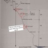
v5 a3 IV
3h50
40min
3h
10min
790m
590m
200m
170m
2x 70m
7
on Foot
Rating:
★★★★★
3 (1)
Info:
★★★
1 (2)
Belay:
★★★
2 (1)
Summary:
machine translated
➜
Original language
Hoher Wasserfall zum Abseilen
High waterfall for rappels
Summary:
machine translated
➜
Original language
Hoher Wasserfall zum Abseilen
High waterfall for rappels
Access:
Approach (40 min):
Tour (3 h):
machine translated
➜
Original language
Drei kleine Abseiler, dann ein c31, danach c170 geteilt in 3 Teile max 65m.
Setzzeug mitnehmen.
Three small rappels, then a c31, then c170 divided into 3 parts max 65m.
Take your climbing gear with you.
Return (10 min):
Coordinates:
Parking Entry and Exit
46.98407°, 8.72394°
↓↑
DMS: 46° 59" 2.65', 8° 43" 26.18'
DM: 46° 59.044", 8° 43.436"
Google Maps
SwissTopo
DMS: 46° 59" 2.65', 8° 43" 26.18'
DM: 46° 59.044", 8° 43.436"
Google Maps
SwissTopo
Canyon End
46.9865°, 8.72037°
↓↑
DMS: 46° 59" 11.4', 8° 43" 13.33'
DM: 46° 59.19", 8° 43.222"
Google Maps
SwissTopo
DMS: 46° 59" 11.4', 8° 43" 13.33'
DM: 46° 59.19", 8° 43.222"
Google Maps
SwissTopo
Canyon Start
46.98758°, 8.72137°
↓↑
DMS: 46° 59" 15.29', 8° 43" 16.93'
DM: 46° 59.255", 8° 43.282"
Google Maps
SwissTopo
DMS: 46° 59" 15.29', 8° 43" 16.93'
DM: 46° 59.255", 8° 43.282"
Google Maps
SwissTopo
Literatures:
Canyoning Book
Swiss Alps - Canyoning - Alpes Suisses
Emmanuel Belut / Laurence Boyé / Thomas Guigon
Association Openbach
2015
9782746679450
13.04.2024
Alex Arnold
⭐
★★★★★
📖
★★★
⚓
★★★
💧
Normal
Completed ✔
machine translated
➜
Original language
Many anchors and possible ways in the wall. We added one redundant anchor on a nose in the middle of the wall because it seems to be the logical way.
Many anchors and possible ways in the wall. We added one redundant anchor on a nose in the middle of the wall because it seems to be the logical way.
28.09.2023
Daniel Sturm
⭐
★★★★★
📖
★★★
⚓
★★★
machine translated
➜
Original language
Basisdaten übernommen mit freundlicher Genehmigung durch Matthias Holzinger aus "Swiss Alps Canyoning VOL. 1.0"
Basic data taken with kind permission by Matthias Holzinger from "Swiss Alps Canyoning VOL. 1.0".
Hydrology:
