v4 a3 III
4h15
50min
3h15
10min
920m
600m
320m
35m
2x40m
on Foot
Rating:
★★★★★
1.9 (2)
Info:
★★★
0 ()
Belay:
★★★
0 ()
Summary:
machine translated
➜
Original language
Eher offene Kalkschlucht mit mehreren kleinen Abseilstellen; ca. 1,5Km Einzugsgebiet; meist wenig Wasser; bis auf den Schlußwasserfall ist der obere Abschnitt schöner und kontinuierlicher; kombinierbar mit Rio Ronc; einige Verklausungen im unteren Teil der Schlucht; als Standplätze dienen Bohrhaken mit Schlingen, Einzelbohrhaken, Baumschlingen und Kettenstände (bei unsere Begehung war alles ok); mehrere Notausstiege möglich; Süd-Westliche Exposition.
Rather open lime canyon with several small abseils; about 1.5Km catchment area; mostly little water; except for the final waterfall, the upper part is more beautiful and continuous; can be combined with Rio Ronc; some entanglements in the lower part of the canyon; as belays serve bolts with slings, single bolts, tree slings and chain anchors (on our ascent everything was ok); several emergency exits possible; south-western exposure.
Access:
machine translated
➜
Original language
Zwischen Chiusaforte und Carnia liegt die Ortschaft Resuitta. Von hier fährt man ins schöne Resia Tal. Man folgt dem Straßenverlauf mit der Beschilderung „Stolvizza“ (P.s. Von der Tafel Ortsende Resuitta bis Stolvizza sind es 9Km). In Stolvizza kann man entweder direkt beim Wanderparkplatz (Holzschild „Ta Lipa Pot“) neben der Pizzeria parken oder man folgt den Straßenverlauf noch ca. 50m weiter und parkt beim Wanderparkplatz (Pusti Gost/ Belvedere) auf der li Seite.
about 20min.
Between Chiusaforte and Carnia is the village of Resuitta. From here you drive into the beautiful Resia Valley. Follow the road with the sign "Stolvizza" (P.s. From the sign Resuitta to Stolvizza is 9Km). In Stolvizza you can either park directly at the parking place for hikers (wooden sign "Ta Lipa Pot") next to the pizzeria or you follow the road for about 50m and park at the parking place for hikers (Pusti Gost/ Belvedere) on the left side.
Approach (50 min):
machine translated
➜
Original language
Vom Wanderparkplatz („Pusti Gost/Belvedere“) folgt man der Beschilderung „Pusti Gost/Belvedere“. Zuerst geht man kurz auf der Straße die dann beim Picknickplatz mit kleinen Holzhütten endet. Hier den Weg über die kleine Holzbrücke weiter li hoch. Man kommt an 3 Beton-Wasserhäuschen vorbei. Beim dritten Wasserhäuschen (blaue Pfeile) könnte man für den unteren Teil zum Bach zusteigen. Für den oberen Einstieg folgt man dem Weg ca. 20-25min weiter hoch, vorbei am kleinen Jesuskreuz bis zur Holzbrücke auf ca. 920m.
P.s. Möchte man vor der Begehung den Wasserstand bei der letzten Abseiler kontrollieren, folgt man dem Wanderweg beim Pizzeria-Parkplatz (Holzschild) „ Ta Lipa Pot“ für ca. 5-10min.
approx. 50min.
From the parking lot ("Pusti Gost/Belvedere") follow the signs to "Pusti Gost/Belvedere". First you walk on the road which ends at the picnic area with small wooden huts. Here you take the path over the small wooden bridge further up to the left. You will pass 3 concrete water houses. At the third water house (blue arrows) you could climb to the stream for the lower part. For the upper entry follow the path for about 20-25min further up, past the small Jesus cross to the wooden bridge at about 920m.
P.s. If you want to check the water level at the last rappel before the ascent, follow the trail at the pizzeria parking lot (wooden sign) " Ta Lipa Pot" for about 5-10min.
Tour (3 h 15):
machine translated
➜
Original language
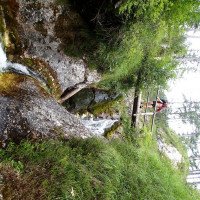
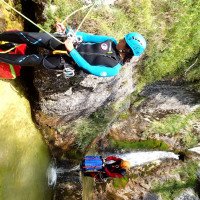
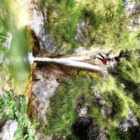
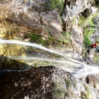
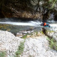
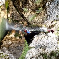
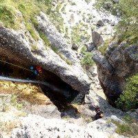
Direkt bei der Holzbrücke auf ca. 920m geht es los mit den ersten Abseilstellen. Die Stufen variieren zwischen 5 und 25m. Da der Bach meist nur wenig Wasser führt sollten die Abseilstellen, die fast alle durch den Wasserstrahl führen, kein Problem darstellen. Der erste schönere Abschnitt (ca. 10 Abseiler) bis zum Mitteleinstieg/-Ausstieg (li) ist kontinuierlicher als der Zweite. Im zweiten Abschnitt kommen auch wieder ca. 10 Abseilstellen (bis max. 35m) unterbrochen von Geh- und Abkletterpassagen. Nach unten hin verengt sich die Schlucht kurz bevor man zur offenen letzten und schönsten Kaskade kommt. Hier seilt man sich zuerst 15m zu einem zwischenstand und dann weitere 35m im Wasser ab (Achtung! Ausstieg aus dem ersten Gumpen zum Zwischenstand ohne Fixseil schwierig besser vor dem Gumpen nach rechts zum Zwischenstand abseilen). Die Kaskade kann re auch umgangen werden. Nach der letzten Abseilstelle steht man schon fast am Wanderweg auf ca. 600m.
approx. 3-3,5h
Directly at the wooden bridge at about 920m we start with the first rappels. The steps vary between 5 and 25m. Since the stream usually has little water, the abseils, almost all of which are through the stream, should not be a problem. The first nicer part (about 10 rappels) to the middle entry/exit (left) is more continuous than the second. In the second part there are again about 10 abseils (up to max. 35m) interrupted by walking and downclimb parts. Towards the bottom the canyon narrows shortly before you reach the open last and most beautiful cascade. Here you first rappel 15m to an intermediate belaystation and then another 35m in the water (Attention! Exit from the first pool to the intermediate rappel is difficult without fixed rope besser before the pool rappel to the right to the intermediate rappel). The cascade can also be bypassed on the right. After the last abseil point you are almost at the hiking trail at about 600m.
Return (10 min):
machine translated
➜
Original language
Man folgt dem Wanderweg „Ta Lipa Pot“ auf der li Seite, der in Kürze zum Wanderparkplatz im Ort zurück führt.
approx. 10min
Follow the trail "Ta Lipa Pot" on the left side, which will lead you back to the parking lot in the village shortly.
Coordinates:
Canyon Start
Parking Entry and Exit
Canyon End
ACA Canyon Info
Cwiki Canyon Info
Other Canyon Info
09.03.2023
System User
⭐
★★★★★
📖
★★★
⚓
★★★
no translation available
Info: Teile der Canyonbeschreibung wurden automatisiert übernommen. Konkret die Felder Weblinks, Koordinaten, Rating, Ort von https://canyon.carto.net/cwiki/bin/view/Canyons/RioLommigCanyon.html
09.03.2023
System User
⭐
★★★★★
📖
★★★
⚓
★★★
no translation available
Daten importiert von https://www.canyoning.or.at/index.php/liste-aller-canyons/405-rio-looming
Hydrology:
