a little difficult
Roßgumpenbach
v4 a3 III
6h20
2h
3h30
50min
1680m
1330m
350m
45m
2x50m, 1x30m
19
1500m
Bike/Mountainbike
Rating:
★★★★★
4.5 (8)
Info:
★★★
3 (5)
Belay:
★★★
2.9 (6)
Summary:
machine translated
➜
Original language
Sehr schöne, offene alpine Schlucht mit Blick in die Bergwelt; kaltes Wasser; mehrere Sprung- und Rutschmöglichkeiten; viele Notausstiegsmöglichkeiten; hoher Schlusswasserfall (45m) mit Zuschauer; Exposition S-W; schönes Wandergebiet; Zufahrt zur Alm mit MTB möglich aber nicht notwendig; Standplätze gut, jedoch einige verbesserungswürdig (Kettenstand am Schlusswasserfall OK); im Frühjahr oft viel Schmelzwasser; kaltes Wasser; Einzugsgebiet ca. 4Km²
Tipp: Einkehrmöglichkeit bei der bewirtschafteten Rossgumpenalm (5min neben Ausstieg). Geld mitnehmen
Very beautiful, open alpine canyon with views of the mountains; cold water; several jumps and slides; many emergency exits; high final waterfall (45m) with spectators; exposure S-W; beautiful hiking area; access to the mountain pasture with MTB possible but not necessary; stands good, but some in need of improvement (chain anchor at the final waterfall OK); in spring often a lot of melt water; cold water; catchment area about 4Km².
Tip: refreshments at the Rossgumpenalm (5min from the exit). Take money with you
South
Summary:
machine translated
➜
Original language
Sehr schöne, offene alpine Schlucht mit Blick in die Bergwelt; kaltes Wasser; mehrere Sprung- und Rutschmöglichkeiten; viele Notausstiegsmöglichkeiten; hoher Schlusswasserfall (45m) mit Zuschauer; Exposition S-W; schönes Wandergebiet; Zufahrt zur Alm mit MTB möglich aber nicht notwendig; Standplätze gut, jedoch einige verbesserungswürdig (Kettenstand am Schlusswasserfall OK); im Frühjahr oft viel Schmelzwasser; kaltes Wasser; Einzugsgebiet ca. 4Km²
Tipp: Einkehrmöglichkeit bei der bewirtschafteten Rossgumpenalm (5min neben Ausstieg). Geld mitnehmen
Very beautiful, open alpine canyon with views of the mountains; cold water; several jumps and slides; many emergency exits; high final waterfall (45m) with spectators; exposure S-W; beautiful hiking area; access to the mountain pasture with MTB possible but not necessary; stands good, but some in need of improvement (chain anchor at the final waterfall OK); in spring often a lot of melt water; cold water; catchment area about 4Km².
Tip: refreshments at the Rossgumpenalm (5min from the exit). Take money with you
Access:
machine translated
➜
Original language
Von Reutte nach Süden in das hintere Lechtal bis zur Ortschaft Holzgau fahren. Gleich nach der Brücke rechts auf den noch kostenlosen, (Stand 2022) Wanderparkplatz (mit Brunnen) fahren. Von hier mit dem Bike oder zu Fuß weiter in das Höhenbachtal.
From Reutte drive south into the rear Lechtal valley to the village of Holzgau. Immediately after the bridge, turn right onto the still free (as of 2022) hikers' parking lot (with fountain). From here, continue by bike or on foot into the Höhenbachtal.
Approach (2 h):
machine translated
➜
Original language
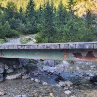
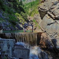
Vom (orographisch rechts) Wanderplatz in Holzgau geht man am Brunnen vorbei in Richtung Hängebrücke. Die breite Forststraße führt neben dem Höhenbach flach entlang bis zum Simms Wasserfall, wo auch ein kleiner Klettersteig eingerichtet wurde. Hier wird es kurz steil. Nach dem Simms Wasserfall führt die Forststraße in leichter Steigung vorbei an einer Hütte (1236m) bis zur unteren Roßgumpen Alm. Kurz vor der Alm (bei der Holzbrücke auf 1330m) sieht man den
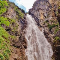
Schlusswasserfall (Wasserstandcheck). Hinter der Roßgumpenalm führt nun ein steiler Zustiegsweg (ca. 45min) zur oberen (nicht bewirtschafteten) Alm. Direkt vor der Alm steigt man bei ca. 1680m in den Bach ein.
Beim Zustieg mit dem MTB verkürzt sich die Zustiegszeit auf etwas 1h15min.
From the (orographically on the right) hiking site in Holzgau, walk past the fountain in the direction of the suspension bridge. The wide forest road leads flat along the Höhenbach stream to the Simms waterfall, where a small via ferrata has also been set up. Here it becomes steep for a short time. After the Simms waterfall, the forest road leads on a slight incline past a hut (1236m) to the lower Roßgumpen Alm. Shortly before the alp (at the wooden bridge at 1330m) you can see the
final waterfall (water level check). Behind the Roßgumpenalm a steep access path (approx. 45min) leads to the upper (not managed) alp. Directly in front of the alp you enter the stream at about 1680m.
When accessing by MTB, the access time is reduced to about 1h15min.
Tour (3 h 30):
machine translated
➜
Original language
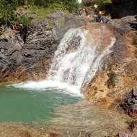
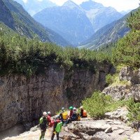
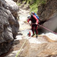
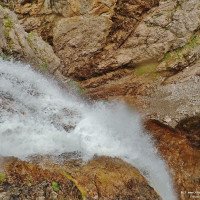
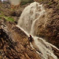
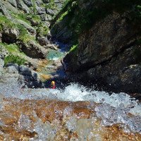
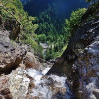
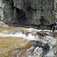
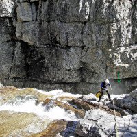
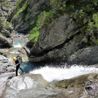
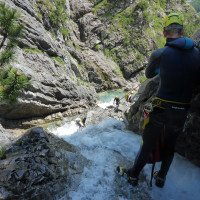
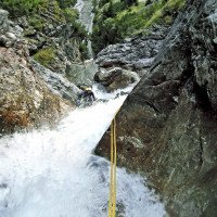
Der Roßgumpenbach ist einer der schönsten Canyoningtouren in Außerfern. Die Offenheit und vielen Ausstiegsmöglichkeiten können aber schnell zum Übermut führen. Die Tour sollte aber aufgrund des alpinen Charakters und dem kalten Wasser nicht unterschätzt werden. Voraussetzung sind aber stabiles Wetter und nicht zu hoher Wasserstand! Mit ausreichend Erfahrung und Kondition ist es eine lässige Ganztagestour die, bis auf wenige Geh- und Abkletterpassagen, sehr kontinuierlich ist. Nach Kontrolle der Wassertiefe können einige Stufen (gerade im oberen Bereich) gerutscht oder gesprungen werden. Im unteren Teil wird die Schlucht anspruchsvoller und die Abseiler höher, sind aber bei nicht zu hohem Wasserstand kein Problem. Die Schlucht bleibt bis zum 45m Schlusswasserfall offen mit schönem Blick auf die umliegenden Berge.
The Roßgumpenbach is one of the most beautiful canyoning tours in Außerfern. However, the openness and many exit options can quickly lead to overconfidence. The tour should not be underestimated because of the alpine character and the cold water. Prerequisites are stable weather and not too high water level! With sufficient experience and condition, it is a casual full-day tour that is very continuous, except for a few walking and downclimb passages. After checking the water depth, some steps (especially in the upper part) can be slid or jumped. In the lower part, the canyon becomes more demanding and the rappels higher, but are not a problem if the water level is not too high. The canyon remains open until the 45m final waterfall with beautiful views of the surrounding mountains.
Return (50 min):
machine translated
➜
Original language
Vom Ausstieg bei der kleinen Holzbrücke (auf ca. 1330m) links über die breite Forststraße zum Wanderparkplatz in Holzgau zurückwandern.
Falls mit dem Fahrrad zugestiegen wurde Rückweg ca. 10 min.
From the exit at the small wooden bridge (at approx. 1330m) hike left along the wide forest road back to the hikers' parking lot in Holzgau.
If you came by bike, the way back takes about 10 min.
Coordinates:
Canyon Start
47.3041°, 10.3385°
↓↑
DMS: 47° 18" 14.76', 10° 20" 18.6'
DM: 47° 18.246", 10° 20.31"
Google Maps
Austria Topo
DMS: 47° 18" 14.76', 10° 20" 18.6'
DM: 47° 18.246", 10° 20.31"
Google Maps
Austria Topo
Canyon End
47.2894°, 10.3363°
↓↑
DMS: 47° 17" 21.84', 10° 20" 10.68'
DM: 47° 17.364", 10° 20.178"
Google Maps
Austria Topo
DMS: 47° 17" 21.84', 10° 20" 10.68'
DM: 47° 17.364", 10° 20.178"
Google Maps
Austria Topo
Parking Entry and Exit
47.26166°, 10.3426°
↓↑
DMS: 47° 15" 41.98', 10° 20" 33.36'
DM: 47° 15.7", 10° 20.556"
Google Maps
Austria Topo
DMS: 47° 15" 41.98', 10° 20" 33.36'
DM: 47° 15.7", 10° 20.556"
Google Maps
Austria Topo
Waypoint
47.28888°, 10.3358°
↓↑
DMS: 47° 17" 19.97', 10° 20" 8.88'
DM: 47° 17.333", 10° 20.148"
Google Maps
Austria Topo
DMS: 47° 17" 19.97', 10° 20" 8.88'
DM: 47° 17.333", 10° 20.148"
Google Maps
Austria Topo
Beim Zustieg mit dem MTB, Fahrräder hier verstecken/anschließen.
Waterlevel Meter Site
47.289487°, 10.336436°
↓↑
DMS: 47° 17" 22.15', 10° 20" 11.17'
DM: 47° 17.369", 10° 20.186"
Google Maps
Austria Topo
DMS: 47° 17" 22.15', 10° 20" 11.17'
DM: 47° 17.369", 10° 20.186"
Google Maps
Austria Topo
Checkpoint am letzten Wasserfall
Intermediate Canyon Exit
47.294828°, 10.336945°
↓↑
DMS: 47° 17" 41.38', 10° 20" 13'
DM: 47° 17.69", 10° 20.217"
Google Maps
Austria Topo
DMS: 47° 17" 41.38', 10° 20" 13'
DM: 47° 17.69", 10° 20.217"
Google Maps
Austria Topo
Literatures:
Canyoning Book
Werner Baumgarten
2013
Canyoning Book
Werner Baumgarten
2010
ACA Canyon Info
Cwiki Canyon Info
Descente Canyon Info
Ropewiki Canyon Info
Gallery
Trip Report (e.g. Blogpost)
28.06.2024
Sascha Schäfer
⭐
★★★★★
📖
★★★
⚓
★★★
💧
High
Completed ✔
machine translated
➜
Original language
Sehr hoher Wasserstand, daher sind wir nach der Gehpassage in der Mitte ausgestiegen. Bis dahin alle haken top Zustand.
Very high water level, so we got out after the walking passages in the middle. Until then all anchors were in top condition.
13.10.2023
Clemens Krabacher
⭐
★★★★★
📖
★★★
⚓
★★★
💧
Low
Completed ✔
machine translated
➜
Original language
Temperatur top - viele Sprünge möglich - Verankerungen alle in Ordnung - traumhaftes Tagl
Temperature top - many jumps possible - anchorages all in order - dreamlike tagl
27.09.2023
Clarissa Linder
⭐
★★★★★
📖
★★★
⚓
★★★
💧
Low
Completed ✔
machine translated
➜
Original language
Mittlerweile leider viel Geschiebe in der Tour. 3 Elektrozäune ca. in der Mitte der Tour über den Bach gespannt. Sonne ab ca. Mittag.
Meanwhile, unfortunately, much debris in the tour. 3 electric fences stretched across the stream approx. in the middle of the tour. Sun from about noon.
11.07.2023
Patrick Summerer
⭐
★★★★★
📖
★★★
⚓
★★★
💧
Low
Completed ✔
machine translated
➜
Original language
Fast überall Klebehaken vorhanden, bei ein paar wenigen Stellen muss abgeklettert werden, für geübte Canyonauten aber kein Problem!
Almost everywhere hooks are available, in a few places you have to climb down, but for experienced canyonauts no problem!
09.03.2023
System User
⭐
★★★★★
📖
★★★
⚓
★★★
no translation available
Info: Teile der Canyonbeschreibung wurden automatisiert übernommen. Konkret die Felder Weblinks, Koordinaten, Rating, Ort, Länge des Canyon, Einfachseil Mindestens von https://canyon.carto.net/cwiki/bin/view/Canyons/RossgumpenbachCanyon.html und https://www.descente-canyon.com/canyoning/canyon/22091
09.03.2023
System User
⭐
★★★★★
📖
★★★
⚓
★★★
no translation available
Daten importiert von https://www.canyoning.or.at/index.php/liste-aller-canyons/583-rossgumpenbach
16.07.2022
Christian Balla
⭐
★★★★★
📖
★★★
⚓
★★★
💧
Normal
Completed ✔
machine translated
➜
Original language
Der Rossgumpenbach ist ein absolut lohenswerter Canyon. Der Zustieg ist ein langer aber gut zu laufender Wanderweg. Der Zustieg sollte nach Möglichkeit frühzeitig erfolgen um die Mittagsonne beim Aufstieg zu vermeiden. Zudem kann es im laufe des Tages schwierig werden, in Holzgau einen Parkplatz zu finden. Zunächst dem Wanderweg zur Rossgumpenalm folgen. Ungefähr 5 Minuten vor der Rossgumpenalm wird der Roßgumpenbach überquert. Von hieraus sollte sollte zunächst der Wasserstand am Rossgumpen Wasserfall überprüft werden. Anschließend den Europafernwanderweg E5 Richtung Kemptener Hütte folgen. Es folgt ein steiler Anstieg außerhalb der Sichtweite des Roßgumpenbach. Sobald der Weg für einen kurzen Moment an den Roßgumpenbach führt ist der 2. Teil erreicht. Nach ungewähr weiteren 15 Minuten Gehzeig zweigen wir an einer kleinen Schutzhütte vom Weg nach rechts zum 1. Teil des Roßgumpenbach ab.
Im Canyon geht es geht Schlag auf Schlag. Nur zwischen den oberen und unteren Abschnitt gibt es eine kurze Laufstrecke. Direkt am Beginn des unteren Abschnitts kann man den Canyon verlassen oder von hier auch erst Starten. Der Fels ist überwiegend griffig.
Sowohl im oberen als auch im unteren Abschnitt gibt es jeweils einen höheren Wasserfall, so dass mindestens zwei Seile a 45m benötigt werden. Bei genügend Personen ist zusätzlich ist ein kürzeres Seil, z.B. 30m, zu empfehlen.
The Rossgumpenbach is an absolutely worthwhile canyon. The access is a long but easy to walk hiking trail. Access should be made early if possible to avoid the midday sun on the ascent. It can also be difficult to find a parking space in Holzgau during the walk. First follow the hiking trail to the Rossgumpenalm. About 5 minutes before the Rossgumpenalm, cross the Roßgumpenbach. From here, you should first check the water level at the Rossgumpen waterfall. Then follow the European long-distance hiking trail E5 towards Kemptener Hütte. This is followed by a steep climb out of sight of the Roßgumpenbach. As soon as the path leads to the Roßgumpenbach for a short moment, the 2nd part is reached. After about another 15 minutes of walking, we turn off the path to the right at a small refuge to the 1st part of the Roßgumpenbach.
In the canyon, it's one step after another. There is only a short running section between the upper and lower parts. You can leave the canyon right at the beginning of the lower parts or start from here. The rock is mostly grippy.
There is a higher waterfall in both the upper and lower parts, so at least two 45m ropes are required. If there are enough people, a shorter rope, e.g. 30m, is also recommended.
11.07.2021
Christian Balla
⭐
★★★★★
📖
★★★
⚓
★★★
🌊
Crazy
Completed ?
machine translated
➜
Original language
Wir sind wegen aufziehenden Gewitterwolken nach dem C35 ausgestiegen. Der Wasserstand war sehr hoch im oberen Teil, vielleicht zu viel für den unteren Abschnitt.
Video der Tour:
https://www.youtube.com/watch?v=1XmpOa-urrw
We got out after the C35 due to approaching thunderclouds. The water level was very high in the upper part, perhaps too much for the lower part.
Video of the tour:
https://www.youtube.com/watch?v=1XmpOa-urrw
New Report
Please briefly and concisely the most important information of the last tour or important current information about the canyon. If necessary with links to videos, photos, etc..
*
*
*
Esc
Del
