a little difficult
Consusa (inferior)
v4 a2 IV
3h50
5min
3h
45min
1500m
1160m
340m
30m
1x30m + 1x40m
18
750m
on Foot
Rating:
★★★★★
3.9 (3)
Info:
★★★
3 (2)
Belay:
★★★
2.5 (2)
Summary:
machine translated
➜
Original language
Abseilcanyon, im Sommer ohne Wasserdurchsatz
Rappel canyon, without water flow in summer
Parts
Name
Difficulty
Approach
Tour
Return
West
Summary:
machine translated
➜
Original language
Abseilcanyon, im Sommer ohne Wasserdurchsatz
Rappel canyon, without water flow in summer
Access:
machine translated
➜
Original language
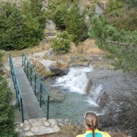
Unterer Parkplatz: Wir fahren auf der A-138 von Ainsa nach Norden in Richtung Bielsa. Wir kommen über Labuerda und Escalona zur Brücke über den Rio Yaga, wo der Miraval-Canyon zu Ende ist - 17 km ab Ainsa, Ortsmitte. Wir fahren an dem Weiler Hospital vorbei und biegen 450 m nach der Brücke über den Rio Yaga in spitzem Winkel links hinauf ab in Richtung Tella, Revilla. Wir fahren stetig bergauf, lassen nach 5,7 km die Abzweigung nach Tella rechts liegen, nehmen weiter Kurs auf Revilla und kommen nach weiteren 4,9 km zu einer scharfen Rechtskurve, an deren linkem Rand sich eine größere Freifläche zum Abstellen unseres Autos findet. Von hier wären es noch 0,9 km bis Revilla.
Oberer Parkplatz: Auf der Straße noch 900m weiter bis zu einer Parkmöglichkeit in einer Rechtskehre (mehrere Infotafeln)
We head north on the A-138 from Ainsa towards Bielsa. We pass through Labuerda and Escalona to reach the bridge over the Rio Yaga, where the Miraval canyon ends - 17 km from Ainsa, town center. We pass the hamlet of Hospital and 450 m after the bridge over the Rio Yaga we turn left uphill at an acute angle towards Tella, Revilla. We drive steadily uphill, leaving the turnoff to Tella on the right after 5.7 km. We continue towards Revilla and after another 4.9 km we come to a sharp right turn, at the left edge of which there is a large open space where we can park our car. From here it would be another 0.9 km to Revilla.
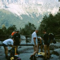
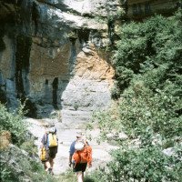
Approach (5 min):
machine translated
➜
Original language
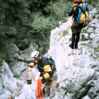
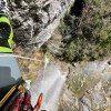
Von der Serpentine nehmen wir dann den Weg, der in etwa horizontal nach NNW führt und sind wenige Minuten später am Bachbett.
From the parking lot, continue along the road to the hairpin bend. From the hairpin bend, take the path that leads roughly horizontally to the NNW and a few minutes later you will be at the streambed,
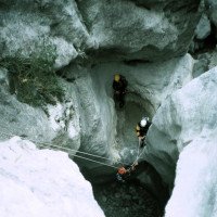
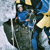
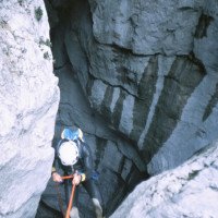
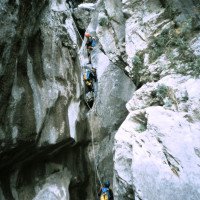
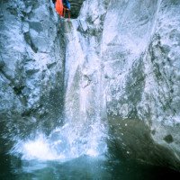
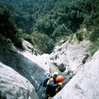
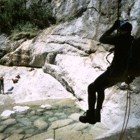
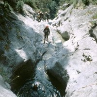
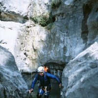
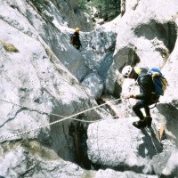
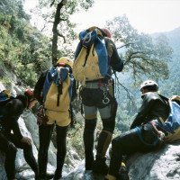
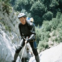
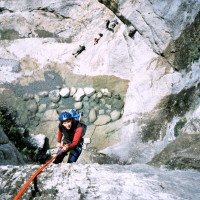
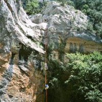
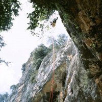
Tour (3 h):
machine translated
➜
Original language
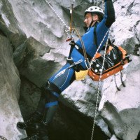
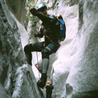
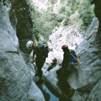
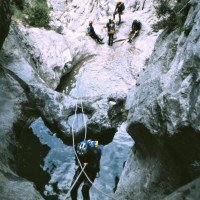
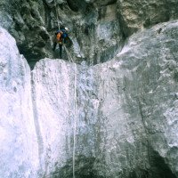
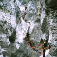
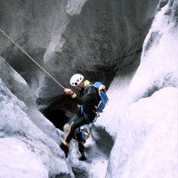
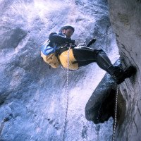
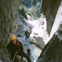
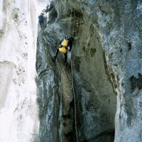
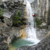
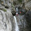
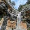
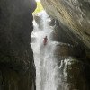
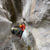
18 Abseiler, teilweise Springbar. Im Sommer einige Marmitas Trampas, der Schlussabseiler im freien Hang hinunter auf den Weg , der rechts nach Escuain und zur gleichnamigen Garganta führt.
18 rappels, some Marmitas Trampas, the final rappel in the free slope down to the path that leads right to Escuain and the Garganta of the same name.
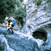
Return (45 min):
machine translated
➜
Original language
Nach dem erwähnten Schlussabseiler links auf einen guten Weg und über diesen hinauf zur Straße und zum Auto.
After the aforementioned final abseil, turn left and up to the road and the car.
Coordinates:
Canyon Start
Parking at Entry
Zustiegsparkplatz in Straßenkehre
Parking at Exit
Parkplatz links neben Straße
Canyon End
wo der Weg zum Escuain den Consusa kreuzt
Literatures:
Map
1:50000
Map
Canyoning Book
Roger Büdeler / Gabriele Flitner
Rother
1997
3-7633-3014-3
88 Abstiege in den Pyrenäen und der Sierra de Guara
Canyoning Book
2010
Canyoning Book
Canyoning Book
José A. Ortega - Miguel A. Cebrián
DESNIVEL
2006
84-9829-034-1
50 Canyon-Beschreibungen
Canyoning Book
Eduardo Gómez - Laura Tejero
Barrabes
2002
Canyoning Book
Fernando Biarge / Ana Biarge
1996
Canyoning Book
Patrick Gimat / Jean Paul Pontroué
1995
Canyoning Book
Luis Mariano Mateos Marcos
1992
Canyoning Book
Francis de Richemond - Claude Chantemesse
Les Editions du Pélican
1992
2 9506764 0 5
2. A. span. (1.A 1988) 20 Abstiege Pyrenäen mit Sierra de Guara
Canyoning Book
Jean Paul Pontroué
Foehn Editions
1992
978-2909694009
Canyoning Book
Fernando Biarge / Enrique Salamero
1991
Canyoning Book
Francis de Richemond - Claude Chantemesse
1988
Canyoning Book
J.P. Pontroué - F. Biarge
1987
2-95033199-1-2
Sierra de Guara + Massiv Mont Perdu (vorwiegend historisches Interesse) (2.A.)
Canyoning Book
Fernando Biarge - Jean Paul Pontroué
Eigenverlag
1986
84-398-6485-X
50 Canyon-Beschreibungen
Canyoning Book
Jean-Paul Pontroué
1985
Other Canyon Info
Cwiki Canyon Info
Descente Canyon Info
Ropewiki Canyon Info
Video
21.03.2024
GeorgB
⭐
★★★★★
📖
★★★
⚓
★★★
💧
High
Completed ✔
machine translated
➜
Original language
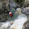
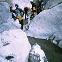
Schneeschmelze mit hohen aber problemlos machbaren Wasserstand. Alle Haken vorhanden. Vorsicht beim Springen, nicht alle Becken sind sauber und das Weißwasser verdeckt Hindernisse.
Melting snow with high but easily manageable water levels. All anchors available. Be careful when jumping, not all pools are clean and the white water hides obstacles.
21.03.2024
Rok
⭐
★★★★★
📖
★★★
⚓
★★★
💧
High
Completed ✔
machine translated
➜
Original language
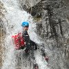
Aktuell super Wasserstand, da der Schnee oberhalb schmilzt. Absolut empfehlenswert und die Stände sind sehr gut. Fast immer 2 Haken. Wir haben die Baumstämme beim letzten Abseiler hinunter befördert, da diese sehr gefährlich an der Kante hangen. Hat zwischendurch ein bisschen Lodrino feeling. Top Schlucht, wenn sie Wasser hat. Alle Becken sind randvoll und kein Problem zum herauskommen.
Currently superiore water level, as the snow above is melting. Absolutely recommendable and the stands are very good. Almost always 2 anchors. We carried the tree trunks down on the last rappel, as they hang very dangerously on the edge. Has a bit of a Lodrino feeling in between. Top canyon when it has water. All the pools are full to the brim and no problem getting out.
09.03.2023
System User
⭐
★★★★★
📖
★★★
⚓
★★★
no translation available
Daten importiert von https://canyon.carto.net/cwiki/bin/view/Canyons/ConsusinferiorCanyon.html
New Report
Please briefly and concisely the most important information of the last tour or important current information about the canyon. If necessary with links to videos, photos, etc..
*
*
*
Esc
Del
Hydrology: