a little difficult
Chassezac
v3 a4 III
2h10
20min
1h10
40min
730m
530m
200m
11m
2x25m
14
3200m
on Foot
Rating:
★★★★★
2.9 (1)
Info:
★★★
0 ()
Belay:
★★★
0 ()
Summary:
machine translated
➜
Original language
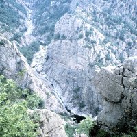
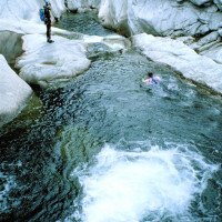
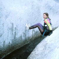
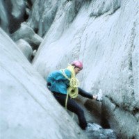
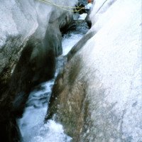
Stark eingeengter Flusslauf zwischen Granit-Felsen. Interessantester Abschnitt des Haut Chassezac.
Der obere Abschnitt hat längere Laufstrecken und sollte mit Umsetzung gemacht werden.
Starl constricted river course between granite rocks. Most interesting part of Haut Chassezac
North
Summary:
machine translated
➜
Original language
Stark eingeengter Flusslauf zwischen Granit-Felsen. Interessantester Abschnitt des Haut Chassezac.
Der obere Abschnitt hat längere Laufstrecken und sollte mit Umsetzung gemacht werden.
Starl constricted river course between granite rocks. Most interesting part of Haut Chassezac
Access:
machine translated
➜
Original language
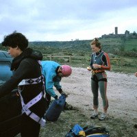
Von Ales auf der D 906 nordwärts nach Villefort (55 km). Weitere 8 km auf der D 906 in nördlicher Richtung, bis kurz nach dem Weiler Garde Guerrin rechts eine kleine Straße zum Belvedere du Chassezac abzweigt (800 m ab Abzweigung). Am Aussichtspunkt Fahrzeug abstellen.
From Ales, take the D 906 north to Villefort (55 km). Continue north on the D 906 for another 8 km until, shortly after the hamlet of Garde Guerrin, a small road branches off to the right to Belvedere du Chassezac (800 m from the turnoff). Park vehicle at the viewpoint.\n
Approach (20 min):
machine translated
➜
Original language
Etwas nördlich vom Aussichtspunkt führt uns ein Pfad hinab zum Fluss am Beginn der Enge La Rajoule.
A little north of the viewpoint, a path leads us down to the river at the beginning of the narrow La Rajoule.
Tour (1 h 10):
machine translated
➜
Original language
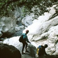
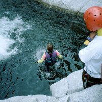
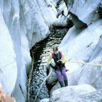
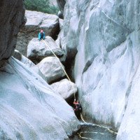
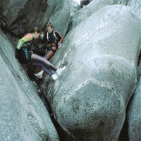
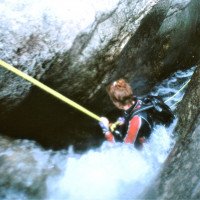
Abseilen, Klettern, Klemmen, Schwimmen zwischen Granitwändern. Vorsicht: ein gefährlicher Siphon!
Rappelling, climbing, clamping, swim between granite walls. Caution: 1 dangerous siphon!
Return (40 min):
machine translated
➜
Original language
Am besten nach der längeren Engstelle 'La Rajole' rechts hinaus und auf Pfadspuren (rote Punkte) hinauf zum Belvedere.Man kann aber auch noch annähernd 1 Std. weitergehen bis zu einer kleinen Staumauer, dort rechts hinaus und auf einem Weg mit blauen Markierungen hinauf nach Garde Guerrin und von dort rechts zum Belvedere.Ein Weiterlaufen nach Pied de Borne (weitere 2 Std.) wäre nur noch ermüdend.
It is best to go out to the right after the long bottleneck 'La Rajole' and up to the Belvedere on path tracks (red dots).You can also continue for about 1 hour to a small dam, out to the right and on a path with blue markings up to Garde Guerrin and from there right to the Belvedere.A further walk to Pied de Borne (another 2 hours) would only be tiring.
Coordinates:
Canyon Start
Canyon End
Parking Entry and Exit
Alternative Canyon Start
integral
Alternative Canyon End
klassisches Ende
Literatures:
Map
IGN TOP25, 2838 OT, Largentiere - Labastide P. Laurent, 1/25 000
Canyoning Book
Le tour de l´Europe en Canyon. Les plus belles descentes
Stéphane Coté / Caracal et les Sancho Panza
2007
124 Canyon-Beschreibungen
Canyoning Book
Descentes de canyons en Ardèche et départements limitrophes
Franck Jourdan / Jean-François Fiorina
2005
2-9523920-0-5
23 Tourenbeschreibungen in französicher und englischer Sprache: Ardeche, dazu Lozere und Gard, einschließlich Chassezac
Canyoning Book
Canyons in Europa. 50 Touren für Schluchten-wanderer, Canyon-Trekker und Wildwasser-fahrer
Alfons Zaunhuber
Berg im Südwest Verlag
1994
978-3763411078
Canyoning Book
Gorges et Canyons en Languedoc Roussillon, Jean-Pierre Lucot et Richard Quintilla, 1990
J.P. Lucot - R. Quintanilla
Edisud
1990
Canyoning Book
À la découverte des canyons
Francis de Richemond - Claude Chantemesse
1988
Cwiki Canyon Info
Descente Canyon Info
Ropewiki Canyon Info
FFME Canyon Info
Other Canyon Info
23.08.2024
franck74
⭐
★★★★★
📖
★★★
⚓
★★★
💧
Normal
Completed ✔
no translation available
Automatisch importiert von Descente-Canyon.com für Canyon Haut Chassezac
RAS, de 9 à 2, avec un départ en 9 aux alentours de 9h, seulement 2 groupes croisés vers le début et personne ensuite.
(Quelle: https://www.descente-canyon.com/canyoning/canyon-debit/2212/observations.html)
17.08.2024
Mfamily
⭐
★★★★★
📖
★★★
⚓
★★★
💧
Normal
Completed ✔
no translation available
Automatisch importiert von Descente-Canyon.com für Canyon Haut Chassezac
De 9 à 0 en 6h
(Quelle: https://www.descente-canyon.com/canyoning/canyon-debit/2212/observations.html)
12.08.2024
Isa_
⭐
★★★★★
📖
★★★
⚓
★★★
💧
Normal
Completed ✔
no translation available
Automatisch importiert von Descente-Canyon.com für Canyon Haut Chassezac
RAS, tout passe dans l’actif. Beaucoup de marche dans les blocs. Quelques passages siphonnant à repérer pour pas se coincer ! Mais avec ce débit, c’est tranquille. Effectué de 7 à 2, en partant juste avant la vague de touristes. On a passé 2h, 2h30 dans l’eau !
(Quelle: https://www.descente-canyon.com/canyoning/canyon-debit/2212/observations.html)
31.07.2024
jerome-g
⭐
★★★★★
📖
★★★
⚓
★★★
💧
Normal
Completed ✔
no translation available
Automatisch importiert von Descente-Canyon.com für Canyon Haut Chassezac
De 8 à 0 (chemin bleu). Un peu déçu par l'eau : très sombre, petite mousse jaune par endroit, algues hyper glissantes. Sinon très sympa.
(Quelle: https://www.descente-canyon.com/canyoning/canyon-debit/2212/observations.html)
29.07.2024
tom2bdx
⭐
★★★★★
📖
★★★
⚓
★★★
💧
Normal
Completed ✔
no translation available
Automatisch importiert von Descente-Canyon.com für Canyon Haut Chassezac
Quelques groupes mais sans plus. Glissant, sinon RAS.
(Quelle: https://www.descente-canyon.com/canyoning/canyon-debit/2212/observations.html)
25.07.2024
didier1999
⭐
★★★★★
📖
★★★
⚓
★★★
💧
Normal
Completed ✔
no translation available
Automatisch importiert von Descente-Canyon.com für Canyon Haut Chassezac
Parcouru en intégrale .Bon débit , équipement RAS.
(Quelle: https://www.descente-canyon.com/canyoning/canyon-debit/2212/observations.html)
20.07.2024
Marc Maurin
⭐
★★★★★
📖
★★★
⚓
★★★
💧
Normal
Completed ✔
no translation available
Automatisch importiert von Descente-Canyon.com für Canyon Haut Chassezac
Débit correct. Eau fraîche au départ, douce ensuite. Fait du point 9 au point 2. Mieux de rentrer au point 7. Pour ça, ne pas prendre à gauche à la première bifurcation mais à droite, puis à gauche direction le Rahan.
(Quelle: https://www.descente-canyon.com/canyoning/canyon-debit/2212/observations.html)
13.07.2024
G
⭐
★★★★★
📖
★★★
⚓
★★★
💧
Normal
Completed ✔
no translation available
Automatisch importiert von Descente-Canyon.com für Canyon Haut Chassezac
5h à trois repère 8 à 0
(Quelle: https://www.descente-canyon.com/canyoning/canyon-debit/2212/observations.html)
12.06.2024
gael63
⭐
★★★★★
📖
★★★
⚓
★★★
💧
Normal
Completed ✔
no translation available
Automatisch importiert von Descente-Canyon.com für Canyon Haut Chassezac
Fait en tant que public support pour la formation DE du CREPS d'Aix. Toujours aussi beau et agréable !
(Quelle: https://www.descente-canyon.com/canyoning/canyon-debit/2212/observations.html)
25.05.2024
edgarfella
⭐
★★★★★
📖
★★★
⚓
★★★
💧
Normal
Completed ✔
no translation available
Automatisch importiert von Descente-Canyon.com für Canyon Haut Chassezac
DC+Super conditions dans le chassezac, sortie rouge, Début de MC dans la rajole tonchée
(Quelle: https://www.descente-canyon.com/canyoning/canyon-debit/2212/observations.html)
09.03.2023
System User
⭐
★★★★★
📖
★★★
⚓
★★★
no translation available
Info: Teile der Canyonbeschreibung wurden automatisiert übernommen. Konkret die Felder Weblinks, Koordinaten, Rating, Länge des Canyon, Einfachseil Mindestens von https://www.descente-canyon.com/canyoning/canyon/2212
09.03.2023
System User
⭐
★★★★★
📖
★★★
⚓
★★★
no translation available
Daten importiert von https://canyon.carto.net/cwiki/bin/view/Canyons/ChassezacCanyon.html
Hydrology:
