Country:
Schweiz / Switzerland
Region: Kanton St. Gallen
Subregion: Wahlkreis See-Gaster
Town: Amden
v5 a4 IV
4h55
10min
4h
45min
945m
750m
195m
18m
2x 25m
11
600m
Car optional
Rating:
★★★★★
3.6 (1)
Info:
★★★
0 ()
Belay:
★★★
0 ()
Summary:
machine translated
➜
Original language
Abseilcanyon
rappel canyon
Parts
Name
Difficulty
Approach
Tour
Return
South
Summary:
machine translated
➜
Original language
Abseilcanyon
rappel canyon
Access:
machine translated
➜
Original language
Autobahn Chur-Zürich bei Ausfahrt 45 am westlichen Ende des Walensees in Richtung Amden verlassen und hinauffahren in Richtung Amden. Die Straße zieht am Fels entlang aufwärts. An der nächsten Linkskehre das erste Auto auf dem Parkplatz abstellen (9,6 km ab Autobahn).
Mit dem zweiten weiter hinauf nach Amden (weitere 2,2 km). 240 m nach Überqueren des Rombachs (schon am Beginn der Ortschaft Amden) links ab in die Durschlegistraße und gleich wieder links auf den großen Parkplatz.
Leave the Chur-Zurich freeway at exit 45 at the western exit of Lake Walen in the direction of Amden and drive up towards Amden. The road goes up along the rock. At the next leftward haipin bend park the first car in the parking lot (9.6 km from the highway).\nContinue with the second car uphill to Amden (another 2.2 km). 240 m after crossing the Rombach (already at the beginning of the village of Amden) turn left into Durschlegistraße and immediately left again into the large parking lot.
Approach (10 min):
machine translated
➜
Original language
Auf der Durschlegistraße 400 m weiter in Richtung NW bis zur Brücke über den Rombach.
Continue on Durschlegistraße for 400 m in a northerly direction until you reach the bridge over the Rombach.
Tour (4 h):
machine translated
➜
Original language
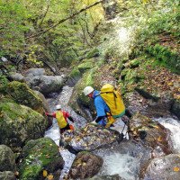
Schon bald eng eingeschnitten, eine Folge von Abseilern (max. 18 m im oberen Abschnitt), dann offener mit abschließender Laufstrecke bis zur Brücke. Hier steigen wir nach rechts auf die Brücke aus. (Einstieg/Ausstieg hier möglich).
Alternativ können wir auch weiter absteigen im Rombach inf. (siehe dort).
Soon narrowly cut, a succession of rappels (max. 18 m in the upper part), then more open with final run to the bridge. Here we exit to the right onto the bridge. (Entry/exit possible here).\n
Return (45 min):
machine translated
➜
Original language
Wir gehen über die Brücke und folgen dem Weg hinauf nach Amden, wenn wir nur 1 Auto haben.
Bei einer Umsetzung nehmen wir den Weg nach unten. Er führt uns zum Auto für den Ausstieg.
We cross the bridge and follow the path up to Amden.
Coordinates:
Canyon Start
47.1523°, 9.13807°
↓↑
DMS: 47° 9" 8.28', 9° 8" 17.05'
DM: 47° 9.138", 9° 8.284"
Google Maps
SwissTopo
DMS: 47° 9" 8.28', 9° 8" 17.05'
DM: 47° 9.138", 9° 8.284"
Google Maps
SwissTopo
Canyon End
Parking at Exit
47.140951°, 9.132462°
↓↑
DMS: 47° 8" 27.42', 9° 7" 56.86'
DM: 47° 8.457", 9° 7.948"
Google Maps
SwissTopo
DMS: 47° 8" 27.42', 9° 7" 56.86'
DM: 47° 8.457", 9° 7.948"
Google Maps
SwissTopo
Parking Entry and Exit
47.149259°, 9.14079°
↓↑
DMS: 47° 8" 57.33', 9° 8" 26.84'
DM: 47° 8.956", 9° 8.447"
Google Maps
SwissTopo
DMS: 47° 8" 57.33', 9° 8" 26.84'
DM: 47° 8.956", 9° 8.447"
Google Maps
SwissTopo
in der Straßenkehre
Literatures:
Map
http://ivs-gis.admin.ch/ (interaktive Karte)
Map
(Suchen/Gemeinden/Kanton(St.Gallen)/Suchergebnis Gemeinde(Amden)
Canyoning Book
Swiss Alps - Canyoning - Alpes Suisses
Emmanuel Belut / Laurence Boyé / Thomas Guigon
Association Openbach
2015
9782746679450
Canyoning Book
Canyoning-Touren Schweiz 2
F. Baumgartner / A. Brunner / D. Zimmermann
2010
Canyoning Book
Le tour de l´Europe en Canyon. T2 - Ligurie, Italia centrale et du sud, Sicile, Sardaigne, Balkans....
Stéphane Coté / Caracal et les Sancho Panza
2009
Cwiki Canyon Info
Descente Canyon Info
Ropewiki Canyon Info
09.03.2023
System User
⭐
★★★★★
📖
★★★
⚓
★★★
no translation available
Daten importiert von https://canyon.carto.net/cwiki/bin/view/Canyons/RombachCanyon.html
Hydrology:


