a little difficult
Kibris inf. (II)
v3 a4 IV
2h35
30min
1h30
35min
985m
860m
125m
11m
2x20m
1
3500m
Car optional
Rating:
★★★★★
2.1 (1)
Info:
★★★
0 ()
Belay:
★★★
0 ()
Summary:
machine translated
➜
Original language
Wandercanyon mit nur einem (Zwangs-)Abseiler.
Hiking canyon with only one (forced) rappel.
Parts
Name
Difficulty
Approach
Tour
Return
Summary:
machine translated
➜
Original language
Wandercanyon mit nur einem (Zwangs-)Abseiler.
Hiking canyon with only one (forced) rappel.
Access:
machine translated
➜
Original language
Von Sütlegen aus fahren wir mit zwei Autos zunächst zum Ausstiegsparkplatz.
Dazu nehmen wir nach Verlassen des zentralen Platzes in Sütlegen die Hauptstraße in südlicher Richtung (Wegweisung Kalkan). Nach 1350 m biegen wir in spitzem Winkel links ab. Wir folgen der schmalen Straße bergab und biegen nach weiteren 900 m links ab auf eine Straße, die etwa höhengleich am Hang entlang läuft. Wiederum 300 m weiter biegen wir von dieser Straße rechts hinunter ab. Wir folgen der Straße abwärts, halten uns bei einer Gabelung (nach etwa 620 m) links und fahren dann noch etwa 2 km weiter. Dort quert die Straße einen kleinen Bach und tritt auf eine Wiesenfläche hinaus. Hier das Auto für den Ausstieg abstellen. Wir könnten zwar noch 270 m weiter bis zum Ende der Straße fahren, doch wollen wir den Arbeitsraum dieses Hofes nicht einengen.
Nun fahren wir mit dem zweiten Auto wieder zurück und die Anfahrtsstraße hinauf. Nach 2,6 km erreichen wir wieder die Straße, die etwa höhengleich am Hang entlang läuft und folgen ihr auf eine Strecke von 2470 m. Dann biegen wir von ihr in offenem Winkel rechts hinab ab. Nun 480 m leicht bergab und bei der Vezweigung rechts hinunter. Jetzt noch fast 300 m, dann stellen wir das Auto für den Zustieg rechts auf der Freifläche vor den letzten Häusern ab (Lautsprecher an Holzmast).
Das ist derselbe Parkplatz wie für den Ausstieg aus dem Kibris superior.
From Sütlegen we drive with two cars first to the parking exit. \nTo do this, after leaving the central square in Sütlegen, we take the main road in the southern direction (Kalkan signpost). After 1350 m we turn left at a sharp angle. We follow the narrow road downhill and after another 900 m we turn left onto a road that runs along the slope at about the same level. Again 300 m further on we turn right down from this road. We follow the road downhill, keep left at a fork (after about 620 m) and then continue for about 2 km. There the road crosses a small stream and steps out onto a meadow area. Park the car here for the exit. We could continue another 270 m to the exit of the road, but we don't want to restrict the working space of this farm.\nNow we drive back with the second car and up the approach road. After 2.6 km we reach the road again, which runs along the slope at about the same level, and we follow it for a distance of 2470 meters. Then we turn from it down to the right at an open angle. Now 480 m slightly downhill and at the fork down to the right. Now almost 300 m, then we park the car for the exit on the right in the open space in front of the last houses (loudspeaker on wooden pole).\nThis is the same parking lot as for the exit from the Kibris superior.
Approach (30 min):
machine translated
➜
Original language
Wir folgen dem Feldweg links an dem letzten Haus vorbei in OSO-Richtung und halten direkt auf die Schlucht zu. Bei Erreichen des Schluchtrandes - linkerhand ein Gehöft - schwenkt der Weg in in einem 90 Grad-Winkel nach rechts und läuft nun gut 100 m am orograf. rechten Rand der Schlucht entlang. Dann biegt er links hinunter in den Hang über der Schlucht. Wir folgen ihm abwärts bis zur Holzbrücke über den Kibris. Bevor der Weg am jenseitigen Ufer in einem Bogen rechts aufwärts zieht, suchen wir linkerhand einen schmalen Felskamm, der Richtung Schlucht läuft. Von ihm führt nach wenigen Metern der Zustieg rechts hinab in eine steile Rinne und zum Flussbett (Einstieg). Ggf. kann man hier auch vom Baum hinunter seilen.
We follow the dirt road to the left past the last house in the OSE direction and keep directly towards the canyons. Upon reaching the canyon rim - a homestead on the left - the trail swings to the right at a 90 degree angle and now walks along the orographic right edge of the canyons for a good 100 meters. Then it turns left down into the slope above the canyon. We follow it downhill to the wooden bridge over the Kibris. Before the path goes up in an arc to the right on the far bank, we look for a narrow rocky ridge on the left that runs towards the canyons. From there, after a few meters, the access leads down to the right into a steep chute and to the riverbed (entry). If necessary, you can also rope down from the tree here.
Tour (1 h 30):
machine translated
➜
Original language
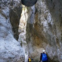
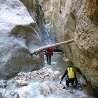
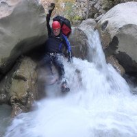
Wanderung im Flussbett bis zum einzigen Abseiler, den wir nach etwa 20 Min. erreichen. Wir haben im Jahre 2ß11 und 2015 rechts von einem Baum abseilt.
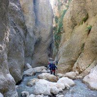
Dann weiter eine Bachwanderung, bis wir bei der engen Schlusspassage je nach Wasserdurchsatz noch einmal gefordert sind.
Hike in the riverbed to the only rappel, which we reach after about 20 min. We rappelled in 2015 left of a tree.\nThen continue a river walk until we are once again challenged in the narrow final passage, depending on the water flow.
Return (35 min):
machine translated
➜
Original language
Etwa 70 m nach dem Schluchtausgang steigen wir rechts aus und suchen im unteren Uferbereich einen Pfad, der hier durch einige Hangabrutsche wiederholt unterbrochen wird. Haben wir ihn aufgenommen, folgen wir ihm zunächst südlicher Richtung über dem Fluss aufwärts. Er zieht dann in einem Bogen um den Hang herum und oberhalb eines Seitenbaches in südwestliche Richtung gleichmäßig und angenehm bergan. Wir haben dann diesen Pfad verlassen und sind - weglos - rechts hinauf. So kommt man auf eine Wiesenfläche, an deren südöstlichem Rand der Feldweg beginnt, der uns sukzessive zu 2 Gehöften und schließlich zum Auto führt.
About 70 m after the canyon exit we get off to the right and look for a path in the lower bank, which is repeatedly interrupted here by some slope slides. Once we have picked it up, we first follow it southwards upwards above the river. It then curves around the slope and above a side stream in a southwesterly direction, moving steadily and pleasantly uphill. We then left this path and went up - pathless - to the right. This brings us to a meadow area, at the southeastern edge of which begins the dirt road that leads us successively to 2 farmsteads and finally to the car.
Coordinates:
Canyon Start
Canyon End
Parking at Entry
Parking at Exit
Literatures:
Map
Lycia West Hiking Map 1:50.000: Wanderkarten inklusive des Lykischen Weges (Englisch) 2015
Cwiki Canyon Info
Descente Canyon Info
Ropewiki Canyon Info
Gallery
09.03.2023
System User
⭐
★★★★★
📖
★★★
⚓
★★★
no translation available
Daten importiert von https://canyon.carto.net/cwiki/bin/view/Canyons/KibrisinferiorCanyon.html
Hydrology:

1 am Parkplatz Zustieg

2 Einstieg jenseits des Ho...

3 Blick von der Brücke

4 Einstieg (ggf. abseilen...

5 Start unter der Brücke
6
7

8

9 Abseilen vom Baum

10 anno 2011 im Strahl rec...

11 dito

12 anno 2015 Strahl orogra...

13 dito

14

15

16

17

18

19

20

21
22

23

25

26 Schluchtausgang

27
28

29

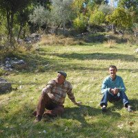
30 Gastfreundschaft