v2 a3 II
3h55
45min
3h
10min
430m
330m
100m
12m
1x30m
6
2100m
on Foot
Rating:
★★★★★
4.5 (8)
Info:
★★★
2.6 (8)
Belay:
★★★
3 (7)
Summary:
machine translated
➜
Original language
Attraktiver Sprung- und Abseilcanyon mit warmen, grünen Wasser.
Attractive jumping and rappel canyon with warm, green water.
Southeast
Summary:
machine translated
➜
Original language
Attraktiver Sprung- und Abseilcanyon mit warmen, grünen Wasser.
Attractive jumping and rappel canyon with warm, green water.
Access:
machine translated
➜
Original language
Von Dolceaqua das Tal aufwärts und in Richtung Rochetta Nervina fahren. Am grossen Parkplatz im Ort parken (2023: 8 Euro pro Tag, 1 Euro die Stunde, Nachts für Wohnmobile gratis). Wasserhahn am Sanitärgebäude/Rückwand. Im Sanitärgebäude auch Dusche - nur tagsüber geöffnet.
From Dolceaqua drive up the valley in the direction of Rochetta Nervina. Park in the large parking lot in the village (2023: 8 euros per day, 1 euro per hour, free for motorhomes at night). Water tap at the sanitary building/back wall. Shower in the sanitary building - only open during the day.
Approach (45 min):
machine translated
➜
Original language
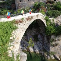
Den Bach überqueren und auf der anderen Ortsseite den Schildern auf einen Maultierpfad ("Sentiero 13") folgen. Den Pfad 35min bis zu einer beschilderten Abzweigung folgen und dort den unteren Steig nehmen. Man quert bald die Bergsturzzone mit zwei grossen Felstrümmern unterhalb des Steiges und erreicht dann den Einstieg bei der Brücke Ponte Cin.
Gebühr für Begehung - 2023 war um 08.45 h Inkasso-Häuschen noch nicht besetzt.
Cross the stream and on the other side of the village follow the signs to a mule track ("Sentiero 13"). Follow the path for 35 minutes to a signposted junction and take the lower path. You soon cross the landslide zone with two large rock debris below the path and then reach the entry point at the Ponte Cin bridge.
Fee for ascent - 2023 collection hut was not yet occupied at 08.45 h.
Tour (3 h):
machine translated
➜
Original language
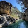
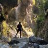
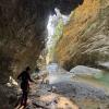
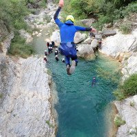
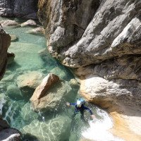
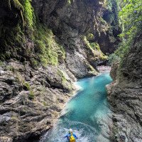
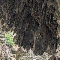
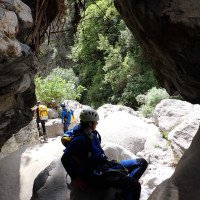
Einstieg ist bei der Brücke über den Bach. Hier kann direkt auf 8.6m (descente) gesprungen werden. Im Folgenden wechseln sich Sprünge bis 12m und kleine, bestens ausgestattete Abseiler bis 10m ab. Im unteren Drittel herrliche Tuff-Formationen ähnlich der Maglia. Nach einer Abseilpassage zwischen riesigen Felsblöcken öffnet sich die Schlucht. Letze Stelle ist der Sprung von der Staumauer. Hier sind häufig Badegäste anzutreffen.
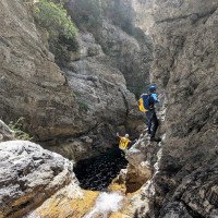
Achtung! Es gibt eine Stelle (Bild 12 zeigt sie von unten) die von kommerziellen häufig genutzt wird um Seilbahnen zu bauen. Hier ist orog. links ein SEHR gut ausgestatteter Standplatz der sich nur mäßig zum Abseilen eignet da das Seil hier gerne in einer Spalte klemmt. Wenn man abseilt dann eher orog. rechts etwas weiter vorn. An dieser Stelle kann gesprungen werden, es ist aber zwingend notwendig die Stelle genauestens auszuchecken. Das Becken wirkt von oben deutlich tiefer als es ist und ist voller großer Steine.
Der Wasserstand kann am besten beim Einstieg bewertet werden.
Es gibt keine offensichtlichen Fluchtmöglichkeiten im kritischen Teil der Schlucht. Die bei descente beschriebenen "Ausgeschilderten" Notausstiege sind nicht existent. An einigen Stellen kann sicherlich linksseitig mühsam der Hang erklommen werden.
Stellen um aus dem Wasser zu kommen gibt es genügend.
Entry is at the bridge over the stream. Here you can jump directly to 8.6m (descente). In the following, jumps up to 12m and small, well-equipped rappels up to 10m alternate. In the lower third there are wonderful tuff formations similar to the Maglia. After a rappel between huge boulders, the canyon opens up. The last point is the jump from the dam wall. Bathers are often to be found here.
Watch out! There is a place (picture 12 shows it from below) that is often used by commercial operators to build ropeways. There is a VERY well-equipped belaystation on the left which is only moderately suitable for rappels as the rope tends to get stuck in a crevice here. If you are rappelling, then rather orog. right a little further ahead. You can jump at this point, but it is essential to check out the spot carefully. The pool looks much deeper from above than it is and is full of large stones.
The water level can best be assessed at the entry.
There are no obvious canyons in the critical part of the canyon. The "signposted" emergency exits described by descente are non-existent. In some places, the slope can certainly be climbed with difficulty on the left.
There are plenty of places to get out of the water.
Return (10 min):
machine translated
➜
Original language
Recht mühsam durchs verblockte Bachbett, bis man einen Badeplatz unterhalb einer künstlichen Stufe erreicht. Hier nach rechts auf guten Steig retour in den Ort.
Quite laborious through the blocked streambed until you reach a bathing area below an artificial step. Turn right here on a good path back to the village.
Coordinates:
Parking Entry and Exit
Canyon End
Canyon Start
Ponte Cin
Alternative Canyon Start
Start Barbaira sup. ca. 1h mehr Canyon lt. Descente nicht lohnenswert
Literatures:
Canyoning Book
Daniele Geuna, Dina Ruotolo
Versante Sud
2010
978-88-87890-94-5
Canyoning Book
Pascal van Duin
Edizioni TopCanyon
2009
100 Beschreibungen
Canyoning Book
Hubert Ayasse - Franck Tessier
Edisud
2006
Canyoning Book
Christophe Folléas / Brigitte Gimenez
2006
Cwiki Canyon Info
Gallery
Other Canyon Info
Other Canyon Info
Ropewiki Canyon Info
Ropewiki Canyon Info
06.04.2025
David Gamperl
⭐
★★★★★
📖
★★★
⚓
★★★
💧
High
Completed ✔
Other users were: Katharina Linder
Very exciting canyon! High water level. Anchors in excellent condition. Lost a camera (DJI Osmo) in the deepest pool (Photo 20/21) so if anyone should find it let me know!
Other users were: Katharina Linder
01.07.2024
Rok
⭐
★★★★★
📖
★★★
⚓
★★★
💧
Normal
Completed ✔
machine translated
➜
Original language
Other users were: Barbora Kohout Julia Straßer
Ein paar Stunden später nochmals begangen, da wir zwei Freunde getroffen haben. Und die Sonne kam auch raus und machte aus der Schlucht eine 5 von 5. Was für ein Erlebnis. Tolles Farbenspiel.
A few hours later we went again, as we met two friends. And the sun came out too, making the canyon a 5 out of 5. What an experience. Great play of colors.
Other users were: Barbora Kohout Julia Straßer
01.07.2024
Rok
⭐
★★★★★
📖
★★★
⚓
★★★
💧
Normal
Completed ✔
machine translated
➜
Original language
Ein Fun-Canyon der seines gleichen sucht. Alles bis auf den letzten Abseiler in der Junglepassage springbar bzw. zum abklettern. Leider keine Sonne in der Schlucht, trotzdem gewaltig und wunderschön. Jeder der springen mag, muss hier hin. Viele Sprünge wiederholbar.
A fun canyon that is second to none. Everything except the last rappel in the jungle passage is jumpable or downclimbable. Unfortunately there is no sun in the canyon, but it is still huge and beautiful. Anyone who likes jumping has to go here. Many jumps can be repeated.
15.09.2023
Daniel Sturm
⭐
★★★★★
📖
★★★
⚓
★★★
💧
Normal
Completed ✔
machine translated
➜
Original language
Alles tip top. Am Tag davor etwas Regen entsprechend guter Wasserstand für Anfang September.
Everything tip top. The day before some rain corresponding to good water level for early September.
17.08.2023
Wolfgang Streicher
⭐
★★★★★
📖
★★★
⚓
★★★
💧
Normal
Completed ✔
machine translated
➜
Original language
Info zum Parkplatz u. Sanitäranlagen bereits eingearbeitet.
Früh unterwegs, deshalb nur Sichtkontakt zu einer anderen Gruppe. Stände ok, alle Sprungmöglichkeiten möglich, einschließlich der ersten von der Bogenbrücke.
Info on parking & sanitary facilities already incorporated.
Early on the road, therefore only visual contact with another group. Stands ok, all jumps possible, including the first from the arch bridge.
20.07.2023
Bernhard
⭐
★★★★★
📖
★★★
⚓
★★★
💧
Normal
Completed ✔
machine translated
➜
Original language
Super Canyon mit vielen Sprüngen . Bis auf einen abseiler alles abkletterbar bzw springbar. Teils hohe Sprünge möglich um die 10m
Wunderschöne Sinterformationen mit Moos
Jedoch sehr überlaufen - deswegen entweder sehr früh oder spät einsteigen - auch ein Problem für die Parkplatzsuche
Super canyon with many jumps. Except for one abseiler everything can be climbed or jumped. Partly high jumps possible around the 10m
Beautiful sinter formations with moss
However, very crowded - therefore either very early or late to enter - also a problem for finding a parking space
19.04.2023
Daniel Sturm
⭐
★★★★★
📖
★★★
⚓
★★★
Completed ✕
machine translated
➜
Original language
Koordinaten und Beschreibung angepasst.
Coordinates and description adjusted.
09.03.2023
System User
⭐
★★★★★
📖
★★★
⚓
★★★
no translation available
Daten importiert von https://canyon.carto.net/cwiki/bin/view/Canyons/BarbairaCanyon.html
New Report
Please briefly and concisely the most important information of the last tour or important current information about the canyon. If necessary with links to videos, photos, etc..
*
*
*
Esc
Del
Hydrology:
