a little difficult
Nala (Superiore)
Country:
Schweiz / Switzerland
Region: Kanton Tessin / Cantone Ticino
Subregion: Bezirk Riviera
Town: Osogna
v4 a3 III
6h15
2h15
3h
1h
1015m
835m
180m
35m
2x 35m
10
750m
on Foot
Specialities:
Dam (inform operator) Dam (autom. flushing)
Dam (inform operator) Dam (autom. flushing)
Rating:
★★★★★
3.7 (5)
Info:
★★★
2.5 (4)
Belay:
★★★
2.5 (4)
Summary:
machine translated
➜
Original language
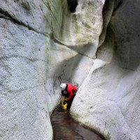
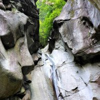
Einige schöne kürzere Abseiler, gewaltige Rutschen und technische Sprünge.
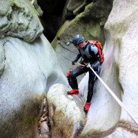
Some nice shorter rappels, huge slides and technical jumps.
Parts
Name
Difficulty
Approach
Tour
Return
June - September
9-12 o clock
West
Granite
Summary:
machine translated
➜
Original language
Einige schöne kürzere Abseiler, gewaltige Rutschen und technische Sprünge.
Some nice shorter rappels, huge slides and technical jumps.
Access:
machine translated
➜
Original language
Vom Autobahnkreuz im Norden von Bellinzona auf der N2 Richtung Biasca. Über Claro und Cresciano kommen wir nach Osogna (11,4 km von Autobahn bis zur Brücke über die Nala). Nach der Nalabrücke bis zum Friedhof fahren und dort das Auto abstellen.
From the freeway junction north of Bellinzona take the N2 towards Biasca. Passing through Claro and Cresciano we reach Osogna (11.4 km from the highway to the bridge over the Nala). After the bridge over the Nala, drive up to the cemetery and leave the car there.
Approach (2 h 15):
machine translated
➜
Original language
Zu Fuß:
Gehen Sie auf der Straße oberhalb des Parkplatzes in Richtung Fluss und steigen Sie zum großen Endbecken hinab. Überprüfen Sie den Wasserfluss, überqueren Sie dann das Flussbett in Richtung Süden und wandern Sie auf der schmalen Bergstraße bis zum Beginn des Weges nach Pönt und Valle di Osogna. Nach dem steilen Anstieg nach Pönt wird der Weg flacher und tritt dann in das Valle di Osogna ein. Ab Brücke 839 geht es wieder bergauf. Überprüfen Sie bei der Steinbrücke 950 sorgfältig den Wasserstand im darunterliegenden Becken (Dieses kann zur Falle werden). Steigen Sie die steilen Stufen hinauf und nehmen Sie auf 1060 Metern den weniger sichtbaren Pfad zu Ihrer Linken hinunter ins Tal zum Fluss und zum Auslass des Ableitungskanals.
Helikopter:
Vom Helipad zunächst hinauf zu den Häusern I Cassin di Carli. Dort nehmen wir den Wanderweg nach rechts. Nach den letzten Häusern führt der Weg auf auf einem Bergrücken abwärts. Wir nehmen auf Höhe 1060m den oben erwähnten nicht sehr deutlich erkennbaren Steig nach rechts. Er führt uns hinunter zum Einstieg beim Auslass des Ableitungskanals.
On foot:
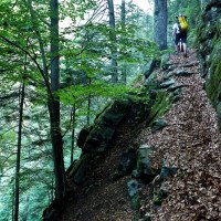
Walk along the road above the parking lot towards the river and descend to the large terminal basin. Check the water flow, then cross the riverbed to the south and hike along the narrow mountain road to the start of the path to Pönt and Valle di Osogna. After the steep ascent to Pönt, the path becomes flatter and then enters the Valle di Osogna. From bridge 839, the path climbs again. At stone bridge 950, carefully check the water level in the basin below (this can become a trap). Climb the steep steps and at 1060 meters take the less visible path on your left down into the valley to the river and the outlet of the diversion channel.
Helicopter:
From the helipad, first go up to the houses I Cassin di Carli. There we take the hiking trail to the right. After the last houses, the path descends along a ridge. At an altitude of 1060m, we take the not very clearly recognizable path to the right. It leads us down to the entry at the outlet of the drainage channel.
Tour (3 h):
machine translated
➜
Original language
Der obere Teil fängt nach der Wasserfassung an und führt entsprechend wenig Wasser. Das Wasser ist im allgemeinen recht kalt. Viele Rutschmöglichkeiten die gut ausgecheckt werden müssen. Dazu einige Sprungmöglichkeiten.
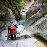
The upper part starts after the water intake and accordingly carries little water. The water is generally quite cold. Many slides that need to be well checked out. There are also some possible jumps.
Return (1 h):
machine translated
➜
Original language
Entweder an der Brücke aussteigen und den Zustiegsweg wieder hinunter oder Fortsetzung in der Nala Intermedio (siehe dort).
Either get off at the bridge and go back down the access path or continue in the Nala Intermedio (see there).
Coordinates:
Parking Entry and Exit
46.31456°, 8.98614°
↓↑
DMS: 46° 18" 52.42', 8° 59" 10.1'
DM: 46° 18.874", 8° 59.168"
Google Maps
SwissTopo
DMS: 46° 18" 52.42', 8° 59" 10.1'
DM: 46° 18.874", 8° 59.168"
Google Maps
SwissTopo
Bitte nicht am Friedhof umziehen. Ausgewiesenen Parkplatz nutzen.
Waterlevel Meter Site
46.31341°, 8.98802°
↓↑
DMS: 46° 18" 48.28', 8° 59" 16.87'
DM: 46° 18.805", 8° 59.281"
Google Maps
SwissTopo
DMS: 46° 18" 48.28', 8° 59" 16.87'
DM: 46° 18.805", 8° 59.281"
Google Maps
SwissTopo
Auch darauf achten wie weiter der Strahl herauskommt. Bei hohem Wasserstand schießt das Wasser in einem recht schmalen Strahl heraus.
Canyon Start
46.32413°, 9.01573°
↓↑
DMS: 46° 19" 26.87', 9° 0" 56.63'
DM: 46° 19.448", 9° 0.944"
Google Maps
SwissTopo
DMS: 46° 19" 26.87', 9° 0" 56.63'
DM: 46° 19.448", 9° 0.944"
Google Maps
SwissTopo
Canyon End
46.31689°, 9.00983°
↓↑
DMS: 46° 19" 0.8', 9° 0" 35.39'
DM: 46° 19.013", 9° 0.59"
Google Maps
SwissTopo
DMS: 46° 19" 0.8', 9° 0" 35.39'
DM: 46° 19.013", 9° 0.59"
Google Maps
SwissTopo
Helipad
46.32431°, 9.01697°
↓↑
DMS: 46° 19" 27.52', 9° 1" 1.09'
DM: 46° 19.459", 9° 1.018"
Google Maps
SwissTopo
DMS: 46° 19" 27.52', 9° 1" 1.09'
DM: 46° 19.459", 9° 1.018"
Google Maps
SwissTopo
Literatures:
Map
1:25000
Canyoning Book
Matthias Holzinger & Thomas Guigon
Pixartprinting.ch
2020
Cwiki Canyon Info
Descente Canyon Info
Ropewiki Canyon Info
Swisscanyon Canyon Info
25.09.2024
Bavarian Canyoning
⭐
★★★★★
📖
★★★
⚓
★★★
💧
Normal
Completed ✔
machine translated
➜
Original language
Wir sind kurz nach der Wasserfassung per Heli in die Schlucht eingestiegen.
Im Sup. sind mehrere Verklausungen, welche aber leicht überganggen werden können.
Fels war sehr rutschig und Verankerung waren in guten Zustand.
We entered the canyon by helicopter shortly after the water intake.
There are several obstructions in the superiore, but these can be easily negotiated.
The rock was very slippery and the anchors were in good condition.
14.09.2024
Cuk
⭐
★★★★★
📖
★★★
⚓
★★★
💧
Low
Completed ✔
no translation available
Automatisch importiert von Descente-Canyon.com für Canyon Osogna (supérieur)
Très joli enchaînement. La partie supérieure me paraît plus intéressante que l’intermédiaire.
(Quelle: https://www.descente-canyon.com/canyoning/canyon-debit/22493/observations.html)
04.09.2024
Bubtore
⭐
★★★★★
📖
★★★
⚓
★★★
💧
Low
Completed ✔
machine translated
➜
Original language
Wir sind bei A Merisciöu auf 1270m eingestiegen (damit die ganze Tour 1000hm ergibt). Vor der Wasserfassung sind ein paar schöne Einzelstellen, aber insgesamt recht flach, und vor allem sehr viele Baumstämme. Bis nach Osogna runter haben wir zu dritt knapp unter 7 Stunden gebraucht, und sind so ziemlich alles gerutscht was rutschbar ist.
We started at A Merisciöu at 1270m (so the whole tour is 1000m). There are a few nice single sections before the water catchment, but overall quite flat, and above all a lot of tree trunks. It took the three of us just under 7 hours to get down to Osogna, and we slid pretty much everything that could slide.
27.08.2024
Massimo Loriato
⭐
★★★★★
📖
★★★
⚓
★★★
💧
Normal
Completed ✔
Other users were: Peter
2h15 approach on foot to superiore, 6h30 tour for superiore + intermedio + inferiore in a group of 7.
Water level normal without any problem, superiore with low flow as usual but with cristal clear pools and lot of water entering from the tributary right after the first stone bridge; all jumps and toboggans doable.
All anchor points in order, in superiore and intermedio many are single.
Other users were: Peter
24.08.2024
Math77
⭐
★★★★★
📖
★★★
⚓
★★★
💧
Low
Completed ✔
no translation available
Automatisch importiert von Descente-Canyon.com für Canyon Osogna (supérieur)
Partie supérieure très inintéressante mise à part l’approche en Hélicoptère !
(Quelle: https://www.descente-canyon.com/canyoning/canyon-debit/22493/observations.html)
24.08.2024
SeflontSandrock60
⭐
★★★★★
📖
★★★
⚓
★★★
💧
Normal
Completed ✔
no translation available
Automatisch importiert von Descente-Canyon.com für Canyon Osogna (supérieur)
Nul nul nulAucun intérêt pour le sup, fait un hélico aujourd'hui
(Quelle: https://www.descente-canyon.com/canyoning/canyon-debit/22493/observations.html)
17.08.2024
rob
⭐
★★★★★
📖
★★★
⚓
★★★
💧
Low
Completed ✕
no translation available
Automatisch importiert von Descente-Canyon.com für Canyon Osogna (supérieur)
(Quelle: https://www.descente-canyon.com/canyoning/canyon-debit/22493/observations.html)
13.08.2024
bastos
⭐
★★★★★
📖
★★★
⚓
★★★
💧
Low
Completed ✔
no translation available
Automatisch importiert von Descente-Canyon.com für Canyon Osogna (supérieur)
Equiement OK. La sortie de la vasque piège passe très bien elle est équipe avec une plaquette et une corde
(Quelle: https://www.descente-canyon.com/canyoning/canyon-debit/22493/observations.html)
09.08.2024
titi04
⭐
★★★★★
📖
★★★
⚓
★★★
💧
Low
Completed ✔
no translation available
Automatisch importiert von Descente-Canyon.com für Canyon Osogna (supérieur)
Sec au début puis l eau arriveTop
(Quelle: https://www.descente-canyon.com/canyoning/canyon-debit/22493/observations.html)
19.06.2024
Sandra66
⭐
★★★★★
📖
★★★
⚓
★★★
💧
Normal
Completed ✔
no translation available
Automatisch importiert von Descente-Canyon.com für Canyon Osogna (supérieur)
Petit filet d'eau sur le début aucun problème pour sortir de la vasque piège puis debit correct sur la fin Équipement très minimaliste !Nous avons descendu l'intégralité du canyon en 9h à 4
(Quelle: https://www.descente-canyon.com/canyoning/canyon-debit/22493/observations.html)
06.09.2023
Bernhard
⭐
★★★★★
📖
★★★
⚓
★★★
💧
Normal
Completed ✔
machine translated
➜
Original language
Zustieg Heli TV (2 min) (180 Franken insg für 4 Personen )
Abstieg weglos durch Wald und abseilen von einem Baum
Schöner Canyon mit mächtigen Rutschen und Sprüngen . Dazwischen immer wieder gehpassagen
Access Heli TV (2 min) (180 francs total for 4 people)
Descent pathless through forest and rappel from a tree
Beautiful canyon with mighty slides and jumps. In between again and again walking passages
03.04.2023
Daniel Sturm
⭐
★★★★★
📖
★★★
⚓
★★★
Completed ✕
machine translated
➜
Original language
Koordinaten und Beschreibung angepasst.
Coordinates and description adjusted.
09.03.2023
System User
⭐
★★★★★
📖
★★★
⚓
★★★
no translation available
Daten importiert von https://canyon.carto.net/cwiki/bin/view/Canyons/NalasuperioreCanyon.html
New Report
Please briefly and concisely the most important information of the last tour or important current information about the canyon. If necessary with links to videos, photos, etc..
*
*
*
Esc
Del
Hydrology:
machine translated
➜
Original language
Ggf. Wasserzuleitung aus dem Stausee-Verbundkanal, der zum Kraftwerk führt (uU automatische Schleusenöffnung bei Problemen im Kanal oder im Kraftwerk, so bei Unglück anno 2001: https://www.nzz.ch/article7KF2C-ld.179745 )
If necessary, water supply from the interconnected reservoir canal leading to the power plant (automatic opening of the sluice in case of problems in the canal or in the power plant, as in the case of the accident in 2001: https://www.nzz.ch/article7KF2C-ld.179745 ).
Waterlevel Meter Site


