difficult
Bodengo III (Boggia III)
v5 a5 IV
5h10
5min
5h
5min
750m
270m
480m
35m
2x40m
36
2600m
Car optional
Rating:
★★★★★
4.4 (6)
Info:
★★★
2.8 (5)
Belay:
★★★
2.6 (5)
Summary:
machine translated
➜
Original language
Gewaltige Schlucht mit hohen Sprüngen, wilden Rutschen und ordentlicher Wasserführung.
Sauberes Wasser; tiefe Gumpen; schöne Einzelpassagen; Wehranlage oberhalb von Bodengo 1; lange Geh- und Kletterpassagen; Kraftwerk mit 2 Wasserableitungen vor 40m Wasserfall; 25m „Sprungschanzen-Rutsche“ im Mittelteil.
Webcam mit Wasserstand: http://www.valbodengo.com/d/phone/webcam.html
Massive canyon with high jumps, wild slides and decent water flow.
Clean water; deep pools; nice single passages; weir above Bodengo 1; long walking and climbing passages; power station with 2 water diversions in front of 40m waterfall; 25m "jumping slide" in the middle section.
Webcam with water level: http://www.valbodengo.com/d/phone/webcam.html
Parts
Name
Difficulty
Approach
Tour
Return
48.00km²
Summary:
machine translated
➜
Original language
Gewaltige Schlucht mit hohen Sprüngen, wilden Rutschen und ordentlicher Wasserführung.
Sauberes Wasser; tiefe Gumpen; schöne Einzelpassagen; Wehranlage oberhalb von Bodengo 1; lange Geh- und Kletterpassagen; Kraftwerk mit 2 Wasserableitungen vor 40m Wasserfall; 25m „Sprungschanzen-Rutsche“ im Mittelteil.
Webcam mit Wasserstand: http://www.valbodengo.com/d/phone/webcam.html
Massive canyon with high jumps, wild slides and decent water flow.
Clean water; deep pools; nice single passages; weir above Bodengo 1; long walking and climbing passages; power station with 2 water diversions in front of 40m waterfall; 25m "jumping slide" in the middle section.
Webcam with water level: http://www.valbodengo.com/d/phone/webcam.html
Access:
machine translated
➜
Original language
Auf der SS36 von Lecco richt.Chiavenna .Kurz vor Chiavenna fährt man in die Ortschaft Gordona bis zur Kirche. Links hinter der Kirche gibt es ein Café wo man für €5,- ein Ticket für die Privat Straße kaufen muss. Danach geht es re. bei der Kirche kurz hoch. Bei der Gabelung li. dann scharfe Kurve (bei Gabelung) re. hoch. Nächste Gabelung li. hoch. Den Straßenverlauf folgen (Richtung Pra Prince).Nach einigen Hm und Serpentinenkurven kommt li. auf ca. 820Hm vor einer scharfen re. Kurve, ein Schotterparkplatz, hier parken. Nach ca. 50m kommt ein Motorrad Fahrverbot Schild (li.) mit Weg Beschilderung Mulattiera per Bodengo und Strada Carrozzabile per Bodengo.
On the SS36 from Lecco direction Chiavenna. Shortly before Chiavenna you drive into the village of Gordona to the church. Left behind the church there is a café where you have to buy a ticket for €5, - for the private road. Afterwards it goes right. at the church briefly up. At the fork left then sharp bend (at fork) right. up. Next fork up on the left. Follow the road (direction Pra Prince).after a few meters and serpentine bends comes on the left at about 820Hm before a sharp right bend, a gravel parking place, park here. After about 50m there is a no motorcycle sign (left) with road signs Mulattiera per Bodengo and Strada Carrozzabile per Bodengo.
Approach (5 min):
machine translated
➜
Original language
10min mit Pkw/ ca.1,5h zu Fuß
Vom Schotterparkplatz auf 820Hm der Straße ca. 50m bis zum Motor-Fahrverbotsschild folgen. Dann weiter li den steilen Wanderweg zur alten Römerbrücke hinunter folgen. Noch vor der Brücke geht es re im Wald, zum Bach runter. Dieser Zufluss (Pilotera) trifft nach wenigen Metern auf Bodengo. Einstieg auf ca. 730Hm unter der Römerbrücke.
Alternative: Verfügt man nur über 1 PKW, so stellt man das Auto unten in der Nähe des Kraftwerks ab. Zu Fuß gelangt man auf der re Seite vom Kraftwerkszaun über eine steile Böschung zum Wanderweg hoch. Nachdem man (li) beim Staubecken den Wasserstand kontrolliert hat, geht man den Weg wieder zurück (Richtung Ort) und weiter entlang, bis zum 1. Haus von Gordona. Hier geht li der Wanderweg D6 (Kompass Karte) weg. Diesen Weg folgt man bis zur Straße hoch. Dann weiter der Straße entlang bis zum Schotterparkplatz li auf 820Hm
10min by car/ approx.1,5h on foot.
From the gravel parking place at 820Hm follow the road for about 50m to the no motoring sign. Then follow the steep hiking trail to the left down to the old Roman bridge. Still before the bridge, go right in the forest, down to the stream. This tributary (Pilotera) meets Bodengo after a few meters. Entry at about 730Hm under the Roman bridge.
Alternative: If you have only 1 car, you leave the car at the bottom near the power station. On foot you reach the hiking trail on the right side of the power plant fence over a steep slope. After checking the water level at the reservoir (on the left), go back along the path (towards the village) until you reach the first house of Gordona. Here the path D6 (compass map) leaves to the left. Follow this path up to the road. Then continue along the road until the gravel parking place on the left at 820Hm.
Tour (5 h):
machine translated
➜
Original language
Der 3. Teil der Bodengo ist der längste und wasserreichste Teil er Schlucht, daher unbedingt den Wasserstand bei der unteren Kraftwerksmauer kontrollieren! Um den Wasserstand zu kontrollieren stellt man das Auto beim Ausstieg ab. Das Kraftwerk wird re umgangen und über die steile Böschung gelangt man zum Weg hoch der li zur Kraftwerksbrücke führt. Hier sieht man zur Wasserableitung und der Zementierten Mauer, wo man die Wassermenge einschätzt. Für eine Begehung sollte der Wasserstand 30-40cm unter der Zementierten Mauer sein.
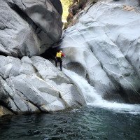
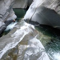
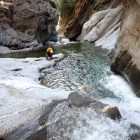
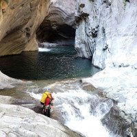
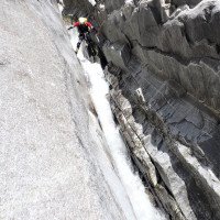
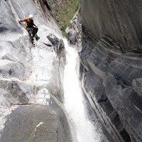
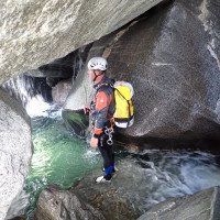
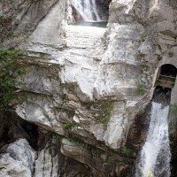
Nahe der schönen alten Römerbrücke auf ca. 750Hm geht es gleich los mit einem Abseiler in einen der unzähligen schönen tiefen Gumpen. Die Schlucht wurde für eine Begehung ausreichend gut eingerichtet, Notmaterial sollte aber trotzdem mitgenommen werden. An den meisten Abseilstellen die direkt im Wasser verlaufen, wurden Seilgeländer oder Ausweichmöglichkeiten eingerichtet. Der Seilabzug ist wegen den Klemmblöcken und Felsritzen nicht immer einfach (Gefahr Seilverklemmung!). Die Bohrhaken sind wegen der gewaltigen Wassermengen oft exponiert angebracht. Viele Stufen/Abseilstellen können gesprungen oder gerutscht werden. Die Gumpen sollten vorher aber gut ausgekundschaftet werden! (viele Unfälle beim Springen/Rutschen. Siehe Facebookseite Pascal van Duin, „Canyoning val Bodengo“). Einziges Manko der grandiosen einzigartigen Schlucht, sind die langen Granitblock-Klettereien zwischen den schönen Passagen. Bei dem verblockten Gelände muss der Weg oft ausgekundschaftet werden. Die höchsten Abseilstellen kommen im letzten Drittel der Schlucht, dort wo man auf rötliches Gestein trifft (hier hat man auch noch eine Notaustiegsmöglichkeit). Bei den letzten Abseilstellen trifft man auf 1 offensichtliche Wasserableitung auf der li Seite mit engem Gitter davor (Evtl. Sogwirkung). Meiner Meinung nach auch bei höheren Wasserstand unbedenklich. ! Lediglich die Strömung vom Wasserfall wird mehr in diese Richtung drücken. Wer möchte kann hier auch über, eine für Wartungsarbeiten eingerichtete Leiter, aussteigen. Die 2. Ableitung befindet sich, nicht offensichtlich, Rechts am Ende des Wasserbeckens, unter Wasser.
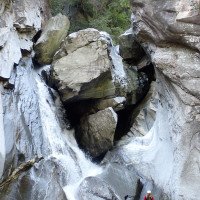
Die letzte 40m Abseilstelle ist re nach dem Becken/Zementmauer. Die Abseilstelle kann auch unterteilt werden (evtl. 30m Abseilen + Sprung re unten vom Felsband). Danach kommen noch eine kleine Stufe und einen 5m Sprung in den Schlussgumpen auf ca. 250Hm..
The 3rd part of the Bodengo is the longest and most watery part of the canyon, so be sure to check the water level at the lower power station wall! To check the water level, park the car at the exit. The power station is bypassed on the right and the steep slope leads up to the path on the left to the power station bridge. Here you can see the water drainage and the cemented wall, where you can estimate the water level. For a walk, the water level should be 30-40cm below the cemented wall.
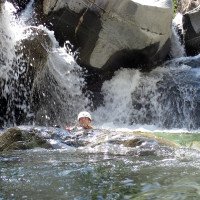
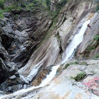
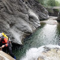
Near the beautiful old Roman bridge at about 750Hm we start immediately with a rappel into one of the countless beautiful deep pools. The canyon was sufficiently well equipped for a walk, but emergency material should still be taken. At most rappelling points that run directly in the water, rope traverses or alternative routes have been set up. The rope retrival is not always easy because of the clamping blocks and rock cracks (danger of rope jamming!). The pitons are often exposed because of the huge amounts of water. Many steps/rappels can be jumped or slid. However, the pools should be well scouted beforehand! (Many accidents while jumping/sliding. See Facebook page Pascal van Duin, "Canyoning val Bodengo"). The only drawback of the grandiose unique canyon, are the long granite block climbs between the beautiful passages. With the terrain being so blocky, the route often has to be scouted out. The highest rappels come in the last third of the canyon, where you meet reddish rock (here you also have an emergency exit). At the last rappelling points you will encounter 1 obvious water drainage on the left side with a narrow grid in front of it (Possibly suction effect). In my opinion, even at higher water levels harmless. ! Only the flow from the waterfall will push more in this direction. Who would like can get out here also over, a ladder furnished for maintenance work. The 2nd derivation is located, not obvious, Right at the exit of the water basin, under water.
The last 40m abseil is on the right after the pool/cement wall. The rappel can also be divided (possibly 30m rappel + jump right down from the rock ledge). After that there is a small step and a 5m jump into the final ravine at about 250m.
Return (5 min):
machine translated
➜
Original language
Steigt man li aus den letzten Gumpen aus, steht man direkt vor dem Parkplatz (evtl. Shutteln)
If you get out of the last pools on the left, you are directly in front of the parking lot (possibly shuttle).
Coordinates:
Canyon Start
Parking at Exit
Parkplatz bei Schluchtausgang
Parking at Entry
Pakplatz 300m vor Brücke
Canyon End
Literatures:
Map
Canyoning Book
Pascal van Duin
Edizioni TopCanyon
2009
100 Beschreibungen
Canyoning Book
Francesco Cacace / Roberto Jarre / Dino Ruotolo / Roberto Schenone
2003
Canyoning Book
Pascal van Duin
Edizioni TopCanyon
2005
978-8890175305
Canyoning Book
Simon Flower
Cicerone
2012
Northern Italy and Ticino
Something else
AIC
2017
Booklet zum AIC Canyoning Meeting 2017 in Delebio
Canyoning Book
Stéphane Coté / Caracal et les Sancho Panza
2007
124 Canyon-Beschreibungen
Canyoning Book
Stéphane Coté / Caracal et les Sancho Panza
2008
Canyoning Book
Cwiki Canyon Info
Other Canyon Info
Ropewiki Canyon Info
Descente Canyon Info
Other Canyon Info
Other Canyon Info
27.08.2024
Pepijn Hoeksema
⭐
★★★★★
📖
★★★
⚓
★★★
💧
Low
Completed ✔
We completed all three sections of Bodengo in one go. The low water level made the entire descent quite easy. It took us 8 hours from start to bottem with a team of 5 people.
The anchor points were generally in good condition, though in Bodengo 3, finding them required a bit more effort. There are also fewer anchor points in this section, which sometimes necessitates climbing down. Fortunately, the rock provides plenty of grip.
Overall, I enjoyed Bodengo 1 and 2 the most. The "Slide of Death" in Bodengo 3 was exciting, but there was also a lot of walking over large boulders, which made it a bit tedious at times.
If I had to choose between the Bodengo Integral and Bares, I would go with Bares!
04.07.2024
Felix
⭐
★★★★★
📖
★★★
⚓
★★★
💧
Normal
Completed ✔
machine translated
➜
Original language
Alle Haken vorhanden und verwendbar, teilweise verbogen. Ein paar Handlines könnte man austauschen. Insgesamt eine sehr lohnende Tour
All anchors present and usable, some bent. A few handlines could be replaced. Overall a very rewarding tour
04.09.2023
Bernhard
⭐
★★★★★
📖
★★★
⚓
★★★
💧
Normal
Completed ✔
machine translated
➜
Original language
Nichts mehr rutschig - das Hochwasser hat alles sauber gefegt
Stände alle gut
Leider zu große Erwartungen durch die oberen zwei Teile . Der Dreier hat doch viel Blockhüpfen
Jedoch die Rutsche muss man gemacht haben!!! (Oder so wie wir - ein fixseil links runter und viermal aufgestiegen und wieder gerutscht )
Als Hinweis - man landet dort wo der Wasserstrahl landet😅
Diesen Canyon auf keinen Fall bei viel Wasser gehen, zwar nicht eng aber oftmals die Gefahr tödlich über eine Kante gespült zu werden (man muss oft den Fluss queren um zu den Ständen zu kommen) - bei normalen Wasserstand aber harmlos
Nothing slippery anymore - the flood has swept everything clean
Stands all good
Unfortunately too much expectation due to the top two parts . The triple has but much block bouncing
However, the slide must have done!!! (Or as we did - a fixseil left down and four times climbed and slid again )
As a hint - you land where the water jet lands😅
This canyon in no case go when there is a lot of water, not narrow but often the danger of being fatally washed over an edge (you often have to cross the river to get to the stands) - at normal water levels but harmless
05.08.2023
Patrick Summerer
⭐
★★★★★
📖
★★★
⚓
★★★
💧
Normal
Completed ✔
machine translated
➜
Original language
Man muss nie direkt im Wasserstrahl abseilen. Zufluss von Pilotera war sehr gering. Im Bachbett teilweise sehr rutschig! Mit einer guten 3er Gruppe waren wir in 3h 45min durch.
You never have to abseil directly in the water stream. Inflow of Pilotera was very low. In the stream bed partly very slippery! With a good group of 3 we were through in 3h 45min.
31.07.2023
Inga
⭐
★★★★★
📖
★★★
⚓
★★★
💧
Normal
Completed ✔
machine translated
➜
Original language
Alle Haken ok! Top Wasserstand.
All hooks ok! Top water level.
05.06.2023
Wolfgang
⭐
★★★★★
📖
★★★
⚓
★★★
Completed ✔
machine translated
➜
Original language
Alle Stände / Fixseile OK ; Toll wie immer , wassermässig kein Problem
All stands / fixed ropes OK ; Great as always , waterwise no problem
03.04.2023
Daniel Sturm
⭐
★★★★★
📖
★★★
⚓
★★★
Completed ✕
machine translated
➜
Original language
Beschreibung und Koordinaten angepasst.
Description and coordinates adjusted.
09.03.2023
System User
⭐
★★★★★
📖
★★★
⚓
★★★
no translation available
Daten importiert von https://canyon.carto.net/cwiki/bin/view/Canyons/Bodengo3Canyon.html
New Report
Please briefly and concisely the most important information of the last tour or important current information about the canyon. If necessary with links to videos, photos, etc..
*
*
*
Esc
Del
Hydrology:


