v5 a1 II
2h38
35min
2h
3min
600m
420m
180m
45m
2x50m + (1x50 ab3)
8
on Foot
Rating:
★★★★★
3.7 (9)
Info:
★★★
3 (8)
Belay:
★★★
3 (8)
Summary:
machine translated
➜
Original language
Wunderschöne kurze kontinuierliche Abseilschlucht, die wunderbar abgesichert ist. Außer in der insgesamt 120m-Abseilkaskade, kann man jederzeit die Schlucht verlassen und auch die Stände sind sehr gut angebracht, sodass praktisch nie eine Wassergefahr besteht.
Die Schlucht führt zwar fast immer Wasser, ist aber nicht sehr aquatisch und mit einer Süd-Ost Exposition relativ warm. Im Sommer reicht definitiv ein 3mm Anzug und etwas zu trinken kann nicht schaden.
Beautiful short continuous rappel canyon, which is wonderfully secured. Except in the total 120m rappel cascade, you can leave the canyon at any time and also the stances are very well placed, so there is practically never any danger of water.
The canyon almost always has water, but it is not very aquatic and relatively warm with a south-east exposure. In summer a 3mm suit is definitely enough and something to drink can't hurt.
Parts
Name
Difficulty
Approach
Tour
Return
Southeast
Summary:
machine translated
➜
Original language
Wunderschöne kurze kontinuierliche Abseilschlucht, die wunderbar abgesichert ist. Außer in der insgesamt 120m-Abseilkaskade, kann man jederzeit die Schlucht verlassen und auch die Stände sind sehr gut angebracht, sodass praktisch nie eine Wassergefahr besteht.
Die Schlucht führt zwar fast immer Wasser, ist aber nicht sehr aquatisch und mit einer Süd-Ost Exposition relativ warm. Im Sommer reicht definitiv ein 3mm Anzug und etwas zu trinken kann nicht schaden.
Beautiful short continuous rappel canyon, which is wonderfully secured. Except in the total 120m rappel cascade, you can leave the canyon at any time and also the stances are very well placed, so there is practically never any danger of water.
The canyon almost always has water, but it is not very aquatic and relatively warm with a south-east exposure. In summer a 3mm suit is definitely enough and something to drink can't hurt.
Access:
machine translated
➜
Original language
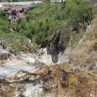
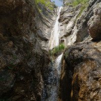
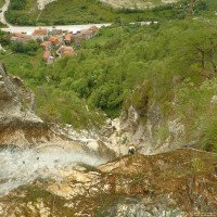
Vom Hotel Carnia in Richtung Norden auf der SS13 nach Chiusaforte. 300m nach der Ortstafel „Villanova / Vilegnove“ bei km 183 IX erscheint auf der rechten Seite eine Bushaltestelle und eine Einfahrt zu einem großen Parkplatz (direkt auf der gegenüberliegenden Straßenseite von Villanova. Hier parken. Anm: Wenn man von Parkplatz in Richtung Villanova schaut, sieht man direkt oberhalb schon die Kaskade mit den insgesamt fast 120 Hm.
From the Hotel Carnia head north on the SS13 to Chiusaforte. 300m after the town sign "Villanova / Vilegnove" at km 183 IX appears on the right a bus stop and an entrance to a large parking lot (directly across the road from Villanova. Park here. Note: If you look from the parking lot in the direction of Villanova, you can already see directly above the cascade with the total of almost 120 hm.
Approach (35 min):
machine translated
➜
Original language
Vom Parkplatz die SS13 beim Zebrastreifen überqueren und links die Straße nach Villanova reingehen. Nach ca. 100m kommt man zu einer kleinen Kreuzung, wo man beim gelben Haus schon das Schild „Cascata Rio Belepeit“ sieht. Hier rechts dem Schild zwischen den Häusern durch folgen. Nach ca. 50 m geht man unter einer Brücke durch, wo oberhalb die ehemalige Bahnstrecke – jetzt Radweg – entlang geht. Hier sieht man den Abschlusswasserfall des Rio Belepeit. Direkt nach der Brücke führen Stufen zum Radweg hoch, oben geht man über die Brücke durch den kleinen Tunnel in Richtung Norden. Direkt nach dem Tunnel führt der gut markierte weg links hangaufwärts (roter Pfeil). Man folgt dem gut sichtbaren Weg steil bergauf, bis man nach ca. 2-3 min bei einer Straße ankommt bei einem kleinen Parkplatz mit weißen Haus (möglicher Parkplatz Rio Mulin).
Der markierte Weg führt links beim weißen Haus über die Terrasse – direkt nach dem Haus sieht man schon wieder die roten Markierungen – denen man vorbei an den Hangverbauungen folgt, bis man zum Rio Belepeit kommt (direkt über dem letzten Abseiler). ACHTUNG hier NICHT den roten Markierungen über den Rio Belepeit folgen, sondern ca. 50m or. links dem Bach entlang hoch und erst hier den Rio Belepeit überqueren und dem Wanderweg weiter folgen. Diesem Weg folgt man nun für ca. 15-20 min vorbei an dem weißen Bildstock hangaufwärts. Nicht davon verunsichern lassen, dass man sich dem Rio Belepeit weit entfernt, da der Weg in Richtung Süden ohne Serpentinen verläuft. Man trifft dann auf den gut markierten Wanderweg „425“ bei einer betonierten Mauer. Dem Weg folgt man entgegen der roten Pfeilmarkierung in Richtung Norden – in Richtung Rio Belepeit. Man folgt dem Weg „425“ für ca. 10 min auf ebener, teilweise leicht abschüssiger Strecke, ehe man direkt auf den Rio Belepeit trifft. Hier bei ca. 500Hm sieht man schon or. rechts den ersten Abseiler (blau-weiße Canyoning-Markierung).
From the parking lot, cross the SS13 at the crosswalk and turn left into the road to Villanova. After about 100m you come to a small crossroads where you can already see the sign "Cascata Rio Belepeit" at the yellow house. Follow the signs to the right between the houses. After about 50 m you pass under a bridge, where above the former railroad line - now a bike path - goes along. Here you can see the final waterfall of the Rio Belepeit. Immediately after the bridge, steps lead up to the bike path, at the top you go over the bridge through the small tunnel to the north. Immediately after the tunnel, the well-marked path leads uphill to the left (red arrow). Follow the clearly visible path steeply uphill until after about 2-3 minutes you reach a road with a small parking lot with a white house (possible parking lot Rio Mulin).
The marked path leads to the left at the white house over the terrace - directly after the house you can see the red markings again - which you follow past the slope constructions until you come to Rio Belepeit (directly above the last rappel). ATTENTION: DO NOT follow the red markings over the Rio Belepeit, but go about 50m or. left along the stream and only here cross the Rio Belepeit and follow the hiking trail. Follow this path for about 15-20 minutes uphill past the white wayside shrine. Don't get confused by the fact that you are far away from the Rio Belepeit, because the path goes south without serpentines. You will then meet the well-marked trail "425" at a concrete wall. Follow the path against the red arrow markings in a northerly direction - towards the Rio Belepeit. You follow the path "425" for about 10 min on a flat, partly slightly sloping track, before you directly meet the Rio Belepeit. Here at about 500Hm you can already see the first rappel (blue-white canyoning marking).
Tour (2 h):
machine translated
➜
Original language
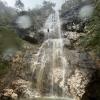
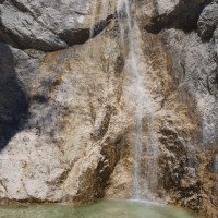
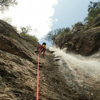
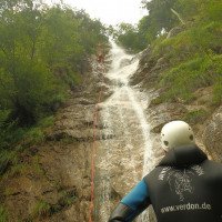
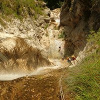
Beim Einstieg auf ca. 500 Hm, wo der der Weg 425 den Rio Belepeit kreuzt, sieht man gleich nach ca. 10m or. rechts den ersten Abseiler (blau-weiße Canyoning-Markierung). Nach 2 kleineren Abseilern beginnt gleich die große wunderschöne Abseilerkaskade. Bei einem guten Kettenstand or rechts beginnt die Kaskade. Man seilt sich ca. 40m ab und findet dann or. rechts, außerhalb des Wassers den nächsten Kettenstand an. Dann geht es für weitere 40m abwärts, ehe man bei einem seichten Gumpen ankommt.
At the entry at about 500 hm, where the path 425 crosses the Rio Belepeit, you can see the first rappel (blue-white canyoning marking) immediately after about 10m or. right. After 2 smaller rappels the big beautiful rappel cascade begins. At a good chain anchor or right the cascade begins. You rappel for about 40m and then find the next chain anchor on the right, outside the water. Then it goes down for another 40m before you arrive at a shallow pool.
Return (3 min):
machine translated
➜
Original language
Nach der Tour geht man ganz einfach den Weg Richtung Parkplatz retour auf dem Weg, der schon für den Zustieg genutzt wurde.
After the tour you simply go back towards the parking lot on the path that was already used for the access.
Coordinates:
Canyon Start
Parking Entry and Exit
Parkplatz bei Spielplatz
Canyon End
Cwiki Canyon Info
AIC Forum
Trip Report (e.g. Blogpost)
Other Canyon Info
Ropewiki Canyon Info
02.10.2024
Manuel Reindl
⭐
★★★★★
📖
★★★
⚓
★★★
💧
Normal
Completed ✔
machine translated
➜
Original language
Other users were: Paul Mistlbacher
Zustiegsweg aufgrund sehr vieler Markierungen eher verwirrend, aber trotzdem durch steiles Waldgestrüpp zum richtigen Weg gelangt. Schlucht top - Stände top. Wasserstand war gerade perfekt.
Access path rather confusing due to many markings, but still reached the right path through steep forest undergrowth. Canyons top - stands top. Water level was just perfect.
Other users were: Paul Mistlbacher
18.07.2024
Bina
⭐
★★★★★
📖
★★★
⚓
★★★
💧
Normal
Completed ✔
machine translated
➜
Original language
Other users were: Patrik Bartel
Hinweg brauchten wir länger als 35Min. da gefühlt 1000 Spinnennetze im Weg waren, ich würde 50Min. rechnen.
Den hohen Wasserfall würden wir das nächste Mal direkt mit einem 80m Seil durchgehen (Zwischenstand ist unbequem).
Bei den Temperaturen reicht nur die Neoprenhose.
Schöne Halbtagesvormittagstour in Kombination mit Patoc am Nachmittag.
It took us longer than 35 minutes to get there as it felt like there were 1000 spider webs in the way, I would reckon 50 minutes.
Next time we would go straight through the high waterfall with an 80m rope (the intermediate stand is uncomfortable).
In these temperatures, only the neoprene pants will do.
Nice half-day morning tour in combination with Patoc in the afternoon.
Other users were: Patrik Bartel
29.05.2024
Thomas Fras
⭐
★★★★★
📖
★★★
⚓
★★★
💧
Low
Completed ✔
machine translated
➜
Original language
Alles im perfekten Zustand
Everything in perfect condition
11.05.2024
Horst Lambauer
⭐
★★★★★
📖
★★★
⚓
★★★
💧
Normal
Completed ✔
machine translated
➜
Original language
Alle Stände tip top. Lohnt sich auch als dritte Tour des Tages 😉
All stands tip top. Also worthwhile as the third tour of the day 😉
06.08.2023
Andreas Bramböck
⭐
★★★★★
📖
★★★
⚓
★★★
💧
Normal
Completed ✔
machine translated
➜
Original language
Sind über alternative Zustiegsroute or. links vom Fluss aufgestiegen. Und den weiteren Weg bis auf ca 700hm gefolgt und somit den untersten Teile des Superiore mitgenommen.
Anfangs gut ausgetretener Pfad. Je Näher am Einstieg desto mehr muss man den Weg suchen. Trotzdem guter Zustieg.
Die Tour selber ist Top.
Have ascended via alternative access route or. left of the river. And followed the further way up to about 700hm and thus took the lowest parts of the Superiore.
Initially well trodden path. The closer to the entrance the more you have to search for the path. Nevertheless, good access.
The tour itself is top.
17.05.2023
Rok
⭐
★★★★★
📖
★★★
⚓
★★★
💧
Normal
Completed ✔
machine translated
➜
Original language
Alles tip top. Pro Canyon! Es gibt einen alternativen Zustieg, ohne den Bach zu queren. Oro links vom Bach beim Strommasten vorbei und dann steil hinauf (ist etwas ausgetreten und teilweise rot markiert, dürfe aber im Sommer zuwachsen). Ist auf OpenStreetMap eingezeichnet der Weg. Kurze, aber schöne Schlucht. Wenn offen, bittet sich das kleine Bistro an, um nach der Schlucht etwas zu trinken (man geht direkt vorbei im Ort, wenn man zum großen Parkplatz geht). Die Wirtin freut sich sehr ;-).
Everything tip top. Per canyon! There is an alternative approach without crossing the creek. Oro left of the creek past the power pole and then steeply up (is somewhat worn and partly red marked, but may be overgrown in summer). Is drawn on OpenStreetMap the way. Short but beautiful gorge. If open, the small bistro begs to drink something after the gorge (you go right past in the village when you go to the big parking lot). The landlady is very happy ;-).
09.03.2023
System User
⭐
★★★★★
📖
★★★
⚓
★★★
no translation available
Daten importiert von https://canyon.carto.net/cwiki/bin/view/Canyons/RioBelepeitCanyon.html
04.08.2022
Daniel Sturm
⭐
★★★★★
📖
★★★
⚓
★★★
💧
Normal
Completed ✔
machine translated
➜
Original language
Other users were: Christoph Cramer Patrick Klarner
Anker top, Wasserstand top.
Anchor top, water level top.
Other users were: Christoph Cramer Patrick Klarner
15.08.2019
Christian Balla
⭐
★★★★★
📖
★★★
⚓
★★★
💧
Normal
Completed ✔
machine translated
➜
Original language
Ein recht offener Canyon mit weiten Blick in das Tal. Der Radweg unterhalb der letzten Abseilstelle ist quasi eine Garantie für Schaulustige. Die Wege beim Zustieg sind nicht immer leicht zu finden.
GPS Tracks und Fotos:
https://www.christian-balla.de/Belepeit
Video:
https://www.youtube.com/watch?v=JNT4GmIOKwk
A fairly open canyon with sweeping views of the valley. The cycle path below the last abseil point is virtually a guarantee for onlookers. The paths on the access are not always easy to find.
GPS tracks and photos:
https://www.christian-balla.de/Belepeit
Video:
https://www.youtube.com/watch?v=JNT4GmIOKwk
New Report
Please briefly and concisely the most important information of the last tour or important current information about the canyon. If necessary with links to videos, photos, etc..
*
*
*
Esc
Del
Hydrology:
