v3 a5 III
2h55
15min
2h30
10min
920m
730m
190m
15m
2x20m (1x20m/1x40m)
Car optional
Specialities:
Fun canyon § Chargeable parking
Fun canyon § Chargeable parking
Rating:
★★★★★
4.5 (8)
Info:
★★★
2.7 (7)
Belay:
★★★
2.7 (7)
Summary:
machine translated
➜
Original language
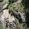
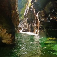
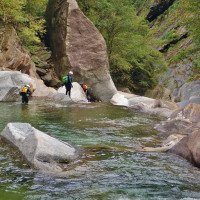
Sehr schöne Schlucht mit smaragdgrünen kalten Wasser; sehr gut eingerichtet; €5,- für private Bergstraße; 1. Teil einfach; 2. Teil mittel, 3. Teil sehr lange und anspruchsvoll (auf Wasserpegel achten!); sehr schönes und griffiges Gneiss- und Granit-Gestein; die meisten Abseiler sind außerhalb der Wasserführung, die Schlucht ist im gesamten jedoch sehr aquatisch!
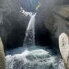
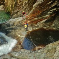
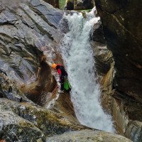
Aquapark-mässiger Spasscanyon. Riesige Becken und viele Rutsch- und Sprungmöglichkeiten. Extrem gut versichert und kommerziell stark begangen.
Very nice canyon with emerald green cold water; very well equipped; €5,- for private mountain road; 1st part easy; 2nd part medium, 3rd part very long and challenging (watch for water level!); very nice and grippy gneiss and granite rock; most of the rappels are out of the water flow, but the canyon is very aquatic in the whole!
Aquapark-style fun canyon. Huge pools and many possible slides and jumps. Extremely well insured and commercially heavily trafficked.
Webcam with water level: http://www.valbodengo.com/d/phone/webcam.html
Parts
Name
Difficulty
Approach
Tour
Return
Northeast
Summary:
machine translated
➜
Original language
Sehr schöne Schlucht mit smaragdgrünen kalten Wasser; sehr gut eingerichtet; €5,- für private Bergstraße; 1. Teil einfach; 2. Teil mittel, 3. Teil sehr lange und anspruchsvoll (auf Wasserpegel achten!); sehr schönes und griffiges Gneiss- und Granit-Gestein; die meisten Abseiler sind außerhalb der Wasserführung, die Schlucht ist im gesamten jedoch sehr aquatisch!
Aquapark-mässiger Spasscanyon. Riesige Becken und viele Rutsch- und Sprungmöglichkeiten. Extrem gut versichert und kommerziell stark begangen.
Very nice canyon with emerald green cold water; very well equipped; €5,- for private mountain road; 1st part easy; 2nd part medium, 3rd part very long and challenging (watch for water level!); very nice and grippy gneiss and granite rock; most of the rappels are out of the water flow, but the canyon is very aquatic in the whole!
Aquapark-style fun canyon. Huge pools and many possible slides and jumps. Extremely well insured and commercially heavily trafficked.
Webcam with water level: http://www.valbodengo.com/d/phone/webcam.html
Access:
machine translated
➜
Original language
Bei der Ortschaft Gordona fährt man zur Kirche --> li. hinter der Kirche gibt es ein Café wo man für €5,- ein Ticket für die Privat Straße kaufen muss --> danach geht es re. bei der Kirche kurz hoch --> bei der Gabelung li. --> dann scharfe Kurve (bei Gabelung) re. hoch --> nächste Gabelung li. hoch --> Straßenverlauf folgen (Richtung Pra Prince) --> auf ca. 820Hm vor einer scharfen re. Kurve, gibt es li. einen Parkplatz --> hier parken --> nach ca. 50m kommt ein Motorrad Fahrverbot Schild (li.) mit Weg Beschilderung Mulattiera per Bodengo und Strada Carrozzabile per Bodengo (dies ist der Weg wo man von der Brücke hoch kommt/ Rückweg).
At the village Gordona you drive to the church --> left. behind the church there is a café where you have to buy a ticket for the private road for €5,- --> after that it goes right. at the church briefly up --> at the bend left --> then sharp bend (at bend) right up --> next bend left. up --> follow the road (direction Pra Prince) --> at approx. 820Hm before a sharp bend on the right, there is a parking lot on the left --> park here --> after approx. 50m there is a no motorcycle sign (on the left) with signs Mulattiera per Bodengo and Strada Carrozzabile per Bodengo (this is the way where you come up from the bridge / way back).
Approach (15 min):
machine translated
➜
Original language
Vom Parkplatz entlang der Straße hoch gelangt man zum Einstieg in den 2. Teil --> vor der kleinen Bergortschaft li. über die Straßenbrücke von Bedolina (ausgeschilderter Parkplatz Bedolina) (Einstieg auf ca. 870Hm).
From the parking lot up along the road you get to the entry to the 2nd part --> before the small mountain village on the left over the road bridge of Bedolina (signposted parking lot Bedolina) (entry at about 870Hm).
Tour (2 h 30):
machine translated
➜
Original language
Geh- und Kletterpassage ca. 50m. Kurze Schwimmstrecke. Geh- und Kletterpassage ca. 50m. Rutsche 3m oder Sprung 3m. Kurze Schwimmstrecke. Geh-, Kletter- und Schwimmpassage ca.100m. li. einzelne Bohrhaken zum Geländerseil. Vom Geländerseil R10 (li.) + Sprung 5m oder Abseilen 15m (li.) Nach den Gumpen Notausstieg (nr.9, orange Tafel) li. Klebehaken für Sicherung zum Stand li. R15 (li.) (Seilabzug von großen Felsblock möglich) Die Schlucht wird enger. Kurze Schwimmstrecke. Gehpassage ca. 100m. Vorbei an großen Felsblock. Notausstieg Nr. 7 (li.) + kl.Zufluss von re. an der Abseilstelle R18 (re.) (bei den 18m nur bei wenig Wasser Sprung (oder Rutsche) in tiefen ausgehöhlten Gumpen möglich, als Ausstiegserleichterung ist am Gumpenrand re. ein einzelner Bohrhaken wo ein Seil angebracht werden kann.) Siphon (re. umgehbar). Sprung in großen Gumpen mit kleiner Schwimmstrecke. Notausstieg Nr. 6. Geh- und Schwimmpassage. Kletterpassage ca. 200m in offener Schlucht. 2 kleine Zuflüsse li. Enger werdende Schlucht mit überlaufene Felsblöcke. Kletter- und Schwimmpassage ca. 80m. Notausstieg Nr. 4. Sehr schöne Passage R10(re.) in Gumpen. re. hochsteigen über Fixseil. Sprung oder Abklettern in großen Gumpen ca. 5m. Geh- und Kletterpassage ca. 50m. Notausstieg Nr. 3. Geh- und Kletterpassage ca. 50m bis zu kurzen engeren Schluchtteil. R15 (li.) auf Felsband aussteigen oder in Strömung + kurze Schwimmstrecke. Gehstrecke bis zur nächsten Abseilstelle R8 (re.) kann li. umgangen und abgeklettert werden. Flache Geh- und Kletterpassage. Kurze Schwimmstrecke in kl. Becken. Einzelne Bohrhaken li. für Sicherung zum Geländerseil oder re. über Klebehaken in ausgehöhltes Becken abseilen und zum Geländerseil über die Strömung + R8 oder S8. Kurze Schwimmstrecke und Abklettern über glattgeschliffene Felsen. Geh- und Kletterpassage über Granitblöcke ca. 100m. Notausstieg Nr. 1. li. 5m über Fixseil abseilen. Großes Becken. li. einzelne Klebehaken für Sicherung zum Stand. Von Kettenstand R10 (li.) oder S10 in großes Becken mit Strömung. re. über Fixseil auf großen Felsblock steigen.Kurz abseilen über Fixseil zum Stand R8 (re.) oder S8 (oder S12 von oben) Kurze Schwimmstrecke. Großen Felsblock re. umgehen. Kurze Kletterpassage und Sprung von Felsblock in Gumpen. Kurze Gehstrecke ca. 50m zur letzte Abseilstelle R10 (li.) (Seilfähre bei viel Wasser ratsam) Kurze Schwimmstrecke bis zum Zusammentreffen mit der Pilotera (Steinbrücke)(ca. 730Hm).
Walking and climbing passage about 50m. Short swimming section. Walking and climbing passage approx. 50m. Slide 3m or jump 3m. Short swimming section. Walking, climbing and swimming passages ca.100m. left. single bolts to the traverese rope. From the traverese rope R10 (left) + jump 5m or rappel 15m (left) After the pools emergency exit (nr.9, orange sign) left. glued anchor for belaying to the belaystation left R15 (left) (rope retrival from big boulder possible) The canyon narrows. Short swimming section. Walking passage approx. 100m. Pass large boulder. Emergency exit No. 7 (left) + small inflow from the right at the abseil point R18 (right) (at the 18m only with little water jump (or slide) in deep hollowed pools possible, as an exit facilitation is at the edge of the pool on the right a single piton where a rope can be attached). Siphon (can be bypassed on the right). Jump into large pools with a small swimming section. Emergency exit no. 6. walking and swimming passage. Climbing passage ca. 200m in open canyon. 2 small tributaries left. Narrowing canyon with overflowing boulders. Climbing and swimming passages about 80m. Emergency exit no. 4. very nice passage R10(r.) in pools. r. climb up via fixed ropes. Jump or downclimb in large pools ca. 5m. Walking and climbing passage ca. 50m. Emergency exit No. 3. 50m walking and climbing passage to short narrower gorge section. R15 (left) exit on rocky ledge or in current + short swim. Walking passages to the next rappel point R8 (right) can be bypassed on the left and downclimbed. Flat walking and climbing passage. Short swimming section in small pool. Single pitons on the left for belaying to the traverese rope or rappel on the right via glued anchors into hollowed pool and to the traverese rope over the current + R8 or S8. Short swim and downclimb over smooth polished rocks. Walking and climbing passage over granite boulders about 100m. Emergency exit no. 1. rappel left. 5m over fixed ropes. Large pool. left. single glued anchors for belay to belaystation. From chain anchor R10 (left) or S10 into large pool with current. r. climb over fixed rope onto large boulder.short rappel over fixed rope to belaystation R8 (right) or S8 (or S12 from above) short swim. Bypass large boulder on the right. Short climbing passage and jump from boulder into pool. Short walking passages approx. 50m to the last rappel point R10 (left) (rope ferry advisable in case of much water). Short swimming passages to the meeting with the Pilotera (stone bridge) (approx. 730Hm).
Return (10 min):
machine translated
➜
Original language
Beim Zufluss der Pilotera (ca. 730Hm) li. den Wanderweg steil hoch zur Straße und re. zum Parkplatz zurück.
At the inflow of the Pilotera (approx. 730Hm) turn left up the trail steeply to the road and right back to the parking lot.
Coordinates:
Canyon Start
Parking at Exit
Pakplatz 300m vor Brücke
Parking at Entry
Parkplatz bei Brücke
Canyon End
Literatures:
Map
1:25000
Map
Canyoning Book
Associazione Italiana Canyoning
2013
Canyoning Book
Simon Flower
Cicerone
2012
Northern Italy and Ticino
Canyoning Book
Associazione Italiana Canyoning
2012
44 Schluchttouren:
Provincia di Sondrio:
1-3 Bodengo, 4 Bondone, 5 Casenda, 6 Cervio, 7 Cormor, 8 Ferro, 9 Lesina, 10 Madrasco, 11 Mengasca, 12 Pilotera, 13 Armisa, 14 Bomino, 15 Caronella, 16 Forcola, 17 Lanterna, 18 Livrio, 19 Malgina, 20 Masino, 21 Mello, 22 Pedena, 23 Ranciga, 24 Val Piccola;
Provincia di Como:
25 Bares, 26 Camoggia, 27 Darengo, 28 Lirone, 29 Perlana, 30 Cairo, 31 Cavargna, 32 Giuf, 33 Rezzo, 34 Giulia;
Provincia di Lecco:
35 Acquaduro, 36 Boauuo, 37 Esino sup., 38 Esino inf., 39 Monastero, 40 Gallavesa, 41 Moregallo, 42 Legnone, 43 Morterone, 44 Rasga.
Canyoning Book
Pascal van Duin
2011
Canyoning Book
Canyoning Book
Pascal van Duin
Edizioni TopCanyon
2009
100 Beschreibungen
Canyoning Book
Stéphane Coté / Caracal et les Sancho Panza
2007
124 Canyon-Beschreibungen
Canyoning Book
Pascal van Duin
Edizioni TopCanyon
2005
978-8890175305
Canyoning Book
Francesco Cacace / Roberto Jarre / Dino Ruotolo / Roberto Schenone
2003
Cwiki Canyon Info
Descente Canyon Info
Ropewiki Canyon Info
Trip Report (e.g. Blogpost)
Other Canyon Info
30.08.2024
AlvaroCanyon
⭐
★★★★★
📖
★★★
⚓
★★★
💧
Normal
Completed ✔
no translation available
Automatisch importiert von Descente-Canyon.com für Canyon Bodengo
Alvaro Canyon
(Quelle: https://www.descente-canyon.com/canyoning/canyon-debit/2533/observations.html)
28.08.2024
Iñaki
⭐
★★★★★
📖
★★★
⚓
★★★
💧
Normal
Completed ✔
no translation available
Automatisch importiert von Descente-Canyon.com für Canyon Bodengo
(Quelle: https://www.descente-canyon.com/canyoning/canyon-debit/2533/observations.html)
27.08.2024
Pepijn Hoeksema
⭐
★★★★★
📖
★★★
⚓
★★★
💧
Low
Completed ✔
We completed all three sections of Bodengo in one go. The low water level made the entire descent quite easy. It took us 8 hours from start to bottem with a team of 5 people.
The anchor points were generally in good condition, though in Bodengo 3, finding them required a bit more effort. There are also fewer anchor points in this section, which sometimes necessitates climbing down. Fortunately, the rock provides plenty of grip.
Overall, I enjoyed Bodengo 1 and 2 the most. The "Slide of Death" in Bodengo 3 was exciting, but there was also a lot of walking over large boulders, which made it a bit tedious at times.
If I had to choose between the Bodengo Integral and Bares, I would go with Bares!
27.08.2024
Reach8399
⭐
★★★★★
📖
★★★
⚓
★★★
💧
Normal
Completed ✔
no translation available
Automatisch importiert von Descente-Canyon.com für Canyon Bodengo
RAS
(Quelle: https://www.descente-canyon.com/canyoning/canyon-debit/2533/observations.html)
25.08.2024
K1000zede63
⭐
★★★★★
📖
★★★
⚓
★★★
💧
Normal
Completed ✔
no translation available
Automatisch importiert von Descente-Canyon.com für Canyon Bodengo
(Quelle: https://www.descente-canyon.com/canyoning/canyon-debit/2533/observations.html)
14.08.2024
Bernhard
⭐
★★★★★
📖
★★★
⚓
★★★
💧
Low
Completed ✔
machine translated
➜
Original language
Schöner Spaß Canyon
Meistens offenes Gelände mit vielen Notausstiegen
Die Bauarbeiten sind komplett abgeschlossen und alles wieder beim alten
Autostoppen geht gut
Nice fun canyon
Mostly open terrain with many emergency exits
The construction work is completely finished and everything is back to normal
Hitchhiking goes well
11.08.2024
SandroS
⭐
★★★★★
📖
★★★
⚓
★★★
💧
Normal
Completed ✔
machine translated
➜
Original language
Alles ok
Everything ok
02.08.2024
Martijn
⭐
★★★★★
📖
★★★
⚓
★★★
💧
Normal
Completed ✔
no translation available
Automatisch importiert von Descente-Canyon.com für Canyon Bodengo
For Bodengo 2, Work on the road looks complete, but the deviation remains recommended because there still is a lot of metal and parts of the road in the canyons.
(Quelle: https://www.descente-canyon.com/canyoning/canyon-debit/2533/observations.html)
04.07.2024
Urs K.
⭐
★★★★★
📖
★★★
⚓
★★★
💧
Normal
Completed ✔
machine translated
➜
Original language
Im Juli ist MO-FR von 8:30-12:00 und 13:30-17:00 die Strasse zwischen Start/Ende von Bodengo 2 gesperrt (aktuell wird die Hangsicherung oberhalb der Strasse gemacht, siehe Foto).
Die Umleitug in der Schlucht mit dem gelben Seil (Info auch an den Umziehkabinen) kann man nicht übersehen beim Abseiler #4.
Abgesehen von de Stelle wo gesperrt ist, ist alles super!
In July, MO-FR from 8:30-12:00 and 13:30-17:00, the road between the start/exit of Bodengo 2 is closed (the slope stabilization above the road is currently being done, see photo).
The diversion in the canyon with the yellow rope (information also at the changing cabins) cannot be overlooked at rappel #4.
Apart from the place where it is closed, everything is superiore!
02.07.2024
Patrik
⭐
★★★★★
📖
★★★
⚓
★★★
💧
Low
Completed ✔
machine translated
➜
Original language
Bis Ende Juli ist die Strasse zum Einstieg nur über Mittag befahrbar (https://www.comune.gordona.so.it/hh/index.php). Deshalb haben wir beim Ausstieg von Bodengo 2 parkiert und sind anschliessend in knapp 40‘ hochgelaufen zum Einstieg Bodengo 1. Das gelbe Seil für die Umgehung beim Felssturz ist auf der rechten Seite gut erkennbar. Beim ersten Sprung sowie bei der Abseilstelle Nr. 3 könnte man ein neues Fixseil anbringen. Ansonsten alle Sprünge sowie Rutschen machbar.
Until the exit in July, the road to the entry is only passable at midday (https://www.comune.gordona.so.it/hh/index.php). We therefore parked at the exit of Bodengo 2 and then walked up to the entry of Bodengo 1 in just under 40'. The yellow rope for bypassing the rockfall is clearly visible on the right-hand side. A new fixed rope could be installed at the first jump and at abseil point no. 3. Otherwise all jumps and slides are doable.
24.06.2024
guigui
⭐
★★★★★
📖
★★★
⚓
★★★
💧
High
Completed ✔
no translation available
Automatisch importiert von Descente-Canyon.com für Canyon Bodengo
Gros débit qui ne pose pas de problème si on connaît le canyon, sûrement plus problématique à vue. Il y a eu un gros éboulement sur la route d'accès avec énormément de débris dans le canyon. Les travaux semblent finis et la route semble ouverte normalement. Équipement ras, il semble qu'on soit les premiers à passer de la saison vu les feuilles dans les broches
(Quelle: https://www.descente-canyon.com/canyoning/canyon-debit/2533/observations.html)
05.08.2023
Patrick Summerer
⭐
★★★★★
📖
★★★
⚓
★★★
💧
Normal
Completed ✔
machine translated
➜
Original language
Viele Sprünge möglich, im Bachbett teilweise sehr rutschig
Many jumps possible, in the creek bed partly very slippery
03.06.2023
Wolfgang
⭐
★★★★★
📖
★★★
⚓
★★★
Completed ✔
machine translated
➜
Original language
Begangen wie zu erwarten alles TipTop, alle üblichen Rutschen und Sprünge möglich
Walked as expected everything TipTop, all the usual slides and jumps possible
03.04.2023
Daniel Sturm
⭐
★★★★★
📖
★★★
⚓
★★★
Completed ✕
machine translated
➜
Original language
Beschreibung und Koords angepasst.
Description and coords adjusted.
09.03.2023
System User
⭐
★★★★★
📖
★★★
⚓
★★★
no translation available
Daten importiert von https://canyon.carto.net/cwiki/bin/view/Canyons/Bodengo2Canyon.html
27.09.2021
Christian Balla
⭐
★★★★★
📖
★★★
⚓
★★★
💧
High
Completed ✔
machine translated
➜
Original language
Der Canyon ist sehr gut eingerichtet und verfügt über viele Notausstiege.
Tourvideo:
https://www.youtube.com/watch?v=Qj77l3PspBE
The canyon is very well equipped and has many emergency exits.
Tour video:
https://www.youtube.com/watch?v=Qj77l3PspBE
New Report
Please briefly and concisely the most important information of the last tour or important current information about the canyon. If necessary with links to videos, photos, etc..
*
*
*
Esc
Del
Hydrology:
no translation available
Webcam mit Wasserstand: http://www.valbodengo.com/d/phone/webcam.html
