a little difficult
Cascada La Eresma
v4 a4 III
5h20
1h40
2h30
1h10
1215m
1045m
170m
55m
2x60m
6
600m
on Foot
Rating:
★★★★★
0 ()
Info:
★★★
0 ()
Belay:
★★★
0 ()
Summary:
machine translated
➜
Original language
Mehrere hohe Wasserfälle, offener Charakter
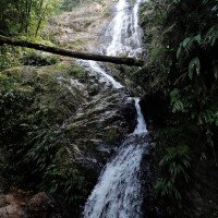
Several high waterfalls, open character
Southwest
Summary:
machine translated
➜
Original language
Mehrere hohe Wasserfälle, offener Charakter
Several high waterfalls, open character
Access:
machine translated
➜
Original language
von Medellin nach San Francisco
from Medellin to San Francisco
Approach (1 h 40):
machine translated
➜
Original language
von San Francisco siehe google earth Karte mit handschriftl. Zustiegsskizze und Lageplan
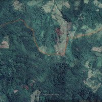
from San Francisco see google earth map with handwritten access sketch and site plan
Tour (2 h 30):
machine translated
➜
Original language
siehe Video und Fotos, Ausstieg vor der Brücke
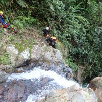
see video and photos, exit in front of the bridge
Return (1 h 10):
machine translated
➜
Original language
wikiloc, siehe unter Links
wikiloc, see under Links
Coordinates:
Parking at Exit
5.977218°, -75.074483°
↓↑
DMS: 5° 58" 37.98', -76° 55" 31.86'
DM: 5° 58.633", -76° 55.531"
Google Maps
DMS: 5° 58" 37.98', -76° 55" 31.86'
DM: 5° 58.633", -76° 55.531"
Google Maps
in der Nähe der Finc Hacienda Sagrada
Canyon Start
5.96587°, -75.075986°
↓↑
DMS: 5° 57" 57.13', -76° 55" 26.45'
DM: 5° 57.952", -76° 55.441"
Google Maps
DMS: 5° 57" 57.13', -76° 55" 26.45'
DM: 5° 57.952", -76° 55.441"
Google Maps
Canyon End
5.963346°, -75.077492°
↓↑
DMS: 5° 57" 48.05', -76° 55" 21.03'
DM: 5° 57.801", -76° 55.35"
Google Maps
DMS: 5° 57" 48.05', -76° 55" 21.03'
DM: 5° 57.801", -76° 55.35"
Google Maps
Ausstieg vor der Brücke
Parking at Entry
5.964896°, -75.101054°
↓↑
DMS: 5° 57" 53.63', -76° 53" 56.21'
DM: 5° 57.894", -76° 53.937"
Google Maps
DMS: 5° 57" 53.63', -76° 53" 56.21'
DM: 5° 57.894", -76° 53.937"
Google Maps
in San Francisco
Hydrology:

1. Lageplan mit Zustieg (ro...

2. Start in San Francisco

3. zunächst über die Wiesen...

4.

5.

6.

7. Einstieg

8.

9.

10.

11.

12.

13.

14. Einstieg in den 1. höher...

15.

16.

17. Auf dem Weg zum 2. Abfal...

18. Rückblick

19. Stand über dem 2. Abfall

20. 2.Abfall

21. dito

22. Über dem 3. Abfall

24. 3. Abfall

25. Nach Ende der Wasserfäll...

26.

27. zwischenzeitlicher Ausst...

28. endgültiger Ausstieg auf...