a little difficult
San Giulio
v4 a3 II
3h13
3min
3h
10min
570m
300m
270m
50m
2x60m
10
1200m
Car optional
Rating:
★★★★★
2.8 (3)
Info:
★★★
3 (1)
Belay:
★★★
3 (1)
Summary:
machine translated
➜
Original language
Abseilcanyon, 3 hohe Kaskaden
3 high cascades
Limestone
4.00km²
Summary:
machine translated
➜
Original language
Abseilcanyon, 3 hohe Kaskaden
3 high cascades
Access:
machine translated
➜
Original language
Von Varese auf der SS394 in Richtung WNW erreicht man nach 17 km und etwa 20 Minuten Cittiglio. Man steuert dort zuerst die Ortsmitte an und hält von da nordwärts, den Wegweisern "Parco delle Cascate" folgend. Man parkt am Ende dieser Zufahrtsstraße.
Mehr Platz wäre aber auf der Piazza degli Alpini, die direkt östlich der innerstädt. Brücke über den Torrente S. Giulio legt.
Sofern man darüber verfügt, mit einem zweiten Auto zurück in's Zentrum und von dort auf der SP 8 am orograf. linken Hang des Wasserlaufs aufwärts in Richtung Vararo. Etwa 3,5 km ab Ortsmitte erreicht die Straße den Bachlauf in der Nähe einer restaurierten Mühle. Hier das zweite Auto abstellen.
From Varese on the SS394 heading WNW, after 17 km and about 20 minutes you reach Cittiglio. The first place to go is the center of the village and from there head north, following the signs for "Parco delle Cascate". You park at the exit of this access road.\nMore space, however, would be in the Piazza degli Alpini, which is just east of the inner city. If you have a second car, take it back to the center of town and from there take SP 8 up the orographic left slope of the watercourse in the direction of Vararo. About 3.5 km from the center, the road reaches the stream near a restored mill. Park the second car here.
Approach (3 min):
machine translated
➜
Original language
Im Bachbett bzw. anfangs rechts oberhalb zu den ersten Stufen.
Sofern man nur 1 Auto zur Verfügung hat, dann man auch auf einem Fußweg, zuletzt über die Auffahrtsstraße am östlichen Rande des Wasserlaufs zum Einstieg in den obersten Wasserfall steigen (etwa 50 Min.).
In the streambed or initially on the right above to the first steps.\nIf you have only 1 car available, then you can also climb on a footpath, last across the driveway on the eastern edge of the watercourse to the entry to the top waterfall (about 50 min).
Tour (3 h):
machine translated
➜
Original language
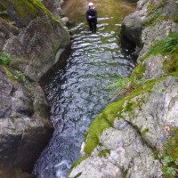
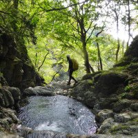
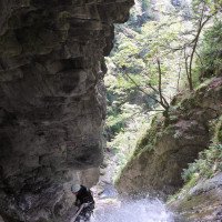
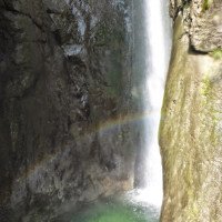
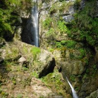
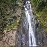
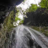
Eine Aufeinanderfolge dreier großer zT. mehrstufiger Wasserfälle, die man auch mittels Benutzung der dortigen Wanderwege miteinander verbinden kann.
A succession of three large waterfalls, some of which have several levels, which can also be connected by using the hiking trails there.
Return (10 min):
machine translated
➜
Original language
Nach der dritten großen Kaskade auf dem Fußweg, dann auf der Straße zum unteren Auto.
After the third large cascade on the footpath, then on the road to the lower car.
Coordinates:
Canyon Start
Canyon End
Parking at Entry
(descente_2)
Parking at Exit
(descente_3)
Literatures:
Map
1:50000
Map
1:25000
Map
1:25000
Canyoning Book
Pascal van Duin
Edizioni TopCanyon
2005
978-8890175305
Canyoning Book
Francesco Cacace / Roberto Jarre / Dino Ruotolo / Roberto Schenone
2003
Cwiki Canyon Info
Descente Canyon Info
Ropewiki Canyon Info
13.07.2024
skeno
⭐
★★★★★
📖
★★★
⚓
★★★
💧
Normal
Completed ✔
no translation available
Automatisch importiert von Descente-Canyon.com für Canyon San Giulio
(Quelle: https://www.descente-canyon.com/canyoning/canyon-debit/21719/observations.html)
09.03.2023
System User
⭐
★★★★★
📖
★★★
⚓
★★★
no translation available
Info: Teile der Canyonbeschreibung wurden automatisiert übernommen. Konkret die Felder Weblinks, Koordinaten, Rating, Länge des Canyon, Einfachseil Mindestens von https://www.descente-canyon.com/canyoning/canyon/21719
09.03.2023
System User
⭐
★★★★★
📖
★★★
⚓
★★★
no translation available
Daten importiert von https://canyon.carto.net/cwiki/bin/view/Canyons/TorrenteSanGiulioCanyon.html
New Report
Please briefly and concisely the most important information of the last tour or important current information about the canyon. If necessary with links to videos, photos, etc..
*
*
*
Esc
Del
Hydrology:


