v4 a4 IV
3h25
50min
2h20
15min
900m
640m
260m
26m
2x30m
8
1800m
on Foot
Rating:
★★★★★
3.8 (9)
Info:
★★★
2.4 (5)
Belay:
★★★
2.3 (7)
Summary:
machine translated
➜
Original language
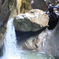
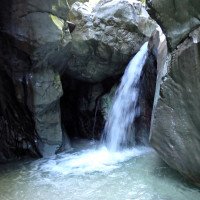
Schöne Schlucht mit einigen Sprüngen und Rutschen. Ist quasi eine Einsteigertour in dieser Region.
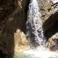
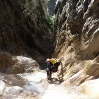
Beautiful canyon with some jumps and slides. Is virtually a beginner tour in this region.
Southwest
Summary:
machine translated
➜
Original language
Schöne Schlucht mit einigen Sprüngen und Rutschen. Ist quasi eine Einsteigertour in dieser Region.
Beautiful canyon with some jumps and slides. Is virtually a beginner tour in this region.
Access:
machine translated
➜
Original language
Claut - Lesis. Kurz nach Lesis kommt man zu einer Brücke über die Cellina. Danach Parkmöglichkeiten
Claut - Lesis. Shortly after Lesis you come to a bridge over the Cellina. After that parking
Approach (50 min):
machine translated
➜
Original language
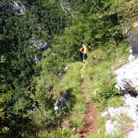
Man folgt dem Steig 391, der bald zu einer Almwiese mit mehreren Gebäuden führt. Gleich beim ersten Gebäude nach links abzweigen (Markierung und Steig schwer zu sehen) und links ansteigend zum Waldrand hinauf. Danach auf schönen Steig in vielen Kehren steil bergauf. Wenn der Steig wieder flacher wird zweigt nach einer Querung eines meist trockenen Bachbetts ein unmarkierter Weg nach links ab - dieser Steig führt zunächst zu einer Ruine einer alten Materialseilbahn, dann steil hinunter zum Bachbett des Ciol della Val den man 2 Abseilstellen vor der Mündung in den Ciolesan erreicht. Man "erspart" sich mit diesen Zustieg die 4 wenig interessanten Abseilstellen des oberen Ciol della Val, der benötigte Seilbedarf reduziert sich dann auch auf 1x 40m: Wer den Bach von ganz oben gehen will folgt einfach den markierten Weg bis dieser auf den Ciol della Val trifft.
Follow path 391, which soon leads to an alpine meadow with several buildings. Immediately at the first building turn left (marking and path difficult to see) and climb left to the edge of the forest. Then on a beautiful path in many hairpin bends steeply uphill. When the path flattens out again, after crossing a mostly dry streambed, an unmarked path branches off to the left - this path first leads to the ruins of an old material cableway, then steeply down to the streambed of the Ciol della Val, which you reach 2 rappels before it flows into the Ciolesan. This access "saves" the 4 not very interesting rappels of the upper Ciol della Val, the required rope is then also reduced to 1x 40m: those who want to walk the stream from the top simply follow the marked path until it meets the Ciol della Val.
Tour (2 h 20):
machine translated
➜
Original language
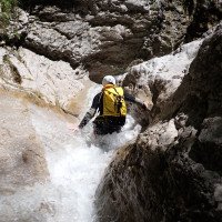
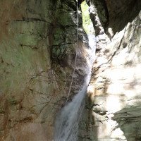
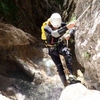
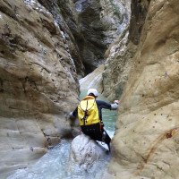
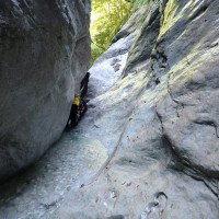
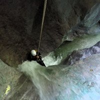
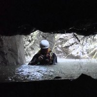
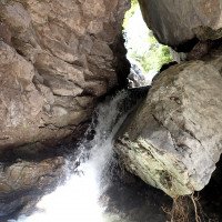
Zuerst sonniger, offener Canyon, dann ab dem Zufluss der Ciolesan eng und spektakulärer. Einige sehr enge Abseilpassagen.
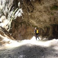
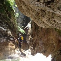
First sunny, open canyon, then from the tributary of the Ciolesan narrow and more spectacular. Some very tight rappel.
Return (15 min):
machine translated
➜
Original language
Wenn sich das Bachbett öffnet, sieht man eine Wasserleitung, die über die Schlucht gespannt ist. Hier links hinaus und der Wasserleitung folgen auf einem deutlichen Weg, der zurück zum Parkplatz führt
As the streambed opens up, you will see a water line stretched across the canyon. Exit here to the left and follow the water pipe along a clear path that leads back to the parking lot
Coordinates:
Canyon Start
Parking Entry and Exit
Parkplatz bei St. de Pol
Canyon End
Literatures:
Map
1:25000
Map
1:25000
Canyoning Book
Simon Flower
Cicerone
2012
Northern Italy and Ticino
Canyoning Book
Pascal van Duin
2011
Canyoning Book
Pascal van Duin
Edizioni TopCanyon
2009
100 Beschreibungen
Canyoning Book
Maurizio Biondi / Francesco Cacace / Roberto Schenone
Adriambiente
2000
978-8890026010
Cwiki Canyon Info
Descente Canyon Info
Other Canyon Info
Other Canyon Info
Other Canyon Info
17.11.2024
MirkoT
⭐
★★★★★
📖
★★★
⚓
★★★
💧
Normal
Completed ✔
no translation available
Automatisch importiert von Descente-Canyon.com für Canyon Ciolesan
Armi ok anche nell'affluente Ciol della Val.Presenza di MC fissi.Molte pozze nuovamente tuffabili.Roccia fornisce molto grip.Avevo brutti ricordi, ma oggi mi sono ricreduto...gran bella riscoperta
(Quelle: https://www.descente-canyon.com/canyoning/canyon-debit/21713/observations.html)
18.10.2024
MartiiinYan09
⭐
★★★★★
📖
★★★
⚓
★★★
🌊
Crazy
Completed ✕
no translation available
Automatisch importiert von Descente-Canyon.com für Canyon Ciolesan
Eau marron, au pic de la crue...
(Quelle: https://www.descente-canyon.com/canyoning/canyon-debit/21713/observations.html)
18.10.2024
Martiiin
⭐
★★★★★
📖
★★★
⚓
★★★
🌊
Crazy
Completed ✕
no translation available
Automatisch importiert von Descente-Canyon.com für Canyon Ciolesan
Et c'est reparti pour les crues!On s'est rabattu sur la cascata saleduogna toute proche. Normalement sèche et là magnifique pendant les pluies.
(Quelle: https://www.descente-canyon.com/canyoning/canyon-debit/21713/observations.html)
16.10.2024
Max H.
⭐
★★★★★
📖
★★★
⚓
★★★
💧
Normal
Completed ✔
machine translated
➜
Original language
Other users were: Sebastian Hehenwarter Steffi Oe. Markus Gottwald
Sind in der Mittw eingestiegen. War eine nette Tour mit vielen kürzeren Abseilern. Wasserstand laut Referenzfoto hat auch in den Engstellen keine Probleme bereitet, sollte bei etwas höherem Wasserstand noch möglich sein. Achtung beim Zustieg zu Beginn beim ersten Haus nach links in den Wald hoch (GPS war hilfreich).
We started in the middle of the day. It was a nice tour with many shorter rappels. Water level according to the reference photo did not cause any problems in the narrow sections, should still be possible with a slightly higher water level. Be careful at the beginning at the first house to the left up into the forest (GPS was helpful).
Other users were: Sebastian Hehenwarter Steffi Oe. Markus Gottwald
25.08.2024
Barbora Kohout
⭐
★★★★★
📖
★★★
⚓
★★★
💧
Normal
Completed ✔
Other users were: Miroslav
Some anchor points are worse, but all in all doable. Everything was good ♡
Other users were: Miroslav
15.08.2024
Péter Bonczi
⭐
★★★★★
📖
★★★
⚓
★★★
💧
Normal
Completed ✔
machine translated
➜
Original language
Jó pár csavart eltávolítottak legutóbbi látogatásom óta, de még megfelelő a felszerelés. Frissen bedőlt fa is van, de nem okoz gondot. Egyébként szép állapotban.
Quite a few screws have been removed since my last visit, but the equipment is still adequate. There is freshly fallen wood, but it's not a problem. Otherwise in nice condition.
08.07.2024
Sandra66
⭐
★★★★★
📖
★★★
⚓
★★★
💧
Normal
Completed ✔
no translation available
Automatisch importiert von Descente-Canyon.com für Canyon Ciolesan
(Quelle: https://www.descente-canyon.com/canyoning/canyon-debit/21713/observations.html)
09.05.2024
gebu2
⭐
★★★★★
📖
★★★
⚓
★★★
💧
High
Completed ✔
no translation available
Automatisch importiert von Descente-Canyon.com für Canyon Ciolesan
Higher water than usual but not as high as other creeks in the area. Very slippery but impressive and fun.
(Quelle: https://www.descente-canyon.com/canyoning/canyon-debit/21713/observations.html)
09.05.2024
Horst Lambauer
⭐
★★★★★
📖
★★★
⚓
★★★
💧
Normal
Completed ✔
machine translated
➜
Original language
Other users were: Wolfgang Rok GeorgB
Sind den unteren Teil begangen. Alle Stände ok
Walked the lower part. All stands ok
Other users were: Wolfgang Rok GeorgB
12.10.2023
Joey CIA
⭐
★★★★★
📖
★★★
⚓
★★★
💧
Low
Completed ✔
machine translated
➜
Original language
Steiler Anstieg, der sich lohnt.
Tolle Tour mit Engstellen.
Sehr Rutschig. Stände alle i.o!
Steep climb that is worth it.
Great tour with narrow places.
Very slippery. Stands all i.o!
11.08.2023
Wolfgang Streicher
⭐
★★★★★
📖
★★★
⚓
★★★
💧
Normal
Completed ✔
machine translated
➜
Original language
Zu Beginn Schwierigkeiten bei der Wegfindung. Bei der Holperrutsche nach dem 2. Abseiler vermisse ich einen Haken für eine Situation mit starkem Wasserdurchsatz. Der attraktive Sprunggumpen aufgekiest. Die Wegfindung für einen zügigen Ausstieg gestaltete sich schwierig.
At the beginning difficulties in finding the way. At the bumpy chute after the 2nd rappel I miss a hook for a situation with strong water flow. The attractive jumping pit is gravelled. The wayfinding for a speedy exit turned out to be difficult.
09.06.2023
Horst Lambauer
⭐
★★★★★
📖
★★★
⚓
★★★
💧
High
Completed ✔
machine translated
➜
Original language
Auch der obere Teil ist durchaus lustig mit 2 Sprüngen und ein paar Abseilern. Außerdem ist es interessant wie sich der Charakter der Schlucht verändert. Oben die offene Waldschlucht und dann zunehmend eng eingeschnitten. Stände in perfekten Zustand.
Wir waren ein gutes Team und waren 2,75h Auto-Auto unterwegs.
The upper part is also quite fun with 2 jumps and a few rappels. In addition, it is interesting how the character of the gorge changes. Above the open forest canyon and then increasingly narrow cut. Stands in perfect condition.
We were a good team and were 2.75h car-car.
09.03.2023
System User
⭐
★★★★★
📖
★★★
⚓
★★★
no translation available
Info: Teile der Canyonbeschreibung wurden automatisiert übernommen. Konkret die Felder Weblinks, Koordinaten, Rating, Länge des Canyon, Einfachseil Mindestens von https://www.descente-canyon.com/canyoning/canyon/21713
09.03.2023
System User
⭐
★★★★★
📖
★★★
⚓
★★★
no translation available
Daten importiert von https://canyon.carto.net/cwiki/bin/view/Canyons/TorrenteCiolesanCanyon.html
New Report
Please briefly and concisely the most important information of the last tour or important current information about the canyon. If necessary with links to videos, photos, etc..
*
*
*
Esc
Del
Hydrology:


