very difficult
Torrente Grigno
Country:
Italia / Italy
Region: Trentino-Alto Adige
Subregion: Trento / Provincia autonoma di Trento
Town: Grigno
v5 a6 VI
5h35
15min
5h
20min
510m
310m
200m
25m
2x30m
15
3200m
Car optional
Specialities:
Dam Water catchment
Dam Water catchment
Rating:
★★★★★
4.4 (5)
Info:
★★★
2.5 (2)
Belay:
★★★
2.7 (3)
Summary:
machine translated
➜
Original language
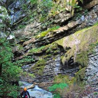
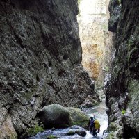
Tief eingeschnittene und wasserreiche Schlucht, die über zwei Drittel Länge so eng ist, dass kaum Licht bis zum Schluchtgrund dringt. Sollte nur von erfahrenen Canyonauten begangen werden, da sehr wasserreich, selbst bei geringen Wasserpegeln, und somit Wildwassererfahrung und Techniken zu Vermeidung des direkten Wasserkontakts beim Abseilen Grundvorraussetzung sind.
Es sollte der Wasserstand geprüft werden, bevor man einsteigt. Grigno hat eine Messtelle (siehe Links) bei der der Wasserstand geprüft werden kann. Für eine halbwegs sicher Begehung sollte der Pegel von 2m³/s nicht überschritten werden, es ist jedoch normal das die Messwerte nicht konstant sind sondern einmal leicht unter oder über 2m³/s ist. Im Schnitt sollten jedoch die 2 m³/s nicht überschritten werden.
Der Canyon sollte nur bei stabilen Wetterlagen begangen werden wegen des sehr großen Einzugsgebiets und da man praktisch für min. 2,5h keine erhöhte Position im Canyon findet geschweige denn eine Fluchtmöglichkeit.
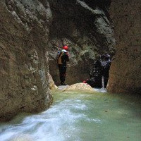
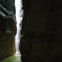
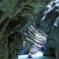
Deeply cut and watery canyon, which is so narrow over two-thirds of its length that hardly any light penetrates to the bottom of the canyon. Should only be done by experienced canyoneers, because very watery, even at low water levels, and therefore whitewater experience and techniques to avoid direct water contact during rappel are basic requirements.
It is advisable to check the water level before entering. Grigno has a measuring point (see links) where the water level can be checked. For a reasonably safe ascent, the water level should not exceed 2m³/s, but it is normal that the readings are not constant but sometimes slightly below or above 2m³/s. The water level should not exceed 2m³/s on average. On average, however, the 2m³/s should not be exceeded.
The canyon should be entered only in stable weather conditions because of the very large catchment area and because you will find practically no elevated position in the canyon for at least 2.5 hours, let alone an escape possibility.
Access:
machine translated
➜
Original language
Von Trento auf der SP 47 kommend biegen wir in die Ortschaft Grigno ab und parken etwas nördlich vom Zentrum auf der orograf. rechten Seite des Torrente Grigno.
Mit dem zweiten Auto zurück zur Hautstraße, dort nach links über den Fluss und etwa 200 Meter weiter wieder links abbiegen auf die Straße nach Castello Tesino. Dort angekommen links halten und weiter nach Pieve Tesino. Vom Ortszentrum in südlicher Richtung nach Cinte Tesino. Man folgt am besten den Wegweisern zum "Ponte de Diabolo" bzw. "Apocalypse Now" und fährt Bergab bis der Wanderweg zum Ponte del Diabolo anfängt. Hier haben ca 2 Autos platz!
Coming from Trento on the SP 47 we turn into the village of Grigno and park a little north of the center on the orographic. right side of the Torrente Grigno.
With the second car return to the main road, turn left over the river and about 200 meters further turn left again on the road to Castello Tesino. Once there, keep left and continue to Pieve Tesino. From the center of the village, head south to Cinte Tesino. Follow the signs to "Ponte de Diabolo" or "Apocalypse Now" and drive downhill until the trail to Ponte del Diabolo begins. There is room for about 2 cars!
Approach (15 min):
machine translated
➜
Original language
Dem hier beginnenden Waldweg folgen wir etwa 200 m bergab bis zur ersten Linkskehre. Der Zustieg ist mit Apocalipse Now beschildert und rot-weiss markiert. Zusätzlich gibt es noch blau-weisse AIC Markierungen. Auf einen Waldrücken nach rechts absteigen und knapp vor einem Bachbett links abzweigen. Beim nächsten Wegweiser paralell zum Bachbett absteigen und bald unter einer glatten Wand nach links zum Einstieg queren.
Wenn man Zeit hat kann man auch den Wegweisern zur Ponte del Diaolo, einer Naturbrücke über den engsten Teil der Klamm, folgen (hin und zurück etwa 40min)
Follow the forest path that starts here downhill for about 200 m until the first leftward haipin bend. The access is signposted Apocalipse Now and marked in red and white. In addition, there are blue-white AIC markings. Descend to the right onto a forest ridge and turn left just before a streambed. At the next signpost, descend parallel to the streambed and soon traverse left under a slick wall to the entry.
If you have time, you can also follow the signs to Ponte del Diaolo, a natural bridge over the narrowest part of the gorge (round trip about 40min).
Tour (5 h):
machine translated
➜
Original language
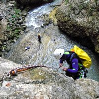
Die Tour ist zum Zeitpunkt 13.8.2023 gut eingesichert mit der Möglichkeit zum Bau von einigen Seilgeländern um dem Wasser beim Abseilen nicht ausgesetzt zu sein. Trotzdem sollte der Torrente Grigno nicht unterschätzt werden, weil sich durch den starken Wasserdurchsatz immer wieder Rückläufe etc bilden können.
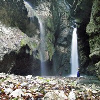
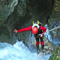
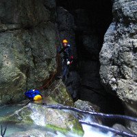
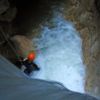
Nachdem man in die Schlucht hinabgeseilt ist, kommt nach einer kleinen Gehstrecke die nächste Abseilstelle die or. re. durch den Bau eines Seilgeländers erreicht werden kann. Nach einem ca 10m Abseiler im trockene or. re. kommt man zu einer nicht ganz einfachen Stelle die überwunden werden muss. Hier gibt es die Möglichkeit kletternd or. re. zu einem trockene Abseilstand zu gelangen oder man baut eine Seilbahn mittels Treibankers. Ein Abseilen direkt in den Wasserfluss sollte nur von Personen, die Grigno kennen riskiert werden.
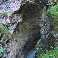
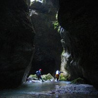
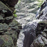
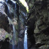
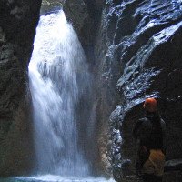
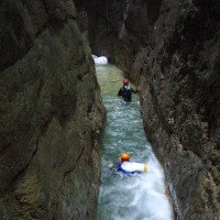
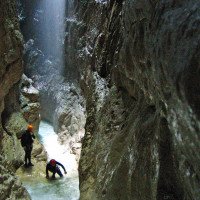
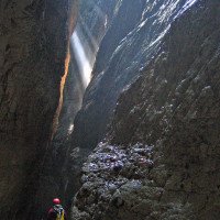
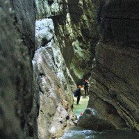
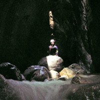
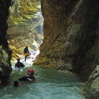
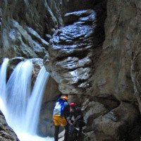
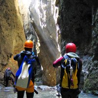
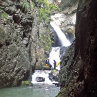
Nun fängt der richtig dunkle Teil des Grigno an. Es folgt ein kleiner Abseiler von ca 3m or. re. der Mittels eines Umlenkers (fix montierter Karabiner) überwunden werden kann und ohne den man direkt in den starken Wasserlauf gelangen würde. Es folgen mehrere Abseilstellen, Sprünge in turbulente Becken und lange dunkle Korridore die je nach Tageszeit teilweise Lichteinfall haben und zu wunderbaren Lichtspielen führen. (Schlucht ist südlich ausgerichtet, d.h. zur Mittagszeit hat man die beste Chance auf schönes Licht im Canyon.
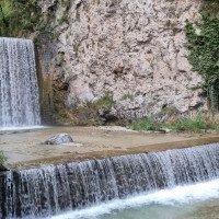
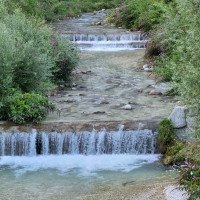
Für ca 2,5h befindet man sich in diesem dunklen Korridoren, wo kein Fluchtweg möglich ist. Danach öffnet sich die Schlucht und es folgt eine ca 30minütige Gehstrecke, die bei der Staumauer, die vom Ort Grigno aus erreicht werden kann, endet.
The tour is well secured at the time 13.8.2023 with the possibility of building some rope traverses to avoid being exposed to the water during rappel. Nevertheless, the Torrente Grigno should not be underestimated because of the strong water flow can always form backflows, etc..
After rappelling down into the canyon, after a short walking passages comes the next rappelling point which can be reached or. right by building a rope traverse. After a rappel of about 10m in the dry or. right you come to a not so easy place that must be overcome. Here there is the possibility of climbing or. right. to a dry abseil stand or one builds a ropeway by means of a drift anchor. A rappel directly into the water flow should only be risked by people who know Grigno.
Now the really dark part of Grigno begins. A small rappel of about 3m ortographic right follows, which can be overcome by means of a pulley (fixed carabiner) and without which one would get directly into the strong water flow. Several abseils, jumps into turbulent pools and long dark corridors follow which, depending on the time of day, have partial light incidence and lead to wonderful light shows. (The canyon is oriented to the south, i.e. at noon you have the best chance to see beautiful light in the canyon.
For about 2.5h you are in this dark corridors where no escape route is possible. After that, the canyon opens and a walking passages of about 30 minutes follows, ending at the dam wall that can be reached from the village of Grigno.
Return (20 min):
machine translated
➜
Original language
Bei der Staumauer führt der Pfad or. re. dem Weg am Fuße der Staumauer, der direkt beim Ort Grigno endet.
At the dam, the path or. right follows the path at the foot of the dam, which ends directly at the village of Grigno.
Coordinates:
Canyon Start
Parking at Entry
Einstiegsparkplatz
Parking at Exit
Ausstiegsparkplatz
Canyon End
Literatures:
Map
1:25000
Map
1:25000
Map
1:25000
Canyoning Book
Simon Flower
Cicerone
2012
Northern Italy and Ticino
Canyoning Book
Pascal van Duin
2011
Canyoning Book
Pascal van Duin
Edizioni TopCanyon
2009
100 Beschreibungen
Canyoning Book
Maurizio Biondi / Francesco Cacace / Roberto Schenone
Adriambiente
2000
978-8890026010
Canyoning Book
Alfons Zaunhuber
1996
Canyoning Book
Michele Sivelli / Mario Vianelli
1988
Canyoning Book
Stéphane Coté / Caracal et les Sancho Panza
2008
Canyoning Book
Matteo Bortot, Roberto Sartor
ViviDolomiti
2019
978-8899106669
45 Canyon-Beschreibungen
Canyoning Booklet
AIC
2024
Booklet des Canyoning Treffens in Südtirol 2024 - Beschreibungen übernommen nach freundlicher Genehmigung
Cwiki Canyon Info
Descente Canyon Info
Ropewiki Canyon Info
Gallery
Other Canyon Info
11.08.2024
Fabrizio Cavazzuti
⭐
★★★★★
📖
★★★
⚓
★★★
💧
High
Completed ✔
no translation available
Automatisch importiert von Descente-Canyon.com für Canyon Grigno
Portata 2.6 MC sec. Uscita riva destra dopo la briglia
(Quelle: https://www.descente-canyon.com/canyoning/canyon-debit/2558/observations.html)
28.07.2024
Demis
⭐
★★★★★
📖
★★★
⚓
★★★
🌊
Crazy
Completed ✔
no translation available
Automatisch importiert von Descente-Canyon.com für Canyon Grigno
Molta acqua...su sito web portata picchi di 3.1m³/s...bisogna fare molta attenzione di non venire risucchiati in tutte le pozze.
(Quelle: https://www.descente-canyon.com/canyoning/canyon-debit/2558/observations.html)
17.09.2023
Jeroen Kirchner
⭐
★★★★★
📖
★★★
⚓
★★★
💧
High
Completed ✔
The new anchors and handlines make Grigno safer but also longer to descend as you have to install all of them. 8 to 10 carabiners will be needed. We did the approach on foot which was quite long, with parts of the path destroyed (and officially closed) due to rockfall (also noticeable in the canyon). Flow was normal with 1.7 to 2.36m3/s.
12.08.2023
Horst Lambauer
⭐
★★★★★
📖
★★★
⚓
★★★
💧
Normal
Completed ✔
machine translated
➜
Original language
Beschreibung des Canyons komplett überarbeitet und Infos zur Wasserstandskontrolle hinzugefügt. Sensationelle aber durchaus spannende Schlucht.
Description of the canyon completely revised and added info on water level control. Sensational but quite exciting canyon.
09.03.2023
System User
⭐
★★★★★
📖
★★★
⚓
★★★
no translation available
Info: Teile der Canyonbeschreibung wurden automatisiert übernommen. Konkret die Felder Weblinks, Koordinaten, Rating, Länge des Canyon, Einfachseil Mindestens von https://www.descente-canyon.com/canyoning/canyon/2558
09.03.2023
System User
⭐
★★★★★
📖
★★★
⚓
★★★
no translation available
Daten importiert von https://canyon.carto.net/cwiki/bin/view/Canyons/TorrenteGrignoCanyon.html
16.08.2022
Bubtore
⭐
★★★★★
📖
★★★
⚓
★★★
💧
High
Completed ✔
machine translated
➜
Original language
Ich mag es nicht 5 Sterne als Bewertung zu geben, aber da muss ich schon. Was für ein Magischer Ort.
I don't like to give 5 stars as a rating, but I have to. What a magical place.
New Report
Please briefly and concisely the most important information of the last tour or important current information about the canyon. If necessary with links to videos, photos, etc..
*
*
*
Esc
Del
Hydrology:
no translation available
Wasserstand: https://www.floods.it/public/index.php
vermutlich dieser: https://www.floods.it/public/Charts.php?Sensori[]=30423


