moins difficile
Staffelgraben (oberer)
Pays:
Deutschland / Germany
Région: Oberbayern / Upper Bavaria
Sous-régione: Landkreis Bad Tölz-Wolfratshausen
Ville: Fall
v3 a2 III
5h25
2h15
2h15
55min
1063m
875m
188m
15m
2x20m
2
1800m
à pied
Spécialités:
§ Interdiction
§ Interdiction
Évaluation:
★★★★★
1.4 (1)
Info:
★★★
0 ()
Belay:
★★★
0 ()
Résumé:
traduction alternative
➜
Langue originale
Abseilcanyon mit vielen Laufpassagen
Rappel canyon with many walking passages
Partie
Nom
Difficulté
Approche
Tour
Retour
Sud-Est
Résumé:
traduction alternative
➜
Langue originale
Abseilcanyon mit vielen Laufpassagen
Rappel canyon with many walking passages
Accès:
traduction alternative
➜
Langue originale
Von Bad Tölz kommend fahren wir auf der B 13, vorbei an Lenggries, zum Sylvensteinspeicher (21,5 km). Auf der Dammkrone angekommen halten wir rechts auf der B 307 in Richtung Fall, Vorderriß. Nach nicht ganz 6 km (ab Dammkrone) biegen wir von der B 307 rechts ab auf eine Schotterstraße und stellen unser Auto vor der Schranke ab.
Coming from Bad Tölz we drive on the B 13, past Lenggries, to the Sylvenstein reservoir (21.5 km). Arrived on the dam crest we keep right on the B 307 in the direction of Fall, Vorderriß. After not quite 6 km (from Dammkrone) we turn right from the B 307 onto a gravel road and park our car in front of the barrier.
Approche (2 h 15):
traduction alternative
➜
Langue originale
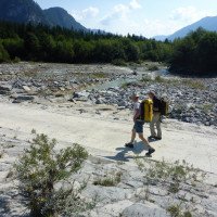
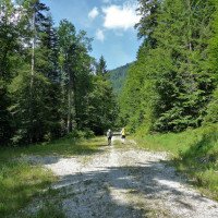
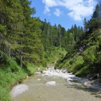
Wir gehen die Piste weiter und queren die Isar auf bzw. neben einem Damm. Etwa 300m weiter beschreibt die Piste einen Rechtsbogen. Am Ende des Rechtsbogens biegen wir links ab auf eine Piste, die nach Norden führt. 70m weiter biegen wir auch von dieser Piste rechts ab und nehmen den Forstweg, der uns zunächst steil bergauf in nördlicher Richtung führt. Etwa 500m nach dessen Beginn schwenkt der Pfad nach links und wir kommen nach weiteren 200m an den Staffelgraben (Dieser Weg - ab Isar - lässt sich gut auf dem "Bayernatlas" (Im Menue "Wanderwege" ankreuzen, dann orange eingezeichnet) nachvollziehen: http://geoportal.bayern.de/bayernatlas/?X=5269874.36&Y=4461781.60&zoom=11&lang=de&topic=ba&bgLayer=atkis&catalogNodes=122& layers=e528a2a8-44e7-46e9-9069-1a8295b113b5 . Nun über den Staffelgraben, dann halten wir links von dem uns entgegenfließenden Seibertsgraben (also orograf. rechts von diesem) den Hang steil hinauf und treffen in 930 m Höhe auf eine quer und horizontal verlaufende Forststraße. Auf dieser nun links. Nach 800m endet die Forststraße an einem Wendeplatz. Hier ginge es in Richtung SSW den Pfad hinunter zum Bach (Einstieg unterer Abschnitt).\nWir gehen jedoch den Forstweg weiter. Er setzt sich fort in einem Steig. Gut 15 Min. weiter kommen wir zu einer Stelle, wo der Steig über Stahlstifte knapp oberhalb des Baches verläuft. Ab hier steigt er dann kräftig an. Weiter oben verzweigt sich der Steig. Wir gehen 2x rechts. Schließlich flacht der Weg ab und wir können den Bacheinschnitt wieder sehen. Hier steigen wir an geeigneter Stelle hinunter in das Bachbett (1063m Höhe).
We continue along the slope and cross the Isar on or next to a dam. About 300m further on the slope describes a right turn. At the exit of the right bend we turn left onto a track that leads to the north. 70m further on we also turn right from this track and take the forest road, which leads us first steeply uphill in northern direction. About 500m after its beginning the path turns to the left and after another 200m we come to the Staffelgraben (This path - from Isar - can be traced well on the "Bayernatlas" (tick in the menu "Wanderwege", then marked in orange): http://geoportal.bayern.de/bayernatlas/?X=5269874.36&Y=4461781.60&zoom=11&lang=de&topic=ba&bgLayer=atkis&catalogNodes=122& layers=e528a2a8-44e7-46e9-9069-1a8295b113b5 . Now over the Staffelgraben, then we keep to the left of the Seibertsgraben flowing towards us (i.e. orographic. to the right of it) up the slope steeply and at an altitude of 930 m we meet a forest road running crosswise and horizontally. On this now left. After 800m the forest road ends at a turning point. Here we would go in the direction of SSW down the path to the stream (entry lower part).\nWir continue, however, the forest road. It continues in a path. A good 15 minutes further on we come to a place where the path runs over steel pins just above the stream. From here on the path rises sharply. Further up the path branches. We go 2x to the right. Finally, the path flattens out and we can see the stream incision again. Here we descend at a suitable point into the streambed (1063m altitude).
Tour (2 h 15):
traduction alternative
➜
Langue originale
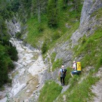
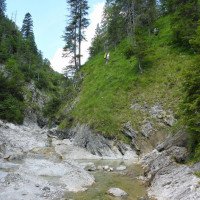
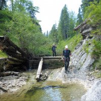
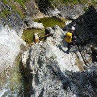
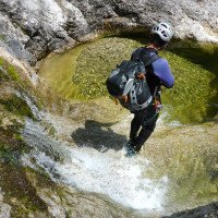
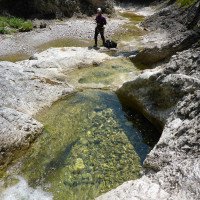
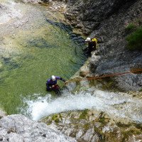
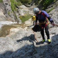
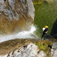
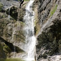
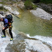
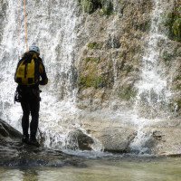
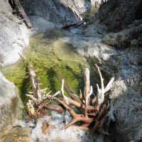
Schnell kommen wir zu einer verfallenen Triftklause und Minuten später zum ersten Abseiler. Der Klebehaken ist umgeschlagen. Doch ließe sich einen flache Bandschlinge einfädeln. Alternativ kann abgeklettert werden. Es folgen 6 weitere Abseiler, die auch zum Teil ohne Seil zu bewältigen sind. Dann folgt ein großer Topf, wo ein Haken sinnvoll ware, da er nur schlecht abzuklettern ist. Wenig später kommen wir zur Stahlstiftpassage. Ab hier laufen wir praktisch horizontal bis zum Ende des oberen Abschnitts (885m Höhe).
Quickly we come to a dilapidated Triftklause and minutes later to the first rappel. The glued anchor is knocked over. But a flat tape loop could be threaded. Alternatively, downclimbing is possible. There are 6 more rappels, some of which can be done without ropes. Then follows a large pot, where an anchor would be useful, because it is difficult to climb down. A little later we come to the steel pin passage. From here we walk practically horizontally until the exit of the upper part (885m altitude).
Retour (55 min):
traduction alternative
➜
Langue originale
Es macht Sinn, die Tour im Bach mit dem unteren Abschnitt fortzusetzen (siehe dortige Beschreibung).\n\nAlternativ kann hier aber auch zur Forstpiste aufgestiegen und anschließend der Zustiegsweg zurück zum Auto genommen werden.
It makes sense to continue the tour in the creek with the lower part (see description there).\nAlternatively, however, you can also climb up to the forest track here and then take the access path back to the car.
Coordonnées:
Départ du Canyon
Littérature:
Carte
Topographische Karte (1/25 000) 8434 - Vorderriß
Carte
Bayern-Atlas: http://geoportal.bayern.de/bayernatlas/?X=5269874.36&Y=4461781.60&zoom=11&lang=de&topic=ba&bgLayer=atkis&catalogNodes=122& layers=e528a2a8-44e7-46e9-9069-1a8295b113b5
Info canyon Cwiki
Galerie
09.03.2023
System User
⭐
★★★★★
📖
★★★
⚓
★★★
pas de traduction disponible
Daten importiert von https://canyon.carto.net/cwiki/bin/view/Canyons/StaffelgrabenobererCanyon.html
Hydrologie:
