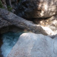
un peu difficile
Frauenbach
v4 a3 III
4h10
30min
3h30
10min
940m
700m
240m
30m
2x40m
26
300m
à pied
Engrenages:
ancre flottante
ancre flottante
Évaluation:
★★★★★
4.5 (14)
Info:
★★★
2.7 (10)
Belay:
★★★
2 (12)
Résumé:
traduction alternative
➜
Langue originale
Zählt zu den schönsten und aquatischeren Kalkschluchten in Österreich; kontinuierlicher Abseilcanyon mit vielen Abseilstellen; sehr gut eingerichtet; mehrere Notausstiege; bei hohem Wasserstand kann die Schlucht sehr gefährlich werden; die meisten Abseilstellen sind direkt im Wasserlauf; kaltes Wasser; gr. Einzugsgebiet + Wehranlage ; 3er Kaskade am Schluss; bei Schießplatzbetrieb ist der Zustieg verboten (Zeiten siehe Links) !
Counts among the most beautiful and aquatic lime canyons in Austria; continuous rappel canyon with many rappelling points; very well equipped; several emergency exits; at high water levels, the canyon can be very dangerous; most rappelling points are directly in the watercourse; cold water; gr. catchment area + weir ; 3er cascade at the end; during shooting range operation, access is prohibited (times see links) !
Nord-Est
Calcaire
Résumé:
traduction alternative
➜
Langue originale
Zählt zu den schönsten und aquatischeren Kalkschluchten in Österreich; kontinuierlicher Abseilcanyon mit vielen Abseilstellen; sehr gut eingerichtet; mehrere Notausstiege; bei hohem Wasserstand kann die Schlucht sehr gefährlich werden; die meisten Abseilstellen sind direkt im Wasserlauf; kaltes Wasser; gr. Einzugsgebiet + Wehranlage ; 3er Kaskade am Schluss; bei Schießplatzbetrieb ist der Zustieg verboten (Zeiten siehe Links) !
Counts among the most beautiful and aquatic lime canyons in Austria; continuous rappel canyon with many rappelling points; very well equipped; several emergency exits; at high water levels, the canyon can be very dangerous; most rappelling points are directly in the watercourse; cold water; gr. catchment area + weir ; 3er cascade at the end; during shooting range operation, access is prohibited (times see links) !
Accès:
traduction alternative
➜
Langue originale
Von Spital an der Trau kommend ins Drautal Ri. Tirol (Lienz) fahren-->nach der Ortschaft Oberdrauburg (nach ca. 10km) beim Hinweisschild „Schotterwerk Schmidl“ li. über die Drau nach Lavant abbiegen --> nach 1,5km an der Zeittafel vom Schießplatz auf dem Forstweg bis zum Schranken (Parkplatz) zurückfahren.
Coming from Spital an der Trau drive into the Drau valley in the direction of Tirol (Lienz) --> after the village of Oberdrauburg (after approx. 10km) at the sign "Schotterwerk Schmidl" turn left across the Drau to Lavant --> after 1.5km at the time sign from the shooting range drive back on the forest road to the barrier (parking lot).
Approche (30 min):
traduction alternative
➜
Langue originale
Vom Parkplatz vor dem Schranken des Schießplatzes (Achtung auf rote Flagge) geht es auf der Forststraße bis zum kl. Kraftwerk- Häuschen (700Hm) --> dort kann man über einen Steig, der li hochgeht, schon die letzte Kaskade bzw. den Wasserstand sehen --> nach der Kontrolle zurück zum Forstweg --> diesen weiter bis zur einzigen Straßengabelung Ri. Lavanter Alm folgen --> nach kurzer Zeit und einigen Hm. kann auf 940Hm einfach in den Bach abgestiegen werden (offenes Gelände mit Blick auf die Berge).
From the parking lot in front of the barrier of the shooting range (attention to red flag) it goes on the forest road to the small power plant cottage (700Hm) --> there you can already see the last cascade or the water level via a path that goes up on the left --> after the check back to the forest road --> follow this further to the only fork in the road Ri. Lavanter Alm --> after a short time and some Hm. can be descended at 940Hm simply in the stream (open terrain with views of the mountains).
Tour (3 h 30):
traduction alternative
➜
Langue originale
Einstieg auf 940Hm --> von hier geht es über eine kl. Abkletterpassage zur ersten Stufe mit kalter Dusche:-) die meisten (am Anfang noch kurzen) Abseilstellen sind im Wassererlauf--> die Standplätze (meist Kettenstand) sind jedoch gut und überlegt angebracht --> es geht sehr kontinuierlich über viele Abseiler durch die Schlucht-->im unteren Teil der Schlucht kommen die höheren Abseilstellen --> der Frauenbach kann sich durch den zum Teil sehr hohen Wasserdurchsatz und Geschiebe sehr schnell verändern daher sollten die Gumpen vor einem möglichen Sprung oder Rutsche gecheckt werden --> im oberen Drittel kommen mehrere Zuläufe in die Schlucht, (Tipp: an der Infotafel am Parkplatz kann man den Normal-Wasserstand sehen!) --> sollte die Wassermenge durch die Zuflüsse für die Begehung doch zu groß sein gibt einige Notausstiege auf der li. Seite --> durch den langen Aufenthalt im kalten Wasser sollte die Schlucht auch an heißen Sommertagen nicht unterschätzt werden. Die letzte Kaskade C10-C30-C25 ist sehr schön kann aber bei hohen Wasser sehr gefährlich werden (trockener 40m Abseiler re. möglich)
Entry at 940Hm --> from here it goes over a kl. Downclimb to the first step with cold shower:-) most of the (at the beginning still short) rappel points are in the watercourse --> the belays (mostly chain anchors) are however well and thoughtfully placed --> it goes very continuously over many rappels through the canyon --> in the lower part of the canyon come the higher rappel points --> the Frauenbach can change very quickly due to the partly very high water flow and debris, therefore the pools should be checked before a possible jump or slide --> in the upper third come several inlets into the canyon, (Tip: at the information board at the parking lot you can see the normal water level!) --> should the amount of water by the tributaries be too large for the walk, there are some emergency exits on the left side --> by the long stay in the cold water, the canyon should not be underestimated even on hot summer days. The last cascade C10-C30-C25 is very beautiful but can be very dangerous at high water (dry 40m rappel right possible)
Retour (10 min):
traduction alternative
➜
Langue originale
Nach der letzten Kaskade steigt man auf 700Hm li aus dem Bach aus und geht zum Kraftwerkshäuschen hoch. Danach folgt man der Forststraße zurück zum Parkplatz.
After the last cascade you get out of the stream at 700Hm on the left and go up to the power station house. Then follow the forest road back to the parking lot.
Coordonnées:
Départ du Canyon
46.78°, 12.8612°
↓↑
DMS: 46° 46" 48', 12° 51" 40.32'
DM: 46° 46.8", 12° 51.672"
Google Maps
Autriche Topographique
DMS: 46° 46" 48', 12° 51" 40.32'
DM: 46° 46.8", 12° 51.672"
Google Maps
Autriche Topographique
(cwiki_1)
Fin du Canyon
46.7831°, 12.8635°
↓↑
DMS: 46° 46" 59.16', 12° 51" 48.6'
DM: 46° 46.986", 12° 51.81"
Google Maps
Autriche Topographique
DMS: 46° 46" 59.16', 12° 51" 48.6'
DM: 46° 46.986", 12° 51.81"
Google Maps
Autriche Topographique
(cwiki_1)
Parking à l'entrée et à la sortie
46.789258°, 12.863322°
↓↑
DMS: 46° 47" 21.33', 12° 51" 47.96'
DM: 46° 47.355", 12° 51.799"
Google Maps
Autriche Topographique
DMS: 46° 47" 21.33', 12° 51" 47.96'
DM: 46° 47.355", 12° 51.799"
Google Maps
Autriche Topographique
Littérature:
Livre Canyoning
Simon Flower
Cicerone
2012
Northern Italy and Ticino
Livre Canyoning
Ingo Neumann / Alfred Wieser / Franz Karger / Reinhard Ranner
2004
http://www.edition-neumann.com
Livre Canyoning
Werner Baumgarten
2010
Livre Canyoning
Werner Baumgarten
2013
Livre Canyoning
Alexander Riml / Gunnar Amor
2012
Livret de canyoning
AIC
2024
Booklet des Canyoning Treffens in Südtirol 2024 - Beschreibungen übernommen nach freundlicher Genehmigung
Info canyon ACA
Info canyon Cwiki
Info canyon Descente
Info canyon Ropewiki
Autre info canyon
Autre info canyon
21.12.2024
Clarissa Linder
⭐
★★★★★
📖
★★★
⚓
★★★
💧
Faible
Terminé ✔
traduction alternative
➜
Langue originale
D'autres utilisateurs ont été: David Greinhofer
Fels teils eingeeist, sehr rutschig. Stände alle frei zugänglich.
Rock partly iced in, very slippery. Stands all freely accessible.
D'autres utilisateurs ont été: David Greinhofer
15.10.2024
Max H.
⭐
★★★★★
📖
★★★
⚓
★★★
💧
Haut
Terminé ✔
traduction alternative
➜
Langue originale
D'autres utilisateurs ont été: Sebastian Hehenwarter Steffi Oe. Markus Gottwald
Begangen von der Mitte bis zum Ende bei leicht erhöhtem Wasserstand (siehe vorher/nachher Bilder) als Aufwärmtour. Keine Wasserprobleme beim Abseilen. Beim letzten Abseiler reichten uns 53m um vom Kettenende bis unten zu kommen. An einer Stelle in der Tour mussten wir aufgrund fehlender Haken das Seil verlängern. Stände waren an allen wichtigen Stellen intakt, jedoch teilweise verbesserungswürdig.
Ascended from the middle to the exit with a slightly higher water level (see before/after pictures) as a warm-up tour. No water problems during the rappel. On the last rappel, 53m was enough to get from the end of the chain to the bottom. At one point in the tour we had to extend the rope due to a lack of anchors. Stands were intact at all important points, but could be improved in places.
D'autres utilisateurs ont été: Sebastian Hehenwarter Steffi Oe. Markus Gottwald
07.10.2024
L'Anglais dans l'eau
⭐
★★★★★
📖
★★★
⚓
★★★
💧
Normale
Terminé ✕
pas de traduction disponible
Automatisch importiert von Descente-Canyon.com für Canyon Frauenbach
J'ai vu les cascades finales en balade, pas plus, je n'ai pas descendu le canyon, mais me semble top, certainement a faire! Je poste pour informer par rapport les fermatures militaires - je ne sais pas si c'est toujours la meme chose, mais pour cette semaine et la semaine derniere, l'acces est fermé entre 3 et 4 jours par semaine. Voir "Schließzeiten Lavanter Forcha".
(Quelle: https://www.descente-canyon.com/canyoning/canyon-debit/21881/observations.html)
21.09.2024
Clarissa Linder
⭐
★★★★★
📖
★★★
⚓
★★★
💧
Normale
Terminé ✔
traduction alternative
➜
Langue originale
D'autres utilisateurs ont été: Tobias Beiser
Alles top, siehe vorige Einträge.
Everything is great, see previous entries.
D'autres utilisateurs ont été: Tobias Beiser
25.08.2024
Joey CIA
⭐
★★★★★
📖
★★★
⚓
★★★
💧
Faible
Terminé ✔
traduction alternative
➜
Langue originale
D'autres utilisateurs ont été: Bavarian Canyoning
Haken i.o
Alle Pools zugeschottert, beim letzten Abseilen fehlt der Haken ,kann aber mit 60er Seil durchgeseilt werden oder recht über die trockene Rinne abgeseilt werden. Standplatz muss angeklettern werden.
Top Bedingungen
Anchors ok
All pools are covered with gravel, the anchor is missing on the last rappel, but can be roped through with a 60 mm rope or rappelled right over the dry chute. The belay must be climbed.
Top conditions
D'autres utilisateurs ont été: Bavarian Canyoning
16.08.2024
Andreas B
⭐
★★★★★
📖
★★★
⚓
★★★
💧
Faible
Terminé ✔
traduction alternative
➜
Langue originale
Schöne Tour. Der obere Teil bis zum Zwischeneinstieg/ Ausstieg ist Recht kurz, aber auch gut mit (geübten) Kindern zu machen. Im zweiten Teil deutlich mehr Wasser Kontakt. Der Haken am letzten Abseiler fehlt weiterhin. Am 14.8 hat eine Gruppe auf der rechten Seite einen Not Haken von Hand gesetzt. Siehe Bild. Auf dessen Nutzung haben wir aber verzichtet. Mit 2 60 Meter Seilen geht das Abziehen aber problemlos. Alternativ die trocken Abseilstrecke rechts (ggf. Mit vorhandenen Zwischenstand) nutzen. Vor dem 3 letzten Abseiler ist ein entsprechendes Seil Geländer vorhanden. Siehe Bild
Beautiful tour. The upper part up to the intermediate entry/exit is quite short, but can also be done well with (experienced) children. Significantly more water contact in the second part. The anchor on the last rappel is still missing. On 14.8 a group has set an emergency anchor by hand on the right side. See picture. However, we decided not to use it. With 2 60 meter ropes, however, the abseil is easy. Alternatively, use the dry rappelling routes on the right (if necessary with existing intermediate stand). There is a corresponding rope railing in front of the last 3 rappels. See picture
16.08.2024
Andreas B
⭐
★★★★★
📖
★★★
⚓
★★★
💧
Faible
Terminé ✔
traduction alternative
➜
Langue originale
Schöne Tour. Der obere Teil bis zum Zwischeneinstieg/ Ausstieg ist Recht kurz, aber auch gut mit (geübten) Kindern zu machen. Im zweiten Teil deutlich mehr Wasser Kontakt. Der Haken am letzten Abseiler fehlt weiterhin. Am 14.8.24 hat eine Gruppe auf der rechten Seite einen Not Haken von Hand gesetzt. Siehe Bild. Auf dessen Nutzung haben wir aber verzichtet. Mit 2 60 Meter Seilen geht das Abziehen aber problemlos. Alternativ die trocken Abseilstrecke rechts (ggf. Mit vorhandenen Zwischenstand) nutzen. Vor dem 3 letzten Abseiler ist ein entsprechendes Seil Geländer vorhanden. Siehe Bild
Den ersten Teil haben wir mit den Kindern gemacht und den zweiten ohne. Da gibt es deutlich mehr Wasser Kontakt, hat daher gut gepasst. Springen / Rutschen ging leider nicht, da alles zugekiest war. Zumindest in ersten Teil. Im zweiten Teil haben wir es nicht mehr versucht. Am 18 Meter Abseiler direkt am Anfang des zweiten Teils teilt sich der nach Bach und man kann direkt am Wasserfall runter, muss dafür aber an einem Seil frei hängend hoch hangeln. Wir sind rechts runter. Da muss man dann aber und Eck abziehen über 2 Stufen. Haben wir erst zu spät gesehen, ging dann aber trotzdem gut
Beautiful tour. The upper part up to the intermediate entry/exit is quite short, but can also be done well with (experienced) children. Significantly more water contact in the second part. The anchor on the last rappel is still missing. On 14.8.24 a group placed an emergency anchor by hand on the right side. See picture. However, we decided not to use it. With 2 60 meter ropes, however, the abseil is easy. Alternatively, use the dry rappelling routes on the right (possibly with an existing intermediate belay station). There is a corresponding rope railing in front of the last 3 rappels. See picture
We did the first part with the children and the second without. There is significantly more water contact, so it was a good mountain pass. Unfortunately, jumping / sliding was not possible as everything was covered in gravel. At least in the first part. We didn't try it in the second part. At the 18-metre rappel right at the start of the second part, the stream splits and you can go straight down the waterfall, but you have to hang freely from a rope. We went down on the right. But then you have to pull off and corner over 2 steps. We only saw this too late, but it still went well
28.07.2024
Theresa Pichler
⭐
★★★★★
📖
★★★
⚓
★★★
💧
Normale
Terminé ✔
traduction alternative
➜
Langue originale
Waren heute zum ersten mal im Frauenbach. Super spaßige Schlucht, wunderschön und ein paar gute Rutschen. Die Verankerung beim letzten Wasserfall fehlt immer noch, Wir haben alles in einem abgeseilt (55m). Seile mit dabei: 1x60, 1x40, 1x20 Wurfsack zum abziehen. Ansonsten sind alle Anker noch ziemlich gut.
Went to the Frauenbach for the first time today. Superiore fun canyon, beautiful and a few good slides. The anchoring at the last waterfall is still missing, we rappelled everything in one (55m). Ropes included: 1x60, 1x40, 1x20 throw bag to pull off. Otherwise, all the anchors are still pretty good.
28.01.2024
Clarissa Linder
⭐
★★★★★
📖
★★★
⚓
★★★
💧
Normale
Terminé ✔
traduction alternative
➜
Langue originale
Siehe letzter Eintrag - die letzten beiden Wasserfälle in einem abgeseilt. Aktuell wenig Eis in der Schlucht (dafür der Zustieg über den Forstweg eine einzige Eisplatte ;)). Einen Haken neu gesetzt.
See last entry - the last two waterfalls rappelled in one. Currently little ice in the canyon (but the access via the forest path is a single slab of ice ;)). One new anchor set.
01.10.2023
Barbora Kohout
⭐
★★★★★
📖
★★★
⚓
★★★
💧
Normale
Terminé ✔
traduction alternative
➜
Langue originale
Be careful at two last waterfalls (30m and 25m). Today, ancor points were missing before the last 25m waterfall. We had a lot of ropes, so we tied them and abseiled 55m in a piece. You can probably climb to the dry rappel (40m), but it is high from the pool and it is slippery. Otherwise, it's a fun canyon, one abseil after another... :) shallow pools, lots of gravel..
Be careful at two last waterfalls (30m and 25m). Today, ancor points were missing before the last 25m waterfall. We had a lot of ropes, so we tied them and abseiled 55m in a piece. You can probably climb to the dry rappel (40m), but it is high from the pool and it is slippery. Otherwise, it's a fun canyon, one abseil after another... :) shallow pools, lots of gravel..
19.08.2023
Wolfgang
⭐
★★★★★
📖
★★★
⚓
★★★
💧
Normale
Terminé ✔
traduction alternative
➜
Langue originale
Bei tollem Wetter hier perfekte Abkühlung gefunden. Stände soweit vorhanden und OK
Found perfect cooling here in great weather. Stands as far as available and OK
02.07.2023
Horst Lambauer
⭐
★★★★★
📖
★★★
⚓
★★★
💧
Faible
Terminé ✔
traduction alternative
➜
Langue originale
Heute 2 Mal begangen, alle Stände ok
Walked 2 times today, all stands ok
15.04.2023
Thomas Fras
⭐
★★★★★
📖
★★★
⚓
★★★
Terminé ✕
traduction alternative
➜
Langue originale
Beschreibung soweit ok
Description so far ok
09.03.2023
System User
⭐
★★★★★
📖
★★★
⚓
★★★
pas de traduction disponible
Info: Teile der Canyonbeschreibung wurden automatisiert übernommen. Konkret die Felder Weblinks, Koordinaten, Rating, Ort, Länge des Canyon, Einfachseil Mindestens von https://canyon.carto.net/cwiki/bin/view/Canyons/FrauenbachCanyon.html und https://www.descente-canyon.com/canyoning/canyon/21881
09.03.2023
System User
⭐
★★★★★
📖
★★★
⚓
★★★
pas de traduction disponible
Daten importiert von https://www.canyoning.or.at/index.php/liste-aller-canyons/29-frauenbach
Nouveau rapport
Veuillez décrire brièvement et de manière concise les informations les plus importantes de la dernière visite ou les informations actuelles importantes sur le canyon. Si nécessaire avec des liens vers des vidéos, photos, etc.
*
*
*
Esc
Del
Hydrologie:
