moins difficile
Agnone
Pays:
France
Région: Corse / Corsica Island
Sous-régione: Corse-du-Sud / South Corsica
Ville: Vizzavona
v3 a2 I
5h5
1h30
3h
35min
1400m
1145m
255m
26m
2x30m
5
1600m
à pied
Évaluation:
★★★★★
1.5 (2)
Info:
★★★
0 ()
Belay:
★★★
0 ()
Résumé:
traduction alternative
➜
Langue originale
Alpine Badewanderung mit einigen fakultativen Abseilern.
Bathing hike with some optional rappel.
Sud
Granit
Résumé:
traduction alternative
➜
Langue originale
Alpine Badewanderung mit einigen fakultativen Abseilern.
Bathing hike with some optional rappel.
Accès:
traduction alternative
➜
Langue originale
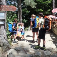
Entweder aus Richtung Ajaccio oder Corte steuern wir den Col de Vizzavona (1163m alt.) an. 550m ONO vom Pass stellen wir unser Auto bei den Häusern des Weilers La Foce ab.
Either from the direction of Ajaccio or Corte we head for the Col de Vizzavona (1163m alt.). 550m NE of the mountain pass we park our car at the houses of the hamlet of La Foce.
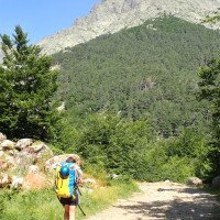
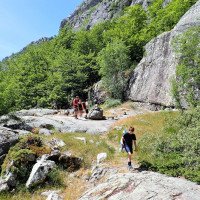
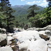
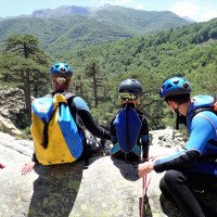
Approche (1 h 30):
traduction alternative
➜
Langue originale
Jenseits des Bachbetts nehmen wir den Pfad, der später in der Nähe der Cascades d'Anglais auf den GR20 stößt. Auf ihm weiter in nördlicher Richtung, dis der Wanderweg auf einer Brücke den Bach quert (Einstieg).
Beyond the streambed, take the path that later joins the GR20 near the Cascades d'Anglais. Continue on it in a northerly direction, where the trail crosses the stream on a bridge (entry).
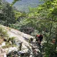
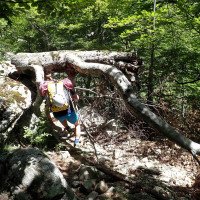
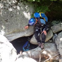
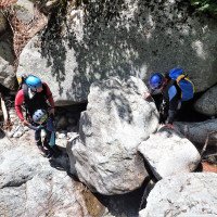
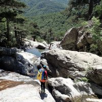
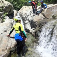
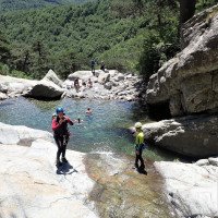
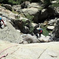
Tour (3 h):
traduction alternative
➜
Langue originale
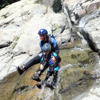
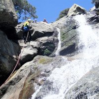
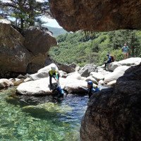
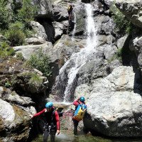
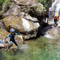
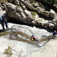
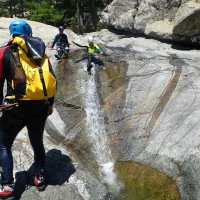
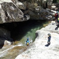
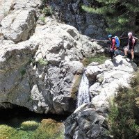
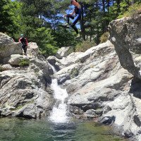
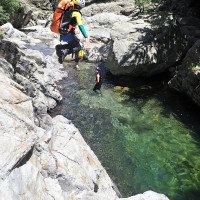
Wanderung im oder neben dem Bach mit einigen fakultativen Abseilern. Es muss damit gerechnet werden, dass die Sicherungen - teilweise - entfernt sind, aber dann bleiben als Alternative das Abseilen vom Baum oder das Umgehen der Wasserfälle. Nach der Cascade d'Anglais mit einer Vielzahl von Besuchern an sonnigen Tagen ist die Tour zu Ende.
Hike in or next to the stream with some optional rappel. It must be expected that the belays are - partially - removed, but then remain as an alternative rappel from the tree or bypassing the waterfalls. After the Cascade d'Anglais with a lot of visitors on sunny days, the tour is over.
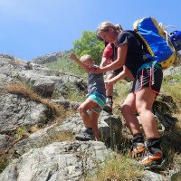
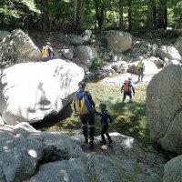
Retour (35 min):
traduction alternative
➜
Langue originale
Nach den Cascades d'Anglais rechts hinaus auf einen bachnahen Pfad, der im weiteren Verlauf auf eine Piste trifft. Auf dieser gehen wir rechts und kommen so zur Straße. Auf dieser 200m nach rechts und wir stehen wieder beim Auto.
After the Cascades d'Anglais, turn right onto a path near the creek, which later meets a dirt road. On this we go right and thus come to the road. On this 200m to the right and we are back at the car.
Coordonnées:
Départ du Canyon
Fin du Canyon
Parking à l'entrée et à la sortie
Littérature:
Carte
1:25000
Carte
1:25/000
Livre Canyoning
Franck Jourdan / Jean-François Fiorina
2006
Livre Canyoning
Franck Jourdan / Jean-François Fiorina
2004
Livre Canyoning
Hubert Ayasse / Philippe Dubreuil
2001
Livre Canyoning
Martin Lendi
2009
Inhalt:
Hinweise zu Ausrüstung, Verhalten und Sicherheit, sowie
27 Schluchttouren-Beschreibungen mit Kartenausschnitten:
Fiumicell
Polischellu
Purcaraccia
Vacca
Piscia di Gallo
Vivaggio
Barac
Ziocu
Sulleoni
Dardo
Lonca
Fango
Ruda
Falconaja
Cipetto
Tavignano
Verghellu
Vecchio
Agnone
Richjusa
Leccia-Rossa
Bucatoggio
Matra
Y-Baum
Macini
Tassi-Undella
Chjuvonu-Scopamene
Info canyon Cwiki
Info canyon Descente
Info canyon Ropewiki
Info canyon FFME
Autre info canyon
09.03.2023
System User
⭐
★★★★★
📖
★★★
⚓
★★★
pas de traduction disponible
Info: Teile der Canyonbeschreibung wurden automatisiert übernommen. Konkret die Felder Weblinks, Koordinaten, Rating, Länge des Canyon, Einfachseil Mindestens von https://www.descente-canyon.com/canyoning/canyon/2322
09.03.2023
System User
⭐
★★★★★
📖
★★★
⚓
★★★
pas de traduction disponible
Daten importiert von https://canyon.carto.net/cwiki/bin/view/Canyons/AgnoneCanyon.html
Nouveau rapport
Veuillez décrire brièvement et de manière concise les informations les plus importantes de la dernière visite ou les informations actuelles importantes sur le canyon. Si nécessaire avec des liens vers des vidéos, photos, etc.
*
*
*
Esc
Del
Hydrologie: