un peu difficile
Combra (Val Malvaglia)
Pays:
Schweiz / Switzerland
Région: Kanton Tessin / Cantone Ticino
Sous-régione: Bezirk Blenio
Ville: Malvaglia
v4 a4 III
2h55
30min
2h15
10min
1135m
990m
145m
25m
2x30m
6
450m
à pied
Évaluation:
★★★★★
4.3 (7)
Info:
★★★
2.3 (3)
Belay:
★★★
2.8 (4)
Résumé:
traduction alternative
➜
Langue originale
Sehr aquatisch; sauberes kaltes Bergwasser; nur Einzellbohrhaken; schönes zum Teil rutschiges Granitgestein; Anfangs und am Schluss Notausstieg; super high Speed Rutsche (20 m; Vorsicht!); eher kurze wenig begangene Schlucht.
Very aquatic; clean cold mountain water; only single pitons; beautiful partly slippery granite rock; emergency exit at the beginning and at the end; super high speed slide (20 m; be careful!); rather short canyons little used.
juillet - septembre
10-15 Heures
Nord
Résumé:
traduction alternative
➜
Langue originale
Sehr aquatisch; sauberes kaltes Bergwasser; nur Einzellbohrhaken; schönes zum Teil rutschiges Granitgestein; Anfangs und am Schluss Notausstieg; super high Speed Rutsche (20 m; Vorsicht!); eher kurze wenig begangene Schlucht.
Very aquatic; clean cold mountain water; only single pitons; beautiful partly slippery granite rock; emergency exit at the beginning and at the end; super high speed slide (20 m; be careful!); rather short canyons little used.
Accès:
traduction alternative
➜
Langue originale
Von Biasca ri Malvaglia/ Motto (Val di Blenio) --> an der 2. Einfahrt re in die Ortschaft Malvaglia Chiesa --> im Ort ri. Norden fahren (mehrere Schwellen ca. 700m) bis zu einer Abzweigung (Pontirone) --> die steile Bergstraße über mehrere Zerpen- tinenkurven hoch bis zu einer Straßengabelung (Steinbogen) --> hier folgt man den Straßenverlauf li, vorbei am Schranken und weiter hoch bis zur riesigen Staumauer --> am oberen Rand befindet sich ein Parkplatz (ca. 990Hm).
From Biasca ri Malvaglia/ Motto (Val di Blenio) --> at the 2nd entrance right into the village Malvaglia Chiesa --> in the village ri. North (several sleepers approx. 700m) to a fork (Pontirone) --> the steep mountain road over several Zerpen- tinenkurven up to a road fork (stone arch) --> here you follow the road course left, past the barrier and further up to the huge dam wall --> at the upper edge is a parking lot (approx. 990Hm).
Approche (30 min):
traduction alternative
➜
Langue originale
Vom Parkplatz über den Staudamm durch das Tunnel --> nach dem Tunnel gleich 360° li den Wanderweg hochgehen --> über eine Brücke und am Haus vorbei --> der Einstieg liegt an der 2. Brücke (über den Bach) auf ca. 1135Hm.
From the parking lot over the dam through the tunnel --> after the tunnel immediately 360° left up the trail --> over a bridge and past the house --> the entry is at the 2nd bridge (over the stream) at about 1135Hm.
Tour (2 h 15):
traduction alternative
➜
Langue originale
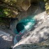
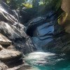
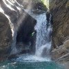
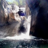
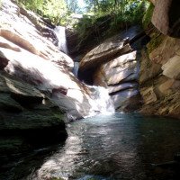
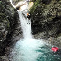
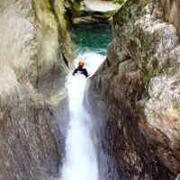
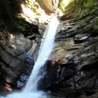
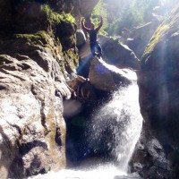
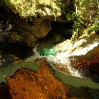
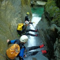
Gleich nach der Brücke hat man den ersten Abseiler C20 (Wasserstandkontrolle) --> diese Stelle kann auch re umgangen werden --> es folgt eine Kaskade die re vom Baum zuerst R15 abgeseilt und 4 m gerutscht werden kann --> sollte hier schon zu viel Wasser sein, kann man am Anfang noch abbrechen --> jetzt folgen einige Sprünge und Rutschen die aber mit Vorsicht zu genießen sind --> die Gumpen sind glasklar jedoch sieht man durch das Weißwasser nicht immer die Tiefe --> die Schlucht macht sehr viel Spaß vor allem für die, die das Springen und Rutschen in Aquatischen Umfeld mögen, kommen auf ihre Kosten --> das Highlight in der Schlucht ist die 20m Rutsche mit fliegenden Abgang (siehe Topo--> nach der großen Rutsche (bzw. Abseiler) geht es meist nur noch abkletterend weiter mit kleine Sprung- und Abseilstellen --> man hat kurz nach der Rutsche die Möglichkeit li auszusteigen oder bis zum Stausee beim großen Trichter zu gehen und li am Geländer auszusteigen (ca.990Hm).
Immediately after the bridge you have the first rappel C20 (water level control) --> this place can also be bypassed right --> a cascade follows the right of the tree first R15 rappel and 4 m can be slid --> should be here already too much water, you can break off at the beginning --> now follow some jumps and slides which are to be enjoyed with caution --> the pools are crystal clear but you can't always see the depth because of the white water --> the canyon is a lot of fun especially for those who like jumping and sliding in an aquatic environment --> the highlight in the canyon is the 20m slide with flying descent (see topographic view --> after the big slide (resp. rappel) it goes mostly only descending with small jump and rappel places --> one has shortly after the slide the possibility to exit left or to go to the reservoir at the big funnel and exit left at the railing (ca.990Hm).
Retour (10 min):
traduction alternative
➜
Langue originale
Vom Wanderweg zurück durch den Tunnel über die Staumauer in Kürze zurück zum Parkplatz.
From the trail back through the tunnel over the dam wall in a short time back to the parking lot.
Coordonnées:
Départ du Canyon
46.4184°, 9.02659°
↓↑
DMS: 46° 25" 6.24', 9° 1" 35.72'
DM: 46° 25.104", 9° 1.595"
Google Maps
Suisse Topographique
DMS: 46° 25" 6.24', 9° 1" 35.72'
DM: 46° 25.104", 9° 1.595"
Google Maps
Suisse Topographique
Fin du Canyon
46.4207°, 9.0236°
↓↑
DMS: 46° 25" 14.52', 9° 1" 24.96'
DM: 46° 25.242", 9° 1.416"
Google Maps
Suisse Topographique
DMS: 46° 25" 14.52', 9° 1" 24.96'
DM: 46° 25.242", 9° 1.416"
Google Maps
Suisse Topographique
Parking à l'entrée et à la sortie
46.42424°, 9.01837°
↓↑
DMS: 46° 25" 27.26', 9° 1" 6.13'
DM: 46° 25.454", 9° 1.102"
Google Maps
Suisse Topographique
DMS: 46° 25" 27.26', 9° 1" 6.13'
DM: 46° 25.454", 9° 1.102"
Google Maps
Suisse Topographique
Site de mesure du niveau d'eau
46.41797°, 9.02687°
↓↑
DMS: 46° 25" 4.69', 9° 1" 36.73'
DM: 46° 25.078", 9° 1.612"
Google Maps
Suisse Topographique
DMS: 46° 25" 4.69', 9° 1" 36.73'
DM: 46° 25.078", 9° 1.612"
Google Maps
Suisse Topographique
Littérature:
Livre Canyoning
Matthias Holzinger & Thomas Guigon
Pixartprinting.ch
2020
Info canyon ACA
Info canyon Cwiki
Info canyon Descente
Info canyon Ropewiki
Info canyon Swisscanyon
Info canyon Schlucht.ch
21.09.2024
patoche67jujul..Aristude
⭐
★★★★★
📖
★★★
⚓
★★★
💧
Normale
Terminé ✔
pas de traduction disponible
Automatisch importiert von Descente-Canyon.com für Canyon Combra
Superbe, les toboggans sont incroyables ! A faire, “real banger ”Equipement assez bon
(Quelle: https://www.descente-canyon.com/canyoning/canyon-debit/2658/observations.html)
17.09.2024
Fs48
⭐
★★★★★
📖
★★★
⚓
★★★
💧
Normale
Terminé ✔
pas de traduction disponible
Automatisch importiert von Descente-Canyon.com für Canyon Combra
Whaou, superbe canyon du Tessin.Nous avons vraiment pris plaisir dans ce canyon. La roche est vraiment hallucinante, les toboggans sont vraiment esthétiques et la couleur de l'eau est juste géniale.
(Quelle: https://www.descente-canyon.com/canyoning/canyon-debit/2658/observations.html)
30.08.2024
ealcaniz
⭐
★★★★★
📖
★★★
⚓
★★★
💧
Normale
Terminé ✔
pas de traduction disponible
Automatisch importiert von Descente-Canyon.com für Canyon Combra
Some toboggan can’t make it but if you check first most of them yes .
(Quelle: https://www.descente-canyon.com/canyoning/canyon-debit/2658/observations.html)
28.08.2024
maximejMatthieu L.
⭐
★★★★★
📖
★★★
⚓
★★★
💧
Normale
Terminé ✔
pas de traduction disponible
Automatisch importiert von Descente-Canyon.com für Canyon Combra
Canyon superbe! Très bonnes conditions, DC+. La T20 est démente, passe bien en mettant un bout de corde jusqu'à l'étroiture ; marche aussi sans corde, mais faut pas zipper !
(Quelle: https://www.descente-canyon.com/canyoning/canyon-debit/2658/observations.html)
27.08.2024
Lucki
⭐
★★★★★
📖
★★★
⚓
★★★
pas de traduction disponible
Automatisch importiert von Schlucht.ch für Canyon Val Combra, Wasserstand: "niedrig" Verankerungen: "OK (inox)"
Alle Rutschen gut machbar.
(Quelle: https://schlucht.ch/schluchten-der-schweiz-liste/1079-val-combra)
18.08.2024
Michele Pazzini
⭐
★★★★★
📖
★★★
⚓
★★★
💧
Haut
Terminé ✔
pas de traduction disponible
Single 10mm anchors. All are in order. High water flow. Some rolls at the base of the waterfalls. Be careful
16.08.2024
clefmentine
⭐
★★★★★
📖
★★★
⚓
★★★
💧
Normale
Terminé ✔
pas de traduction disponible
Automatisch importiert von Descente-Canyon.com für Canyon Combra
eau froide une paire de gants aurait été la bienvenue
(Quelle: https://www.descente-canyon.com/canyoning/canyon-debit/2658/observations.html)
04.08.2024
Yan09
⭐
★★★★★
📖
★★★
⚓
★★★
💧
Normale
Terminé ✔
pas de traduction disponible
Automatisch importiert von Descente-Canyon.com für Canyon Combra
Supers conditions. Départ du lac sympa. Le tob est impressionnant ( pas fait car entorse juste avant...).
(Quelle: https://www.descente-canyon.com/canyoning/canyon-debit/2658/observations.html)
30.07.2024
Armin Grob
⭐
★★★★★
📖
★★★
⚓
★★★
pas de traduction disponible
Automatisch importiert von Schlucht.ch für Canyon Val Combra, Wasserstand: "viel-machbar" Verankerungen: "ok"
Um die grossen Rutschen voll auszukosten zu viel Wasser. Insgesamt aber managebarer Wasserstand, ohne CF oder RG machbar.
(Quelle: https://schlucht.ch/schluchten-der-schweiz-liste/1079-val-combra)
25.07.2024
Inga
⭐
★★★★★
📖
★★★
⚓
★★★
💧
Haut
Terminé ✕
traduction alternative
➜
Langue originale
D'autres utilisateurs ont été: Daniela Rossi SandroS
Wasserstand minimal weniger als auf dem 2. Referenzbild. Nicht eingestiegen
Water level slightly less than on the 2nd reference picture. Not boarded
D'autres utilisateurs ont été: Daniela Rossi SandroS
15.07.2024
Andi Augsburger
⭐
★★★★★
📖
★★★
⚓
★★★
pas de traduction disponible
Automatisch importiert von Schlucht.ch für Canyon Val Combra, Wasserstand: "Hoch" Verankerungen: "Gut"
Wir sind zu 6 eingestigen, mussten aber bereits den ersten Abseiler umgehen. Bei S8 und R8 entschieden wir, dass es nur mit Silbahn möglich wäre, umgingen die Stelle dann aber trotzdem. Vor T15 entschieden wir aber, dass es definitiv zu viel Wasser war und stiegen aus.
(Quelle: https://schlucht.ch/schluchten-der-schweiz-liste/1079-val-combra)
13.07.2024
Stephan Gehringer
⭐
★★★★★
📖
★★★
⚓
★★★
💧
Haut
Terminé ✔
traduction alternative
➜
Langue originale
13.11.2023
severin
⭐
★★★★★
📖
★★★
⚓
★★★
💧
Normale
Terminé ✔
pas de traduction disponible
Automatisch importiert von Descente-Canyon.com für Canyon Combra
Fait a 4 en DC+, le tobogan de 20m poussait quand meme pas mal. Tres joli canyon moins parcouru que les majeurs mais sympa et ludique.
(Quelle: https://www.descente-canyon.com/canyoning/canyon-debit/2658/observations.html)
02.10.2023
Montie
⭐
★★★★★
📖
★★★
⚓
★★★
💧
Normale
Terminé ✔
pas de traduction disponible
Very nice canyon with very cold water. Many options to jump and slide. Can get a bit difficult with more water. Not super beginner friendly. Video of our tour here: https://youtu.be/6Plvkp-l5Sw?si=so3AuazQgCCgJAsq
10.09.2023
Inga
⭐
★★★★★
📖
★★★
⚓
★★★
💧
Normale
Terminé ✔
traduction alternative
➜
Langue originale
Wassertemperatur ziemlich frisch, glasklares Wasser, super Grip.
Alle Haken i.O.. Lediglich im letzten Abschnitt wurde durch das Unwetter ein Block mit Haken verschoben. Dieser befindet sich nun unerreichbar auf ca 5 m Höhe. Durch verschiedene Verankerungsmöglichkeiten jedoch improvisierbar :)
Alle Sprünge und Rutschen ok!
Wunderschöne Schlucht!
Water temperature quite fresh, crystal clear water, super grip.
All hooks i.O.. Only in the last section was moved by the storm a block with hooks. This is now unreachable at about 5 m height. Through various anchoring options but improvable :)
All jumps and slides ok!
Beautiful gorge!
04.04.2023
Daniel Sturm
⭐
★★★★★
📖
★★★
⚓
★★★
Terminé ✕
traduction alternative
➜
Langue originale
Koordinaten und Beschreibung angepasst.
Coordinates and description adjusted.
09.03.2023
System User
⭐
★★★★★
📖
★★★
⚓
★★★
pas de traduction disponible
Info: Teile der Canyonbeschreibung wurden automatisiert übernommen. Konkret die Felder Weblinks, Koordinaten, Rating, Ort, Länge des Canyon, Einfachseil Mindestens von https://canyon.carto.net/cwiki/bin/view/Canyons/CombraCanyon.html und https://www.descente-canyon.com/canyoning/canyon/2658
09.03.2023
System User
⭐
★★★★★
📖
★★★
⚓
★★★
pas de traduction disponible
Daten importiert von https://www.canyoning.or.at/index.php/liste-aller-canyons/113-combra-val-malvaglia
Nouveau rapport
Veuillez décrire brièvement et de manière concise les informations les plus importantes de la dernière visite ou les informations actuelles importantes sur le canyon. Si nécessaire avec des liens vers des vidéos, photos, etc.
*
*
*
Esc
Del
