très difficile
Ferreiro
v6 a4 V
3h40
10min
3h
30min
500m
260m
240m
45m
2x60m
10
700m
Voiture obligatoire
Évaluation:
★★★★★
4 (3)
Info:
★★★
3 (1)
Belay:
★★★
3 (1)
Résumé:
traduction alternative
➜
Langue originale
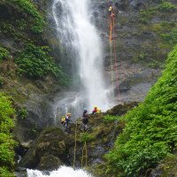
Vertikaler Abseilcanyon in großartiger Landschaft. Im Rückblick vom jenseitigen Seeufer sieht man auf eine eindrucksvolle Kaskadenreihe, die dem Trou de Fer auf Reunion nur in der Höhe nachsteht.
Vertical rappel canyon in a magnificent scenic setting. Looking back from the far shore of the lake, one can see an impressive series of cascades, second only in height to the Trou de Fer in Reunion.
Nord-Est
Résumé:
traduction alternative
➜
Langue originale
Vertikaler Abseilcanyon in großartiger Landschaft. Im Rückblick vom jenseitigen Seeufer sieht man auf eine eindrucksvolle Kaskadenreihe, die dem Trou de Fer auf Reunion nur in der Höhe nachsteht.
Vertical rappel canyon in a magnificent scenic setting. Looking back from the far shore of the lake, one can see an impressive series of cascades, second only in height to the Trou de Fer in Reunion.
Accès:
traduction alternative
➜
Langue originale
Von Fajâ Grande auf der Westseite der Insel fahren wir in Richtung Fajâzinha bzw. Santa Cruz Das Flores. Nach etwa 3 km (ab Ortsmitte Fajâ Grande) überqueren wir die Ribeira do Ferreiro. Nach der Brücke rechts stellen wir das Auto für den Ausstieg ab. \nMit dem zweiten Auto fahren wir weiter in Richtung Santa Cruz, überqueren nach 300 m die Ribeira Grande und stoßen nach weiteren 3,9 km auf die ER 1-2. Nun links weiter in Richtung Santa Cruz. Nach etwas mehr als 2 km auf der ER 1-2 biegen wir von dieser Straße links auf euíne Piste ab. Etwa 250 m weiter geht links ein Feldweg in spitzem Winkel durch die Büsche. Hier parken wir unser zweites Auto.
From Fajâ Grande on the west side of the island we drive in the direction of Fajâzinha or Santa Cruz Das Flores. After about 3 km (from the center of Fajâ Grande) we cross the Ribeira do Ferreiro. After the bridge on the right we park the car for the exit. \With the second car we continue in the direction of Santa Cruz, after 300 m we cross the Ribeira Grande and after another 3.9 km we meet the ER 1-2. Now we continue to the left in the direction of Santa Cruz. After a little more than 2 km on the ER 1-2, we turn left from this road onto a dirt road. About 250 m further on, a dirt road goes left at a sharp angle through the bushes. Here we park our second car.
Approche (10 min):
traduction alternative
➜
Langue originale
Wir überwinden die Absperrung und folgen dem Feldweg in südwestlicher Richtung. Nach 210 m schwenkt er nach Norden, die Abzweigung geradeaus ignorieren wir. Nach weiteren 300 m stehen wir an der Ribeira do Ferreiro unterhalb eines Wasserfalls. Am linken Ufer geht es noch etwa 50 m bachab, dann steigen wir in den Bach ein (ggf. mit Sprung nach vorheriger Prüfung).
We overcome the barrier and follow the dirt road in a southwesterly direction. After 210 m it turns to the north, we ignore the turnoff straight ahead. After another 300 m we are at the Ribeira do Ferreiro below a waterfall. On the left bank we go down the stream for about 50 m, then we enter the stream (if necessary with a jump after prior testing).
Tour (3 h):
traduction alternative
➜
Langue originale
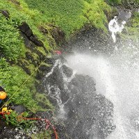
Schon nach 5 Min. kommen wir zum ersten Abseiler (R1 - 45m). Nun reiht sich, allenfalls mit kurzen Laufpassagen unterbrochen, ein Abseiler an den anderen: R2 - 24m; R3 - 10m; R4 - 17m. Es folgt eine längere Passage, wo der Bachlauf mit großen Blöcken überdeckt ist. \nDann stehen wir über der großen Vertikale - fast 110 m. Nach dem Einstiegsabseiler R5 - 20m folgen 3 Umsteiger, jeweils etwas zurückgesetzt (Steinschlaggefahr) nach links: R6 - 45m; R7 - 10m; R8 - 40m. Dann schwimmt man im großen Gumpen, der zusätzlich von einem linken Seitenbach gespeist wird. Bei größerem Wasserdurchsatz kann es hier Schwierigkeiten geben (a5). Wir erklettern den Steinwall über dem großen Gumpen und finden dort einen letzten Schrägabseiler: R9 - 40m.\n
After only 5 minutes we come to the first rappel (R1 - 45m). Now, interrupted by short walking passages, one rappel follows the other: R2 - 24m; R3 - 10m; R4 - 17m. A longer passage follows, where the stream course is covered with large boulders. \nThen we are above the big vertical - almost 110m. After the entry rappel R5 - 20m, 3 switchbacks follow, each set back a bit (danger of falling rocks) to the left: R6 - 45m; R7 - 10m; R8 - 40m. Then you swim in the large pool, which is also fed by a left side stream. In case of larger water flow, there may be difficulties here (a5). We climb the stone wall above the big pool and find a final sloping rope there: R9 - 40m.\n
Retour (30 min):
traduction alternative
➜
Langue originale
Unten angekommen folgen wir dem Bachlauf zum See Lagoa das Patas, auf den wir schon lange herunter sahen. Wir schwimmen linkshaltend in südöstlicher Richtung und erreichen nach etwa 120m das jenseitige Ufer bei den Bäumen. Der See ist ziemlich verkrautet und so sollte man sich über einen entsprechenden "Behang" am Ausstieg nicht wundern. Schließlich folgen wir dem Weg, der vom See hinunter zur Straße und zum Parkplatz führt.
At the bottom we follow the stream to the lake Lagoa das Patas, on which we have been looking down for a long time. We swim to the left in a southeasterly direction and after about 120m we reach the far shore at the trees. The lake is quite weedy and so one should not be surprised about a corresponding "hanging" at the exit. Finally, we follow the path that leads from the lake down to the road and the parking lot.
Coordonnées:
Départ du Canyon
39.4393°, -31.2351°
↓↑
DMS: 39° 26" 21.48', -32° 45" 53.64'
DM: 39° 26.358", -32° 45.894"
Google Maps
DMS: 39° 26" 21.48', -32° 45" 53.64'
DM: 39° 26.358", -32° 45.894"
Google Maps
Fin du Canyon
39.4379°, -31.2377°
↓↑
DMS: 39° 26" 16.44', -32° 45" 44.28'
DM: 39° 26.274", -32° 45.738"
Google Maps
DMS: 39° 26" 16.44', -32° 45" 44.28'
DM: 39° 26.274", -32° 45.738"
Google Maps
Parking à l'entrée
39.4387°, -31.2312°
↓↑
DMS: 39° 26" 19.32', -32° 46" 7.68'
DM: 39° 26.322", -32° 46.128"
Google Maps
DMS: 39° 26" 19.32', -32° 46" 7.68'
DM: 39° 26.322", -32° 46.128"
Google Maps
(descente_3)
Parking à la sortie
(descente_4)
Littérature:
Carte
Livre Canyoning
Silva/Almeida/Pacheco
2014
Info canyon Cwiki
Info canyon Descente
Info canyon Ropewiki
04.06.2024
Jo Haegeman
⭐
★★★★★
📖
★★★
⚓
★★★
💧
Normale
Terminé ✔
pas de traduction disponible
3.5 hours with 3 persons. Some anchorpoints were loose so we tightened them. Nice waterflow at the 120m. Rappelling just next to the water. Swam across the lake, what a view! All the falls were pouring water down. Amazing sight!
04.06.2024
Zeau_be
⭐
★★★★★
📖
★★★
⚓
★★★
💧
Normale
Terminé ✔
pas de traduction disponible
Automatisch importiert von Descente-Canyon.com für Canyon Ferreiro
3.5 hours with 3 persons. Some anchorpoints were loose so we tightened them. Nice waterflow at the 120m. Rappelling just next to the water. Swam across the lake, what a view! All the falls were pouring water down. Amazing sight!
(Quelle: https://www.descente-canyon.com/canyoning/canyon-debit/21613/observations.html)
09.03.2023
System User
⭐
★★★★★
📖
★★★
⚓
★★★
pas de traduction disponible
Info: Teile der Canyonbeschreibung wurden automatisiert übernommen. Konkret die Felder Weblinks, Koordinaten, Rating, Länge des Canyon, Einfachseil Mindestens von https://www.descente-canyon.com/canyoning/canyon/21613
09.03.2023
System User
⭐
★★★★★
📖
★★★
⚓
★★★
pas de traduction disponible
Daten importiert von https://canyon.carto.net/cwiki/bin/view/Canyons/FerreiroCanyon.html
Nouveau rapport
Veuillez décrire brièvement et de manière concise les informations les plus importantes de la dernière visite ou les informations actuelles importantes sur le canyon. Si nécessaire avec des liens vers des vidéos, photos, etc.
*
*
*
Esc
Del
Hydrologie:


