un peu difficile
Malvaglia - Orino (Inferiore)
Pays:
Schweiz / Switzerland
Région: Kanton Tessin / Cantone Ticino
Sous-régione: Bezirk Blenio
Ville: Malvaglia
v4 a4 III
2h50
15min
2h30
5min
580m
380m
200m
45m
2x 45m
8
900m
Voiture facultative
Évaluation:
★★★★★
3.9 (9)
Info:
★★★
2.4 (5)
Belay:
★★★
2.8 (8)
Résumé:
traduction alternative
➜
Langue originale
Eher kurze Tour; bei zu wenig oder zu viel Wasser nicht empfehlenswert; einige rutschige Stellen; Stände oft ausgesetzt; zum Teil verwinkelte, schlecht einsehbare Abseilstellen; Finalwasserfall außerhalb der Wasserführung; Kraftwerkbetreiber anrufen! +41 (0) 917566615
Schöne Rutschen!
Rather short tour; not recommended when there is too little or too much water; some slippery spots; stands often exposed; partly winding, poorly visible rappelling spots; final waterfall outside the water flow; call power plant operator! +41 (0) 917566615
Nice slides!
Partie
Nom
Difficulté
Approche
Tour
Retour
mai - septembre
10-14 Heures
Sud-Ovest
Granit
6.00km²
Résumé:
traduction alternative
➜
Langue originale
Eher kurze Tour; bei zu wenig oder zu viel Wasser nicht empfehlenswert; einige rutschige Stellen; Stände oft ausgesetzt; zum Teil verwinkelte, schlecht einsehbare Abseilstellen; Finalwasserfall außerhalb der Wasserführung; Kraftwerkbetreiber anrufen! +41 (0) 917566615
Schöne Rutschen!
Rather short tour; not recommended when there is too little or too much water; some slippery spots; stands often exposed; partly winding, poorly visible rappelling spots; final waterfall outside the water flow; call power plant operator! +41 (0) 917566615
Nice slides!
Accès:
traduction alternative
➜
Langue originale
Von Biasca ri Malvaglia/ Motto (Val di Blenio) --> an der 2. Einfahrt re in die Ortschaft Malvaglia Chiesa --> weiter li über mehrere Schwellen (ca. 700m) bis zu einer Abzweigung --> hier gerade aus bis zur Brücke --> an der li Seite das Überstellungs- fahrzeug parken --> der Wasserstand kann an der unteren Brücke bedingt festgestellt werden --> mit dem 2. PKW geht es zurück und gleich li hoch ri Pontirone --> nach mehreren Serpentinen kommt der Ort Tagnugna und eine scharfe re Kehre wo li schon die Wandertafel nach Ponte Lau 300m steht (ca.590Hm) --> an der re Straßenseite ist eine kleine Parkmöglichkeit (3 Autos). Alternativ kann auch ohne zweiten PKW bei Orino über den Wanderweg „Ponte Laù“ (ca. 1h) orographisch hochgewandert werden.
From Biasca ri Malvaglia/ Motto (Val di Blenio) --> at the 2nd entrance on the right into the village of Malvaglia Chiesa --> continue on the left over several thresholds (approx. 700m) to a fork --> here straight on to the bridge --> park the transfer vehicle on the left side --> the water level can be determined conditionally at the lower bridge --> with the 2nd car go back and immediately on the left up to Pontirone --> after several serpentines there is the village of Tagnugna and a sharp right turn where on the left there is already a hiking sign for Ponte Lau 300m. After several hairpin bends you reach the village of Tagnugna and a sharp hairpin bend to the right where you can already see the hiking sign for Ponte Lau 300m on the left (ca.590Hm) --> on the right side of the road is a small parking (3 cars). Alternatively, you can also hike up orographically without a second car at Orino via the hiking trail "Ponte Laù" (approx. 1h).
Approche (15 min):
traduction alternative
➜
Langue originale
Den Wanderweg li leicht abfallend bis zur Brücke folgen (zweite Möglichkeit der Wasserstandkontrolle) --> vor der Brücke (an der Markierung) --> den Pfad parallel auf der orographisch linken Schluchtenseite folgen und über ein Seilgeländer in die Schlucht absteigen (560Hm).
Follow the trail on the left slightly downhill to the bridge (second possibility to check the water level) --> before the bridge (at the marker) --> follow the trail parallel on the orographic left side of the canyon and descend over a rope traverse into the canyon (560Hm).
Tour (2 h 30):
traduction alternative
➜
Langue originale
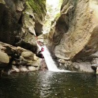
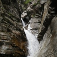
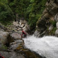
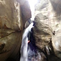
Der untere Schluchtenabschnitt sollte nicht bei hohen Wasserstand begangen werden da die Abseilstellen verwinkelt, rutschig und meist im Wasserverlauf sind –- die erste Stelle wird re über ein Fixseil abgeklettert (Steine im Gumpen) –- es folge einige rutschige Felsen die umgangen oder abgeklettert werden --> unterhalb der Ponte Laù (Brücke) kommt der erste aquatische Abseiler C 18 re --> darauf folgt ein Mc + C24 re --> diese beiden Abseiler können vom Standplatz nur schlecht eingeschätzt werden (die Gumpen sind jedoch Tief) --> wer nach diesen beiden Stellen genug hat kann li über den Notausstieg aussteigen --> nach kleine Abkletterpassagen kommen 2 Rutschen die beide ca. 7-8m sind --> weitere Kletterstelle und flache Rutsche ca. 6m --> die nächste Stelle von ca. 18m kann abgeseilt oder gesprungen werden (!!!beim Absprung Ausrutschgefahr) --> nach dem großen Becken kommt eine Geh- und Abkletterpassage bis zu einen großen Felsblock --> an diesen befindet sich ein Bohr- haken an den man die erste Person ca. 10m durch die Rinne zum Stand li abseilt (!rutschig) --> vom Stand geht es weiter durch das „S“ in den Gumpen (letztes Stück kann auch gerutscht werden) --> danach kommt gleich li ein Seilgeländer und die höchste Stelle --> die Abseiler C40 und C38 sind li und eher außerhalb der Wasserführung --> nach dem Finalwasserfall kommen noch einige rutschige Steine und Felsen die umgangen oder abgeklettert werden müssen --> nach wenigen Minuten erreicht man die Brücke --> Ausstieg auf ca. 380Hm.
The lower section of the gorge should not be climbed when the water level is high, as the abseils are twisted, slippery and mostly in the course of the water, slippery and mostly in the course of the water -- the first place is rappelled on the right over a fixed rope (stones in the pool) -- there follow some slippery rocks which are bypassed or rappelled --> below the Ponte Laù (bridge) comes the first aquatic rappel C18 on the right --> these two rappels are difficult to estimate from the belaystation> then a Mc + C24 r --> these two rappels are difficult to assess from the belaystation (but the pools are deep) --> if you have had enough after these two places, you can exit via the emergency exit --> after small downclimbs there are 2 slides, both of which are approx. 7-8m --> another climbing spot and a shallow slide of approx. 6m --> the next spot of approx. 18m can be rappelled or jumped (!!!danger of slipping when jumping) --> after the big pool there is a walking and downclimb up to a big boulder --> at this boulder there is a drilling hook where you rappel the first person about 10m through the chute to the left side of the belaystation (!slippery) --> from the belaystation you continue through the "S" into the pool (the last part can also be slid) --> after that there is a rope traverse on the left and the highest point --> the rappel C40 and C38 are on the left and rather out of the water --> after the final waterfall there are some slippery stones and rocks that have to be avoided or rappelled --> after a few minutes you reach the bridge --> exit at approx. 380Hm.
Retour (5 min):
traduction alternative
➜
Langue originale
Der angenehmere Ausstieg über die Böschung liegt li kurz vor der 2. Brücke --> jetzt ist es nur noch ein kurzes Stück zurück zum Parkplatz
The more pleasant exit over the embankment is on the left just before the 2nd bridge --> now it's only a short distance back to the parking lot
Coordonnées:
Départ du Canyon
46.4099°, 8.98919°
↓↑
DMS: 46° 24" 35.64', 8° 59" 21.08'
DM: 46° 24.594", 8° 59.351"
Google Maps
Suisse Topographique
DMS: 46° 24" 35.64', 8° 59" 21.08'
DM: 46° 24.594", 8° 59.351"
Google Maps
Suisse Topographique
Fin du Canyon
46.41079°, 8.98273°
↓↑
DMS: 46° 24" 38.84', 8° 58" 57.83'
DM: 46° 24.647", 8° 58.964"
Google Maps
Suisse Topographique
DMS: 46° 24" 38.84', 8° 58" 57.83'
DM: 46° 24.647", 8° 58.964"
Google Maps
Suisse Topographique
Parking à l'entrée
46.40762°, 8.98882°
↓↑
DMS: 46° 24" 27.43', 8° 59" 19.75'
DM: 46° 24.457", 8° 59.329"
Google Maps
Suisse Topographique
DMS: 46° 24" 27.43', 8° 59" 19.75'
DM: 46° 24.457", 8° 59.329"
Google Maps
Suisse Topographique
Parking à la sortie
46.41026°, 8.98155°
↓↑
DMS: 46° 24" 36.94', 8° 58" 53.58'
DM: 46° 24.616", 8° 58.893"
Google Maps
Suisse Topographique
DMS: 46° 24" 36.94', 8° 58" 53.58'
DM: 46° 24.616", 8° 58.893"
Google Maps
Suisse Topographique
Site de mesure du niveau d'eau
46.41081°, 8.98258°
↓↑
DMS: 46° 24" 38.92', 8° 58" 57.29'
DM: 46° 24.649", 8° 58.955"
Google Maps
Suisse Topographique
DMS: 46° 24" 38.92', 8° 58" 57.29'
DM: 46° 24.649", 8° 58.955"
Google Maps
Suisse Topographique
Site de mesure du niveau d'eau
46.40983°, 8.98921°
↓↑
DMS: 46° 24" 35.39', 8° 59" 21.16'
DM: 46° 24.59", 8° 59.353"
Google Maps
Suisse Topographique
DMS: 46° 24" 35.39', 8° 59" 21.16'
DM: 46° 24.59", 8° 59.353"
Google Maps
Suisse Topographique
Littérature:
Carte
1:25000
Livre Canyoning
Associazione Italiana Canyoning
2013
Livre Canyoning
Simon Flower
Cicerone
2012
Northern Italy and Ticino
Livre Canyoning
F. Baumgartner / A. Brunner / D. Zimmermann
2010
Livre Canyoning
Anna Nizzola / Luca Nizzola
2010
Livre Canyoning
Matthias Holzinger & Thomas Guigon
Pixartprinting.ch
2020
Info canyon Cwiki
Info canyon Descente
Info canyon Ropewiki
Galerie
Info canyon Swisscanyon
Autre info canyon
Info canyon ACA
Info canyon Schlucht.ch
27.09.2024
Bavarian Canyoning
⭐
★★★★★
📖
★★★
⚓
★★★
💧
Normale
Terminé ✔
traduction alternative
➜
Langue originale
Sehr rutschiger Fels.
Alle Rutschen und Sprünge waren tief genug.
Haken waren überall in sehr gutem Zustand.
Jedes mal eine schöne Tour!
Very slippery rock.
All slides and jumps were deep enough.
Anchors were in very good condition everywhere.
A nice tour every time!
21.09.2024
patoche67jujul..Aristude
⭐
★★★★★
📖
★★★
⚓
★★★
💧
Normale
Terminé ✔
pas de traduction disponible
Automatisch importiert von Descente-Canyon.com für Canyon Malvaglia (inférieur)
Belle course après avoir fait Combra, c’est complet avec la grande c80 fractionnée
(Quelle: https://www.descente-canyon.com/canyoning/canyon-debit/2671/observations.html)
17.09.2024
Fs48
⭐
★★★★★
📖
★★★
⚓
★★★
💧
Normale
Terminé ✔
pas de traduction disponible
Automatisch importiert von Descente-Canyon.com für Canyon Malvaglia (inférieur)
(Quelle: https://www.descente-canyon.com/canyoning/canyon-debit/2671/observations.html)
17.09.2024
Joey CIA
⭐
★★★★★
📖
★★★
⚓
★★★
💧
Faible
Terminé ✔
traduction alternative
➜
Langue originale
Alles ok! Rutschig!
Everything ok! Slippery!
15.09.2024
Yann_del
⭐
★★★★★
📖
★★★
⚓
★★★
💧
Normale
Terminé ✔
pas de traduction disponible
Automatisch importiert von Descente-Canyon.com für Canyon Malvaglia (inférieur)
(Quelle: https://www.descente-canyon.com/canyoning/canyon-debit/2671/observations.html)
07.09.2024
Andrea S.Andrea S.
⭐
★★★★★
📖
★★★
⚓
★★★
💧
Normale
Terminé ✔
pas de traduction disponible
Automatisch importiert von Descente-Canyon.com für Canyon Malvaglia (inférieur)
(Quelle: https://www.descente-canyon.com/canyoning/canyon-debit/2671/observations.html)
06.09.2024
Lolotte
⭐
★★★★★
📖
★★★
⚓
★★★
💧
Normale
Terminé ✔
pas de traduction disponible
Automatisch importiert von Descente-Canyon.com für Canyon Malvaglia (inférieur)
DC- sympa mais l'eau sent un peu ...
(Quelle: https://www.descente-canyon.com/canyoning/canyon-debit/2671/observations.html)
02.09.2024
Lucki
⭐
★★★★★
📖
★★★
⚓
★★★
pas de traduction disponible
Automatisch importiert von Schlucht.ch für Canyon Orino inferiore / Val Malvaglia, Wasserstand: "niedrig" Verankerungen: "sehr gut (inox)"
(Quelle: https://schlucht.ch/schluchten-der-schweiz-liste/1078-orino-inferiore-val-malvaglia)
22.08.2024
Peter
⭐
★★★★★
📖
★★★
⚓
★★★
💧
Normale
Terminé ✔
traduction alternative
➜
Langue originale
D'autres utilisateurs ont été: Massimo Loriato
Molto bello. Portata normale. Ancoraggi in ordine. Più scivoloso della parte superiore.
Very nice. Normal scope. Anchors in good order. More slippery than the top.
D'autres utilisateurs ont été: Massimo Loriato
07.08.2024
rostolane
⭐
★★★★★
📖
★★★
⚓
★★★
💧
Normale
Terminé ✔
pas de traduction disponible
Automatisch importiert von Descente-Canyon.com für Canyon Malvaglia (inférieur)
Fait avec team titi
(Quelle: https://www.descente-canyon.com/canyoning/canyon-debit/2671/observations.html)
05.08.2024
Mitch
⭐
★★★★★
📖
★★★
⚓
★★★
💧
Faible
Terminé ✔
traduction alternative
➜
Langue originale
D'autres utilisateurs ont été: Sascha Schäfer
Wasserqualität ging noch, wird aber schon langsam schlechter. Nicht zu rutschig
Water quality was still good, but is slowly deteriorating. Not too slippery
D'autres utilisateurs ont été: Sascha Schäfer
27.07.2024
johnus
⭐
★★★★★
📖
★★★
⚓
★★★
💧
Normale
Terminé ✔
pas de traduction disponible
Automatisch importiert von Descente-Canyon.com für Canyon Malvaglia (inférieur)
(Quelle: https://www.descente-canyon.com/canyoning/canyon-debit/2671/observations.html)
25.07.2024
Daniela Rossi
⭐
★★★★★
📖
★★★
⚓
★★★
💧
Normale
Terminé ✔
traduction alternative
➜
Langue originale
19.07.2024
Bubtore
⭐
★★★★★
📖
★★★
⚓
★★★
💧
Normale
Terminé ✔
traduction alternative
➜
Langue originale
Alles in Ordnung.
Everything is in order.
10.07.2024
Franz Baumgartner
⭐
★★★★★
📖
★★★
⚓
★★★
pas de traduction disponible
Automatisch importiert von Schlucht.ch für Canyon Orino inferiore / Val Malvaglia, Wasserstand: "Mittel. " Verankerungen: "Sehr gut. "
Sanierte Stände gesäubert.
(Quelle: https://schlucht.ch/?view=article&id=1078&Itemid=203)
03.06.2024
Joey CIA
⭐
★★★★★
📖
★★★
⚓
★★★
💧
Haut
Terminé ✔
traduction alternative
➜
Langue originale
Sehr sportlicher Wasserstand,
alle Haken okay, Pools alle tief, sehr sehr rutschig
Very sporty water level,
all anchors okay, pools all deep, very very slippery
31.05.2024
ayla
⭐
★★★★★
📖
★★★
⚓
★★★
💧
Normale
Terminé ✔
pas de traduction disponible
Automatisch importiert von Descente-Canyon.com für Canyon Malvaglia (inférieur)
Entre DC+ et GD, mais tout passe assez bien !
(Quelle: https://www.descente-canyon.com/canyoning/canyon-debit/2671/observations.html)
09.05.2024
Lucki
⭐
★★★★★
📖
★★★
⚓
★★★
pas de traduction disponible
Automatisch importiert von Schlucht.ch für Canyon Orino inferiore / Val Malvaglia, Wasserstand: "mittel" Verankerungen: "Alle Installationen sind sehr gut (inox). "
Die durch das Hochwasser im August 2023 malträtierten Standplätze wurden durch neue massive J-Anker mit Ringen ersetzt. Alle Pools frei.
(Quelle: https://schlucht.ch/?view=article&id=1078&Itemid=203)
27.11.2023
zede63Papaya
⭐
★★★★★
📖
★★★
⚓
★★★
💧
Normale
Terminé ✔
pas de traduction disponible
Automatisch importiert von Descente-Canyon.com für Canyon Malvaglia (inférieur)
Alle Haken top! Jemand hat hier eine super Arbeit geleistet, Danke.
(Quelle: https://www.descente-canyon.com/canyoning/canyon-debit/2671/observations.html)
19.11.2023
Bina
⭐
★★★★★
📖
★★★
⚓
★★★
💧
Normale
Terminé ✔
pas de traduction disponible
Automatisch importiert von Descente-Canyon.com für Canyon Malvaglia (inférieur)
(Quelle: https://www.descente-canyon.com/canyoning/canyon-debit/2671/observations.html)
19.11.2023
Patrik B
⭐
★★★★★
📖
★★★
⚓
★★★
pas de traduction disponible
Automatisch importiert von Schlucht.ch für Canyon Orino inferiore / Val Malvaglia, Wasserstand: "Etwas mehr als mittel" Verankerungen: "Gut"
Immer noch erstaunlich griffig.
(Quelle: https://schlucht.ch/schluchten-der-schweiz.html?cid=78)
10.09.2023
Wolfgang
⭐
★★★★★
📖
★★★
⚓
★★★
💧
Normale
Terminé ✔
traduction alternative
➜
Langue originale
Nette Tour ; einige Haken sind nicht mehr die Besten ;-)
Hat Spaß gemacht
Nice tour ; some hooks are no longer the best ;-)
Has been fun
04.04.2023
Daniel Sturm
⭐
★★★★★
📖
★★★
⚓
★★★
Terminé ✕
traduction alternative
➜
Langue originale
Koordinaten und Beschreibung angepasst.
Coordinates and description adjusted.
09.03.2023
System User
⭐
★★★★★
📖
★★★
⚓
★★★
pas de traduction disponible
Daten importiert von https://canyon.carto.net/cwiki/bin/view/Canyons/MalvagliainferioreCanyon.html
Nouveau rapport
Veuillez décrire brièvement et de manière concise les informations les plus importantes de la dernière visite ou les informations actuelles importantes sur le canyon. Si nécessaire avec des liens vers des vidéos, photos, etc.
*
*
*
Esc
Del
Hydrologie:
Site de mesure du niveau d'eau
Site de mesure du niveau d'eau
