v4 a2 V
4h25
10min
4h
15min
1900m
1540m
360m
27m
2x30m
23
1000m
Voiture obligatoire
Spécialités:
Passage dans une grotte Barrage
Passage dans une grotte Barrage
Engrenages:
Lampe frontale
Lampe frontale
Évaluation:
★★★★★
4.9 (11)
Info:
★★★
3 (9)
Belay:
★★★
3 (9)
Résumé:
traduction alternative
➜
Langue originale
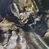
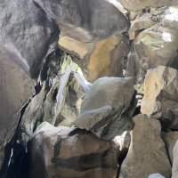
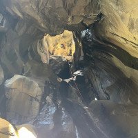
Ungemein eindrucksvoller Serpentincanyon der größtenteils unterhalb von riesigen Felsblöcken verläuft. Wasserdichte Stirnlampe notwendig. Schwierige Orientierung im Felschaos (da und dort Steinmänner)
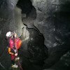
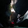
Immensely impressive serpentine canyon that runs mostly below huge boulders. Waterproof headlamp necessary. Difficult orientation in the rock chaos (here and there cairns).
Sud-Ovest
Gneiss
Résumé:
traduction alternative
➜
Langue originale
Ungemein eindrucksvoller Serpentincanyon der größtenteils unterhalb von riesigen Felsblöcken verläuft. Wasserdichte Stirnlampe notwendig. Schwierige Orientierung im Felschaos (da und dort Steinmänner)
Immensely impressive serpentine canyon that runs mostly below huge boulders. Waterproof headlamp necessary. Difficult orientation in the rock chaos (here and there cairns).
Accès:
traduction alternative
➜
Langue originale
Von Sondrio nordwärts in Richtung Chiesa in Valmalenco. Diese Ortschaft, die jenseits des Flusses liegt, passieren und unmittelbar nach Überquerung des von Osten kommenden Baches rechts ab in Richtung Lanzada, Tornadri. Nach diesen Orten weiter und in vielen Serpentinen steil hinauf. Nach Durchfahren einiger Tunnels erreichen wir einen großen Parkplatz beim Restaurant Edelweiss.
Einstiegsparkplatz: Rechts auf einer schmalen Asphaltstrasse aufwärts Richtung Campo Moro. Entweder am grossen Wanderparkplatz parken oder bei den ersten Häusern links abwärts auf einer Schotterpiste zu einem kleinen Parkplatz unterhalb der Staumauer fahren. Ab, über den Cormor nach Franscia und in der Nähe der Brücke über den Laterna parken.
From Sondrio head north towards Chiesa in Valmalenco. Pass this village, which is on the other side of the river, and immediately after crossing the stream coming from the east, turn right towards Lanzada, Tornadri. After these places continue and climb steeply in many switchbacks. After passing through a few tunnels, we reach a large parking lot near the Edelweiss Restaurant.
Parking entry: on the right on a narrow asphalt road uphill in the direction of Campo Moro. Either park at the large parking lot for hikers or at the first houses turn left downhill on a gravel road to a small parking lot below the dam wall. From there, cross the Cormor to Franscia and park near the bridge over the Laterna.
Approche (10 min):
traduction alternative
➜
Langue originale
Vom Wanderparkplatz über einen Pfad auf die Schotterpiste und dieser bis zum Parkplatz an der Staumauer folgen.
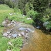
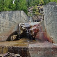
Vom Parkplatz unter der Staumauer orografisch links auf einem deutlichen Steig absteigen. Nach etwa 3min erreicht der Steig das mit gigantischen Blöcken gefüllte Bachbett. Einstieg an einem Flutwarnschild und einem orangen Reflektor an einem Baum.
From the hikers' parking lot, take a path to the gravel road and follow it to the parking lot at the dam wall.
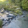
From the parking lot, descend orographic left on a clear path under the dam. After about 3min the path reaches the streambed filled with giant boulders. Entry at a flood warning sign and an orange reflector on a tree.
Tour (4 h):
traduction alternative
➜
Langue originale
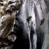
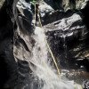
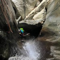
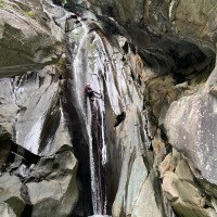
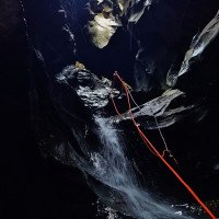
Unter den ersten Blöcken zum ersten 13m Abseiler abklettern, danach von rechts unter verkeilten Blöcken 25m, 12m und 7m abseilen. Ab hier 3 Abseilstellen in völliger Dunkelheit bevor es wieder kurz ins Helle geht. Ein Siphon muss verwinkelt und kleinräumig oberhalb umklettert werden bis man den Bach wieder oberhalb einer 22m Abseilstelle erreicht. Weitere 4 Abseilstellen, teilweise wieder im Dunklen, führen zum höchsten Wasserfall der Tour: 27m gehts durch ein Felstor abwärts. Hier gibts den einzigen Fluchtweg der Tour nach links. Auch hier ist ein oranger Reflektor an einem Baum. Ein Nebenbach bringt mindestens das Doppelte an Wasser mit, wenn es bereits im ersten Teil Probleme gegeben hat sollte man nicht weitergehen.
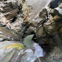
Der zweite Teil beginnt am Pfad des Notausstiegs und ist wieder mit einem orangen Reflektor markiert. Man steigt wieder ins verblockte Bachbett ein und folgt möglichst dem Wasser durch unübersichtliche Blockkletterei bevor es für längere Zeit dunkel wird. 9 Abseilstellen in wunderschön ausgewaschenen Serpentin folgen, beim 18m Wasserfall unbedingt auf das Hängebecken links achten - bei hohen Wasserstand ist es sehr schwer dort wieder rauszukommen. Man kann das Becken aber orogr. links vermeiden.
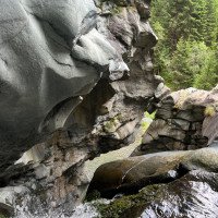
Die Klamm endet im Blockchaos, besser in der Nähe des Bachlaufes bis zur Brücke abklettern, oberhalb der Blöcke ist der Fels bewachsen und sehr rutschig. Über eine alte Holzleiter (bei rot/weisser Wegmarkierung auf Block im Bachbett) kann man bereits vorher rechts das Bachbett verlassen.
Downclimb under the first blocks to the first 13m rappel, then rappel from the right under wedged blocks 25m, 12m and 7m. From here 3 rappels in complete darkness before it goes again briefly into the light. A siphon must be climbed around in a twisted and small way above until you reach the stream again above a 22m rappel point. Another 4 rappels, partly in the dark again, lead to the highest waterfall of the tour: 27m down through a rock gate. Here is the only escape route of the tour to the left. Also here is an orange reflector on a tree. A side stream brings at least double the water, if you have already had problems in the first part you should not continue.
The second part starts at the path of the emergency exit and is again marked with an orange reflector. You climb back into the blocked streambed and follow the water as much as possible through obscure block climbing before it gets dark for a longer time. 9 abseils in beautifully washed out serpentine follow, at the 18m waterfall be sure to watch out for the hanging basin on the left - at high water levels it is very difficult to get out of there again. You can avoid the basin but orographic left.
The gorge ends in block chaos, better downclimb near the stream to the bridge, above the blocks the rock is overgrown and very slippery. About an old wooden ladder (at red / white trail marking on block in the streambed) you can already leave the streambed before right.
Retour (15 min):
traduction alternative
➜
Langue originale
Die Brücke überqueren und den rot/weiß markierten Steig am rechten Ufer bis zum unteren Parkplatz folgen.
Cross the bridge and follow the red/white marked path on the right bank to the lower parking lot.
Coordonnées:
Départ du Canyon
Parking à la sortie
Großer Parkplatz bei Restaurant Edelweiss
Parking à l'entrée
Parkplatz unter Staumauer
Fin du Canyon
Parking à l'entrée
Wanderparkplatz
Littérature:
Livre Canyoning
Pascal van Duin
2011
Livre Canyoning
Pascal van Duin
Edizioni TopCanyon
2005
978-8890175305
Livre Canyoning
Simon Flower
Cicerone
2012
Northern Italy and Ticino
Info canyon Cwiki
Info canyon Descente
Rapport de voyage (ex. Blogpost)
Info canyon Ropewiki
15.09.2024
MirkoT
⭐
★★★★★
📖
★★★
⚓
★★★
💧
Faible
Terminé ✔
pas de traduction disponible
Automatisch importiert von Descente-Canyon.com für Canyon Cormor
I primi due inforramenti avevano un rivolo d'acqua, mentre dopo l'affluenza da sx il flusso è diventato nella media. Acqua bella fresca.Armi tutti ok.Super i giochi di luce che si infilano nel buio sotto la frana.La spiaggia alla fine del secondo inforramento è perfetta per una lunga pausa al sole...con possibilità di sforrare.
(Quelle: https://www.descente-canyon.com/canyoning/canyon-debit/2532/observations.html)
28.08.2024
SVC
⭐
★★★★★
📖
★★★
⚓
★★★
💧
Faible
Terminé ✔
pas de traduction disponible
Automatisch importiert von Descente-Canyon.com für Canyon Cormor
Classe!!
(Quelle: https://www.descente-canyon.com/canyoning/canyon-debit/2532/observations.html)
28.08.2024
Pepijn Hoeksema
⭐
★★★★★
📖
★★★
⚓
★★★
💧
Faible
Terminé ✔
pas de traduction disponible
The trip is 100% worth it. It is a beautiful area. Technically not difficult with this low water level. Before the trip we walked to the dam keeper's house and registered.
We took it easy:
Approach: 15 min
Descent: 4 hours
Exit: 20 minutes
28.08.2024
Reach8399
⭐
★★★★★
📖
★★★
⚓
★★★
💧
Faible
Terminé ✔
pas de traduction disponible
Automatisch importiert von Descente-Canyon.com für Canyon Cormor
RAS
(Quelle: https://www.descente-canyon.com/canyoning/canyon-debit/2532/observations.html)
27.08.2024
AlvaroCanyon
⭐
★★★★★
📖
★★★
⚓
★★★
💧
Faible
Terminé ✔
pas de traduction disponible
Automatisch importiert von Descente-Canyon.com für Canyon Cormor
Alvaro Canyon
(Quelle: https://www.descente-canyon.com/canyoning/canyon-debit/2532/observations.html)
23.08.2024
Iñaki
⭐
★★★★★
📖
★★★
⚓
★★★
💧
Normale
Terminé ✔
pas de traduction disponible
Automatisch importiert von Descente-Canyon.com für Canyon Cormor
(Quelle: https://www.descente-canyon.com/canyoning/canyon-debit/2532/observations.html)
26.06.2024
Mann
⭐
★★★★★
📖
★★★
⚓
★★★
💧
Normale
Terminé ✔
pas de traduction disponible
Automatisch importiert von Descente-Canyon.com für Canyon Cormor
(Quelle: https://www.descente-canyon.com/canyoning/canyon-debit/2532/observations.html)
25.06.2024
guigui
⭐
★★★★★
📖
★★★
⚓
★★★
💧
Normale
Terminé ✔
pas de traduction disponible
Automatisch importiert von Descente-Canyon.com für Canyon Cormor
Première partie sans soucis. La seconde demande un peu de vigilance mais sans soucis particulier. Tous les ancrages sont en bon état. 5h à 5Pour trouver la seconde partie, il suffit juste de suivre l'eau...
(Quelle: https://www.descente-canyon.com/canyoning/canyon-debit/2532/observations.html)
24.06.2024
Sandra66
⭐
★★★★★
📖
★★★
⚓
★★★
💧
Haut
Terminé ✔
pas de traduction disponible
Automatisch importiert von Descente-Canyon.com für Canyon Cormor
3ème fois que je parcours ce canyon et première fois que je vois autant d'eau dans la première partie. Suite aux précédentes pluies j'imagine...Aucun problème pour descendre les obstacles, malgré le niveau d'eau deja haut lorsqu'il faut ramper sous les blocs, nous avons donc pris la décision de ne pas faire la 2eme partie que nous savons plus en eau que la première.L'affluent coulait pas mal.Eau très froide 7°C et de couleur marron ... Autre information : au niveau du barrage ça ne lâchait pas plus que d'habitude.
(Quelle: https://www.descente-canyon.com/canyoning/canyon-debit/2532/observations.html)
16.06.2024
Damien
⭐
★★★★★
📖
★★★
⚓
★★★
💧
Normale
Terminé ✔
pas de traduction disponible
Automatisch importiert von Descente-Canyon.com für Canyon Cormor
Climbed after 24 hours of light rain the day before. Despite this, the water level was not high, even in the second part. We enjoy the gorge and had 6 hours with 6 people.At the end of the second part there is a fresh hand slide, which we were able to climb through a hole on the orographic left. However the rock is very loose. Then continue underground along the river to the wooden ladder on the orographic right. All anchors are top.
(Quelle: https://www.descente-canyon.com/canyoning/canyon-debit/2532/observations.html)
16.06.2024
Damien
⭐
★★★★★
📖
★★★
⚓
★★★
💧
Normale
Terminé ✔
traduction alternative
➜
Langue originale
Begehung nach 24h leichtem Regen am Tag davor. Trotzdem war der Wasserstand nicht hoch, auch im zweiten Teil. Falls man die Schlucht geniessen will, sind 4 Stunden für den Abstieg eher knapp bemessen. (Wir hatten 6 Stunden mit 6 Personen)
Am Ende des zweiten Teils hat es eine frische Handrutschung, die wir orographisch links durch ein Loch durchklettern konnten. Das Gestein ist aber sehr lose. Danach unterirdisch dem Fluss nach weiter bis zur Holzleiter orog. rechts. Alle Verankerungen top.
Ascent after 24 hours of light rain the day before. Nevertheless, the water level was not high, even in the second part. If you want to enjoy the canyon, 4 hours for the descent is rather short. (We had 6 hours with 6 people)
At the exit of the second part there is a fresh hand slide, which we were able to climb through orographically on the left through a hole. However, the rock is very loose. Then continue underground along the river to the wooden ladder orog. right. All anchors top.
31.05.2024
Clarissa Linder
⭐
★★★★★
📖
★★★
⚓
★★★
💧
Haut
Terminé ✔
traduction alternative
➜
Langue originale
D'autres utilisateurs ont été: Peter Lampacher
Tour unter Schneefall nach mehreren Regentagen begangen. Wasserstand trotzdem gut machbar. Haken alle in Ordnung.
Tour under snowfall after several days of rain. Water level still manageable. Anchors all in order.
D'autres utilisateurs ont été: Peter Lampacher
14.09.2023
Tobias Beiser
⭐
★★★★★
📖
★★★
⚓
★★★
💧
Faible
Terminé ✔
traduction alternative
➜
Langue originale
Teilweise sehr rutschige Kletterpassagen. Manche Klebehaken wackeln, aber nur an Stellen die man auch abklettern/umgehen kann. Die restlichen Stände sind top gebohrt.
Partly very slippery climbing passages. Some glue hooks wobble, but only in places that you can also climb off / go around. The remaining stands are top drilled.
03.08.2023
Patrick Summerer
⭐
★★★★★
📖
★★★
⚓
★★★
💧
Faible
Terminé ✔
traduction alternative
➜
Langue originale
Wasserdichte Stirnlampe unbedingt notwendig, da komplett dunkle Stellen.
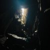
Waterproof headlamp absolutely necessary because completely dark places.
31.07.2023
Bastien P.
⭐
★★★★★
📖
★★★
⚓
★★★
💧
Faible
Terminé ✔
traduction alternative
➜
Langue originale
Nur die obere Hälfte bis zum Notausstieg. In den Höhlenpassagen wird einem schnell kühler
Only the upper half to the emergency exit. In the cave passages you quickly get cooler
31.07.2023
Christoph Cramer
⭐
★★★★★
📖
★★★
⚓
★★★
💧
Faible
Terminé ✔
traduction alternative
➜
Langue originale
Recht kaltes Wasser, Landschaftlich krass, mehr Höhle als Canyon. Wegfindung teilweise nicht einfach aber wir hatten 2 Höhlenerfahrene dabei 😁 Durchgehend Kettenstände, wenige Fixseile in optische sehr gutem Zustand. Mobilfunkempfang am Einstieg, Notausstieg und Ausstieg sowie teilweise in den offeneren Passagen vorhanden (5G/LTE/3G/E)
Quite cold water, scenery stark, more cave than canyon. Wayfinding partly not easy but we had 2 cave experienced with us 😁 Throughout chain stands, few fixed ropes in optical very good condition. Mobile phone reception at the entrance, emergency exit and exit and partly in the more open passages available (5G/LTE/3G/E).
08.06.2023
Michael Rosenhammer
⭐
★★★★★
📖
★★★
⚓
★★★
💧
Normale
Terminé ✔
traduction alternative
➜
Langue originale
Stände sind top. Austieg rechts bei der Holzleiter. Schöne Tour.
Stands are top. Exit right at the wooden ladder. Beautiful tour.
09.03.2023
System User
⭐
★★★★★
📖
★★★
⚓
★★★
pas de traduction disponible
Info: Teile der Canyonbeschreibung wurden automatisiert übernommen. Konkret die Felder Weblinks, Koordinaten, Rating, Länge des Canyon, Einfachseil Mindestens von https://www.descente-canyon.com/canyoning/canyon/2532
09.03.2023
System User
⭐
★★★★★
📖
★★★
⚓
★★★
pas de traduction disponible
Daten importiert von https://canyon.carto.net/cwiki/bin/view/Canyons/CormorCanyon.html
02.10.2021
Christian Balla
⭐
★★★★★
📖
★★★
⚓
★★★
Terminé ✔
traduction alternative
➜
Langue originale
Ein faszinierender Canyon. Die meisten Ankerpunkte waren bei unserer Tour in guter bis sehr guter Qualität. Man muss die Ankerpunkte, wie auch manchmal den Weg, nur finden. An einem höheren unterirdischen Wasserfall haben wir nur eine Bandschlinge um einen Fels gefunden, welche aber gehalten hat.
Video zur Tour:
https://www.youtube.com/watch?v=UuozZn2Uuf4
Bilder zur Tour:
https://www.christian-balla.de/Cormor
A fascinating canyon. Most of the anchor points on our tour were of good to very good quality. You just have to find the anchor points and sometimes the path. At a higher underground waterfall, we only found one sling around a rock, but it held.
Video of the tour:
https://www.youtube.com/watch?v=UuozZn2Uuf4
Pictures of the tour:
https://www.christian-balla.de/Cormor
Nouveau rapport
Veuillez décrire brièvement et de manière concise les informations les plus importantes de la dernière visite ou les informations actuelles importantes sur le canyon. Si nécessaire avec des liens vers des vidéos, photos, etc.
*
*
*
Esc
Del
Hydrologie:
pas de traduction disponible
Direkt unterhalb einer Staumauer
