v5 a4 V
10h40
1h45
8h15
40min
1300m
600m
700m
30m
2x40m (1x40/1x30m)
55
3200m
à pied
Évaluation:
★★★★★
4.9 (6)
Info:
★★★
2.5 (2)
Belay:
★★★
2.8 (4)
Résumé:
traduction alternative
➜
Langue originale
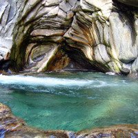
Sehr lange Tour; körperlich und technisch sehr anspruchsvoll; nur für sehr erfahrenen Canyonauten; kein Handyempfang; unbedingt Wasserstand am Ausstieg (bei der 2. Wasserableitung) kontrollieren; mehrere Zuläufe im unteren Teil der Schlucht; steile Ein-/Ausstiegsmöglichkeit im Mittelteil (Nähe des Wanderwegs); sehr schöne Maserungen und Auswaschungen im Granitgestein; einige Becken mit starker Strömung; Vorsicht vor Seilverklemmung; sauberes, kaltes Wasser.
Very long tour; physically and technically very demanding; only for very experienced canyoneers; no cell phone reception; be sure to check the water level at the exit (at the 2nd water diversion); several inlets in the lower part of the canyon; steep entry/exit in the middle section (near the hiking trail); very beautiful veining and washouts in the granite rock; some pools with strong current; beware of rope entanglement; clean, cold water.
Gneiss
Résumé:
traduction alternative
➜
Langue originale
Sehr lange Tour; körperlich und technisch sehr anspruchsvoll; nur für sehr erfahrenen Canyonauten; kein Handyempfang; unbedingt Wasserstand am Ausstieg (bei der 2. Wasserableitung) kontrollieren; mehrere Zuläufe im unteren Teil der Schlucht; steile Ein-/Ausstiegsmöglichkeit im Mittelteil (Nähe des Wanderwegs); sehr schöne Maserungen und Auswaschungen im Granitgestein; einige Becken mit starker Strömung; Vorsicht vor Seilverklemmung; sauberes, kaltes Wasser.
Very long tour; physically and technically very demanding; only for very experienced canyoneers; no cell phone reception; be sure to check the water level at the exit (at the 2nd water diversion); several inlets in the lower part of the canyon; steep entry/exit in the middle section (near the hiking trail); very beautiful veining and washouts in the granite rock; some pools with strong current; beware of rope entanglement; clean, cold water.
Accès:
traduction alternative
➜
Langue originale
Vom Campingplatz Solarium in Domaso (vor Ort Garvedona) die Straße nach Garvedona nehmen --> gleich am Anfang der Ortseinfahrt re. ri. Livo hochfahren (steile Asphaltstraße) --> in der Ortschaft Livo li. Richtung Dangri --> ab den Friedhof noch 2,8km auf schlechter Schotterstraße bis ans Ende der Straße fahren (begrenzter Parkplatz vor der Brücke) (650Hm).
Es gibt einen neuen Ticketautomat links am Dorfanfang Livo .Preis 3€ , Auch Kartenzahlung am Automat möglich; Autokennzeichen muss man angeben
From the campsite Solarium in Domaso (in front of Garvedona) take the road to Garvedona --> at the beginning of the village turn right to Livo (steep asphalt road) --> in the village Livo turn left to Dangri --> from the cemetery drive 2.8km on a bad gravel road to the exit of the road (limited parking before the bridge) (650Hm).
There is a new ticket machine on the left at the beginning of the village Livo. Price 3€, also card payment possible at the machine; you have to indicate your license plate number.
Approche (1 h 45):
traduction alternative
➜
Langue originale
Vom Parkplatz Dangri geht man über die 2 Steinbrücken --> danach geht man den Weg re. der sich kurz darauf teilt --> hier li bis in die verlassene Ortschaft Provego (940Hm) hochgehen --> nach der Ortschaft geht man über eine Brücke und weiter hoch bis zu den nächsten Häuser von Pianezzola --> hier den Weg oberhalb der Häuser nach re folgen --> hat man die Häuser hinter sich gelassen kommt ein großer zugewachsener Hang der zumindest eine schöne Aussicht auf den Comosee bietet -->auf ca. 1030Hm lichtet sich der Weg --> man folgt den Steinplattenstufen leicht abwärts --> der Weg führt hier parallel zur Schlucht (Einstiegs-/Ausstiegsmöglichkeit) mit kleinen Steigungen bis zu den verfallenen Berghäuser --> will man sich den obersten Teil (ca. 100Hm) sparen, hat man bei der großen Buche am re Wegrand (ca. 1200Hm), eine gute Möglichkeit über die Wiese in die Schlucht abzusteigen --> der eigentliche Einstieg liegt jedoch auf 1300Hm nach den Häuser.
From the parking lot Dangri you go over the 2 stone bridges --> then you take the path on the right, which shortly thereafter divides --> here go up on the left to the abandoned village of Provego (940Hm) --> after the village you go over a bridge and continue up to the next houses of Pianezzola --> here follow the path above the houses to the right --> once you have left the houses behind you comes a large overgrown slope that at least offers a beautiful view of Lake Como -->at approx. 1030Hm the path clears --> follow the stone steps slightly downhill --> the path leads parallel to the canyon (entry/exit possibility) with small slopes up to the ruined mountain houses --> if you want to save the upper part (approx. 100Hm), you have a good possibility to descend over the meadow into the canyon at the big beech on the right side of the path (approx. 1200Hm) --> the actual entry is at 1300Hm after the houses.
Tour (8 h 15):
traduction alternative
➜
Langue originale
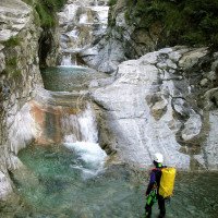
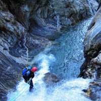
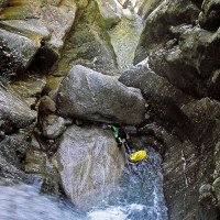
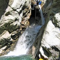
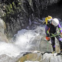
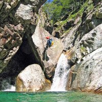
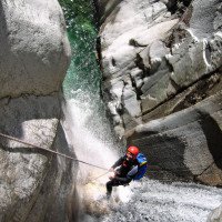
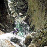
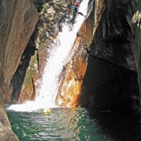
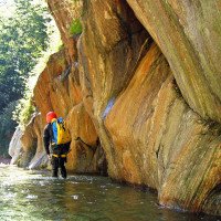
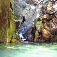
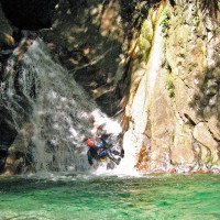
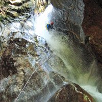
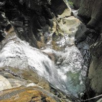
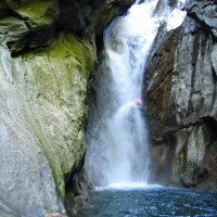
Die Bares ist sicherlich einer der schönsten und längsten Schluchten am Comosee --> wegen der Abgeschnittenheit und den technisch anspruchsvollen Stellen sowie dem kalten Wasser sollten nur erfahren Canyonauten in diese Schlucht einsteigen --> die Schlucht hat viele kurze anspruchsvolle Abseilstellen wobei die Gumpen meist nicht einsehbar sind --> auch Sprünge sind mit Vorsicht zu genießen --> ohne lange Gehstrecken hat man einen ständigen Wechsel von Engstellen, Klemmblöcke und Gumpen die auch sehr turbulent sein können --> in der Mitte der Schlucht (ca.900Hm) findet man eine offenen Stelle mit einer großen Felsplatte auf der re Seite, hier gibt es einen steilen Notausstieg (Einstieg)--> war im oberen Teil die Wassermenge schon grenzwertig, sollte hier ausgestiegen werden, da der Wasserstand im unteren Teil durch mehrere Zuflüsse noch ansteigt --> die 2. Hälfte bietet eine einzigartige Schluchtenlandschaft mit kontinuierlich aufeinander folgenden Abbrüchen --> bis zum letzten Abseiler ist volle Konzentration gefragt, bevor man an der Wasserableitung aussteigt --> eine zusätzliche mentale Belastung zur Abgeschiedenheit ist der permanente Geräuschpegel den man nach der Tour erleichtert hinter sich lässt. In großen und ganzen jedoch eine perfekte Schlucht.
approx. 7,5-9h
The Bares is certainly one of the most beautiful and longest canyons at Lake Como --> because of the cut-off and the technically demanding places as well as the cold water only experienced canyoneers should enter this canyon --> the canyon has many short demanding rappelling places whereby the pools are mostly not visible --> also jumps are to be enjoyed with caution --> without long walking passages you have a constant change of narrow places, clamping blocks and pools which can also be very turbulent --> in the middle of the canyon (approx.900Hm) one finds an open place with a large rock plate on the right side, here there is a steep emergency exit (entry) --> was in the upper part of the water volume already borderline, should be exited here, because the water level in the lower part by several tributaries still rises --> the 2. Half offers a unique canyon landscape with continuous successive abruptness --> until the last rappel full concentration is required before you get out at the water discharge --> an additional mental burden to the seclusion is the permanent noise level that you leave behind after the tour relieved. On the whole, however, a perfect canyon.
Retour (40 min):
traduction alternative
➜
Langue originale
Von der Wasserableitung re über die Metallstufen absteigen und den Weg folgen --> nach ca. 20min kommt eine weitere Wasserableitung --> diese passieren bis man nach weiteren 15-20min wieder den Ausgangspunkt (Dangri) erreicht.
From the water drainage descend right over the metal steps and follow the path --> after about 20min there is another water drainage --> pass it until you reach the starting point (Dangri) again after another 15-20min.
Coordonnées:
Départ du Canyon
Sortie intermédiaire du canyon
Parking à l'entrée et à la sortie
Inconnu
Ticketautomat für Mautstraße
Fin du Canyon
Info canyon Cwiki
Info canyon Descente
Info canyon Ropewiki
Autre info canyon
Autre info canyon
Autre info canyon
31.08.2024
Stefano
⭐
★★★★★
📖
★★★
⚓
★★★
💧
Normale
Terminé ✔
pas de traduction disponible
Automatisch importiert von Descente-Canyon.com für Canyon Bares
Tutto ok
(Quelle: https://www.descente-canyon.com/canyoning/canyon-debit/21028/observations.html)
30.08.2024
Pepijn Hoeksema
⭐
★★★★★
📖
★★★
⚓
★★★
💧
Faible
Terminé ✔
pas de traduction disponible
Approach: 2:15h
Descent: 6:30h
Exit: 0:40h
Beautiful canyon with obstacles that follow each other in quick succession. Currently low water. Team with 5 people.
30.08.2024
Reach8399
⭐
★★★★★
📖
★★★
⚓
★★★
💧
Normale
Terminé ✔
pas de traduction disponible
Automatisch importiert von Descente-Canyon.com für Canyon Bares
RAS
(Quelle: https://www.descente-canyon.com/canyoning/canyon-debit/21028/observations.html)
23.08.2024
zede63K1000
⭐
★★★★★
📖
★★★
⚓
★★★
💧
Normale
Terminé ✔
pas de traduction disponible
Automatisch importiert von Descente-Canyon.com für Canyon Bares
Ras. Superbe. On l'a fait à partir de la rechap 2. Entrée un peu tôt et le soleil est à peine rentré. Idéal vers 11h pour la partie inférieure
(Quelle: https://www.descente-canyon.com/canyoning/canyon-debit/21028/observations.html)
23.08.2024
zede63
⭐
★★★★★
📖
★★★
⚓
★★★
💧
Normale
Terminé ✔
pas de traduction disponible
Automatisch importiert von Descente-Canyon.com für Canyon Bares
Débit très tranquille, équipement ok. Magnifique comme d'habitude !
(Quelle: https://www.descente-canyon.com/canyoning/canyon-debit/21028/observations.html)
11.09.2023
Tobias Beiser
⭐
★★★★★
📖
★★★
⚓
★★★
💧
Normale
Terminé ✔
traduction alternative
➜
Langue originale
Alle Haken top.
Sehr viele Sprünge möglich
Teilweise etwas rutschig
All hooks top.
Very many jumps possible
Partly a bit slippery
02.08.2023
Patrick Summerer
⭐
★★★★★
📖
★★★
⚓
★★★
💧
Normale
Terminé ✔
traduction alternative
➜
Langue originale
Alle Stände mit doppelten Klebehaken abgesichert. Sehr viele Sprünge möglich. Einige wenige Becken schauen aber tiefer aus als sie sind aufgrund der dunkelgrünen Farbe, man sollte nicht in Versuchung kommen ohne Check überall hineinzuspringen.
All stands secured with double adhesive hooks. Very many jumps possible. However, a few pools look deeper than they are due to the dark green color, you should not be tempted to jump in everywhere without checking.
06.06.2023
Wolfgang
⭐
★★★★★
📖
★★★
⚓
★★★
💧
Haut
Terminé ✔
traduction alternative
➜
Langue originale
Perfektes Wetter für diese tolle Schlucht, der bei einer Begehung vor ca 10 tagen fehlten Haken kann problemlos angekletter/abgerutscht werden.
Ein paar Abkletterstellen wegen doch "gut Wasser" schwierig abzuklettern aber alles machbar.
Perfect weather for this great gorge, the hook missing during an ascent about 10 days ago can be climbed / slipped down without any problems.
A few Abletterstellen because of yet "good water" difficult to climb off but all doable.
09.03.2023
System User
⭐
★★★★★
📖
★★★
⚓
★★★
pas de traduction disponible
Info: Teile der Canyonbeschreibung wurden automatisiert übernommen. Konkret die Felder Weblinks, Koordinaten, Rating, Ort, Länge des Canyon, Einfachseil Mindestens von https://canyon.carto.net/cwiki/bin/view/Canyons/BaresCanyon.html und https://www.descente-canyon.com/canyoning/canyon/21028
09.03.2023
System User
⭐
★★★★★
📖
★★★
⚓
★★★
pas de traduction disponible
Daten importiert von https://www.canyoning.or.at/index.php/liste-aller-canyons/47-bares
Nouveau rapport
Veuillez décrire brièvement et de manière concise les informations les plus importantes de la dernière visite ou les informations actuelles importantes sur le canyon. Si nécessaire avec des liens vers des vidéos, photos, etc.
*
*
*
Esc
Del
Hydrologie:

