moins difficile
Kammersbach
v3 a3 III
4h20
1h20
2h15
45min
1030m
850m
180m
40m
2x40
4
1600m
à pied
Évaluation:
★★★★★
1.9 (3)
Info:
★★★
2 (1)
Belay:
★★★
1 (1)
Résumé:
traduction alternative
➜
Langue originale
Kleines Einzugsgebiet; 40m Einstiegs-Abseiler in die Schlucht; Sauberes Wasser; Kalkgestein; schöne Einzelpassagen; viele Geh- und Abkletterpassagen; Geld- und Zeitersparnis mit Bike; einige Holzverklausungen; Achtung! die Gumpen verleiten oftmals zum Springen, sind aber meist untief ; mehrere schwerere Notausstiege möglich.
Small catchment area; 40m entry rappel into the canyon; clean water; limestone; beautiful single passages; many walking and downclimb passages; money and time savings with bike; some wooden entrapments; Attention! the pools often tempt to jump, but are mostly shallow ; several more difficult emergency exits possible.
Accès:
traduction alternative
➜
Langue originale
von Sbg.Nord fährt man über die A1 bis zur Abfahrt Mondsee. Dann weiter Richtung Wolfgangsee/Bad Ischl. Bei Weißenbach biegt man re in Richtung Postalm ab. Nach einigen Km neben dem Bach trifft man auf eine Mautstation, wo pro Person € 5,- fällig werden. (Empfehlung: Fahrrad mitnehmen = Geld und Zeit sparen). Ca. 2Km nach der Mautstation parkt man das Auto bei der 1. Kehre, vor dem Schranken (begrenzte Parkmöglichkeit!).
from Sbg.Nord you drive over the A1 until the exit Mondsee. Then continue in the direction of Wolfgangsee/Bad Ischl. At Weißenbach turn right in the direction of Postalm. After some km beside the brook one meets a toll station, where per person € 5, - are due. (Recommendation: take your bike with you = save money and time). Approx. 2Km after the toll station you park the car at the 1st haipin bends, in front of the barrier (limited parking!).
Approche (1 h 20):
traduction alternative
➜
Langue originale
(mit dem Bike große Zeitersparnis!)
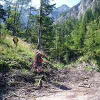
Nach dem Schranken folgt man der flachen Fortstraße (Wanderwegmarkierung). Nach einiger Zeit führt die Forststraße an einer großen Hütte vorbei und quert einen Bach bevor sie ansteigt und zum Staudam vom Kammersbach führt. Man quert die Brücke und nach einer Kehre kommt eine Wegbeschilderung (Abzweigung) wo man re abbiegt. Oberhalb der Jagdhütte geht man bis zum Ende der Straße. Hier findet man einen anfangs schlecht erkennbaren Steig der li hoch zum Karlschlaggelände führt. Der Steig führt oberhalb vom Bach über mehrere kl. Zuflüsse bis zum 2. Jägerstand auf ca. 1070Hm. Nach dem Jägerstand steigt man gleich re im Zufluss ab, der einen zum 1. ca. 40m Abseiler führt (Baumschlinge re.) auf ca. 1030Hm. (Es gibt aber Alternativen)
(with the bike big time saving!).
After the barrier, follow the flat fort road (hiking trail marking). After some time the forest road passes a large hut and crosses a stream before it rises and leads to the dam of the Kammersbach. You cross the bridge and after a hairpin bend you come to a signpost (junction) where you turn right. Above the hunting lodge you go to the exit of the road. Here you will find a path that is difficult to see at the beginning, which leads up to the left to the Karlschlag area. The path leads above the stream over several small tributaries to the 2nd hunter's stand at about 1070Hm. After the hunter's stand one descends immediately right in the tributary, which leads one to the 1st approx. 40m rappel (tree loop right) at approx. 1030Hm. (But there are alternatives)
Tour (2 h 15):
traduction alternative
➜
Langue originale
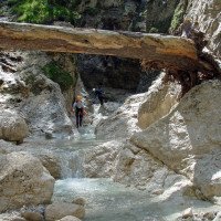
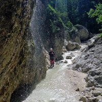
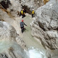
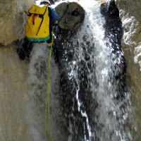
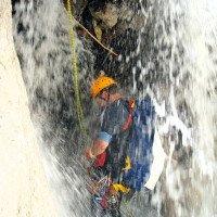
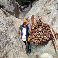
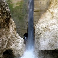
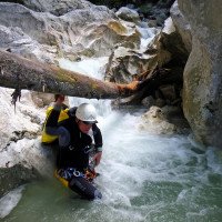
Um in die Schlucht zu gelangen seilt man sich 40m vom Baum ab. Im Bachbett angekommen folgt eine Gehpassage mit kleinen Stufen und Gumpen die abgeklettert oder gerutscht werden können. Nach ca. 150m kommt die 2. Abseilstelle die über eine Holzverklausung direkt im Wasser verläuft. Es folgen wieder Geh- und Abkletterpassagen die zu einem großen Felsenen führen. Hier wird re abgeklettert und in Kürze steht man beim 3. Abseiler (10m). Weiters folgt ein unterhaltsamer Geh- und Abkletterabschnitt, wo bis auf eine 5m Stufe auf das Seil verzichtet werden kann. Vor der 5m Stufe verengt sich die Schlucht, es folgen viele kleine Wasserbecken die vorsichtig durchstiegen werden. Eine markante enge Rinne markiert das Ende des eingeschnittenen Abschnittes. Diese Stelle wird abgeklettert oder mit dem Seil über eine Sanduhr (li) abgeseilt. Ein kurzer Gehabschnitt führt zur Brücke/ Staudam, wo man li aus der Schlucht aussteigt (ca. 850Hm). Wer noch Lust hat weiter zu gehen, kann sich nach dem Staudamm vom Baum ca. 30m in den unteren Teil der Schlucht abseilen. Für den weiteren Verlauf wird meist kein Seil mehr benötigt. Nach ca. 40min. abklettern und gehen hat man li eine Ausstiegsmöglichkeit über einen Zufluss oder man wählt den einfacheren Ausstieg bei der nächsten Brücke.
To get into the canyon you rappel 40m from the tree. Arrived in the streambed follows a walking passage with small steps and pools that can be downclimbed or slid. After about 150m comes the 2nd rappelling point which runs directly in the water over a wooden crate. There are again walking and downclimb passages that lead to a large rock. Here is downclimbed to the right and shortly you are at the 3rd rappel (10m). Further follows an entertaining walking and descending section, where, except for a 5m step, the rope can be dispensed with. Before the 5m step, the canyon narrows, followed by many small water basins that are carefully climbed through. A prominent narrow chute marks the exit of the cut part. This section is rappelled downclimbed or with the ropes over an hourglass (left). A short walking section leads to the bridge/dam, where you exit the canyon on the left (approx. 850Hm). If you still feel like going further, you can rappel from the tree about 30m into the lower part of the canyon after the dam. For the further course usually no more ropes are needed. After about 40min. downclimbing and walking, you have an exit on the left via a tributary or you can choose the easier exit at the next bridge.
Retour (45 min):
traduction alternative
➜
Langue originale
Nach der Brücke verlässt man das Bachbett auf der li Seite. Der schon bekannten Forststraße folgt man bis zum Parkplatz zurück.
After the bridge you leave the streambed on the left side. Follow the already known forest road back to the parking lot.
Coordonnées:
Départ du Canyon
47.639°, 13.4747°
↓↑
DMS: 47° 38" 20.4', 13° 28" 28.92'
DM: 47° 38.34", 13° 28.482"
Google Maps
Autriche Topographique
DMS: 47° 38" 20.4', 13° 28" 28.92'
DM: 47° 38.34", 13° 28.482"
Google Maps
Autriche Topographique
(descente_1)
Fin alternative du canyon
47.6525°, 13.4655°
↓↑
DMS: 47° 39" 9', 13° 27" 55.8'
DM: 47° 39.15", 13° 27.93"
Google Maps
Autriche Topographique
DMS: 47° 39" 9', 13° 27" 55.8'
DM: 47° 39.15", 13° 27.93"
Google Maps
Autriche Topographique
si continuer après le barrage (descente)
Parking à l'entrée et à la sortie
47.6724°, 13.4602°
↓↑
DMS: 47° 40" 20.64', 13° 27" 36.72'
DM: 47° 40.344", 13° 27.612"
Google Maps
Autriche Topographique
DMS: 47° 40" 20.64', 13° 27" 36.72'
DM: 47° 40.344", 13° 27.612"
Google Maps
Autriche Topographique
prochaine parking (descente)
Point de repère
47.6704°, 13.4608°
↓↑
DMS: 47° 40" 13.44', 13° 27" 38.88'
DM: 47° 40.224", 13° 27.648"
Google Maps
Autriche Topographique
DMS: 47° 40" 13.44', 13° 27" 38.88'
DM: 47° 40.224", 13° 27.648"
Google Maps
Autriche Topographique
Départ de l\'approche (descente)
Fin alternative du canyon
47.6471°, 13.472°
↓↑
DMS: 47° 38" 49.56', 13° 28" 19.2'
DM: 47° 38.826", 13° 28.32"
Google Maps
Autriche Topographique
DMS: 47° 38" 49.56', 13° 28" 19.2'
DM: 47° 38.826", 13° 28.32"
Google Maps
Autriche Topographique
Départ de la sente (descente)
Fin alternative du canyon
47.6487°, 13.4708°
↓↑
DMS: 47° 38" 55.32', 13° 28" 14.88'
DM: 47° 38.922", 13° 28.248"
Google Maps
Autriche Topographique
DMS: 47° 38" 55.32', 13° 28" 14.88'
DM: 47° 38.922", 13° 28.248"
Google Maps
Autriche Topographique
Sortie avant le barrage (descente)
Littérature:
Info canyon ACA
Info canyon Cwiki
Info canyon Descente
Info canyon Ropewiki
28.06.2023
Thomas Fras
⭐
★★★★★
📖
★★★
⚓
★★★
Terminé ✕
traduction alternative
➜
Langue originale
Beschreibung soweit okay
Description so far okay
09.03.2023
System User
⭐
★★★★★
📖
★★★
⚓
★★★
pas de traduction disponible
Info: Teile der Canyonbeschreibung wurden automatisiert übernommen. Konkret die Felder Weblinks, Koordinaten, Rating, Ort, Länge des Canyon, Einfachseil Mindestens von https://canyon.carto.net/cwiki/bin/view/Canyons/KammersbachCanyon.html und https://www.descente-canyon.com/canyoning/canyon/22114
09.03.2023
System User
⭐
★★★★★
📖
★★★
⚓
★★★
pas de traduction disponible
Daten importiert von https://www.canyoning.or.at/index.php/liste-aller-canyons/34-kammersbach
Nouveau rapport
Veuillez décrire brièvement et de manière concise les informations les plus importantes de la dernière visite ou les informations actuelles importantes sur le canyon. Si nécessaire avec des liens vers des vidéos, photos, etc.
*
*
*
Esc
Del
Hydrologie:


