difficile
Rio Chiampeit
v5 a2 IV
3h35
30min
3h
5min
630m
300m
330m
70m
2x70m (2x50m)
11
1600m
Voiture facultative
Évaluation:
★★★★★
3.5 (7)
Info:
★★★
2.4 (7)
Belay:
★★★
1.5 (6)
Résumé:
traduction alternative
➜
Langue originale
Schöne, lohnenswerte Kalkschlucht; 70m Finalwasserfall (unterteilbar); Einzugsgebiet ca. 3Km²; oberer Teil meist trocken, ab Zufluss im unteren Teil aquatischer; einige Blockklettereien und Gehstrecken; je nach Wasserstand mehrere Sprung- und Rutschmöglichkeiten; zwei Zustiegsmöglichkeiten; Standplatzschlingen und Laschen älteren Baujahres (im Zweifelsfall ersetzen), guter Kettenstand bei 70m Wasserfall.
Beautiful, worthwhile lime canyon; 70m final waterfall (divisible); catchment area approx. 3Km²; upper part mostly dry, from tributary in the lower part more aquatic; some boulder climbing and walking passages; depending on water level several jumps and slides; two access points; belay slings and tabs of older construction (replace if in doubt), good chain anchor at 70m waterfall.
Nord
Calcaire
3.00km²
Résumé:
traduction alternative
➜
Langue originale
Schöne, lohnenswerte Kalkschlucht; 70m Finalwasserfall (unterteilbar); Einzugsgebiet ca. 3Km²; oberer Teil meist trocken, ab Zufluss im unteren Teil aquatischer; einige Blockklettereien und Gehstrecken; je nach Wasserstand mehrere Sprung- und Rutschmöglichkeiten; zwei Zustiegsmöglichkeiten; Standplatzschlingen und Laschen älteren Baujahres (im Zweifelsfall ersetzen), guter Kettenstand bei 70m Wasserfall.
Beautiful, worthwhile lime canyon; 70m final waterfall (divisible); catchment area approx. 3Km²; upper part mostly dry, from tributary in the lower part more aquatic; some boulder climbing and walking passages; depending on water level several jumps and slides; two access points; belay slings and tabs of older construction (replace if in doubt), good chain anchor at 70m waterfall.
Accès:
traduction alternative
➜
Langue originale
Von Carnia kommend fährt man auf der SS13 Richtung Tarvisio. Ca. 4 km nach dem Hotel Carnia kommt li. die Abbiegespur nach Moggio. Diese nicht nehmen, sondern dem Straßenverlauf (SS13) noch ca. 50m weiter folgen und dann scharf rechts in die kleine Seitenstraße abbiegen. Man folgt dieser Straße bis zum Ende und parkt das Überstellungsfahrzeug vor dem Schranken unter der Autobahnbrücke (der Schlußwasserfall ist schon vom Parkplatz aus zu sehen).
Anfahrtsmöglichkeit 1: (30min Auto + 30min Zustieg)
Mit dem zweiten Auto fährt man wieder Richtung Carnia (Udine). Nach dem Verkehrsknoten bei Carnia fährt man über eine Brücke mit darunter liegenden Gleisen. Kurz danach sollte man li. Richtung Tugliezzo abbiegen, ist jedoch wegen der Sperrlinie nicht möglich also ein Stück weiter und re Richtung Carnia abbiegen.Dann bei der ersten Gelegenheit wieder rechts abbiegen und der Straße links anhaltend folgen (führt unter der Bundesstraße SS13 durch) bei der Kreuzung fährt man gerade aus Richtung Tugliezzo. Eine Asphaltierte Bergstraße windet sich neben dem riesigen Schotterfeld in Richtung der wenigen Häuser von Tugliezzo hinauf. Nach den Häusern auf der Hochebene führt die Straße abfallend mit starker re Kurve vorbei an einen Schranken und der Brücke die über den Rio Lavarie führt. Man folgt der Straße immer weiter hoch bis zu einem großen Umkehrplatz, wo man das zweite Auto parkt (Der weitere Straßenverlauf sollte besser zu Fuß gemacht werden…sehr schmal und steil).
Anfahrtsmöglichkeit 2: (10min. Auto + 1h15min Zustieg)
Mit dem zweiten PKW fährt man kurz nach dem Ort Moggia Udinese re auf eine anfangs asphaltierte Straße bis zu den Häusern von „Stavolli Rovorade“ (516m). Hier parkt man das zweite Auto.
Coming from Carnia, take the SS13 in the direction of Tarvisio. Approx. 5,5km after the Hotel Carnia on the left is the turning lane to Moggio. Follow the road (SS13) for about 50m, then turn sharp right into a small side road. Follow this road to the exit and park the shuttle car in front of the barrier under the highway bridge (the final waterfall can already be seen from the parking lot).
Access option 1: (30min car + 30min access)
With the second car you drive again in the direction of Carnia (Udine). After the traffic junction at Carnia, you cross a bridge with tracks underneath. Shortly after you should turn left towards Tugliezzo, but this is not possible because of the barrier line, so continue a little further and turn right towards Carnia. Then at the first opportunity turn right again and follow the road stopping on the left (goes under the SS13 main road) at the crossroads go straight on towards Tugliezzo. An asphalted mountain road winds up next to the huge gravel field towards the few houses of Tugliezzo. After the houses on the plateau, the road descends with a sharp bend to the right, passing a barrier and the bridge that crosses the Rio Lavarie. You follow the road up and up until a large turnaround place where you park the second car (the rest of the road is better done on foot...very narrow and steep).
Access option 2: (10min. car + 1h15min access).
With the second car, shortly after the village of Moggia Udinese, turn right onto a road that is asphalted at the beginning until you reach the houses of "Stavolli Rovorade" (516m). Here you park the second car.
Approche (30 min):
traduction alternative
➜
Langue originale
ca. 30min
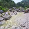
1. Möglicheit: Vom Umkehrparkplatz (siehe Anfahrtsmöglichkeit 1)folgt man der steilen schmalen Bergstraße bis zum Ende bei den Häusern „Cuel Lunc alto“. Hier trifft man auf die Wanderwegtafel 743 „Stavoli/DelVerzan“. Achtung der Weg führt hier re entlang der Hecke nach unten in den Wald. Nach kurzer Zeit quert man ein trockenes Bachbett. Hier noch nicht einsteigen sondern noch weier absteigen bis zum Hauptbach auf ca. 650m (Mauerreste).
2. Möglichkeit (ca. 1h15min): Von den Häusern bei Stavoli Ravorade (516m) folgt man den Steigspuren Richtung den Häusern von „Verzan“ auf ca. 720m. Bei Verzan steigt man in das offene meist trockenen Bachbetts ab.
About 30min
1st option: From the reversible parking (see option 1), follow the steep and narrow mountain road until the exit at the houses "Cuel Lunc alto". Here you will find the sign 743 "Stavoli/DelVerzan". Attention the path goes down here to the right along the hedge into the woods. After a short while you cross a dry streambed. Do not enter here but descend further to the main stream at approx. 650m (remains of walls).
2nd possibility (about 1h15min): From the houses at Stavoli Ravorade (516m) follow the tracks towards the houses of "Verzan" at about 720m. At Verzan you descend into the open mostly dry streambed.
Tour (3 h):
traduction alternative
➜
Langue originale
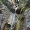
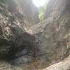
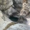
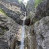
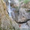
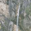
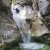
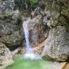
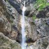
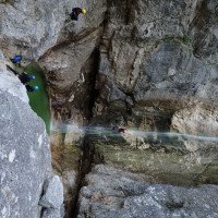
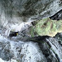
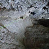
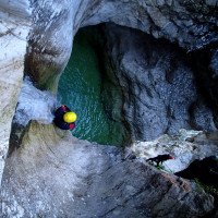
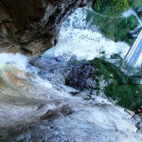
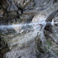
Der Rio Chiampeit ist eine schöne lohnenswerte Kalkschlucht die am besten nach Regenfällen oder im Frühjahr begangen werden sollte, da dann auch im oberen Teil Wasser in den Gumpen ist (trocken auch nicht schlecht). Der obere Abschnitt der Schlucht ist sehr vielseitig. Geh- und Abkletterpassagen wechseln sich mit Abseilstufen bis max. 25m ab. Der Kalkfels ist schön ausgeschliffen und einige Gumpen laden zum Springen oder Rutschen ein. Ab der Hälfte kommt eine längere Abkletterpassage über Felschaos. Im unteren Gehabschnitt kommen kleine Quellen und ein Zufluss von li dazu die auch im Sommer Wasser in die Schlucht bringen. Hier hat man re auch die Möglichkeit eines Zwischeneinstiegs/ Abbruchmöglichkeit. Es folgen noch einige kleine Sprung-, Rutschmöglichkeiten und zwei 5m Stufen die abgeseilt oder gesprungen werden können. Nach einer kürzeren Gehpassage mit zwei kleinen Sprungmöglichkeiten wird es ernst. Man steht nun kurz vor dem Finalwasserfall (li) bzw. den letzten zwei Abseilstellen (15m+70m). Die erste Stufe kann mit genügend Schwung auch gerutscht werden (Fels läuft schräg in den Gumpen!). Aufpassen sollte man jedoch bei der darauf folgenden Kante, da das Wasser hier direkt 70m in die Tiefe rauscht (Im Zweifel baut man ein abziehbares Seilgeländer auf). Der Stand für den 70m Abseiler ist rechts etwas höher und ausgesetzt angebracht (zwei Klebehaken zur Absicherung vorhanden!). Der fast 70m Abseiler kann auch unterteilt werden. Dafür seilt man sich zuerst ca. 25m im Wasserstrahl über einen Überhang ab. Gleich nach dem ersten Überhang gelangt man auf ein schmales Felsband, das man nach (orographisch) links bis zum ersten Haken hinaus quert. Von diesem letzten Standplatz seilt man sich dann meist außerhalb der Wasserführung ca. 45m ab.
The Rio Chiampeit is a beautiful worthwhile lime canyon that should be walked best after rains or in the spring, because then there is also water in the pools in the upper part (dry also not bad). The upper part of the canyon is very diverse. Walking and downclimb alternate with rappelling up to max. 25m. The limestone rock is nicely polished and some pools invite you to jump or slide. From the halfway point there is a longer downclimb over rock chaos. In the lower walking section there are small springs and a tributary from the left that also bring water into the canyon in summer. Here one has right also the possibility of an intermediate entry / break-off possibility. There are still some small jumps, slides and two 5m steps that can be rappelled or jumped. After a shorter walking passage with two possible jumps, it gets serious. You are now just before the final waterfall (left) and the last two abseils (15m+70m). The first step can also be slid with enough momentum (rock runs diagonally into the pool!). However, one should be careful at the following edge, since the water rushes here directly 70m into the depth (in case of doubt, one builds a removable rope traverse). The belaystation for the 70m rappel is a bit higher and exposed on the right side (two glued anchors are available!). The almost 70m rappel can also be divided. To do this, you first rappel about 25m in a water stream over an overhang. Immediately after the first overhang you reach a narrow rock band, which you traverse to the (orographic) left to the first anchor. From this last belaystation you rappel mostly outside the water flow for about 45m.
Retour (5 min):
traduction alternative
➜
Langue originale
Nach dem Finalwasserfall beim zweiten Gumpen (350m) steigt man li aus dem Bach aus und gelangt in Kürze zum Parkplatz.
After the final waterfall at the second pool (350m) you get out of the creek on the left and shortly reach the parking lot.
Coordonnées:
Départ du Canyon
Parking à la sortie
Parkplatz unter Autobahn
Fin du Canyon
Parking à l'entrée
Variante 2
Parking à l'entrée
Variante 1
Littérature:
Carte
1/25.000
Carte
Livre Canyoning
Franco Longo
2011
Italia: Zemola inf., Vinadia, Chiantone, Picchions,Lumiei, Novarza, Frondizzon,Leale inf., Pissanda,
Favarinis, Lavarie,Chiampeit, Stivane, Nero, Alba, Tralba inf.,Simon inf., Cuestis, Belepeit, Mulin,
Brussine, Patoc, Rivis, Costa Stretta, Sbrici, Lis Cladis, Malinberg, Pliz, Torto, Trincea
Slovenia: Predelica, Fratarica, Susec, Kozjak, Brus-Rocica, Smast, Sopotnica, Jerecica, Gremecica
(kein Inhalts- oder Stichwortverzeichnis, keine Seitenangaben)
Livre Canyoning
Associazione Italiana Canyoning
2009
Italien
Novarza
Lumiei
Torrente La Foce
Rio Picchions-Vinadia
Rio Chiantone
Rio Frondizzon
Rio Favarinis
Rio Pissanda
Rio Lavarie
Rio Chiampeit
Rio Tralba
Rio Simon
Rio Cuestis (Umschlagfoto)
Rio Belepeit
Rio del Mulin
Patoc
Lis Cladis – Impresis
Rio Malinberg
Rio Pliz
Slowenien
Globoski Potoc
Predelica
Fratarica
Mlinarica
Podolu
Österreich
Frauenbach
Steinerne Rinne
Silberbach
Livre Canyoning
Maurizio Biondi / Francesco Cacace / Roberto Schenone
Adriambiente
2000
978-8890026010
Info canyon Cwiki
Info canyon Ropewiki
Autre info canyon
17.08.2024
Georg Rudelstorfer
⭐
★★★★★
📖
★★★
⚓
★★★
💧
Faible
Terminé ✔
traduction alternative
➜
Langue originale
D'autres utilisateurs ont été: Andreas Bramböck
Wir sind über den Einstieg der Lavarie gestartet. Anfahrt bis zum Umkehrplatz problemlos möglich. Anfangs leider komplett trocken und ab ca. höhe zwischeneinstieg wunderschönes glasklares Wasser. Einige Sprünge möglich. Den 70m Abseiler haben wir über den Zwischenstand gemacht. Beim Ankunftsbecken sind viele Leute die Baden und gerne den Leuten beim Abseilen zuschauen. Die Querung ist etwas rutschig aber gut machbar. Es ist auch ein Abseilring vorhanden den man für ein Seilgeländer nutzen könnte. Abseiler sind zum Großteil mit Seilschlingen eingerichtet. Aktuell kein einziger Kettenstand aber definitiv lohnende Schlucht. Da der obere Teil wirklich komplett trocken war, empfiehlt es sich möglicherweise erst beim Zwischeneinstieg einzusteigen. Dort sind aber aktuell sehr viel umgestürzte Bäume.
Leider habe ich in dieser Tour meine Steigklemme plus Petzl Ovalo Karibner verloren (ich vermute im oberen Trockenen Teil). Falls ihn wer findet würde ich mich freuen ;-) (+436769144462)
We started from the Lavarie entry point. The approach to the turnaround point was easy. Unfortunately it was completely dry at the beginning and from about the intermediate entry point the water was crystal clear. Some jumps possible. We did the 70m rappel via the intermediate level. At the arrival pool there are many people swimming and watching the people rappelling. The traverse is a bit slippery but easy to do. There is also an abseil ring that could be used for a rope traverse. Rappels are mostly set up with rope slings. Currently not a single chain anchor but definitely worthwhile canyons. As the upper part was really completely dry, it may be advisable to start at the intermediate entrance. However, there are currently a lot of fallen trees there.
Unfortunately, I lost my ascender plus Petzl Ovalo Karibner on this tour (I suspect in the upper dry part). If anyone finds it I would be happy ;-) (+436769144462)
D'autres utilisateurs ont été: Andreas Bramböck
29.06.2024
GeorgB
⭐
★★★★★
📖
★★★
⚓
★★★
💧
Normale
Terminé ✔
traduction alternative
➜
Langue originale
D'autres utilisateurs ont été: Pavel Urbanek
Wasserstand im obersten Teil OK, dann schnell trocken. Erst etwas oberhalb vom Zwischeneinstieg kommt das Wasser wieder zum Vorschein. Unten dann sehr unterhaltsamer Wasserstand. Alle Sprünge und Rutschen machbar
Water level in the uppermost part OK, then quickly dry. Only a little above the intermediate entrance does the water reappear. The water level at the bottom is then very entertaining. All jumps and slides are doable
D'autres utilisateurs ont été: Pavel Urbanek
27.06.2024
Jason Walker
⭐
★★★★★
📖
★★★
⚓
★★★
💧
Normale
Terminé ✔
pas de traduction disponible
All stands fine - not amazing. All anchors were double bolt, but often one bolt was marginal. The picture attached - the flow at the top was fine, but felt like it could have taken more. However, the final waterfall with a lot more flow would be quite intimidating.
The traverse to the second stand for the final drop is a little slippery and awkward with a big bag on. The stainless rap ring on this stand was looking a little old - and will likely need replacing soonish.
26.06.2024
Bernhard
⭐
★★★★★
📖
★★★
⚓
★★★
💧
Normale
Terminé ✔
traduction alternative
➜
Langue originale
Super Wasserstand derzeit , oberer Teil hat gut Wasser und vieles springbar
Eine fantastische Sprung Rutsche gleich am Anfang
Vorletzten abseiler sind wir gerutscht (absolute top Rutsche )
Letzten 70er abseiler haben wir in einem gemacht
Stände sind teilweise schlecht aber zumindest das meiste redundant. Im unteren Teil gute Stände
Superiore water level at the moment, upper part has good water and much jumpable
A fantastic slide right at the beginning
We did the last 70 rappel in one go
16.06.2024
Clarissa Linder
⭐
★★★★★
📖
★★★
⚓
★★★
💧
Haut
Terminé ✔
traduction alternative
➜
Langue originale
D'autres utilisateurs ont été: Mario Duller
Nach Regenfällen hatte auch der obere Teil Wasser. Schöne türkise Becken. Einige Sprünge möglich.
After rainfall, the upper part also had water. Beautiful turquoise pools. Some jumps possible.
D'autres utilisateurs ont été: Mario Duller
05.08.2023
Andreas Bramböck
⭐
★★★★★
📖
★★★
⚓
★★★
💧
Haut
Terminé ✔
traduction alternative
➜
Langue originale
Zufahrt über Anfahrtsmöglichkeit 2 nur mit höhergelegtem Auto möglich. Sehr enge ubd steile bis oben asphaltierte Straße. Wenig bis keine Umkehrmöglichkeit.
Wegen hohen Wasserstands sind wir beim Zwischenausstieg raus. Dieser ist aktuell voll mit Bäumen. Der Weg leider stellenweise abgerutscht.
Stände sind spärlich eingerichtet. Unbedingt Material mitnehmen.
Access via access option 2 only possible with a higher car. Very narrow ubd steep to top asphalt road. Little or no possibility to turn back.
Because of high water level we are out at the intermediate exit. This is currently full of trees. The path unfortunately slipped in places.
Stands are sparsely furnished. Be sure to take material with you.
11.04.2023
Daniel Sturm
⭐
★★★★★
📖
★★★
⚓
★★★
Terminé ✕
traduction alternative
➜
Langue originale
Koordinaten und Beschreibung angepasst.
Coordinates and description adjusted.
09.03.2023
System User
⭐
★★★★★
📖
★★★
⚓
★★★
pas de traduction disponible
Daten importiert von https://canyon.carto.net/cwiki/bin/view/Canyons/ChiampeitCanyon.html
Nouveau rapport
Veuillez décrire brièvement et de manière concise les informations les plus importantes de la dernière visite ou les informations actuelles importantes sur le canyon. Si nécessaire avec des liens vers des vidéos, photos, etc.
*
*
*
Esc
Del
Hydrologie:
