facile
La Marive
v2 a2 III
1h15
5min
1h
10min
850m
790m
60m
15m
2x 15m
4
650m
à pied
Évaluation:
★★★★★
3 (2)
Info:
★★★
3 (1)
Belay:
★★★
2 (1)
Résumé:
traduction alternative
➜
Langue originale
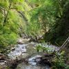
Kurze Waldschlucht
Short forest gorge
avril - novembre
Est
12.00km²
Résumé:
traduction alternative
➜
Langue originale
Kurze Waldschlucht
Short forest gorge
Accès:
traduction alternative
➜
Langue originale
Wir kommen auf der A12 (Fribourg - Vevey) und verlassen sie über die Ausfahrt Bulle. Die Stadt umfahren wir im Westen und nehmen dir Straße nach Süden, Richtung Chateau-d'Oex. Wir passieren Grandvillard und kommen 15,5 km nach dem Kreisverkehr an der Autobahnausfahrt nach Abeuve. Noch vor den ersten Gewerbebauten auf der rechten Seite biegen wir rechts ab und erreichen 900m weiter einen großen Platz oberhalb der Marive. Hier stellen wir unser Auto ab, ohne evtl. Arbeitsvorgänge auf dem Holzlagerplatz zu behindern (zur Anfahrt siehe Fotogalerie auf carto.net).
We arrive on the A12 (Fribourg - Vevey) and leave it via the Bulle exit. We bypass the city to the west and take the road to the south, direction Chateau-d'Oex. We pass Grandvillard and come to Abeuve 15.5 km after the traffic circle at the highway exit. Before the first industrial buildings on the right, we turn right and 900m further we reach a large square above the Marive. Here we park our car without interfering with any work that may be going on in the wood yard (for the approach, see the photo gallery on carto.net).
Approche (5 min):
traduction alternative
➜
Langue originale
Ein paar Meter weiter auf der Straße kommen wir zu einer Hängebrücke über die Marive. Hier können wir mit 2x50m Seil in den Bach hinunter seilen. Alternativ gehen wir noch etwa 150m am Bach entlang aufwärts. Dort eröffnet sich ein bequemer fußläufiger Zustieg.
A few meters further on the road we come to a suspension bridge over the Marive. Here we can rope down into the stream with 2x50m of rope. Alternatively, we go up along the stream for about 150m. There opens a comfortable access on foot.
Tour (1 h):
traduction alternative
➜
Langue originale
Einige kleinere Abseiler (insgesamt 4), dazwischen kurze Laufpassagen nicht ohne Reiz (Schichtkalk). Wenige Meter, nachdem sich der Blick auf die Kapelle am rechts gegenüber liegenden Hang eröffnet hat, links hinauf zur Straße.
Some smaller rappel (4 in total), in between short walking passages not without charm (stratified limestone). A few meters after the view of the chapel on the opposite slope on the right opens, left up to the road.
Retour (10 min):
traduction alternative
➜
Langue originale
Auf der Straße nach links zum Auto.
On the road to the left to the car.
Coordonnées:
Fin du Canyon
46.5202°, 7.0515°
↓↑
DMS: 46° 31" 12.72', 7° 3" 5.4'
DM: 46° 31.212", 7° 3.09"
Google Maps
Suisse Topographique
DMS: 46° 31" 12.72', 7° 3" 5.4'
DM: 46° 31.212", 7° 3.09"
Google Maps
Suisse Topographique
Départ alternatif du Canyon
46.5199°, 7.04521°
↓↑
DMS: 46° 31" 11.64', 7° 2" 42.76'
DM: 46° 31.194", 7° 2.713"
Google Maps
Suisse Topographique
DMS: 46° 31" 11.64', 7° 2" 42.76'
DM: 46° 31.194", 7° 2.713"
Google Maps
Suisse Topographique
Passerelle au dessus du canyon (entrée possible) (descente)
Départ du Canyon
46.5208°, 7.04279°
↓↑
DMS: 46° 31" 14.88', 7° 2" 34.04'
DM: 46° 31.248", 7° 2.567"
Google Maps
Suisse Topographique
DMS: 46° 31" 14.88', 7° 2" 34.04'
DM: 46° 31.248", 7° 2.567"
Google Maps
Suisse Topographique
E1 - sans rappel (descente)
Parking à l'entrée et à la sortie
46.5196°, 7.04736°
↓↑
DMS: 46° 31" 10.56', 7° 2" 50.5'
DM: 46° 31.176", 7° 2.842"
Google Maps
Suisse Topographique
DMS: 46° 31" 10.56', 7° 2" 50.5'
DM: 46° 31.176", 7° 2.842"
Google Maps
Suisse Topographique
(descente_2)
Littérature:
Carte
CNS 1245, Château d'Oex, 1/25000
Livre Canyoning
Swiss Alps - Canyoning - Alpes Suisses
Emmanuel Belut / Laurence Boyé / Thomas Guigon
Association Openbach
2015
9782746679450
Info canyon Cwiki
Info canyon Descente
Info canyon Ropewiki
15.07.2024
zede63
⭐
★★★★★
📖
★★★
⚓
★★★
💧
Normale
Terminé ✔
pas de traduction disponible
Automatisch importiert von Descente-Canyon.com für Canyon La Marive
Joli encaissement, malheureusement rempli d'embâcles...
(Quelle: https://www.descente-canyon.com/canyoning/canyon-debit/22264/observations.html)
14.07.2024
Sacha
⭐
★★★★★
📖
★★★
⚓
★★★
💧
Normale
Terminé ✔
pas de traduction disponible
Automatisch importiert von Descente-Canyon.com für Canyon La Marive
Équipement ok. Débit correct +. Beaucoup de bois mais ne gênant pas la progression.
(Quelle: https://www.descente-canyon.com/canyoning/canyon-debit/22264/observations.html)
09.03.2023
System User
⭐
★★★★★
📖
★★★
⚓
★★★
pas de traduction disponible
Info: Teile der Canyonbeschreibung wurden automatisiert übernommen. Konkret die Felder Weblinks, Koordinaten, Rating, Länge des Canyon, Einfachseil Mindestens von https://www.descente-canyon.com/canyoning/canyon/22264
09.03.2023
System User
⭐
★★★★★
📖
★★★
⚓
★★★
pas de traduction disponible
Daten importiert von https://canyon.carto.net/cwiki/bin/view/Canyons/MariveCanyon.html
15.06.2022
Tim
⭐
★★★★★
📖
★★★
⚓
★★★
💧
Normale
Terminé ✔
traduction alternative
➜
Langue originale
Nicht speziell aber toll die Schlucht mal gemacht zu haben, zudem ist das abseilen von der Brücke toll.
Not special but great to have done the canyon, plus the rappel from the bridge is great.
Hydrologie:


