Pays:
Schweiz / Switzerland
Région: Kanton Wallis / Canton du Valais
Sous-régione: Bezirk Brig
Ville: Brig
v4 a2 V
4h50
30min
3h45
35min
1200m
876m
324m
25m
2x30m (2x40m)
6
4200m
Voiture facultative
Spécialités:
Barrage (informer l'exploitant)
Barrage (informer l'exploitant)
Évaluation:
★★★★★
4.2 (3)
Info:
★★★
2 (1)
Belay:
★★★
1 (1)
Résumé:
traduction alternative
➜
Langue originale
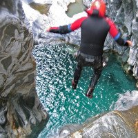
Schöne Gneisschlucht mit riesigen Felsblöcken und Abkletterpassagen; beeindruckende Gneisformationen; mehrere Ein- und Ausstiegsvarianten möglich; großer Staudamm, unbedingt vorher anrufen! (+41 27 970 59 04) . Ausreichende Absicherungen; meist wenig kaltes Wasser; die meiste Sonne hat man ab Mittag in der Schlucht; Notausstieg nach 7m Sprung.
Beautiful gneiss gorge with huge boulders and downclimb; impressive gneiss formations; several entry and exit options possible; large dam, be sure to call ahead! (+41279216525)(tape); sufficient belaying; mostly little cold water; most sun is in the canyon from noon on; emergency exit after 7m jump.
septembre - octobre
10-16 Heures
Sud-Ovest
Gneiss
1.00km²
Résumé:
traduction alternative
➜
Langue originale
Schöne Gneisschlucht mit riesigen Felsblöcken und Abkletterpassagen; beeindruckende Gneisformationen; mehrere Ein- und Ausstiegsvarianten möglich; großer Staudamm, unbedingt vorher anrufen! (+41 27 970 59 04) . Ausreichende Absicherungen; meist wenig kaltes Wasser; die meiste Sonne hat man ab Mittag in der Schlucht; Notausstieg nach 7m Sprung.
Beautiful gneiss gorge with huge boulders and downclimb; impressive gneiss formations; several entry and exit options possible; large dam, be sure to call ahead! (+41279216525)(tape); sufficient belaying; mostly little cold water; most sun is in the canyon from noon on; emergency exit after 7m jump.
Accès:
traduction alternative
➜
Langue originale
Von Brig fährt man nach Naters. Dann folgt man der asphaltierten Bergstraße Richtung Blatten. Nach ein paar Kehren kommt re eine Abzweigung in den Ort Hegdorn, wo man am Ende der Straße das Überstellungsfahrzeug parkt (ausgeschilderter Parkplatz). Von hier entweder zu Fuß zurück zur Hauptstraße und mit dem Bus hoch zur Ortschaft Blatten oder mit dem 2. PKW. Der Bus hat die Endstation Blatten. Danach folgt man der Bergstraße bzw. Weg weiter immer rechts haltend (Richtung Staudamm) bis zur Schranken (Fahrverbotstafel). Vor dem Schranken (meist offen) hat man re genügend Parkmöglichkeiten. (Alternativ kann man mit dem Auto hinunter bis zum Fuß der Staumauer fahren). (Übernachtungsmöglichkeit nach der Brücke auf 1270m).
Ohne Überstellungsfahrzeug kann man das Auto entweder in Hegdorn (Parkplatz) stehen lassen um dann mit dem Bus hochzufahren oder umgekehrt (Auto am Einstieg parken und nach der Tour mit dem Bus hochfahren). Der Weg/Zeitaufwand von der Bus-Endstation zur Schlucht bzw. zum Auto bleibt gleich.
35min
From Brig you drive to Naters. Then follow the asphalted mountain road in the direction of Blatten. After a few hairpin bends on the right there is a turnoff to the village of Hegdorn, where you park the shuttle car at the exit of the road (signposted parking lot). From here either walk back to the main road and take the bus up to the village of Blatten or take the 2nd car. The bus has the final stop Blatten. Then follow the mountain road or path, always keeping to the right (in the direction of the dam) until you reach the barrier (no driving sign). In front of the barrier (usually open) there is enough parking space on the right. (Alternatively, you can drive down to the foot of the dam). (Possibility to stay overnight after the bridge at 1270m).
Without a shuttle car you can either leave the car in Hegdorn (parking lot) and then take the bus up or vice versa (park the car at the entry and take the bus up after the tour). The way/time from the bus terminus to the canyon or to the car remains the same.
Approche (30 min):
traduction alternative
➜
Langue originale
Vom Parkplatz aus folgt man der Straße zum Fuß des gewaltigen Staudammes (1270m). Man könnte bei der Brücke gleich einsteigen oder man spart sich den ersten Teil (Blockgelände) und folgt den Wanderweg Richtung "Bitsch" (orographisch li). An der Stelle wo man auf die schöne Holzhütte trifft, verlässt man den Weg. Hier geht man geradewegs über die Wiese hinunter in Richtung Bach. Der Einstieg wird kurz vor dem Bach steiler. (1200m)
30min
From the parking lot, follow the road to the foot of the massive dam (1270m). You could enter right at the bridge or save the first part (block terrain) and follow the trail towards "Bitsch" (orographically left). At the place where you meet the beautiful wooden hut, you leave the path. Here you go straight down over the meadow towards the stream. The entry becomes steeper just before the stream. (1200m)
Tour (3 h 45):
traduction alternative
➜
Langue originale
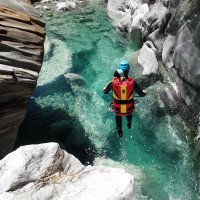
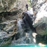
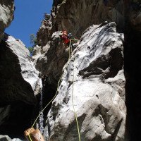
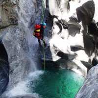
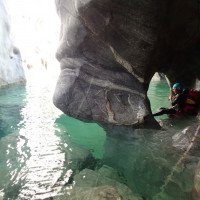
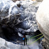
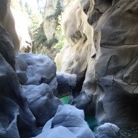
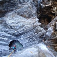
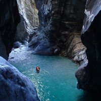
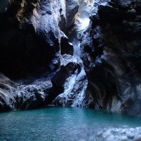
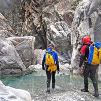
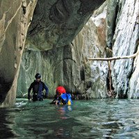
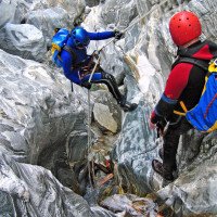
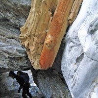
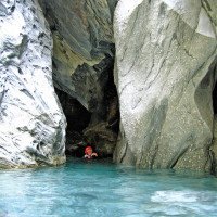
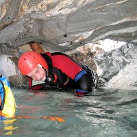
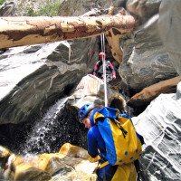
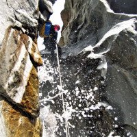
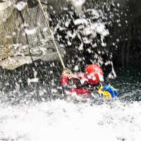
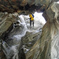
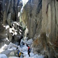
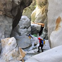
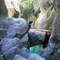
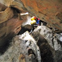
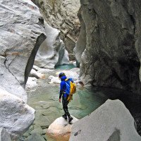
Die Massaschlucht ist mehr ein Wander- und Schwimmcanyon als ein Abseilcanyon. Trotzdem bietet die Schlucht schöne Abseilpassagen in herrlich grün/bläulichen Gumpen. Auch die unzähligen Abkletterpassagen (zum Teil über Fixseile) werden nie langweilig da man sich den Weg geschickt durch Spalten und Löcher suchen muss. Einer der Highlights ist die Abseilpassage (ca. 25m) in die sogenannte Kathedrale (Stand li oder re - ausgesetzt) gefolgt von einem engen Spalt mit Stufe und großen Becken danach nähert man sich dem möglichen Ausstieg. Es gibt aber auch die Möglichkeit nach dem letzten Blockgelände bei einer Wasserableitung re aus der Schlucht auszusteigen und über einen Steg/Wanderweg zur Straße zu gelangen.
approx. 3,5-4h
Massa Gorge is more of a hiking and swim canyon than a rappel canyon. Nevertheless, the canyon offers beautiful rappel passages in lovely green/blue pools. Also the countless downclimb passages (partly over fixed ropes) are never boring as you have to find your way skillfully through crevasses and holes. One of the highlights is the rappel passage (about 25m) into the so-called cathedral (stand left or right - exposed) followed by a narrow gap with steps and large pools then you approach the possible exit. But there is also the possibility after the last block terrain at a water drainage right to get out of the canyon and via a footbridge / hiking trail to the road.
Retour (35 min):
traduction alternative
➜
Langue originale
Wenn man sich nicht sicher ist, blickt man nach oben. Hier führt eine Leitung über die Schlucht. Diese 1. Ausstiegsvariante erfordert leichte Kletterei bis zur eine Wiese. Dann entlang der Strommasten bis zu den kleinen Holzhütten. Weiter oberhalb von den Hütten gelangt man in Kürze zu einer Straße. Hier entweder der Straße oder der Wanderwegbeschilderung bis in den Ort Hegdorn folgen. In der kleinen Ortschaft mit den schönen Holzhäusern haltet man sich re bis man zum Überstellungsfahrzeug oder zur Bushaltestelle gelangt. (30-40min). Der Bus fährt alle Stunden (7.04, 7.27, 8.27, 9.27, etc. und kostet CHF3, 60).
30-40min
If you are not sure, look up. There is a line across the canyon here. This 1st exit option requires easy climbing up to a meadow. Then along the power poles to the small wooden huts. Further up from the huts, you will shortly reach a road. Here, follow either the road or the hiking trail signs to the village of Hegdorn. In the small village with the beautiful wooden houses you keep right until you reach the shuttle car or the bus stop. (30-40min). The bus leaves every hour (7.04, 7.27, 8.27, 9.27, etc. and costs CHF3, 60).
Coordonnées:
Départ du Canyon
46.3611°, 7.9965°
↓↑
DMS: 46° 21" 39.96', 7° 59" 47.4'
DM: 46° 21.666", 7° 59.79"
Google Maps
Suisse Topographique
DMS: 46° 21" 39.96', 7° 59" 47.4'
DM: 46° 21.666", 7° 59.79"
Google Maps
Suisse Topographique
(cwiki_1)
Fin du Canyon
46.3341°, 8.006°
↓↑
DMS: 46° 20" 2.76', 8° 0" 21.6'
DM: 46° 20.046", 8° 0.36"
Google Maps
Suisse Topographique
DMS: 46° 20" 2.76', 8° 0" 21.6'
DM: 46° 20.046", 8° 0.36"
Google Maps
Suisse Topographique
(cwiki_1)
Info canyon ACA
Info canyon Cwiki
Info canyon Descente
Info canyon Ropewiki
Info canyon Schlucht.ch
28.09.2024
Pierre Nicollier
⭐
★★★★★
📖
★★★
⚓
★★★
💧
Normale
Terminé ✔
pas de traduction disponible
Automatisch importiert von Descente-Canyon.com für Canyon Massaschlucht
Les sauts classiques sont tous ok, les surverses du barrage ont vidé les vasques ensablées.Plusieurs courtes cordes fixes +/- ok en place dans les petits ressauts.Parfait sans navette avec les transports publics Brig-Blatten puis Bitsch-Brig
(Quelle: https://www.descente-canyon.com/canyoning/canyon-debit/21007/observations.html)
20.08.2023
Reto Baumberger
⭐
★★★★★
📖
★★★
⚓
★★★
💧
Terminé ✕
traduction alternative
➜
Langue originale
Die Nummer mit dem Band zur Info von Massa und Gondoschlucht ist aktuell:
+41 27 970 59 04
Die in der Beschreibung angegebene Nummer spielt den Wintersport-Bericht der Belalp ab, war nicht hilfreich ;)
The number with the band to the info of Massa and Gondo Gorge is current:
+41 27 970 59 04
The number given in the description plays the winter sports report of Belalp, was not helpful ;)
09.03.2023
System User
⭐
★★★★★
📖
★★★
⚓
★★★
pas de traduction disponible
Info: Teile der Canyonbeschreibung wurden automatisiert übernommen. Konkret die Felder Weblinks, Koordinaten, Rating, Ort, Länge des Canyon, Einfachseil Mindestens von https://canyon.carto.net/cwiki/bin/view/Canyons/MassaCanyon.html und https://www.descente-canyon.com/canyoning/canyon/21007
09.03.2023
System User
⭐
★★★★★
📖
★★★
⚓
★★★
pas de traduction disponible
Daten importiert von https://www.canyoning.or.at/index.php/liste-aller-canyons/372-massaschlucht
08.09.2021
Bubtore
⭐
★★★★★
📖
★★★
⚓
★★★
💧
Faible
Terminé ✔
traduction alternative
➜
Langue originale
Oh was für eine grossartige lange Tour. Mit Stirnlampe begehen wenn man unter die Blöcke durch will. Bohrmaschine unbedingt mitnehmen, da bewegt sich ordentlich was bei Hochwassee. Manche Passagen sind echt der Hammer! Da komm ich wieder mal.
Oh what a great long tour. Walk with a headlamp if you want to go under the blocks. Be sure to take a drill with you, there is a lot of movement in the high water. Some passages are really awesome! I'll be back again.
Nouveau rapport
Veuillez décrire brièvement et de manière concise les informations les plus importantes de la dernière visite ou les informations actuelles importantes sur le canyon. Si nécessaire avec des liens vers des vidéos, photos, etc.
*
*
*
Esc
Del
Hydrologie:
