moins difficile
Rio Patoc (inferiore)
v3 a3 III
2h30
30min
1h30
30min
550m
400m
150m
17m
1x40m
6
2500m
à pied
Évaluation:
★★★★★
3.5 (20)
Info:
★★★
2.9 (18)
Belay:
★★★
2.8 (18)
Résumé:
traduction alternative
➜
Langue originale
Schöne Halbtagestour; kurze Abseilpassagen im Wasser; oberer Teil offen, unterer Teil eingeschnitten; kurzer Zustieg; Rückweg über Fella Fluss (Achtung Wasserstand!); Nachmittags hat man mehr Sonne in der Schlucht;
Nice half-day tour; short rappels in the water; upper part open, lower part cut; short access; return via Fella River (attention water level!); in the afternoon you have more sun in the canyon;
Accès:
traduction alternative
➜
Langue originale
Von Carnia fährt man Richtung Tarvisio --> am Ende der Ortschaft Chiusaforte biegt man re Richtung „Sella Nevea“/Raccolana ab -->nach der Brücke fährt man li Richtung Kirche --> hinter der Kirche kann man das Auto neben der Straße parken.
Wenn man nicht mitten im Ort parken (umziehen, Sachen Aufhängen,..) will kann man sehr am "Brussine Parkplatz stehen bleiben (siehe Koords). Dort hat man viel mehr Platz und man stört niemand (+2min längere Gehstrecke)
approx. 15min
From Carnia drive towards Tarvisio --> at the exit of Chiusaforte turn right towards "Sella Nevea"/Raccolana --> after the bridge drive left towards the church --> behind the church you can park your car next to the road.
Approche (30 min):
traduction alternative
➜
Langue originale
Hinter der Kirche zweigt li von der Straße der Wanderweg 620 mit der Tafel „Patoc“ ab --> diesen Weg folgt man Anfangs leicht ansteigend und ab einen kleinen Bildstock leicht abfallend bis zum Bach-->die letzten Meter geht man parallel zur Schlucht zu einer Steinbrücke auf ca. 550Hm --> der Einstieg für den unteren Teil der Schlucht liegt direkt re nach der Steinbrücke.
approx. 20min
Behind the church the hiking trail 620 with the sign "Patoc" branches off to the left of the road --> follow this trail slightly uphill at the beginning and from a small wayside shrine slightly downhill to the creek-->the last meters you walk parallel to the canyon to a stone bridge at about 550Hm --> the entry for the lower part of the canyon is directly to the right after the stone bridge.
Tour (1 h 30):
traduction alternative
➜
Langue originale
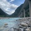
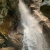
Der Rio Patoc ist eine kurze interessante Schlucht, die bei höheren Wasserstand aber sehr Knackig werden kann da die meisten kurzen Abseiler direkt im Wasserlauf sind--> im oberen Teil der „Patoc inferiore“ können einige Stellen umgangen bzw. abgeklettert werden --> der unteren Teil der Schlucht ist eingeschnittener und technisch anspruchsvoller --> hier befindet sich auch die höchste Abseilstelle von ca. 15m --> zwischen den Abseilstellen gibt es nur wenig Gehpassagen -->nach einer kleinen Rinne und Wasserfall endet die Tour plötzlich --> nach ca.100 Meter steht man unter der Eisenbahn-/ Autobahnbrücke und vor dem Fella Fluss (ca.400Hm.)
Möchte man die ganze Schlucht gehen folgt man den Wanderweg 620 bis zur Ortschaft Patoc (Zufahrt auch mit PKW möglich) --> jedoch wird meist auf den oberen Teil aufgrund von mangelenden Interesse verzichtet (nur Geh- und Kletterpassagen).
about 1,5h
The Rio Patoc is a short interesting canyon, which can be very tricky at higher water levels because most of the short rappels are directly in the watercourse --> in the upper part of the "Patoc inferiore" some places can be avoided or downclimbed --> the lower part of the canyon is more incised and technically more demanding --> here is also the highest rappel point of about 15m --> between the rappel points there are only a few walking passages --> after a small chute and waterfall the tour ends suddenly --> after about 100 meters you are standing under the railroad / highway bridge and in front of the Fella river (ca.400Hm.)
If you want to walk the whole canyon, follow the trail 620 to the village of Patoc (access also possible by car) --> however, the upper part is usually abandoned due to lack of interest (only walking and climbing passages).
Retour (30 min):
traduction alternative
➜
Langue originale
Für den Rückweg gibt es 2 Optionen:
Option 1:
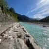
Man schwimmt die Fella runter für ca 15 min --> vor der Straßenbrücke von Raccolana gibt es auf der li Seite eine Eisenleiter, die das Aussteigen erleichtert --> in Kürze gelangt man an der Straße wieder zurück zum PKW.
Option 2: Bei der Einmündung des Patoc in die Fella geht man die Fella stromaufwärts ca. 200m. Man kommt zu einer Stelle mit Fixseilen an denen entlang man zum Radweg hangaufwärts kommt. Dann geht man den Radweg nach Chiusaforte und über die Brücke zum Parkplatz. ca, 20min
approx. 15-20min
For the way back there are 2 options:
Option 1:
You swim down the Fella for about 15min --> before the road bridge of Raccolana there is an iron ladder on the left side, which makes it easier to get out --> shortly you get back to the car at the road.
Option 2: At the confluence of the Patoc with the Fella, walk upstream along the Fella for about 200m. You will come to a place with fixed ropes along which you will reach the bike path uphill. Then follow the cycle path to Chiusaforte and cross the bridge to the parking lot. ca, 20min
Coordonnées:
Départ du Canyon
Parking à l'entrée et à la sortie
Parkmöglichkeit bei Kirche
Fin du Canyon
Parking à l'entrée et à la sortie
46.405493°, 13.316154°
↓↑
DMS: 46° 24" 19.77', 13° 18" 58.15'
DM: 46° 24.33", 13° 18.969"
Google Maps
DMS: 46° 24" 19.77', 13° 18" 58.15'
DM: 46° 24.33", 13° 18.969"
Google Maps
Gr Parkplatz abseits der Ortschaft wo man niemanden stört , ca 2min längere Wegstrecke
Point de repère
46.409088°, 13.315483°
↓↑
DMS: 46° 24" 32.72', 13° 18" 55.74'
DM: 46° 24.545", 13° 18.929"
Google Maps
DMS: 46° 24" 32.72', 13° 18" 55.74'
DM: 46° 24.545", 13° 18.929"
Google Maps
Beginn Wanderweg im Ort
Info canyon ACA
Info canyon Cwiki
Info canyon Descente
Info canyon Ropewiki
05.10.2024
Horst Lambauer
⭐
★★★★★
📖
★★★
⚓
★★★
💧
Haut
Terminé ✔
traduction alternative
➜
Langue originale
D'autres utilisateurs ont été: Wolfgang
Sind den Canyon heute bei Sehr hohen Wasserstand begangen. Auch wenn die Abseilstellen im Wasser sind entwickeln sie sich bei hohem Wasser so, dass man den Hauptwasserstrahl umgehen kann. Stände sind alle ok
Went into the canyon today when the water level was very high. Even if the abseils are in the water, they develop at high water in such a way that you can avoid the main water jet. Stands are all ok
D'autres utilisateurs ont été: Wolfgang
29.08.2024
Florian Heufler
⭐
★★★★★
📖
★★★
⚓
★★★
💧
Faible
Terminé ✔
traduction alternative
➜
Langue originale
Stände alle ok, oben gemütlich unten eingeschnitten und wunderschön!
Stalls all ok, cozy at the top and beautiful at the bottom!
25.08.2024
Montie
⭐
★★★★★
📖
★★★
⚓
★★★
💧
Faible
Terminé ✔
pas de traduction disponible
Great little tour for arrival or departure day, or in combination with other canyons in the area. 2 very beautiful rappels, the rest is a little less impressive but still nice! Nice and clean water, and everything is very easy to find. Also took the bikelane back, as swimming the Fella would currently get you a bruised butt.
21.08.2024
Edgar Göhr
⭐
★★★★★
📖
★★★
⚓
★★★
💧
Faible
Terminé ✔
traduction alternative
➜
Langue originale
D'autres utilisateurs ont été: Uschi Moc
Fella zu wenig Wasser. Fixseil für Rückweg über Radweg top. Leicht zu finden.
Fells too little water. Fixed ropes for return via cycle path top. Easy to find.
D'autres utilisateurs ont été: Uschi Moc
03.08.2024
Matteo Zocca
⭐
★★★★★
📖
★★★
⚓
★★★
💧
Normale
Terminé ✔
pas de traduction disponible
Automatisch importiert von Descente-Canyon.com für Canyon Patoc
(Quelle: https://www.descente-canyon.com/canyoning/canyon-debit/2598/observations.html)
31.07.2024
Roland Hatzenbichler
⭐
★★★★★
📖
★★★
⚓
★★★
Terminé ✔
traduction alternative
➜
Langue originale
Teil unseres Familiencanyoning Urlaubs. Alles in bester Ordnung.
Der Parkplatz bei der Parkbucht neben der Straße ist eher geeignet für die Begehung inkl. oberen Teil und umsetzen mit zweiten PKW.
Parken unterhalb der Kirche problemlos möglich und meine Empfehlung.
Part of our family canyoning vacation. Everything was in perfect order.
The parking lot at the parking bay next to the road is more suitable for the ascent including the upper part and implementation with a second car.
Parking below the church is no problem and is my recommendation.
25.07.2024
Ladauge
⭐
★★★★★
📖
★★★
⚓
★★★
💧
Normale
Terminé ✔
Canyon annoncé en 2 heures mais réalisé en 3 heures car nous étions 7 et que quasiment aucune des 7 difficultés ne sont sautables ou évitables. Belle partie étroite et eau limpide.
18.07.2024
Bina
⭐
★★★★★
📖
★★★
⚓
★★★
💧
Normale
Terminé ✔
pas de traduction disponible
Automatisch importiert von Descente-Canyon.com für Canyon Patoc
Did Patoc after Belepeit.
(Quelle: https://www.descente-canyon.com/canyoning/canyon-debit/2598/observations.html)
18.07.2024
Bina
⭐
★★★★★
📖
★★★
⚓
★★★
💧
Normale
Terminé ✔
traduction alternative
➜
Langue originale
D'autres utilisateurs ont été: Patrik Bartel
Hinweg würde ich 30 Minuten rechnen, wie auch für den Rückweg. (Wir haben die Fella gequert und sind die alte Strasse zurückgelaufen. Schöne Tour nach Belepeit.
I would calculate 30 minutes to get there, as well as for the way back. (We crossed the Fella and walked back along the old road. Nice tour to Belepeit.
D'autres utilisateurs ont été: Patrik Bartel
13.07.2024
Fimbi
⭐
★★★★★
📖
★★★
⚓
★★★
💧
Normale
Terminé ✔
traduction alternative
➜
Langue originale
Sehr schöner Halbtagescanyon. Alle Klebehaken in top Zustand.
Rückweg über den Fluss. Hin und wieder konnte man sich nicht zurück treiben lassen, da zu seicht.
Very nice half-day canyon. All glued anchors in top condition.
Return via the river. Now and then you couldn't drift back because it was too shallow.
08.07.2024
Anja Rot
⭐
★★★★★
📖
★★★
⚓
★★★
💧
Faible
Terminé ✔
pas de traduction disponible
D'autres utilisateurs ont été: Rick Paapy
Everything good, walking up 30 min, we did the swim back, not the nicest in our opinion.
D'autres utilisateurs ont été: Rick Paapy
24.06.2024
Bernhard
⭐
★★★★★
📖
★★★
⚓
★★★
💧
Normale
Terminé ✔
traduction alternative
➜
Langue originale
Netter kurzer Canyon
Auto Auto alleine in 1:15h
Fella zurückschwimmen ist eher ein ständiger Wechsel zwischen mittreiben , seichtes Wasser gehen, und große Steine andocken
Nice short canyon
Car Car alone in 1:15h
Fella swim back is more of a constant change between drifting along, going shallow water, and docking big rocks
23.06.2024
Georg Rudelstorfer
⭐
★★★★★
📖
★★★
⚓
★★★
💧
Haut
Terminé ✔
traduction alternative
➜
Langue originale
D'autres utilisateurs ont été: Theresa Prandstätter
Gut abgesichert und auch bei erhöhtem Wasserstand gut machbar. Beim aktuellen Wasserstand der Fella (siehe Eintrag von Rok 22.06.2023) empfiehlt sich durchaus Variante 2 für den Ausstieg da die Strömung nicht unterschätzt werden sollte.
Well secured and easy to do even when the water level is high. At the current water level of the Fella (see entry by Rok 22.06.2023), variant 2 is definitely recommended for the exit as the current should not be underestimated.
D'autres utilisateurs ont été: Theresa Prandstätter
22.06.2024
Rok
⭐
★★★★★
📖
★★★
⚓
★★★
💧
Haut
Terminé ✔
traduction alternative
➜
Langue originale
Alles tip top. Aktuell sehr schöner Wasserstand, aber keine Probleme. Etwas rutschig. Noch schnell als 2ten Bach durchgehüpft. Auto-Auto ca. 1,5 Stunden. Fella hat aktuell gut Wasser.
Everything is tip top. Very nice water level at the moment, but no problems. A little slippery. Quickly hopped through as 2nd stream. Car-car about 1.5 hours. Fella currently has good water.
17.06.2024
Martin Jasek
⭐
★★★★★
📖
★★★
⚓
★★★
💧
Normale
Terminé ✔
pas de traduction disponible
Very nice canyon, little higher water level, SOS marked anchor points provides best way for rappelling, sometimes hard to find. There is some places, where it looks like a nice jump place, but definitely no, always hidden rocks in the waterfall. Return to the car by river was fast and we enjoyed it as well.
15.06.2024
Rick Paapy
⭐
★★★★★
📖
★★★
⚓
★★★
💧
Haut
Terminé ✔
pas de traduction disponible
With high water level awesome canyon love it, all anchors are in the water way. Too bad not be able to swim back, walked back in 20 mins to the car
30.04.2024
Péter Bonczi
⭐
★★★★★
📖
★★★
⚓
★★★
💧
Normale
Terminé ✔
traduction alternative
➜
Langue originale
Minden TOP
All TOP
06.04.2024
Horst Lambauer
⭐
★★★★★
📖
★★★
⚓
★★★
💧
Haut
Terminé ✔
traduction alternative
➜
Langue originale
Sind den Patoc nach dem Bianco gegangen. sehr schön alle Stände ok.
Walked the Patoc after the Bianco. very nice all stands ok.
22.07.2023
Rok
⭐
★★★★★
📖
★★★
⚓
★★★
💧
Normale
Terminé ✔
traduction alternative
➜
Langue originale
Alles tip top. Ging diesmal sehr schnell runter, da das Wetter etwas unbeständig war. Auto/Auto unter 2 Stunden.
Everything tip top. Went down very quickly this time, as the weather was somewhat fickle. Car / car under 2 hours.
19.07.2023
Wolfgang
⭐
★★★★★
📖
★★★
⚓
★★★
💧
Normale
Terminé ✔
traduction alternative
➜
Langue originale
Alles soweit Ok ,..das runterschwimmen in der Fella ist bei diese heißen Temperaturen einen tolle Sache
Everything so far Ok ,..the swim down in the Fella is at these hot temperatures a great thing
06.05.2023
Rok
⭐
★★★★★
📖
★★★
⚓
★★★
💧
Normale
Terminé ✔
traduction alternative
➜
Langue originale
Alles soweit noch ok.
Everything is still ok so far.
11.04.2023
Daniel Sturm
⭐
★★★★★
📖
★★★
⚓
★★★
Terminé ✕
traduction alternative
➜
Langue originale
Koordinaten und Beschreibung bearbeitet.
Coordinates and description edited.
09.03.2023
System User
⭐
★★★★★
📖
★★★
⚓
★★★
pas de traduction disponible
Info: Teile der Canyonbeschreibung wurden automatisiert übernommen. Konkret die Felder Weblinks, Koordinaten, Rating, Ort, Länge des Canyon, Einfachseil Mindestens von https://canyon.carto.net/cwiki/bin/view/Canyons/PatocCanyon.html und https://www.descente-canyon.com/canyoning/canyon/2598
09.03.2023
System User
⭐
★★★★★
📖
★★★
⚓
★★★
pas de traduction disponible
Daten importiert von https://www.canyoning.or.at/index.php/liste-aller-canyons/67-rio-patoc-inferiore
Nouveau rapport
Veuillez décrire brièvement et de manière concise les informations les plus importantes de la dernière visite ou les informations actuelles importantes sur le canyon. Si nécessaire avec des liens vers des vidéos, photos, etc.
*
*
*
Esc
Del
Hydrologie:
