difficile
Rosengarten (Oberer)
v5 a2 III
2h35
30min
2h
5min
1200m
1050m
150m
50m
14
550m
à pied
Évaluation:
★★★★★
4.1 (13)
Info:
★★★
2.9 (11)
Belay:
★★★
2.8 (12)
Résumé:
traduction alternative
➜
Langue originale
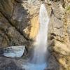
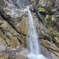
Schön eingeschnittene Tour mit klaren blauen Becken. Den Höhepunkt stellen Abseilstelle 7 und 6 dar: insgesamt 68m über einen Zwischenstand.
Beautifully cut tour with clear blue pools. The highlight are rappels 7 and 6: a total of 68m over an intermediate stand.
Partie
Nom
Difficulté
Approche
Tour
Retour
mai - octobre
6.45km²
Résumé:
traduction alternative
➜
Langue originale
Schön eingeschnittene Tour mit klaren blauen Becken. Den Höhepunkt stellen Abseilstelle 7 und 6 dar: insgesamt 68m über einen Zwischenstand.
Beautifully cut tour with clear blue pools. The highlight are rappels 7 and 6: a total of 68m over an intermediate stand.
Accès:
traduction alternative
➜
Langue originale
Von Imst Richtung Hochimst fahren. Dort beim Kreisverkehr die zweite Ausfahrt nehmen (links von den Imster Bergbahnen) und das Auto am oberen Parkplatz (Parkplatz Nord, nach einer kleinen Brücke) abstellen.
From Imst drive in the direction of Hochimst. There, at the traffic circle, take the second exit (left of the Imst cable cars) and park the car at the upper parking lot (parking lot north, after a small bridge).
Approche (30 min):
traduction alternative
➜
Langue originale
Wieder über die kleine Brücke auf den Forstweg. Diesem folgen, bis zum Pilzlehrpfad (führt am linken Schluchtenrand entlang). Bei Pilz Nr. 16 (Parasol) nach links ins Bachbett absteigen.
Cross the small bridge again onto the forest road. Follow this until you reach the mushroom trail (leads along the left edge of the gorge). At mushroom no. 16 (Parasol) descend to the left into the streambed.
Tour (2 h):
Retour (5 min):
traduction alternative
➜
Langue originale
Am Ende des Canyons den Metallrohren folgen, bis man zu einem Weg kommt, der einen direkt zum Parkplatz führt.
At the exit of the canyon, follow the metal pipes until you come to a path that leads you directly to the parking lot.
Coordonnées:
Départ du Canyon
47.2425°, 10.71°
↓↑
DMS: 47° 14" 33', 10° 42" 36'
DM: 47° 14.55", 10° 42.6"
Google Maps
Autriche Topographique
DMS: 47° 14" 33', 10° 42" 36'
DM: 47° 14.55", 10° 42.6"
Google Maps
Autriche Topographique
Fin du Canyon
47.2403°, 10.7147°
↓↑
DMS: 47° 14" 25.08', 10° 42" 52.92'
DM: 47° 14.418", 10° 42.882"
Google Maps
Autriche Topographique
DMS: 47° 14" 25.08', 10° 42" 52.92'
DM: 47° 14.418", 10° 42.882"
Google Maps
Autriche Topographique
Parking à l'entrée et à la sortie
47.240723°, 10.719967°
↓↑
DMS: 47° 14" 26.6', 10° 43" 11.88'
DM: 47° 14.443", 10° 43.198"
Google Maps
Autriche Topographique
DMS: 47° 14" 26.6', 10° 43" 11.88'
DM: 47° 14.443", 10° 43.198"
Google Maps
Autriche Topographique
Littérature:
Carte
1:25000
Carte
Carte
1:25000
Livre Canyoning
Werner Baumgarten
2010
Livre Canyoning
Alexander Riml / Gunnar Amor
2012
Livre Canyoning
Werner Baumgarten
2013
Info canyon Cwiki
Info canyon Descente
Info canyon Ropewiki
Vidéo
Info canyon Schlucht.ch
13.04.2025
Andreas Gobber
⭐
★★★★★
📖
★★★
⚓
★★★
💧
Faible
Terminé ✔
traduction alternative
➜
Langue originale
Super zu begehen und eine tolle Tour zwischendurch.
Beim letzten großen Abseiler (20m + 20m) ist, beim unteren, der "Sauschwanz"/Umlenker gebrochen und der Orografisch linke Stand (trockener Kettenstand) ist stets auf wirkliche Verwendbarkeit zu prüfen, rechts git es aber ein Klebehaken.
Ein Video der Tour findet ihr wie gewohnt auf Instagram unter
https://www.instagram.com/reel/DIa0vItA9Cg/?igsh=MXdndHM2ZHVsc3Jqcw==
Superiore to climb and a great tour in between.
On the last big rappel (20m + 20m), the "Sauschwanz"/diverter is broken on the lower one and the orographic left stand (dry chain anchor) must always be checked for real usability, but there is a glued anchor on the right.
12.04.2025
Jeroen Kirchner
⭐
★★★★★
📖
★★★
⚓
★★★
💧
Normale
Terminé ✔
pas de traduction disponible
Super grip, nice flow. Only downfall are the pools that are with gravel and the occasional rock surprise in the reception. Optimal with morning to midday sun.
05.04.2025
Clarissa Linder
⭐
★★★★★
📖
★★★
⚓
★★★
💧
Normale
Terminé ✔
traduction alternative
➜
Langue originale
09.03.2025
Manuel Reindl
⭐
★★★★★
📖
★★★
⚓
★★★
💧
Faible
Terminé ✔
traduction alternative
➜
Langue originale
D'autres utilisateurs ont été: Clemens Krabacher
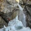
Noch Schnee und Eis in der Schlucht. Begehung aber problemlos möglich. Stände alle top, leicht zugänglich und eisfrei.
Still snow and ice in the canyon. However, ascent possible without any problems. Stands all top, easily accessible and ice-free.
D'autres utilisateurs ont été: Clemens Krabacher
09.08.2024
zede63
⭐
★★★★★
📖
★★★
⚓
★★★
💧
Normale
Terminé ✔
pas de traduction disponible
Automatisch importiert von Descente-Canyon.com für Canyon Rosengartenschlucht (obere)
(Quelle: https://www.descente-canyon.com/canyoning/canyon-debit/22375/observations.html)
09.08.2024
Gregor Bernsteiner
⭐
★★★★★
📖
★★★
⚓
★★★
💧
Normale
Terminé ✔
traduction alternative
➜
Langue originale
Alles Top
all top
02.08.2024
Waldemar Engelhardt
⭐
★★★★★
📖
★★★
⚓
★★★
💧
Normale
Terminé ✔
traduction alternative
➜
Langue originale
D'autres utilisateurs ont été: Raimund
Verankerungen alle gut. Schlucht ist stark zugekiest und immer noch viel Steintransport im Wasser. Vorsicht Steinschlag in den Wasserfällen
Anchorages all good. The canyon is heavily gravelled and there is still a lot of rock transport in the water. Beware of falling rocks in the waterfalls
D'autres utilisateurs ont été: Raimund
20.06.2024
Mats Vancraeynest
⭐
★★★★★
📖
★★★
⚓
★★★
💧
Normale
Terminé ?
pas de traduction disponible
Bit higher water level then normal but very doable.
Took exit after r65 after unexpected weather. It was good signaled and doable to exit
30.04.2024
Yorickvn
⭐
★★★★★
📖
★★★
⚓
★★★
💧
Normale
Terminé ✔
pas de traduction disponible
Automatisch importiert von Descente-Canyon.com für Canyon Rosengartenschlucht (obere)
Nice, challenging canyon. Flow a little high, but not too much. Equipment in decent state, except for 1 of 2 bolts in the last anchor. The nut is loose and the bolt is partly uncovered. Can be avoided by doing the last two rappels combined. All three escapes in very good condition.
(Quelle: https://www.descente-canyon.com/canyoning/canyon-debit/22375/observations.html)
26.12.2023
Clarissa Linder
⭐
★★★★★
📖
★★★
⚓
★★★
💧
Haut
Terminé ✔
traduction alternative
➜
Langue originale
Top. Aktuell kein Eis in der Schlucht.
Top. Currently no ice in the gorge.
07.10.2023
Patrick Klarner
⭐
★★★★★
📖
★★★
⚓
★★★
💧
Faible
Terminé ✔
traduction alternative
➜
Langue originale
Top Bedingungen, 2,75 h mit 7 Leuten und 50% wenig Erfahrenen. Keine Abweichung zu vorigen Beschreibungen.
Top conditions, 2.75 h with 7 people and 50% less experienced. No deviation from previous descriptions.
04.10.2023
Clarissa Linder
⭐
★★★★★
📖
★★★
⚓
★★★
💧
Faible
Terminé ✔
traduction alternative
➜
Langue originale
Am Ende der Tour wurde künstlich ein kleines Becken aufgestaut.
At the end of the tour, a small basin was artificially dammed.
12.08.2023
Clarissa Linder
⭐
★★★★★
📖
★★★
⚓
★★★
💧
Normale
Terminé ✔
traduction alternative
➜
Langue originale
Alles in top Zustand. Wasser war sehr warm. 4G fast in der gesamten Schlucht ;)
Everything in top condition. Water was very warm. 4G almost in the entire gorge ;)
17.06.2023
Hendrik
⭐
★★★★★
📖
★★★
⚓
★★★
💧
Normale
Terminé ✔
traduction alternative
➜
Langue originale
Etwas viel Kies drin, Wasserstand ist gut, Haken sind sehr gut.
A bit much gravel in it, water level is good, hooks are very good.
09.03.2023
System User
⭐
★★★★★
📖
★★★
⚓
★★★
pas de traduction disponible
Daten importiert von https://canyon.carto.net/cwiki/bin/view/Canyons/ObereRosengartenCanyon.html
Nouveau rapport
Veuillez décrire brièvement et de manière concise les informations les plus importantes de la dernière visite ou les informations actuelles importantes sur le canyon. Si nécessaire avec des liens vers des vidéos, photos, etc.
*
*
*
Esc
Del
Hydrologie:
