un peu difficile
Val Progero (inferiore)
Pays:
Schweiz / Switzerland
Région: Kanton Tessin / Cantone Ticino
Sous-régione: Bezirk Bellinzona
Ville: Progero
v4 a4 II
4h5
35min
3h20
10min
460m
270m
190m
45m
2x 50m
10
400m
à pied
Évaluation:
★★★★★
3.7 (7)
Info:
★★★
2.3 (6)
Belay:
★★★
2.3 (6)
Résumé:
traduction alternative
➜
Langue originale
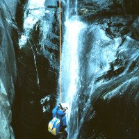
Abseilcanyon mit ein paar kleinen rutschen und einem Sprung.
Rappel canyon with partly somewhat gloomy ambience.
mai - octobre
10-15 Heures
Sud
Résumé:
traduction alternative
➜
Langue originale
Abseilcanyon mit ein paar kleinen rutschen und einem Sprung.
Rappel canyon with partly somewhat gloomy ambience.
Accès:
traduction alternative
➜
Langue originale
Von Bellinzona auf der rechtsufrig am Ticino entlangführenden Landstraße in Richtung Tenero und Locarno. Man durchquert die Ortschaft Sementina und ca. 3 km nach Sementina zweigt man von der Hauptstraße nach rechts ab in die Ortschaft Gudo. 300 m nach der Abzweigung von der Hauptstraße fährt man nach der Kirche rechts hoch, gleich wieder links und dann 600 m geradeaus weiter. Man erreicht eine 180°-Rechtskehre, nach der auf der rechten Seite eine gute Parkmöglichkeit besteht.
From Bellinzona, take the road along the right bank of the Ticino in the direction of Tenero and Locarno. Pass through the village of Sementina and about 3 km after Sementina turn right off the main road into the village of Gudo. 300 m after the turn-off from the main road, after the church, go up to the right, immediately turn left again and go straight on for 600 m. You reach a 180° right turn. You reach a 180° rightward haipin bend, after which there is a good parking place on the right.
Approche (35 min):
traduction alternative
➜
Langue originale
30 m weiter die Straße aufwärts findet man linkerhand einen Wegweiser "Monts del Laghetto". Auf diesem Weg ca. eine halbe Stunde bergan bis zu einer Verzweigung mit Wegweisern. Hier nach links und 100 m weiter findet man bei einer Brücke den Einstieg.
30 m further up the road you will find a signpost "Monts del Laghetto" on the left. Follow this path uphill for about half an hour until you reach a fork with signposts. Turn left here and 100 m further on you will find the entry by a bridge.
Tour (3 h 20):
traduction alternative
➜
Langue originale
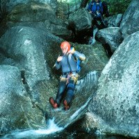
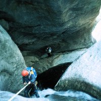
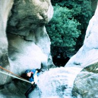
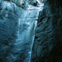
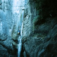
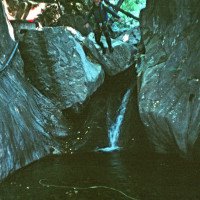
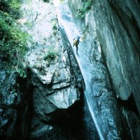
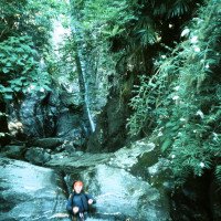
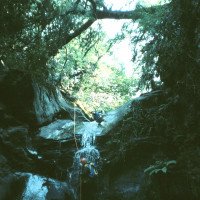
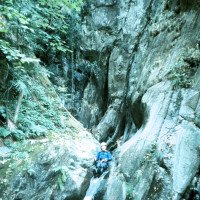
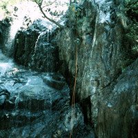
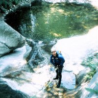
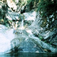
Landschaftlich überrascht die Tour durch die vielen Palmen, die mitten in der Schlucht wachsen. Wohl deshalb bekam die Schlucht von Luca Nizzola den Namen Ri delle Palme.
Das Geläuf im Bach ist sehr glitschig!
T3
C5
C12
Mc 4
C45
R6
C6
T3
S4
T3
Mc 3
C30
T2
T3
T4
C12
C16
C8 + C24 (Stand ums Eck, hinter dem Eck aus dem Wasser)
C17
C24 (t4)
Scenic, the tour surprises by the many palm trees that grow in the middle of the canyon. This is probably why Luca Nizzola named the canyon Ri delle Palme.\nSince some rappelling routes lead right through the water line, it is essential to check the water level before the tour! Water level check: If you leave the main road Bellinzona-Locarno in Gudo and turn right at the Ristorante "Cottini" and continue in the direction of "Cantina Ramelli", you will cross our stream. The steps below the bridge must not be flooded more than 5 cm.\nThe terrain in the stream is very slippery!
Retour (10 min):
traduction alternative
➜
Langue originale
Nach der letzten Rutsche mit einem Fixseil auf der linken Seite ist das Ende der Schlucht erreicht.
Nach rechts aussteigen und den Pfad außerhalb des Privatgrundstücks folgen bis zur Brücke. Darüber hinüber und der Straße bergan bis zum Auto folgen.
Nach der Hälfte der Tour besteht eine Ausstiegsmöglichkeit nach links zum Aufstiegsweg auf einem Weg, der den Bach kreuzt.
After the last slide with a fixed rope on the left (better rappel from the tree on the right!) and the clear end of the canyon, a metal staircase leads out of the creek on the left and a path up to a red-yellow painted building. Here through the passage to the right and down to the road (private property!-if you want to avoid trouble, so get out further down the creek!). On the road to the left in a few meters to the car.\nAfter half of the tour there is an exit possibility to the left to the ascent path on a path that crosses the stream.
Coordonnées:
Départ du Canyon
46.1796°, 8.94377°
↓↑
DMS: 46° 10" 46.56', 8° 56" 37.57'
DM: 46° 10.776", 8° 56.626"
Google Maps
Suisse Topographique
DMS: 46° 10" 46.56', 8° 56" 37.57'
DM: 46° 10.776", 8° 56.626"
Google Maps
Suisse Topographique
Fin du Canyon
46.1758°, 8.9419°
↓↑
DMS: 46° 10" 32.88', 8° 56" 30.84'
DM: 46° 10.548", 8° 56.514"
Google Maps
Suisse Topographique
DMS: 46° 10" 32.88', 8° 56" 30.84'
DM: 46° 10.548", 8° 56.514"
Google Maps
Suisse Topographique
Site de mesure du niveau d'eau
46.17452°, 8.93991°
↓↑
DMS: 46° 10" 28.27', 8° 56" 23.68'
DM: 46° 10.471", 8° 56.395"
Google Maps
Suisse Topographique
DMS: 46° 10" 28.27', 8° 56" 23.68'
DM: 46° 10.471", 8° 56.395"
Google Maps
Suisse Topographique
Ebenfalls Parkmöglichkeit
Parking à l'entrée et à la sortie
46.17598°, 8.94408°
↓↑
DMS: 46° 10" 33.53', 8° 56" 38.69'
DM: 46° 10.559", 8° 56.645"
Google Maps
Suisse Topographique
DMS: 46° 10" 33.53', 8° 56" 38.69'
DM: 46° 10.559", 8° 56.645"
Google Maps
Suisse Topographique
Littérature:
Carte
1:25000
Livre Canyoning
F. Baumgartner / A. Brunner / D. Zimmermann
2010
Livre Canyoning
Anna Nizzola / Luca Nizzola
2010
Livre Canyoning
Matthias Holzinger & Thomas Guigon
Pixartprinting.ch
2020
Info canyon Cwiki
Info canyon Descente
Info canyon Ropewiki
Info canyon Swisscanyon
Info canyon Schlucht.ch
18.09.2024
Marco Brack
⭐
★★★★★
📖
★★★
⚓
★★★
pas de traduction disponible
Automatisch importiert von Schlucht.ch für Canyon Valle di Progero / Riale delle Palme, Wasserstand: "Niedrig" Verankerungen: "i.O."
-
(Quelle: https://schlucht.ch/schluchten-der-schweiz-liste/1088-valle-di-progero-riale-delle-palme)
14.07.2024
RURE
⭐
★★★★★
📖
★★★
⚓
★★★
💧
Normale
Terminé ✔
traduction alternative
➜
Langue originale
alles io
all io
27.06.2024
Horst Lambauer
⭐
★★★★★
📖
★★★
⚓
★★★
💧
Normale
Terminé ✔
traduction alternative
➜
Langue originale
D'autres utilisateurs ont été: Wolfgang
Sehr nette Schlucht, vor alle durch die Jungle-Artige Vegetation. Durchaus lohnenswert.
Very nice canyon, especially because of the jungle-like vegetation. Definitely worthwhile.
D'autres utilisateurs ont été: Wolfgang
02.06.2024
Alexxx
⭐
★★★★★
📖
★★★
⚓
★★★
💧
Normale
Terminé ✔
pas de traduction disponible
Automatisch importiert von Descente-Canyon.com für Canyon Progero (inférieur)
All Installations ok. We did the Sup and the Inf in 2.5 hours.
(Quelle: https://www.descente-canyon.com/canyoning/canyon-debit/2678/observations.html)
02.06.2024
Alex
⭐
★★★★★
📖
★★★
⚓
★★★
💧
Normale
Terminé ✔
traduction alternative
➜
Langue originale
D'autres utilisateurs ont été: Wolfgang
lohnend, schön, griffig.
Verankerungen: überall vorhanden und stabil.
Beschreibung: wir haben für den Sup und den Inf insgesamt 2.5 Stunden benötigt und wir haben gemütlich gemacht. Die Zeiten in der Beschreibung sind also eher zu hoch. Und es war nicht glitschig, wie es in der Beschreibung steht, sondern griffig.
rewarding, beautiful, easy to grip.
Anchorages: present everywhere and stable.
Description: we needed a total of 2.5 hours for the sup and the inf and we did it comfortably. So the times in the description are rather too high. And it was not slippery, as it says in the description, but grippy.
D'autres utilisateurs ont été: Wolfgang
02.06.2024
Bavarian Canyoning
⭐
★★★★★
📖
★★★
⚓
★★★
💧
Normale
Terminé ✔
traduction alternative
➜
Langue originale
Haken sind alle vorhanden, allerdings sind einige durch Geschiebe deformiert. Gehalten hat aber jeder.
Rutschen wurden von uns ein paar aufgrund von Verlockung unter wasser ausgelassen.
Bei dem dritt-letzten Abseiler lohnt es sich bestimmt den Zwischenstand aufgrund der scharfen Kante zu nehmen. Dieser befindet sich orthographisch rechts ums Eck, nach der Verengung mit dem Wasserlauf.
Im gesamten aber eine sehr schöne und lohnenswerte Tour.
All anchors are present, but some are deformed by debris. But everyone held on.
We skipped a few slides due to temptation under water.
At the third-to-last rappel, it is definitely worth taking the intermediate belay due to the sharp edge. This is located orthographically to the right around the corner, after the narrowing with the watercourse.
Overall, however, a very beautiful and rewarding tour.
02.06.2024
Alex
⭐
★★★★★
📖
★★★
⚓
★★★
pas de traduction disponible
Automatisch importiert von Schlucht.ch für Canyon Valle di Progero / Riale delle Palme, Wasserstand: "normal" Verankerungen: "ok"
Haben den Sup und den Inf in 2.5 Stunden gemacht. Tolle Verhältnisse, fast überall griffig.
(Quelle: https://schlucht.ch/?view=article&id=1088&Itemid=203)
11.05.2024
Daniel Sturm
⭐
★★★★★
📖
★★★
⚓
★★★
💧
Haut
Terminé ✔
traduction alternative
➜
Langue originale
D'autres utilisateurs ont été: Christoph Cramer daniel albrecht Patrick Klarner
Alles okay. Ein paar der Stände könnte man etwas erneuern, aber alles in sicherem Zustand.
Recht griffig.
Everything was okay. A few of the stands could be renewed, but everything is in safe condition.
Quite handy.
D'autres utilisateurs ont été: Christoph Cramer daniel albrecht Patrick Klarner
10.05.2024
Lucki
⭐
★★★★★
📖
★★★
⚓
★★★
pas de traduction disponible
Automatisch importiert von Schlucht.ch für Canyon Valle di Progero / Riale delle Palme, Wasserstand: "mittel-hoch" Verankerungen: "gut (inox)"
aktuell keine Sprünge möglich - Pools recht zugekiest
(Quelle: https://schlucht.ch/?view=article&id=1088&Itemid=203)
05.05.2024
s.caron22
⭐
★★★★★
📖
★★★
⚓
★★★
💧
Haut
Terminé ✔
pas de traduction disponible
Automatisch importiert von Descente-Canyon.com für Canyon Progero (inférieur)
Fait avec la partie sup. (Pas mal de troncs au début)La 45m remet à l'ordre avec ce débit.RAS
(Quelle: https://www.descente-canyon.com/canyoning/canyon-debit/2678/observations.html)
20.04.2024
Jeanne
⭐
★★★★★
📖
★★★
⚓
★★★
💧
Normale
Terminé ✔
pas de traduction disponible
Automatisch importiert von Descente-Canyon.com für Canyon Progero (inférieur)
DC+
(Quelle: https://www.descente-canyon.com/canyoning/canyon-debit/2678/observations.html)
20.04.2024
Alex Arnold
⭐
★★★★★
📖
★★★
⚓
★★★
💧
Haut
Terminé ✔
traduction alternative
➜
Langue originale
Passt. Tolle Frühlingstour
Mountain pass. Great spring tour
13.04.2024
Makknn
⭐
★★★★★
📖
★★★
⚓
★★★
💧
Haut
Terminé ✔
pas de traduction disponible
Automatisch importiert von Descente-Canyon.com für Canyon Progero (inférieur)
all oke, really nice canyon with this flow. No problems
(Quelle: https://www.descente-canyon.com/canyoning/canyon-debit/2678/observations.html)
08.04.2024
freecanyon
⭐
★★★★★
📖
★★★
⚓
★★★
💧
Haut
Terminé ✔
pas de traduction disponible
Automatisch importiert von Descente-Canyon.com für Canyon Progero (inférieur)
RAS, superbes conditions ce jour. Les deux grandes poussent un peu !
(Quelle: https://www.descente-canyon.com/canyoning/canyon-debit/2678/observations.html)
26.11.2023
Patrik B
⭐
★★★★★
📖
★★★
⚓
★★★
pas de traduction disponible
Automatisch importiert von Schlucht.ch für Canyon Valle di Progero / Riale delle Palme, Wasserstand: "Mittel" Verankerungen: "Gut"
(Quelle: https://schlucht.ch/schluchten-der-schweiz.html?cid=88)
03.04.2023
Daniel Sturm
⭐
★★★★★
📖
★★★
⚓
★★★
Terminé ✕
traduction alternative
➜
Langue originale
Koordinaten & Beschreibung angepasst.
Coordinates & description adjusted.
09.03.2023
System User
⭐
★★★★★
📖
★★★
⚓
★★★
pas de traduction disponible
Daten importiert von https://canyon.carto.net/cwiki/bin/view/Canyons/ProgeroCanyon.html
Nouveau rapport
Veuillez décrire brièvement et de manière concise les informations les plus importantes de la dernière visite ou les informations actuelles importantes sur le canyon. Si nécessaire avec des liens vers des vidéos, photos, etc.
*
*
*
Esc
Del
Hydrologie:
pas de traduction disponible
Da einige Abseilstrecken voll durch die Wasserlinie führen ist ein genaues Begutachten des Wasserstandes vor der Tour unerlässlich! Wasserstandskontrolle: Fährt man in Gudo von der Hauptstraße Bellinzona-Locarno rechts ab beim Ristorante "Cottini und weiter in Richtung "Cantina Ramelli", überquert man unseren Bach. Die unterhalb der Brücke gelegene Stufe darf maximal 5 cm hoch überflutet sein.
Site de mesure du niveau d'eau
