moins difficile
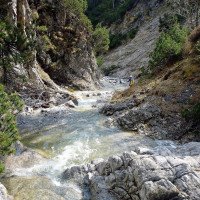
Marienbergbach
v3 a2 III
3h20
40min
2h30
10min
1380m
1160m
220m
17m
2x20m
12
1400m
à pied
Évaluation:
★★★★★
2.6 (4)
Info:
★★★
3 (2)
Belay:
★★★
3 (2)
Résumé:
traduction alternative
➜
Langue originale
Abseilcanyon
rappel canyon
Sud
Calcaire
Résumé:
traduction alternative
➜
Langue originale
Abseilcanyon
rappel canyon
Accès:
traduction alternative
➜
Langue originale
Von Nassereith, südlich des Fernpasses nach dem Tunnel in Richtung Innsbruck fahren. Die Kehren hinauf nach Holzleiten (8,5 km ab Tunnel). Hier von der Bundesstraße 189 abbiegen,, durch Holzleiten nordwärts nach Weisland und weiter in Richtung Aschland. Zwischen beiden Orten überquert die Straße den Bach. Ca. 50 m vor der Brücke rechts der Straße parken.
From Nassereith, south of the Fernpass after the tunnel drive in the direction of Innsbruck. The hairpin bends up to Holzleiten (8.5 km from the tunnel). Here turn off the main road 189,, through Holzleiten northwards to Weisland and further in the direction of Aschland. Between both villages the road crosses the brook. Park approx. 50 m before the bridge on the right side of the road.
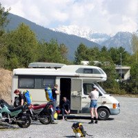
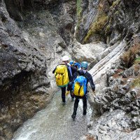
Approche (40 min):
traduction alternative
➜
Langue originale
Vom Parkplatz (1150 m ü.NN) führt eine Forststraße zur Marienbergalm. Bei der ersten Verzweigung (1410 m ü.NN) der rechten flachen oder leicht fallenden Forststraße zur Holzerhütte (1390 m ü.NN) folgen.
From the parking lot (1150 m a.s.l.) a forest road leads to the Marienbergalm. At the first junction (1410 m a.s.l.) follow the right flat or gently sloping forest road to the Holzerhütte (1390 m a.s.l.).
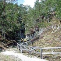
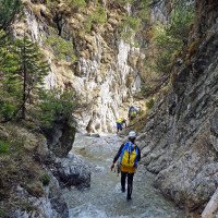
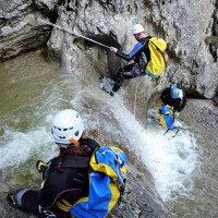
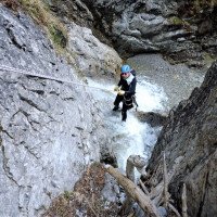
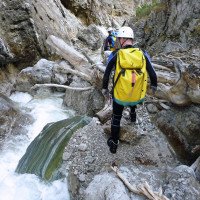
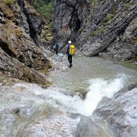
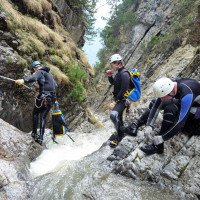
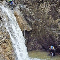
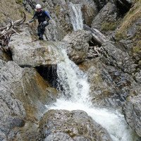
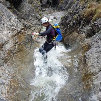
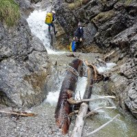
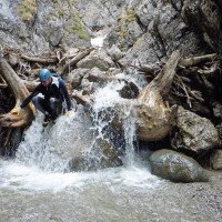
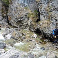
Tour (2 h 30):
traduction alternative
➜
Langue originale
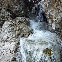
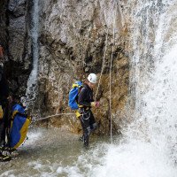
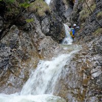
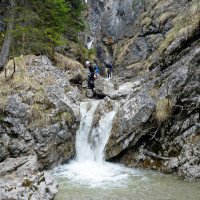
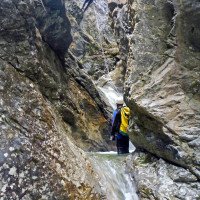
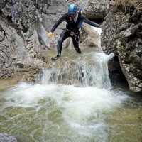
Viele kleinere Abseiler, Abklettern, keine Sprünge oder Rutschen
Many smaller rappels, downclimbs, no jumps or slides
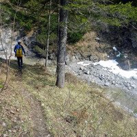
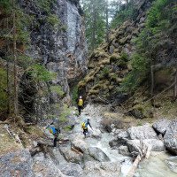
Retour (10 min):
traduction alternative
➜
Langue originale
Nach dem letzten Zig-zag-Abseiler, den man links durch einen kleinen Schlupf umgehen kann, rechts über deutliche Spuren hinaus auf einen kleinen Pfad, der hinab führt zur Forststraße und zum Auto.
After the last zig-zag rappel, which can be bypassed on the left by a small slip, turn right beyond clear tracks onto a small path that leads down to the forest road and the car.
Coordonnées:
Départ du Canyon
47.3285°, 10.898°
↓↑
DMS: 47° 19" 42.6', 10° 53" 52.8'
DM: 47° 19.71", 10° 53.88"
Google Maps
Autriche Topographique
DMS: 47° 19" 42.6', 10° 53" 52.8'
DM: 47° 19.71", 10° 53.88"
Google Maps
Autriche Topographique
Fin du Canyon
47.3193°, 10.8976°
↓↑
DMS: 47° 19" 9.48', 10° 53" 51.36'
DM: 47° 19.158", 10° 53.856"
Google Maps
Autriche Topographique
DMS: 47° 19" 9.48', 10° 53" 51.36'
DM: 47° 19.158", 10° 53.856"
Google Maps
Autriche Topographique
Parking à l'entrée et à la sortie
47.31705°, 10.89739°
↓↑
DMS: 47° 19" 1.38', 10° 53" 50.6'
DM: 47° 19.023", 10° 53.843"
Google Maps
Autriche Topographique
DMS: 47° 19" 1.38', 10° 53" 50.6'
DM: 47° 19.023", 10° 53.843"
Google Maps
Autriche Topographique
Littérature:
Carte
1:50000
Carte
Livre Canyoning
Alexander Riml / Gunnar Amor
2012
Info canyon Cwiki
Info canyon Descente
Info canyon Ropewiki
Galerie
31.07.2024
Waldemar Engelhardt
⭐
★★★★★
📖
★★★
⚓
★★★
💧
Faible
Terminé ✔
traduction alternative
➜
Langue originale
D'autres utilisateurs ont été: Raimund
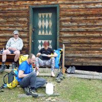
Stände alle soweit in Ordnung. Der Einstieg ist nicht so einfach zu finden. Wir sind von weiter oben durch ein trockenes Bachbett hinter der Geschiebebremse eingestiegen
Stands all in order so far. The entry is not so easy to find. We entered from further up through a dry streambed behind the slide brake
D'autres utilisateurs ont été: Raimund
02.10.2023
daniel albrecht
⭐
★★★★★
📖
★★★
⚓
★★★
💧
Faible
Terminé ✔
traduction alternative
➜
Langue originale
Beschreibung passt, Abseilstände alle okay, nur die als Einstiegsmarkierung genutzte Jagdhütte sieht man schlecht oder spät
Description fits, abseil stands all okay, only the hunting lodge used as an entry marker can be seen poorly or late
09.03.2023
System User
⭐
★★★★★
📖
★★★
⚓
★★★
pas de traduction disponible
Info: Teile der Canyonbeschreibung wurden automatisiert übernommen. Konkret die Felder Weblinks, Koordinaten, Rating, Länge des Canyon, Einfachseil Mindestens von https://www.descente-canyon.com/canyoning/canyon/22413
09.03.2023
System User
⭐
★★★★★
📖
★★★
⚓
★★★
pas de traduction disponible
Daten importiert von https://canyon.carto.net/cwiki/bin/view/Canyons/MarienberbachCanyon.html
Nouveau rapport
Veuillez décrire brièvement et de manière concise les informations les plus importantes de la dernière visite ou les informations actuelles importantes sur le canyon. Si nécessaire avec des liens vers des vidéos, photos, etc.
*
*
*
Esc
Del
Hydrologie: