v5 a3 V
4h40
40min
3h30
30min
1240m
890m
350m
50m
2x50
10
à pied
Évaluation:
★★★★★
3 (1)
Info:
★★★
0 ()
Belay:
★★★
0 ()
Résumé:
traduction alternative
➜
Langue originale
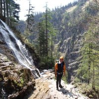
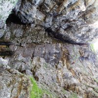
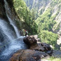
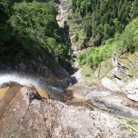
Kalkschlucht mit Tiefblick; Abseilstellen mit Steinschlaggefahr und scharfe Kanten; Quellwasser; letzte 50m Abseilstelle über überdachten Wanderweg; Grenzgebiet Bayern-Österreich; mündet im Fischbach; Notausstieg direkt zum Wanderweg möglich; Seilabzug oft schwierig; 3mm Neopren ausreichend.
Lime canyon with deep views; rappelling points with danger of falling rocks and sharp edges; spring water; last 50m rappel point over covered hiking trail; border area Bavaria-Austria; flows into the Fischbach; emergency exit directly to the hiking trail possible; rope retrival often difficult; 3mm neoprene sufficient.
Accès:
traduction alternative
➜
Langue originale
Von Salzburg Süd fährt man auf der Autobahn bis zur Abfahrt Wals dann über die Walserberg-Grenze Richtung Lofer. Nach dem Tunnel an der Grenze re Richtung Unken. Im Ort folgt man re. der Beschilderung hinauf ins Heutal (steile Straße) bis zum Parkplatz vom Alpengasthof . (Für freies Parken gönnt man sich nach der Tour einen Radler)
approx. 50min-1h
From Salzburg south you drive on the highway to the exit Wals then over the Walserberg border in the direction of Lofer. After the tunnel at the border turn right towards Unken. In the village, follow the signs on the right up into Heutal (steep road) to the parking lot of the Alpengasthof . (For free parking treat yourself to a cyclist after the tour).
Approche (40 min):
traduction alternative
➜
Langue originale
Noch vor dem Alpengasthof Heutal (974m) folgt man der Wanderbeschilderung Richtung Hochalm. Auf der Asphaltstraße geht man 100m bis zur ersten Abzweigung (li). Dann geht es weiter auf der Schotterstraße und über die Brücke mit Schranken (Tipp: Seile beim Bach/Brücke nass machen!). . Nach den Hütten und einigen Höhenmeter kommt eine Rechtskurve mit einer Abzweigung. Hier geht es li weiter. Nach kurzer Zeit kommt eine weitere Abzweigung wo man sich rechts hält. Ab hier folgt man der Forststraße bis zu einer Waldlichtung auf 1230Hm wo die Straße endet. Ab hier links (Achtung: nicht weiter hoch) ca. 100m die steile Waldböschung in Richtung weißen Grenzstein (190/2) queren/absteigen. Beim Grenzstein nochmals ca. 50m bis zum Baum mit Schlinge absteigen (Achtung sehr steil!).
Access (approx. 40min)
Before you reach the Alpengasthof Heutal (974m), follow the signs for Hochalm. On the asphalt road you walk 100m to the first junction (left). Then continue on the gravel road and cross the bridge with barriers (tip: wet the ropes by the stream/bridge!). . After the huts and a few meters of altitude comes a right turn with a fork. Here it goes on the left. After a short time there is another junction where you keep to the right. From here follow the forest road to a clearing at 1230m where the road ends. From here, cross/descend the steep forest slope for about 100m in the direction of the white boundary stone (190/2). At the boundary stone descend again about 50m to the tree with sling (Attention: very steep!).
Tour (3 h 30):
traduction alternative
➜
Langue originale
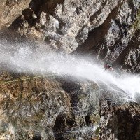
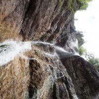
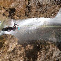
Die Schlucht ist aufgrund des schwierigen Zu-und Abstiegs nur für fortgeschrittene Canyonauten (kleine Gruppen) empfehlenswert. Nach dem man 3 trockene Abseilstellen (50/40/40m) bewältigt hat, steht man unterhalb der Quelle die aus dem Felsspalt sprudelt. Von hier folgt man dem Wasser. Die Ersten rutschigen Stufen werden re umgangen/abgestiegen. Unterhalb der ersten großen Stufe kommt eine schräge Felsplatte/Quergang. Hier richtet man ein abziehbares Seilgeänder (25m) bis zum nächsten Stand ein. (Alternativ kann man den Quergang auslassen und im Wald weiter absteigen um dann von einem kleinen Baum mit Schlinge ein 35m Seilgeländer bis zum Stand einzurichten.) Nach dem Quergang geht es nur noch vertikal weiter (25, 40, 30, 20,50m). Die letzte (höchste) 50m Abseilstelle über den Wanderweg ist direkt im Wasserstrahl und sollte daher nicht unterschätzt werden (zur Not bzw. bei starker Wasserführung) kann auf den Wanderweg abgeseilt werden). Nach dem schönen Schlusswasserfall steigt man re auf ca. 890m über die steile Böschung zum Wanderweg hoch.
approx. 3-4h
The canyon is recommended only for advanced canyoneers (small groups) because of the difficult ascent and descent. After you have mastered 3 dry rappels (50/40/40m), you stand below the spring that bubbles out of the crevice. From here you follow the water. The first slippery steps are bypassed/descended on the right. Below the first big step there is a sloping rock slab/cross passage. Here you set up a removable rope railing (25m) to the next belaystation. (Alternatively, you can skip the traverse and continue descending in the forest and then set up a 35m rope traverse from a small tree with a sling to the belaystation). After the traverse, the descent continues only vertically (25, 40, 30, 20,50m). The last (highest) 50m rappel over the hiking trail is directly in the water stream and should therefore not be underestimated (in an emergency or in case of strong water flow) it is possible to rappel onto the hiking trail). After the beautiful final waterfall, climb up the steep slope to the path on the right at approx. 890m.
Retour (30 min):
traduction alternative
➜
Langue originale
Den Wanderweg re bis zum Heutalerhof und dann weiter li über die Holzbrücke bis zum Alpengasthof folgen.
approx. 30min
Follow the hiking trail on the right to the Heutalerhof and then further on the left over the wooden bridge to the Alpengasthof.
Coordonnées:
Parking à l'entrée et à la sortie
47.662393°, 12.66415°
↓↑
DMS: 47° 39" 44.61', 12° 39" 50.94'
DM: 47° 39.744", 12° 39.849"
Google Maps
Autriche Topographique
DMS: 47° 39" 44.61', 12° 39" 50.94'
DM: 47° 39.744", 12° 39.849"
Google Maps
Autriche Topographique
Départ du Canyon
47.671735°, 12.654128°
↓↑
DMS: 47° 40" 18.25', 12° 39" 14.86'
DM: 47° 40.304", 12° 39.248"
Google Maps
Autriche Topographique
DMS: 47° 40" 18.25', 12° 39" 14.86'
DM: 47° 40.304", 12° 39.248"
Google Maps
Autriche Topographique
Fin du Canyon
47.6702°, 12.6485°
↓↑
DMS: 47° 40" 12.72', 12° 38" 54.6'
DM: 47° 40.212", 12° 38.91"
Google Maps
Autriche Topographique
DMS: 47° 40" 12.72', 12° 38" 54.6'
DM: 47° 40.212", 12° 38.91"
Google Maps
Autriche Topographique
Ende Staubfall und Fischbach
09.03.2023
System User
⭐
★★★★★
📖
★★★
⚓
★★★
pas de traduction disponible
Daten importiert von https://www.canyoning.or.at/index.php/liste-aller-canyons/317-staubfall
Hydrologie:
