moins difficile
Perlana
v3 a3 III
3h17
37min
2h15
25min
450m
280m
170m
25m
2x30m
12
1200m
à pied
Évaluation:
★★★★★
3.3 (7)
Info:
★★★
2.3 (4)
Belay:
★★★
2.8 (5)
Résumé:
traduction alternative
➜
Langue originale
Abwechslungsreiche Kalkschlucht; mehrere Rutschen/Sprungmöglichkeiten; Exposition Süd/Ost; ca. 30m Grotte mit schönen Versinterungen (Lampe nicht zwingend notwendig); Wasser zeitweise etwas trüb durch Vegetation; schöne 12m Rutsche; mehrere rutschige Stellen; Absicherung gut (10mm Inox); mehrere Fluchtmöglichkeiten.
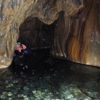
Varied lime canyon; several slides/possible jumps; exposure south/east; approx. 30m grotto with beautiful sintering (lamp not absolutely necessary); water at times somewhat turbid due to vegetation; nice 12m slide; several slippery spots; protection good (10mm Inox); several possible jumps.
Sud-Est
Calcaire
Résumé:
traduction alternative
➜
Langue originale
Abwechslungsreiche Kalkschlucht; mehrere Rutschen/Sprungmöglichkeiten; Exposition Süd/Ost; ca. 30m Grotte mit schönen Versinterungen (Lampe nicht zwingend notwendig); Wasser zeitweise etwas trüb durch Vegetation; schöne 12m Rutsche; mehrere rutschige Stellen; Absicherung gut (10mm Inox); mehrere Fluchtmöglichkeiten.
Varied lime canyon; several slides/possible jumps; exposure south/east; approx. 30m grotto with beautiful sintering (lamp not absolutely necessary); water at times somewhat turbid due to vegetation; nice 12m slide; several slippery spots; protection good (10mm Inox); several possible jumps.
Accès:
traduction alternative
➜
Langue originale
Von Domaso Richtung Süden fahren bis zur Ortschaft Leno. In der Ortschaft Leno die erste Straße rechts in die Via S. Pellico hochfahren (Beschilderung „Santario dell Soccorso“). Gleich nach der Abzweigung links halten und der Straße Bergauf folgen. Bei einer Kreuzung rechts halten und weiter hochfahren bis zur Kirche „Acquafredda“ mit großer Parkmöglichkeit.
Alternativ den Parkplatz am Ausstieg wählen um den Rückweg zum höheren Parkplatz nicht im Neopren zurückzulegen.
From Domaso head south until you reach the town of Leno. In Leno, take the first road on the right up Via S. Pellico (signposted "Santario dell Soccorso"). Immediately after the fork, keep left and follow the road uphill. At a crossroads keep right and continue uphill until you reach the church "Acquafredda" with a large parking area.
Alternatively, choose the parking area at the exit to avoid having to walk back to the higher parking area in neoprene.
Approche (37 min):
traduction alternative
➜
Langue originale
Vom Parkplatz bei der Kirche folgt man zuerst der gepflasterter Bergstraße „Via S. Benedetto“ steil bergauf. Nach ca. 20min. kommt eine Abzweigung mit gelbem Pfeil an der linken Seite. Hier verlässt man die Bergstraße und folgt dem an Bäumen und Felsen gelb markierten Weg/Pfad links oberhalb der Schlucht. Nach ca. 15min. führt der Weg zu einer am Baum befestigten Abseilstelle in den Bach.
From the parking lot near the church, first follow the paved mountain road "Via S. Benedetto" steeply uphill. After about 20min. there is a fork with a yellow arrow on the left. Here you leave the mountain road and follow the path/trail marked yellow on trees and rocks to the left above the canyon. After about 15min. the path leads to an abseil point attached to the tree into the stream.
Tour (2 h 15):
traduction alternative
➜
Langue originale
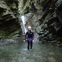
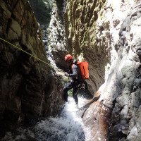
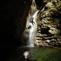
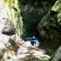
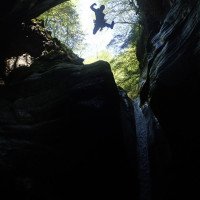
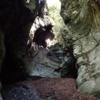
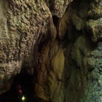
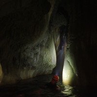
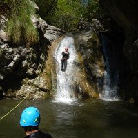
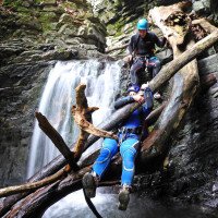
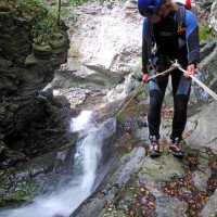
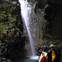
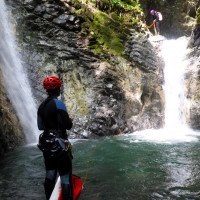
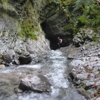
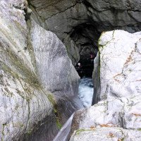
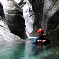
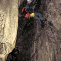
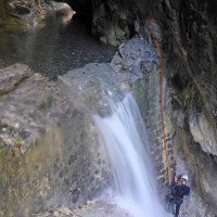
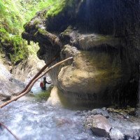
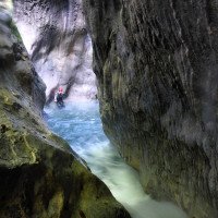
Die Perlana inferiore ist eine vegetationsreiche diskontinuierliche überwiegend offene Kalkschlucht mit mehreren kurzen Abseilstellen bzw. Rutsch- oder Sprungmöglichkeiten. Zwischen den Stufen kommen vor allem im oberen Teil immer wieder kürzere Geh- und Abkletterstellen vor (zum Teil mit kleinen Verklausungen). Eine schöne ausgeschliffene 12m Rutsche in tiefen Gumpen und eine kleine finstere Grotte mit Versinterungen in der Mitte der Schlucht sind die Highlights der Perlana. Leider war die Grotte bei unserer Begehung oben bei der eigentlichen Abseilstelle in die Grotte komplett verklaust. Eine Besichtigung von unten war jedoch möglich. Die Schlucht wird auch kommerziell begangen und ist durch die Süd/Ost Ausrichtung und mehreren Sprung- und Rutschmöglichkeiten sehr beliebt. In der Schlucht gibt es mehrere Fluchtmöglichkeiten/Einstiegsmöglichkeiten. Im Normalfall wird vor der Brücke rechts ausgestiegen da nach der Brücke noch drei eher uninteressante Abseilstellen (16m, 14m, 18m) folgen.
The Perlana inferiore is a discontinuous lime canyon rich in vegetation and mostly open, with several short rappels or possible jumps and slides. Between the steps, especially in the upper part, there are always shorter walking and downclimbing steps (some with small creeks). A beautiful 12m slide in deep pools and a small dark grotto with sintering in the middle of the canyon are the highlights of Perlana. Unfortunately, the grotto was completely clogged at the top at the actual rappelling point into the grotto during our ascent. However, a visit from below was possible. The canyon is also used commercially and is very popular due to the south/east orientation and several jumps and slides. There are several escape/entry points in the canyon. Normally, you get off to the right before the bridge, because after the bridge there are three rather uninteresting rappelling points (16m, 14m, 18m).
Retour (25 min):
traduction alternative
➜
Langue originale
Vor der Brücke auf der rechten Seite aussteigen (links Privat). Dann über die Brücke und links die Straße hoch bis zur Kirche/Parkplatz zurück folgen (steile Abkürzung über Pflastersteine möglich).
Get off before the bridge on the right side (left private). Then follow back over the bridge and left up the road to the church/parking lot (steep shortcut over cobblestones possible).
Coordonnées:
Départ du Canyon
Fin du Canyon
(cwiki_1)
Parking à l'entrée et à la sortie
Kirche „Acquafredda“
Parking à la sortie
Parkplatz nah am Ausstieg
Départ alternatif du Canyon
Ingresso dalla Val Chisola
Départ alternatif du Canyon
Ingresso dalla Valle di Gada
Info canyon ACA
Info canyon Cwiki
Info canyon Descente
Info canyon Ropewiki
Autre info canyon
Autre info canyon
26.08.2024
Pepijn Hoeksema
⭐
★★★★★
📖
★★★
⚓
★★★
💧
Faible
Terminé ✔
pas de traduction disponible
We had a training day here focused on efficiency. The canyon can be approached in several ways. We followed the route on the left bank. We followed the path on the map up to the gorge. This path is quite exposed in some places. At the end of the path, there was a rope around a tree with a maillon. We descended from there and ended up in the canyon. We completed the entire canyon, including the last three waterfalls, in just under an hour and a half.
26.08.2024
AlvaroCanyonSVC
⭐
★★★★★
📖
★★★
⚓
★★★
💧
Normale
Terminé ✔
pas de traduction disponible
Automatisch importiert von Descente-Canyon.com für Canyon Perlana
L’approche RG mérite un bon coup de pioche!
(Quelle: https://www.descente-canyon.com/canyoning/canyon-debit/2999/observations.html)
26.08.2024
AlvaroCanyon
⭐
★★★★★
📖
★★★
⚓
★★★
💧
Normale
Terminé ✔
pas de traduction disponible
Automatisch importiert von Descente-Canyon.com für Canyon Perlana
Alvaro Canyon
(Quelle: https://www.descente-canyon.com/canyoning/canyon-debit/2999/observations.html)
26.08.2024
Reach8399
⭐
★★★★★
📖
★★★
⚓
★★★
💧
Normale
Terminé ✔
pas de traduction disponible
Automatisch importiert von Descente-Canyon.com für Canyon Perlana
RAS
(Quelle: https://www.descente-canyon.com/canyoning/canyon-debit/2999/observations.html)
01.07.2024
Felix
⭐
★★★★★
📖
★★★
⚓
★★★
💧
Faible
Terminé ✔
traduction alternative
➜
Langue originale
Seit diesem Jahr ist die Höhle wieder offen. Dadurch wird die Tour um einiges aufgewertet. In der Höhle liegt noch etwas Holz, was aber super links rum umgangen werden kann.
The cave has been open again since this year. This has enhanced the tour considerably. There is still some wood in the cave, but this can be easily bypassed to the left.
22.06.2024
Sandra66
⭐
★★★★★
📖
★★★
⚓
★★★
💧
Haut
Terminé ✔
pas de traduction disponible
Automatisch importiert von Descente-Canyon.com für Canyon Perlana
Gros débit - Les pluies de la veille ont levé le niveau d'eau du canyon mais cela ne pose aucun problème sur les obstacles.
(Quelle: https://www.descente-canyon.com/canyoning/canyon-debit/2999/observations.html)
22.05.2024
Mathias Boeckx
⭐
★★★★★
📖
★★★
⚓
★★★
💧
Haut
Terminé ✔
pas de traduction disponible
Automatisch importiert von Descente-Canyon.com für Canyon Perlana
We hebben de boom kunnen verleggen in de mooie tobogan. Hierdoor is deze terug te doen. ook het grotje is terug open en geeft de canyon zo terug een mooi uitstraling.
(Quelle: https://www.descente-canyon.com/canyoning/canyon-debit/2999/observations.html)
09.05.2024
Phrandjo
⭐
★★★★★
📖
★★★
⚓
★★★
💧
Normale
Terminé ✔
pas de traduction disponible
Automatisch importiert von Descente-Canyon.com für Canyon Perlana
Both the beautiful 12m toboggan and the toboggan/jump right after it have a tree trunk stuck at the end of them and are for this reason to be rappelled. The entrance to the cave is open again but the anchors to get in have been either torn away or are just covered by the remains of the landslide that used to block it. We have put in place an energency anchor with a rock piton just above the rappel to enter the cave. Even though by looking at it from outside it seems to have loads of wood stuck in the narrow part the cave is actually practicable
(Quelle: https://www.descente-canyon.com/canyoning/canyon-debit/2999/observations.html)
05.08.2023
Christoph Cramer
⭐
★★★★★
📖
★★★
⚓
★★★
💧
Normale
Terminé ✔
traduction alternative
➜
Langue originale
Das Highlight der Höhlenpassage und Sprung in's dunkele Loch ist derzeit wegen massiver Verblockung am hinteren Höhleneingang nicht möglich. Unterm Strich zu wenig Schönes für die lange verblockte Strecke, den Zustieg und die Verbauung im unteren Teil, beschreibung aktualisiert mit Parkplatz.
The highlight of the cave passage and jump in's dark hole is currently not possible due to massive blocking at the rear cave entrance. Bottom line too little beautiful for the long verblockte route, the approach and the Verbauung in the lower part, description updated with parking.
05.08.2023
Bastien P.
⭐
★★★★★
📖
★★★
⚓
★★★
💧
Normale
Terminé ✔
traduction alternative
➜
Langue originale
Stände alle in Ordnung. Canyon dem leider etwas fehlt, dass er zu was besonderem wird.
Stands all in order. Canyon which unfortunately lacks something that it becomes something special.
09.06.2023
Michael Rosenhammer
⭐
★★★★★
📖
★★★
⚓
★★★
Terminé ✔
traduction alternative
➜
Langue originale
Stande sind Ok, Zustieg beim gelben Pfeil (leicht verblast am Boden makiert), gelbe Punkte makieren den Steig der zum Einstieg führt (rutschig nach regen). Rutsche war machbar, lohnenswerte Tour.
Stands are Ok, approach at the yellow arrow (slightly faded marked on the ground), yellow dots mark the trail that leads to the entrance (slippery after rain). Slide was doable, worthwhile tour.
04.06.2023
Wolfgang
⭐
★★★★★
📖
★★★
⚓
★★★
Terminé ✔
traduction alternative
➜
Langue originale
Wegen Regen im Norden etwas weiter in den Süden gefahren. Zustieg wegen Regen zuvor extrem rutschig (macht nicht mehr Spaß)
Alle Stände soweit ok
Due to rain in the north a little further to the south. Approach because of rain before extremely slippery (no longer fun).
All stands so far ok
09.03.2023
System User
⭐
★★★★★
📖
★★★
⚓
★★★
pas de traduction disponible
Info: Teile der Canyonbeschreibung wurden automatisiert übernommen. Konkret die Felder Weblinks, Koordinaten, Rating, Ort, Länge des Canyon, Einfachseil Mindestens von https://canyon.carto.net/cwiki/bin/view/Canyons/PerlanaCanyon.html und https://www.descente-canyon.com/canyoning/canyon/2999
09.03.2023
System User
⭐
★★★★★
📖
★★★
⚓
★★★
pas de traduction disponible
Daten importiert von https://www.canyoning.or.at/index.php/liste-aller-canyons/456-perlana
Nouveau rapport
Veuillez décrire brièvement et de manière concise les informations les plus importantes de la dernière visite ou les informations actuelles importantes sur le canyon. Si nécessaire avec des liens vers des vidéos, photos, etc.
*
*
*
Esc
Del
Hydrologie:
