un peu difficile
Hidan lower mit Hidan Siq
Pays:
الأردن / Jordan
Région: مادبا / Muḩafazat Madaba
Sous-régione: لواء ذيبان / Dhiban
Ville: محمية الموجب للمحيط الحيوي
v4 a4 IV
9h40
1h10
7h
1h30
-70m
-300m
230m
60m
1x60m, 2x30m
2
5000m
Voiture obligatoire
Spécialités:
Permis requis Barrage
Permis requis Barrage
Évaluation:
★★★★★
3.6 (1)
Info:
★★★
0 ()
Belay:
★★★
0 ()
Résumé:
traduction alternative
➜
Langue originale
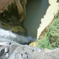
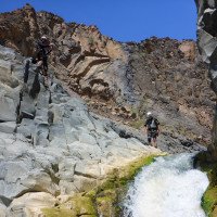
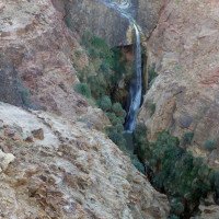
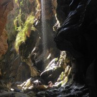
Der zentrale Abschnitt des Hidan beginnt mit einem 60m-Abseiler, ist im übrigen aber ein Wandercanyon mit einigen Passagen zum Abklettern. Interessant ist dann wieder der letzte Abschniit, der Hidan Siq.
Der zentrale Abschnitt des Hidan sowie dessen letzter Teil, Hidan Siq, liegen in einem Wildschutzgebiet, das nur mit einem entsprechenden Permit zugänglich ist. Das Permit bekommst du als Nichtjordanier ohne Vitamin B nicht, also muss man einen Guide buchen, der über die entsprechende Erlaubnis verfügt, Kunden mit durch die Schlucht nehmen zu dürfen.
The central part of the Hidan starts with a 60m rappel, but for the rest it is a hiking canyon with some downclimbing passages.
Ouest
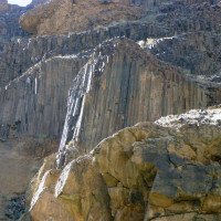
Basalte
Résumé:
traduction alternative
➜
Langue originale
Der zentrale Abschnitt des Hidan beginnt mit einem 60m-Abseiler, ist im übrigen aber ein Wandercanyon mit einigen Passagen zum Abklettern. Interessant ist dann wieder der letzte Abschniit, der Hidan Siq.
Der zentrale Abschnitt des Hidan sowie dessen letzter Teil, Hidan Siq, liegen in einem Wildschutzgebiet, das nur mit einem entsprechenden Permit zugänglich ist. Das Permit bekommst du als Nichtjordanier ohne Vitamin B nicht, also muss man einen Guide buchen, der über die entsprechende Erlaubnis verfügt, Kunden mit durch die Schlucht nehmen zu dürfen.
The central part of the Hidan starts with a 60m rappel, but for the rest it is a hiking canyon with some downclimbing passages.
Accès:
traduction alternative
➜
Langue originale
Zunächst müssen wir das Auto für den Ausstieg auf der Straße "65" am Toten Meer abstellen. Dazu fahren wir von der Stadt Karak auf der "50" hinunter zum Toten Meer (Dead Sea). Nach 26,2 km kommen wir zur zur T-Kreuzung "Mazra Junction" und fahren dort nach rechts weiter auf der "65" Richtung Norden und zwar 23,5 km. Hier (1,9 km vor der Brücke über das Wadi Mujib) stellen wir unser Auto für den Ausstieg ab.
Mit dem zweiten Auto fahren wir wieder zurück und hinauf nach Karak, nehmen hier den alten "Kings Highway", Straße "35", in Richtung Madaba. Nach etwa 65 km (ab Karak) und 10 km nach Durchfahren der Ortschaft Dhiban kommen wir an die Brücke über das Wadi Wala, den Oberlauf des Wadi el Hidan.
Im Norden der Brücke biegen wir links ab und fahren 17 km am Wadi entlang abwärts. Dann sind wir am Einstieg in den oberen Abschnitt des Hidan Upper angekommen.
Wir fahren nun aber weitere 1,2 km auf dieser Straße. Wir kommen zu einer Stelle, wo die Straße sich in einer Rechtskurve vom Wadi "verabschiedet". Hier stellen wir das obere Auto ab.
First we have to park the car for the exit on the road "65" at the Dead Sea. For this we drive from the city of Karak on the "50" down to the Dead Sea. After 26.2 km we come to the T-junction "Mazra Junction" and there we continue to the right on the "65" towards the north for 23.5 km. Here (1,9 km before the bridge over the Wadi Mujib) we park our car for the exit.
With the second car we drive back and up to Karak, here we take the old "Kings Highway", road "35", in the direction of Madaba. After about 65 km (from Karak) and 10 km after passing the village of Dhiban, we come to the bridge over the Wadi Wala, the upper reaches of the Wadi el Hidan.
To the north of the bridge we turn left and descend along the wadi for 17 km. Then we have reached the entry to the upper part of the Hidan Upper.
However, we now drive another 1.2 km on this road. We come to a place where the road "says goodbye" to the wadi in a right turn. Here we park the upper car.
Approche (1 h 10):
traduction alternative
➜
Langue originale
Der Zustieg, der möglichst direkt zum Einstieg des Hidan Lower, also zum zentralen Abschnitt des Wadis am 60m-Abseiler führt, erfordert Orientierungssinn und ein gewisses Gespür bei der Wegfindung. Er ist zugleich der Ausstieg aus dem Hidan Upper, Abschnitt II (GPS - Koordinaten: 31°28'35.10"N / 35°39'28.33"E). Von hier sind es noch etwa 1000 m bis zum 60m-Einstiegswasserfall.
Wer auf "Nummer Sicher" gehen will, steigt vom Parkplatz ("P 2") in den Hidan Upper, Abschnitt II ein und läuft in diesem Abschnitt etwa 3 Stunden bis zum Einstiegswasserfall. Sinn macht auch, vorher den Hidan upper II zu gehen und sich den Ausstieg dann für die Begehung des Hidan lower (dann als Zustieg) zu merken (ggf mit GPS-Logger).
The access, which leads as directly as possible to the entry of the Hidan Lower, that is, to the central part of the wadi at the 60m rappel, requires a sense of direction and a certain intuition in finding the way. It is also the exit from the Hidan Upper, part II (GPS coordinates: 31°28'35.10 "N / 35°39'28.33 "E). From here it is about 1000m to the 60m entry waterfall.
If you want to be on the safe side, you can take the Hidan Upper, part II from the parking lot ("P 2") and walk in this part for about 3 hours until you reach the waterfall. It also makes sense to walk the Hidan upper II before and then remember the exit for the ascent of the Hidan lower (then as access) (if necessary with GPS logger).
Tour (7 h):
traduction alternative
➜
Langue originale
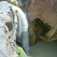
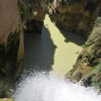
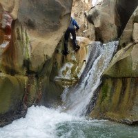
Der Einstiegswasserfall ("Barta") hat eine Höhe von etwa 60 m (rechts oberhalb des Strahls). Dort gibt es inzwischen einen eingerichteten Stand links vom Strahl. Zudem finden sich direkt über dem Wasserfall selbst im Abstand von etwa 8m zwei Bohrlöcher mit Gewinde für 10er-Schrauben (mit Laschen), die (beide) selbst mitzubringen wären. (zuletzt anno 2016 verifiziert).
Offenbar gibt es auch einen Stand etwa 20 m rechts vom Wasserfall. Dazu steigt man einige Meter rechts hinauf und quert dann über ein Felsenkar abwärts und - etwas ausgesetzt - einen felsigen Balkon bis in eine Rinne, wo wir die Sicherung finden dürften - so Gott will (vgl. Video: https://youtu.be/sRH-NuqocrU ab 1.30 min). Sonst heißt es, selbst einen Haken setzen.
Bei unserer Begehung anno 2016 haben unsere Guides den Wasserfall orograf. links (!) umgangen und sind in die Flusssohle unterhalb des Wasserfalls abgeklettert.
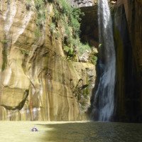
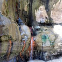
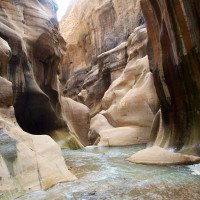
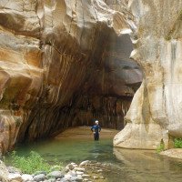
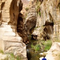
Interessant in diesem Kessel, an dessen Basis wir nach dem Abseilen nun stehen, ist die Schichtung von Sandstein und Basalt.
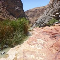
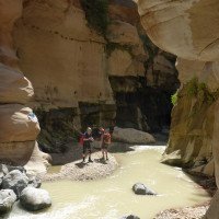
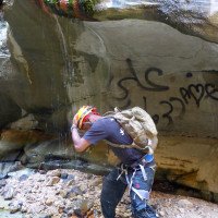
Wir gehen flussabwärts und stoßen abwechselnd auf kalte und heiße Quellzuflüsse. Die heißen erkennt man schon rein optisch idR an der roten Einfärbung des umgebenden Gesteins. Nach etwa 1 Stunde weitet sich die Schlucht. Wir sind bei unserer Begehung anno 2016 hier dann nach rechts ausgestiegen (etwa 160m unter NN) und zurück zum Parkplatz P2 gestiegen (ca. 300 m Aufstieg).
Sowohl die richtige Ausstiegsstelle wie auch der anschließende Weg nach oben sind nicht einfach zu finden. Unsere Guides bedienten sich zu diesem Zweck eines einheimischen Ziegenhirten.
Später mündet auch bald das Wadi Nimr von Norden in den Hidan. Das Wadi Nimr bringt auch heißes Wasser.
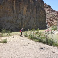
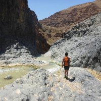
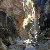
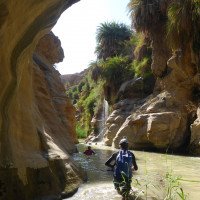
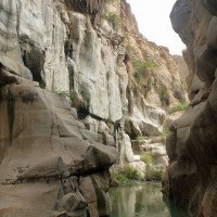
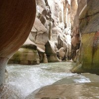
Geht man weiter flussabwärts, hindert eine teilweise dichte Vegetation die Fortbewegung. Wir können diesen Abschnitt jedoch auf einem Pfad umgehen, der am Südhang des Wadi entlang läuft und gegenüber der Mündung des Wadi Nimr seinen Anfang nimmt. Der Pfad zieht etwa auf ein Drittel Höhe des Schluchtrandes hinauf und wir folgen ihm fast 1 km weit. Dann führt der Pfad wieder hinunter in die Flusssohle. Etwa 2 Stunden später verschwindet die Vegetation völlig, die Schlucht wird wieder eng und über viele kleine Basaltstufen geht es - mit Schwimmeinlagen zwischendurch - abwärts. Wir befinden uns im Hidan Siq. Auch Sprünge sind hier - nach vorheriger Prüfung - möglich.
Besondere Vorsicht ist angezeigt an einer "Rutsche", die 2012 mit einem Fixseil von unten her zu erklimmen war. Im Unterlauf war nämlich ein spitzer Stein so gefährlich verklemmt, dass hier sogar beim Aufstieg bzw. Abstieg am Fixseil Verletzungsgefahr drohte (der Fluss macht an dieser Stelle eine Linkskurve von fast 90 Grad).
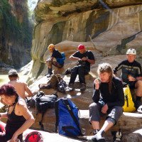
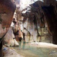
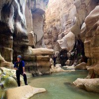
Dann ist es nicht mehr weit (ca. 30 Min.) und wir erreichen den markanten Schlussgumpen mit einer Felsplattform darüber, die zu einer Rast einlädt.
Der Abschnitt des Hidan Siq ist auch für sich allein begehbar und wird dann von unten her angelaufen. Ausgangspunkt ist dann der oben beschriebene Parkplatz an der "65" direkt am Toten Meer. Von hier geht man die unter "Rueckweg" beschriebene Route in umgekehrter Richtung. Also zuerst die schlechte Piste hinauf, oben dann auf eine von rechts kommende Piste nach links einschwenken und dieser Piste dann folgen, zuletzt steil hinab zum Wadi Mujib. Im Wadi Mujib dann flussauf, bis von links, orograf. also von rechts die Wasser des Hidan durch einen Schilfgürtel in den Mujib münden.
Durch den Schilfgürtel hinauf zu dem beschriebenen großen Gumpen unterhalb des "Rastplatzes" auf der Felsplatte. Dann im Stream hinauf bis zu einem großen Topf, der früher das Ende und den Umkehrpunkt der Tour bedeutete. Im Jahre 2012 war jedoch in der Rinne oberhalb ein Fixseil angebracht. So konnten wir das Hindernis überwinden. Damit ist der Weg frei für eine weitere ungehinderte Begehung des Hidan Siq flussaufwärts.
Der Rückweg erfolgt dann in umgekehrter Richtung.
In aller Regel wird mit dieser isolierten Begehung des Hidan Siq auch die Begehung des Mujib Siq verbunden, siehe dortige Beschreibung.
The entry waterfall ("Barta") has a height of about 60m (right above the beam). There is no equipped stand there, but directly above the waterfall itself are in the distance of about 8m two drill holes with thread for 10er screws (with tabs), which (both) would have to bring yourself. (last verified anno 2016).
Apparently there is also a stand about 20m to the right of the waterfall. To do this, climb up a few meters to the right and then traverse down a rocky cirque and - somewhat exposed - a rocky balcony to a chute, where we should find the belay - God willing (see video: https://youtu.be/sRH-NuqocrU from 1.30 min). Otherwise, it means to set an anchor yourself.
During our ascent in 2016, our guides bypassed the waterfall orographic left (!) and downclimbed into the riverbed below the waterfall.
Interesting in this basin, at the base of which we are now standing after the rappel, is the layering of sandstone and basalt.
We go downstream and encounter alternately cold and hot spring tributaries. The hot ones can be recognized purely visually idR by the red coloring of the surrounding rock. After about 1 hour the canyon widens. During our walk in 2016, we got off here to the right (about 160m below sea level) and climbed back to the parking lot P2 (about 300 m ascent).
Both the correct exit point and the subsequent way up are not easy to find. Our guides helped themselves to a local goatherd for this purpose.
Later, the Wadi Nimr soon joins the Hidan from the north. The Wadi Nimr also brings hot water.
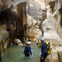
Going further downstream, some dense vegetation prevents us from moving. However, we can bypass this part on a path that runs along the southern slope of the wadi and starts opposite the mouth of Wadi Nimr. The path goes up to about a third of the height of the canyon rim and we follow it for almost 1 km. Then the trail descends back down to the river bottom. About 2 hours later the vegetation disappears completely, the canyon becomes narrow again and over many small basalt steps we descend - with swimming in between. We are now in the Hidan Siq. Jumps are also possible here - after prior testing.
Special caution is indicated at a "slide", which had to be climbed from below with a fixed rope in 2012. In the lower reaches, a sharp stone was so dangerously jammed that there was even a risk of injury during the ascent or descent on fixed ropes (the river makes a left turn of almost 90 degrees at this point).\nThen it is not far (about 30 min.) and we reach the striking final ravine with a rock platform above it, which invites us to take a rest.
The part of the Hidan Siq can also be hiked on its own and is then approached from below. The starting point is then the above described parking lot at the "65" directly at the Dead Sea. From here you walk the route described under "Rueckweg" in the opposite direction. So first up the bad slope, above then turn left on a slope coming from the right and then follow this slope, finally steeply down to Wadi Mujib. In the Wadi Mujib then upstream until the waters of the Hidan flow into the Mujib from the left, orographic, i.e. from the right through a reed belt.
Through the reed belt up to the described large pool below the "resting place" on the rock plate. Then up the stream to a large pot that used to be the exit and turnaround point for the tour. However, in 2012 there was a fixed rope in the chute above. So we were able to overcome the obstacle. This clears the way for another unimpeded ascent of Hidan Siq upstream.
The way back is then done in the opposite direction.
As a rule, this isolated ascent of Hidan Siq is also combined with the ascent of Mujib Siq, see the description there.
Retour (1 h 30):
traduction alternative
➜
Langue originale
Vom "Rastplatz" abwärts kommen wir schnell zum Zusammenfluss von Hidan u. Mujib. Im Mujib laufen wir abwärts bis zum Fesspalt, der den Beginn des Mujib Siq bedeutet. Sollten wir hier nicht im Mujib weiter gehen wollen - noch einmal 3 bis 4 Stunden bis zum Ausstieg auf die "65" - gehen wir in dem Taleinschnitt vor den Felswänden links hinauf und stoßen hier schnell auf die zerfurchten Reste einer ehemaligen Piste. Auf ihr aufwärts steigend gelangen wir auf einen Sattel und wandern jenseits mit schönem Blick auf und über das Tote Meer hinab zu unserem Auto. So die Piste sich verzweigt, halten wir uns rechts und tendieren in der Falllinie hinunter zum Meer.
From the "resting place" downhill we quickly come to the confluence of Hidan u. Mujib. In the Mujib we walk downhill until we reach the fissure, which is the beginning of the Mujib Siq. If we don't want to continue in the Mujib - another 3 to 4 hours to the exit on the "65" - we go up in the valley cut in front of the rock walls on the left and quickly come across the rutted remains of a former track. Climbing upwards on it we reach a saddle and hike beyond with a beautiful view of and over the Dead Sea down to our car. As the track branches, we keep to the right and tend in the fall line down to the sea.
Coordonnées:
Départ du Canyon
Parking à l'entrée
P auch für Ausstieg Hidan upper II, Zustieg u. Ausstieg Hidan middle, Zustieg Hidan integral
Fin du Canyon
wenige Meter vor Erreichen des Wadi Mujib
Parking à la sortie
Parkplatz am Ende des Mujib Siq, sofern man nicht vor diesem schon aussteigt
Parking à l'entrée et à la sortie
31.455017°, 35.569135°
↓↑
DMS: 31° 27" 18.06', 35° 34" 8.89'
DM: 31° 27.301", 35° 34.148"
Google Maps
DMS: 31° 27" 18.06', 35° 34" 8.89'
DM: 31° 27.301", 35° 34.148"
Google Maps
Parkplatz für Austieg Hidan lower, sofern nicht in Mujib Siq fortgesetzt, Zustieg für Hidan Siq u. Mujib Siq
Point de repère
Beginn Hidan Siq
Littérature:
Carte
https://goo.gl/photos/b9PpbJ7jCsDWrXPMA (Hidan upper - Zufahrt)
Carte
https://goo.gl/photos/nakdb5HH7DJyG8Ue7 (Hidan + Mujib Siq: Zu- und Ausstiege)
Carte
http://www.everytrail.com/view_trip.php?trip_id=3113875 (Gesamter Hidan + Mujib Siq)
Livre Canyoning
Trekking and Canyoning in the Jordanian Dead Sea Rift
Itai Haviv
2000
Livre Canyoning
Jordan - Walks, Treks, Caves, Climbs & Canyons. (2. Auflage)
Di Taylor / Tonny Howard
Cicerone
2008
Livre Canyoning
Walking in Jordan. Walks, treks, caves, climbs, canyons
Di Taylor, Tony Howard
H.M. Queen
2001
978-1566563796
Info canyon Cwiki
Info canyon Descente
Info canyon Ropewiki
09.03.2023
System User
⭐
★★★★★
📖
★★★
⚓
★★★
pas de traduction disponible
Daten importiert von https://canyon.carto.net/cwiki/bin/view/Canyons/HidanMiddleCanyon.html
Hydrologie:
