très difficile
Alpbach
v6 a3 III
6h
30min
5h
30min
1450m
750m
700m
70m
1000m
Téléphérique
Évaluation:
★★★★★
3.1 (1)
Info:
★★★
0 ()
Belay:
★★★
0 ()
Résumé:
traduction alternative
➜
Langue originale
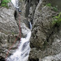
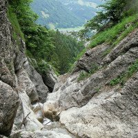
Langer, eher offener, alpiner Abseilcanyon. Kernstück ist ein 70m Wasserfall der von der L200 aus zu sehen ist.
Long, rather open, alpine rappel canyon. The centerpiece is a 70m waterfall that can be seen from the L200.
Nord
Résumé:
traduction alternative
➜
Langue originale
Langer, eher offener, alpiner Abseilcanyon. Kernstück ist ein 70m Wasserfall der von der L200 aus zu sehen ist.
Long, rather open, alpine rappel canyon. The centerpiece is a 70m waterfall that can be seen from the L200.
Accès:
traduction alternative
➜
Langue originale
Von Dornbirn übers Bödele in den Bregenzerwald und weiter nach Mellau. Dann beim Parkplatz der Bergbahn Mellau parken.
From Dornbirn via Bödele into the Bregenzerwald and on to Mellau. Then park at the parking lot of the Mellau mountain railroad.
Approche (30 min):
traduction alternative
➜
Langue originale
Gemütlich mit der Bahn hoch und oben ostwärts Richtung Kanisalpe, bis man nach knapp 30 Minuten zu einer Brücke kommt. Nun 2 Minuten am Bach entlang zum Einstieg.\n\nZu Fuß (ohne Bergbahnbenutzung) vom Parkplatz Richtung Kanisfluh nach 1500 m rechts abzweigen nach Hofstätten. Bei Hofstätten rechts Richtung Mittagsspitze, dann kommt man zur zuvor beschriebenen Brücke (ca. 2 Stunden).
Comfortably up with the train and above eastwards in the direction of Kanisalpe, until after just under 30 minutes you come to a bridge. Now 2 minutes along the stream to the entry.\n\on foot (without using the cable car) from the parking lot in the direction of Kanisfluh after 1500 m turn right to Hofstätten. At Hofstätten turn right in the direction of Mittagsspitze, then you come to the previously described bridge (about 2 hours).
Tour (5 h):
traduction alternative
➜
Langue originale
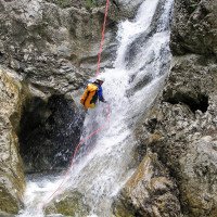
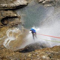
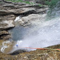
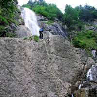
Der obere Teil hat einen alpinen Charakter, wobei ein Ausstieg sehr mühsam würde. Bei A1 ist es empfehlenswert, eine Rappel Guide zum Fixseil (Stahlseil) zu bauen. Es ist sehr rutschig hier und links wird man vom Wasser gegen den Fels gedrückt. Bei 2A Rappel vorteilhaft. Vor A4 großen Block links umgehen dann Traverse nach rechts und ein Seilgeländer zum Stand bauen.Der mittlere Teil ist offen und leicht begehbar.Ausstiegsmöglichkeiten überall.Der untere Teil beginnt dort, wo sich die Schlucht wieder verengt; hier ist auch der letzte Notausstieg nach links möglich.Nach 4 Abseilstellen kommt man zum Kernstück, dem 70 m Wasserfall (Wandbuch) der mit 2x Abseilen (10m/60m) oder 3x Abseilen (10m/35m/30m) überwunden wird. Nach weiteren 4 Abseilstellen ist man am Ende der Tour.
The upper part has an alpine character, where an exit would be very troublesome. At A1 it is recommended to build a rappel guide to the fixed rope (steel rope). It is very slippery here and on the left you are pushed against the rock by the water. With 2A Rappel advantageous. Before A4 large block left bypass then traverse to the right and build a rope traverse to stand.The middle part is open and easy to walk.Exit possibilities everywhere.The lower part begins where the canyon narrows again; here is also the last emergency exit to the left possible.After 4 rappel points you come to the core piece, the 70 m waterfall (wall book) which is overcome with 2x rappel (10m/60m) or 3x rappel (10m/35m/30m). After another 4 rappels you are at the exit of the tour.
Retour (30 min):
traduction alternative
➜
Langue originale
Es ist unbedingt darauf zu Achten, das Bachbett nach ca. 300 m nach links (Block) zu verlassen und einem alten Weg, später am Wiesenrand bis zum Güterweg zu folgen, dann links zurück zum Parkplatz.
It is essential to pay attention to leave the streambed after about 300 m to the left (block) and follow an old path, later on the edge of the meadow to the goods road, then left back to the parking lot.
Coordonnées:
Départ du Canyon
47.3286°, 9.89766°
↓↑
DMS: 47° 19" 42.96', 9° 53" 51.58'
DM: 47° 19.716", 9° 53.86"
Google Maps
Autriche Topographique
DMS: 47° 19" 42.96', 9° 53" 51.58'
DM: 47° 19.716", 9° 53.86"
Google Maps
Autriche Topographique
Fin du Canyon
47.3379°, 9.8998°
↓↑
DMS: 47° 20" 16.44', 9° 53" 59.28'
DM: 47° 20.274", 9° 53.988"
Google Maps
Autriche Topographique
DMS: 47° 20" 16.44', 9° 53" 59.28'
DM: 47° 20.274", 9° 53.988"
Google Maps
Autriche Topographique
Parking à l'entrée et à la sortie
47.34535°, 9.88926°
↓↑
DMS: 47° 20" 43.26', 9° 53" 21.34'
DM: 47° 20.721", 9° 53.356"
Google Maps
Autriche Topographique
DMS: 47° 20" 43.26', 9° 53" 21.34'
DM: 47° 20.721", 9° 53.356"
Google Maps
Autriche Topographique
Littérature:
Carte
Freytag & Berndt WK 364, Bregenzerwald, 1:50 000
Info canyon Cwiki
Info canyon Descente
Info canyon Ropewiki
09.03.2023
System User
⭐
★★★★★
📖
★★★
⚓
★★★
pas de traduction disponible
Info: Teile der Canyonbeschreibung wurden automatisiert übernommen. Konkret die Felder Weblinks, Koordinaten, Rating, Länge des Canyon, Einfachseil Mindestens von https://www.descente-canyon.com/canyoning/canyon/22065
09.03.2023
System User
⭐
★★★★★
📖
★★★
⚓
★★★
pas de traduction disponible
Daten importiert von https://canyon.carto.net/cwiki/bin/view/Canyons/WaterworldCanyon.html
Hydrologie:
pas de traduction disponible
https://vowis.vorarlberg.at/stationsInfo/tbl_Abflussstationen.aspx

