moins difficile
Chaude
v3 a3 II
2h10
35min
1h20
15min
670m
625m
45m
16m
2x20m
7
1000m
à pied
Évaluation:
★★★★★
2.5 (1)
Info:
★★★
0 ()
Belay:
★★★
0 ()
Résumé:
traduction alternative
➜
Langue originale
Unterer Abschnitt eines in seiner vollen Länge nicht sonderlich attraktiven Abseilcanyons, der in den Rivière du Galion mündet und dort noch einen attraktiven Schlusspunkt setzt.
Lower part of a rappel canyon that is not particularly attractive in its full length, which flows into the Rivière du Galion and adds an attractive final point.
Sud-Est
Basalte
Résumé:
traduction alternative
➜
Langue originale
Unterer Abschnitt eines in seiner vollen Länge nicht sonderlich attraktiven Abseilcanyons, der in den Rivière du Galion mündet und dort noch einen attraktiven Schlusspunkt setzt.
Lower part of a rappel canyon that is not particularly attractive in its full length, which flows into the Rivière du Galion and adds an attractive final point.
Accès:
pas de traduction disponible
siehe: https://www.google.com/maps/dir/15.9916091,-61.7290104/16.0097727,-61.6728652/@15.99843,-61.7081592,5080m/data=!3m1!1e3!4m2!4m1!3e0?entry=ttu
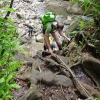
Approche (35 min):
pas de traduction disponible
siehe Karte und topo-Zeichnung bei https://ankanionla-madinina.com/ravine-chaude/
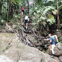
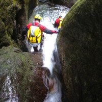
Tour (1 h 20):
pas de traduction disponible
siehe Fotos u. Video
Retour (15 min):
pas de traduction disponible
am Ende der Tour links hinaus und den Anmarschweg zurück
Coordonnées:
Départ du Canyon
Fin du Canyon
Parking à l'entrée et à la sortie
16.01039°, -61.67198°
↓↑
DMS: 16° 0" 37.4', -62° 19" 40.87'
DM: 16° 0.623", -62° 19.681"
Google Maps
DMS: 16° 0" 37.4', -62° 19" 40.87'
DM: 16° 0.623", -62° 19.681"
Google Maps
Littérature:
Carte
IGN TOP25 4605GT - Basse-Terre/La Soufrière/Les Saintes/Parc National de la Guadeloupe - 1:25.000
Livre Canyoning
Topographies. Les canyons de Guadeloupe Commission Canyon FFS, 1995
Info canyon Cwiki
Info canyon Descente
Info canyon Ropewiki
Vidéo
Autre info canyon
Autre info canyon
Autre info canyon
Autre info canyon
09.03.2023
System User
⭐
★★★★★
📖
★★★
⚓
★★★
pas de traduction disponible
Info: Teile der Canyonbeschreibung wurden automatisiert übernommen. Konkret die Felder Weblinks, Koordinaten, Rating, Länge des Canyon, Einfachseil Mindestens von https://www.descente-canyon.com/canyoning/canyon/22329
09.03.2023
System User
⭐
★★★★★
📖
★★★
⚓
★★★
pas de traduction disponible
Daten importiert von https://canyon.carto.net/cwiki/bin/view/Canyons/ChaudeCanyon.html
Hydrologie:


