un peu difficile
Tuwald
v4 a3 III
3h25
45min
1h10
1h30
980m
850m
130m
50m
Évaluation:
★★★★★
2.4 (3)
Info:
★★★
2 (2)
Belay:
★★★
1.5 (2)
Résumé:
traduction alternative
➜
Langue originale
Südseitiger Abseilcanyon mit mehrere Einstiegsmöglichkeiten hinunter in's Vomper Loch. Keine Sprung- oder Rutschmöglichkeiten. Fangt fast trocken an im obere Teil (achtung lawineresten) aber ist zu empfehlen im Fruhling.
Relatively short south-facing rappel canyon down into Vomper Loch. No jumps or slides.
Accès:
traduction alternative
➜
Langue originale
Von Schwaz im Inntal nach Vomp und im Ort in der Nähe der Kirche nach Norden in Richtung Vomperberg. Bei den folgenden Abzweigungen immer links halten in Richtung Gasthaus Karwendelrast. Hier angekommen Auto an geeigneter Stelle parken.
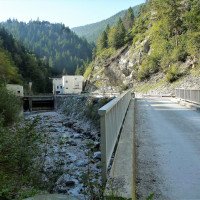
Alternativ kann man auch das Kraftwerk am Ende des Vomper Loches anfahren und dort parken.
From Schwaz in the Inn valley to Vomp and in the village near the church north towards Vomperberg. At the following junctions always keep left in the direction of Gasthaus Karwendelrast. Once here, park your car in a suitable place.
Approche (45 min):
traduction alternative
➜
Langue originale
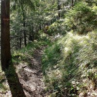
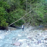
Vom Gasthaus Karwendelrast (860 m ü.NN) auf einer Forststraße ca. 1500 m in westl. Richtung, bis links ein Steig (Nr. 224) abgeht zum 'Hallangerhaus'. Bald kommt man zum Haag Bründl (Stub Bach). Links vorbei geht es auf dem nur schwach ansteigenden Pfad über dem Vomper Loch weiter westwärts. Nach etwa 45 Min. erreicht man den Tuwaldbach (In AV-Karte als Kühsoachgraben ausgewiesen).
From the Karwendelrast inn (860 m above sea level) on a forest road in a westerly direction for about 1500 m, until a path (no. 224) leads off to the left to the 'Hallangerhaus'. Soon you come to the Haag Bründl (Stub Bach). Pass it on the left and continue westwards on the only slightly ascending path above Vomper Loch. After about 45 min. you reach the Tuwaldbach (shown in AV map as Kühsoachgraben).
Tour (1 h 10):
traduction alternative
➜
Langue originale
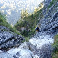
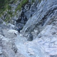
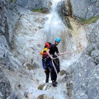
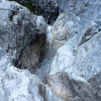
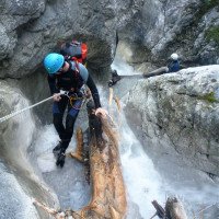
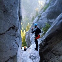
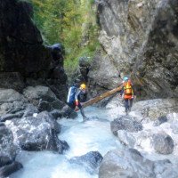
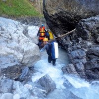
Abseilcanyon in wunderschönen weissen Kalkgestein. Keine Rutschen oder Sprünge.
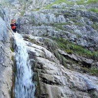
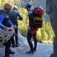
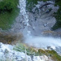
9 sunny (if the sun is shining) rappel to the high fall (50m). Then downclimb to Vomper Bach in a few minutes. No slides or jumps.\n
Retour (1 h 30):
traduction alternative
➜
Langue originale
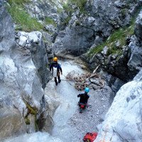
Entweder nach etwa 100 m im Vomper Loch links weglos durch den Buchenwald hinauf zum Anmarschweg und auf diesem zurück zum Auto.
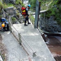
Oder im Vomper Loch weiter abwärts.Beim E-Werk (670 m ü.NN) rechts über die Leiter hinaus und links der Wasserfassung hinunter (das Absperr-Tor ist von innen zu öffnen). Von der z.T. betonierten ebenen Fläche zieht links ein Steig hinauf zum Gasthof Karwendelrast (ca. 25 Min. ab Wasserfassung).
Eine Auto-Umsetzung ist möglich, aber kaum lohnend.
Either after about 100 m in Vomper Loch turn left without a path through the beech forest up to the approach path and on this back to the car.\nOr in Vomper Loch continue downhill.We come here to a water drainage, but after a few hundred meters the streambed fills again with the amount that we were used to before the drainage.At the E-Werk (670 m above sea level) right over the ladder and down to the left of the water intake (the barrier gate can be opened from the inside). From the partly concreted flat area, a path on the left leads up to the Karwendelrast inn (approx. 25 min. from the water intake).\nA car transfer is possible, but hardly worthwhile.
Coordonnées:
Départ du Canyon
47.3493°, 11.6266°
↓↑
DMS: 47° 20" 57.48', 11° 37" 35.76'
DM: 47° 20.958", 11° 37.596"
Google Maps
Autriche Topographique
DMS: 47° 20" 57.48', 11° 37" 35.76'
DM: 47° 20.958", 11° 37.596"
Google Maps
Autriche Topographique
Fin du Canyon
47.3461°, 11.6271°
↓↑
DMS: 47° 20" 45.96', 11° 37" 37.56'
DM: 47° 20.766", 11° 37.626"
Google Maps
Autriche Topographique
DMS: 47° 20" 45.96', 11° 37" 37.56'
DM: 47° 20.766", 11° 37.626"
Google Maps
Autriche Topographique
Parking à l'entrée et à la sortie
47.34678°, 11.65522°
↓↑
DMS: 47° 20" 48.41', 11° 39" 18.79'
DM: 47° 20.807", 11° 39.313"
Google Maps
Autriche Topographique
DMS: 47° 20" 48.41', 11° 39" 18.79'
DM: 47° 20.807", 11° 39.313"
Google Maps
Autriche Topographique
Parkplatz oben (bei Karwendelrast)
Parking à l'entrée et à la sortie
47.33948°, 11.655°
↓↑
DMS: 47° 20" 22.13', 11° 39" 18'
DM: 47° 20.369", 11° 39.3"
Google Maps
Autriche Topographique
DMS: 47° 20" 22.13', 11° 39" 18'
DM: 47° 20.369", 11° 39.3"
Google Maps
Autriche Topographique
Parkplatz unten (beim Kraftwerk Vomperbach/Oberstufe)
Littérature:
Carte
1:50000
Livre Canyoning
Werner Baumgarten
2013
Livre Canyoning
Alexander Riml / Gunnar Amor
2012
Livre Canyoning
Werner Baumgarten
2010
Info canyon Cwiki
Info canyon Descente
Info canyon Ropewiki
23.08.2024
Jeroen Kirchner
⭐
★★★★★
📖
★★★
⚓
★★★
💧
Faible
Terminé ✔
pas de traduction disponible
D'autres utilisateurs ont été: Peter Lampacher
Wonderful Karwendeltour from Vomp. Almost dry in its upper part but recommended for its curvy shapes in compact, white limestone. To our joy we found most drops rebolted straight from the start, with single, generally well-placed glue-in bolts (8mm). The original anchors are still in place, but no longer used (all are missing quicklink). The lower section on the other hand is almost excessively equipped with chains and fixed ropes. We added one Tebylon anchor in the upper part where a hanger was missing (but the rock on this location was bad) otherwise the bolting is fine. With a minimal bolting kit, this canyon should be doable top-to-bottom. As the book says, an ice axe could be interesting early season. Vomper loch currently has more gravel than usual.
D'autres utilisateurs ont été: Peter Lampacher
23.08.2024
Peter Lampacher
⭐
★★★★★
📖
★★★
⚓
★★★
💧
Faible
Terminé ✔
traduction alternative
➜
Langue originale
D'autres utilisateurs ont été: Jeroen Kirchner
Alles gut, 1 Haken fehlt (frischer Murabgang), aber genug Bäume da
All good, 1 anchor missing (fresh debris flow), but enough trees there
D'autres utilisateurs ont été: Jeroen Kirchner
09.03.2023
System User
⭐
★★★★★
📖
★★★
⚓
★★★
pas de traduction disponible
Daten importiert von https://canyon.carto.net/cwiki/bin/view/Canyons/TuwaldCanyon.html
Nouveau rapport
Veuillez décrire brièvement et de manière concise les informations les plus importantes de la dernière visite ou les informations actuelles importantes sur le canyon. Si nécessaire avec des liens vers des vidéos, photos, etc.
*
*
*
Esc
Del
Hydrologie:
pas de traduction disponible
Depening on snowmelt/rain, the upper part has more or less (almost no) water. Almost by the end of the canyon, it receives plenty water from underground sources, hence is fresh whereas the upper part may feel quite warm and desert-like.
