un peu difficile
Torrente Soffia
v4 a4 IV
7h5
1h30
5h30
5min
780m
410m
370m
38m
17
1700m
à pied
Spécialités:
§ Interdiction
§ Interdiction
Évaluation:
★★★★★
4.6 (7)
Info:
★★★
2.8 (5)
Belay:
★★★
2.9 (6)
Résumé:
traduction alternative
➜
Langue originale
Ein einmaliges Juwel. Wahrscheinlich die schönste Schlucht in sehr weitem Umkreis. Sportlich anspruchsvoll, entsprechende Fachkenntnisse, Kondition und Ausrüstung erforderlich. Es wird alles geboten, was das gehobene Canyonautenherz begehrt. Kein Ausstieg für Stunden! Insgesamt deutlich weniger ernst als Val Clusa.
A unique jewel. Probably the most beautiful canyon in a very wide area. Demanding in terms of sport, appropriate expertise, fitness and equipment required. It offers everything a canyoneer's heart desires. No exit for hours! Altogether much less serious than Val Clusa.
Partie
Nom
Difficulté
Approche
Tour
Retour
Sud-Ovest
Résumé:
traduction alternative
➜
Langue originale
Ein einmaliges Juwel. Wahrscheinlich die schönste Schlucht in sehr weitem Umkreis. Sportlich anspruchsvoll, entsprechende Fachkenntnisse, Kondition und Ausrüstung erforderlich. Es wird alles geboten, was das gehobene Canyonautenherz begehrt. Kein Ausstieg für Stunden! Insgesamt deutlich weniger ernst als Val Clusa.
A unique jewel. Probably the most beautiful canyon in a very wide area. Demanding in terms of sport, appropriate expertise, fitness and equipment required. It offers everything a canyoneer's heart desires. No exit for hours! Altogether much less serious than Val Clusa.
Accès:
traduction alternative
➜
Langue originale
SS203 von Belluno Ri. Agordo nach Sospirolo und dann Ri. "Lago del Mis" Schöne Übernachtungsmöglichkeit am See (Auto/Zelt), nach der Brücke im Bereich "Cascate della Soffia" parken.
Take the SS203 from Belluno towards Agordo to Sospirolo and then towards "Lago del Mis" Nice overnight accommodation by the lake (car/tent), park after the bridge in the "Cascate della Soffia" area.
Approche (1 h 30):
traduction alternative
➜
Langue originale
Steile Asphaltstrasse bis Gena Alta (Fahrverbot fuer Nicht-Anrainer). Rechts bei Brunnen alten Forstweg, bis wir Bachbett erreichen.
Steep asphalt road to Gena Alta (driving ban for non-residents). Take the old forest road on the right at the fountain until near the streambed.
Tour (5 h 30):
traduction alternative
➜
Langue originale
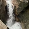
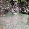
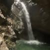
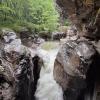
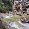
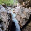
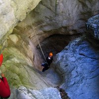
Zunächst enger werdenen Schlucht (2-3h) mit Rutschen, Sprüngen, Abseiler bis 30m. Dann der Zusammenfluß mit dem (auch sehr lohnenden Val Pisson). Eine Verschnaufpause auf Felsabsatz, dann 35m in gewaltigen Kessel abseilen. ("Mini-Trou de Fer"). Weiter abseilend wird's offener und etwas verspielter, aber es wartet noch einiges an Arbeit.. Hier haben wir Sprünge bis 18m absolviert...Letzlich gelangt man zu den Schaufällen am Ende vor der Einmündung in den See. Toll ist die kleine Halbhöhle mit Sitzecke aus Stein rechts. Je nach Pegelstand vom Lago del Mis evtl einige Meter Unterwasser!
First narrow canyon (2-3h) with slides, jumps, rappels up to 30m. Then the confluence with the Val Pisson (also very rewarding). A breather on a ledge, then a 35m rappel into a huge cauldron. ("Mini-Trou de Fer"). Further on the rappel becomes more open and a little more playful, but there is still a lot of work to do... Here we completed jumps of up to 18m... Finally, you reach the Schaufällen at the exit before the confluence with the lake. The small half-cave with a stone seating area on the right is great. Depending on the water level of the Lago del Mis, it may be a few meters underwater!
Retour (5 min):
traduction alternative
➜
Langue originale
Rechts hinaus und retour zu Parkplatz
Alternativ bis in den See Mis und von dort zum Parkplatz
Out to the right and back to the parking lot
Coordonnées:
Départ du Canyon
Parking à l'entrée et à la sortie
Parkplatz bei Gaststätte
Fin du Canyon
Sortie intermédiaire du canyon
Ein & Ausstieg kurz vor der Brücke möglich.
Littérature:
Carte
1/25000
Carte
1:25000
Livre Canyoning
Simon Flower
Cicerone
2012
Northern Italy and Ticino
Livre Canyoning
Pascal van Duin
2011
Livre Canyoning
Pascal van Duin
Edizioni TopCanyon
2009
100 Beschreibungen
Livre Canyoning
Stéphane Coté / Caracal et les Sancho Panza
2007
124 Canyon-Beschreibungen
Livre Canyoning
Maurizio Biondi / Francesco Cacace / Roberto Schenone
Adriambiente
2000
978-8890026010
Livre Canyoning
Michele Sivelli / Mario Vianelli
1988
Info canyon Cwiki
Info canyon Descente
Info canyon Ropewiki
Galerie
Autre info canyon
Rapport de voyage (ex. Blogpost)
07.09.2024
Daniele
⭐
★★★★★
📖
★★★
⚓
★★★
💧
Normale
Terminé ✔
traduction alternative
➜
Langue originale
Ancoraggi ottimi, pozze da verificare prima di tuffarsi. Usciti alla diga di cemento verso destra
Anchors good, puddles to check before diving. Exit at the concrete dam to the right.
04.08.2024
Gareth Evans
⭐
★★★★★
📖
★★★
⚓
★★★
Terminé ✕
pas de traduction disponible
Hello,
I was planning to run this canyon last year, and was told by people at the café near the exit that access to the canyon is forbidden and that rangers patrol and fine poeple using it. Does anyone know if this is still the case? Also @bina from your description is sounds like exit via the lake is prohibited by the land owner? Would be very greatful for any and all information!
Thanks
01.08.2024
Alex Arnold
⭐
★★★★★
📖
★★★
⚓
★★★
💧
Normale
Terminé ✔
traduction alternative
➜
Langue originale
Alles gut
All good
28.07.2024
Bina
⭐
★★★★★
📖
★★★
⚓
★★★
💧
Normale
Terminé ✔
traduction alternative
➜
Langue originale
D'autres utilisateurs ont été: Horst Lambauer Wolfgang Patrik Bartel
Eine tolle Schlucht 😃.
Bitte unbedingt die letzten 2 Abseiler nach der betonierten Stelle weglassen und auf einem Pfad zur Strasse aussteigen, Alle nachfolgenden Canyonisten werden es danken. (Ist die Bitte eines Einheimischen)
A great canyon 😃.
Please be sure to skip the last 2 rappels after the concreted section and exit on a path to the road, all canyonists following will thank you. (This is a request from a local)
D'autres utilisateurs ont été: Horst Lambauer Wolfgang Patrik Bartel
21.06.2024
Madie Ga
⭐
★★★★★
📖
★★★
⚓
★★★
Terminé ✔
pas de traduction disponible
Water level check photos
19.06.2024
Madie Ga
⭐
★★★★★
📖
★★★
⚓
★★★
💧
Normale
Terminé ✔
pas de traduction disponible
Apparently all anchors are good. Walk in 1 hr, canyon 2.45 ish, the lower section is not as nice or continuous
16.05.2024
Christian Balla
⭐
★★★★★
📖
★★★
⚓
★★★
🌊
Fou
Terminé ✕
traduction alternative
➜
Langue originale
Nach Regen aktuell nicht begehbar
Currently not accessible after rain
12.05.2024
Christian Balla
⭐
★★★★★
📖
★★★
⚓
★★★
💧
Normale
Terminé ✔
traduction alternative
➜
Langue originale
Ideale Bedingungen - Perfekte Wassermenge, sehr Klares Wasser, Wetter top und Stabil. Canyon sehr gut eingerichtet.
https://www.christian-balla.de/Soffia
Ideal conditions - perfect amount of water, very clear water, weather top and stable. Canyon very well equipped.
https://www.christian-balla.de/Soffia
09.03.2023
System User
⭐
★★★★★
📖
★★★
⚓
★★★
pas de traduction disponible
Daten importiert von https://canyon.carto.net/cwiki/bin/view/Canyons/TorrenteSoffiaCanyon.html
22.08.2022
Bubtore
⭐
★★★★★
📖
★★★
⚓
★★★
💧
Faible
Terminé ✔
traduction alternative
➜
Langue originale
Zu zweit im Eiltempo Forti, Pisson, Sofia gemacht (und noch den Rucksack einer anderen Gruppe aus einem Pool gefischt), weil wir danach noch 5 Stunden Autofahrt hatten.
The two of us made Forti, Pisson, Sofia in a rush (and fished another group's rucksack out of a pool) because we still had a 5-hour drive afterwards.
Nouveau rapport
Veuillez décrire brièvement et de manière concise les informations les plus importantes de la dernière visite ou les informations actuelles importantes sur le canyon. Si nécessaire avec des liens vers des vidéos, photos, etc.
*
*
*
Esc
Del
Hydrologie:
