un peu difficile
Fallbach (Hall)
v4 a3 IV
4h40
1h20
3h
20min
1260m
960m
300m
60m
3x60m
12
1100m
à pied
Évaluation:
★★★★★
3.5 (11)
Info:
★★★
2.4 (7)
Belay:
★★★
2.5 (9)
Résumé:
traduction alternative
➜
Langue originale
Südseitige Ausrichtung; Folge meist höherer Abseiler, keine Einschluchtung, keine Rutschen oder Sprünge möglich.
South-facing orientation; consequence usually higher rappel, no gorge, no slides or jumps possible.
Résumé:
traduction alternative
➜
Langue originale
Südseitige Ausrichtung; Folge meist höherer Abseiler, keine Einschluchtung, keine Rutschen oder Sprünge möglich.
South-facing orientation; consequence usually higher rappel, no gorge, no slides or jumps possible.
Accès:
traduction alternative
➜
Langue originale
Wir verlassen die Inntalautobahn A12 etwa 14 km östlich von Innsbruck über die Ausfahrt Hall-Mitte. Wir fahren auf der 171a nach Hall hinein, folgen im Prinzip immer dieser Straße, die nach Überfahren der ersten großen Kreuzung als L225 um den Kern der Stadt in einem Rechtsbogen herumzieht. Dann wendet sie sich an einem Kreisverkehr nach Norden in Richtung Absam, Gnadenwald. Wir durchfahren Absam und folgen ziemlich am Ortsende weiter der L225, die in einem leichten Rechtsknick nach NO zieht, in Richtung Gnadenwald. 1200m nach diesem Knick passieren wir die Waldkapelle. 150m weiter biegen wir links in den Wald ab und parken unser Auto auf der großen Freifläche.
Auch eine Autoumsetzung ist möglich (7 km). Dazu fährt man mit dem 2. Auto zurück auf die Walderstr. und hier 1,9 km links in Richtung Gnadenwald Hier in St. Martin biegen wir links ab auf die Mautstraße (Hinterhornstraße), die hinauf führt zur Hinterhornalm (1522m). Wir fahren auf dieser Mautstraße 5 km bergauf. In der Nähe einer markanten Rechtsserpentine auf 1400m Höhe stellen wir das zweite Auto ab auf einer zum Parken ausgewiesenen Stelle ab.\nAn dieser Rechtskehre nehmen wir den Wanderweg in westlicher Richtung (Wegweiser Alpensöhnehütte). Er führt im Wesentlichen fast höhengleich, insgesamt gesehen sogar leicht abfallend unter den Gipfeln der Nordkette entlang. Wir queren einige Sturzbäche, passieren den Kandlerboden und komme nach etwa 1 Std. zur "Schäferhütte". Direkt danach erreichen wir das geröllige Bachbett des Fallbachs.
We leave the Inntalautobahn A12 about 14 km east of Innsbruck via the exit Hall-Mitte. We drive into Hall on the 171a, basically always following this road, which after passing the first major intersection goes around the core of the town in a right-hand bend as the L225. Then it turns north at a traffic circle in the direction of Absam, Gnadenwald. We drive through Absam and follow pretty much at the end of the town further the L225, which moves in a slight right bend to the NE, in the direction of Gnadenwald. 1200m after this bend we pass the Waldkapelle. 150m further we turn left into the forest and park our car on the large open space.
A shuttle is also possible (7 km). To do this, take the 2nd car back to Walderstr. and here 1.9 km left in the direction of Gnadenwald Here in St. Martin we turn left onto the toll road (Hinterhornstraße), which leads up to the Hinterhornalm (1522m). We drive uphill on this toll road for 5 km. Near a prominent rightward haipin bend at 1400m we park the second car on a spot marked for parking.\nAt this rightward haipin bend we take the hiking trail in a westerly direction (signpost Alpensöhnehütte). It leads essentially almost level, overall even slightly sloping along under the peaks of the Nordkette. We cross some torrents, pass the Kandlerboden and after about 1 hour we come to the "Schäferhütte". Immediately after that we reach the scree-strewn streambed of the Fallbach.
Approche (1 h 20):
traduction alternative
➜
Langue originale
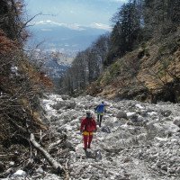
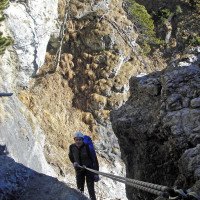
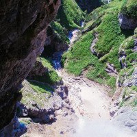
Im Bereich des Parkplatzes nehmen 3 Forststaßen ihren Anfang. Wir nehmen die mittlere bergauf und kommen nach etwa 300m zu einer Verzweigung. Von rechts kommt die Piste, die wir nach dem Ausstieg herabkommen werden. Wir halten uns aber auf der Piste halblinks ("Rundweg Usterberg"). Wir kommen zu einer ersten scharfen Linkskehre (885m üNN), lassen später eine Abzweigung nach links (935m üNN) unbeachtet und kommen bei 980m üNN zu einer zweiten scharfen Linkskehre. Wir nehmen nun den hier abgehenden Steig, der in nördlicher Richtung in gewissem Abstand zwar, aber letztlich parallel zum Fallbach aufwärts zieht. Etwa auf Höhe 1240m üNN stoßen wir auf einen horizontal querenden Wanderweg, dem wir nach rechts bis in das Bachbett des Fallbaches folgen (Einstieg).
In the area of the parking lot 3 forest roads start. We take the middle one uphill and after about 300m we come to a junction. From the right comes the slope, which we will descend after the exit. But we keep half-left on the slope ("Rundweg Usterberg"). We come to a first sharp leftward haipin bend (885m a.s.l.), later we ignore a turnoff to the left (935m a.s.l.) and at 980m a.s.l. we come to a second sharp leftward haipin bend. We now take the path that leaves here, which goes up in a northerly direction at a certain distance, but ultimately parallel to the Fallbach. At about 1240m a.s.l. we come across a horizontally crossing hiking trail, which we follow to the right until we reach the streambed of the Fallbach (entry).
Tour (3 h):
traduction alternative
➜
Langue originale
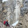
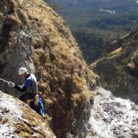
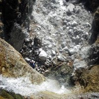
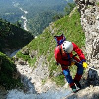
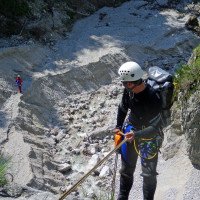
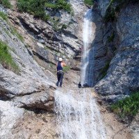
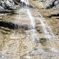
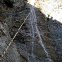
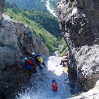
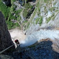
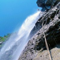
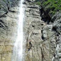
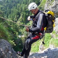
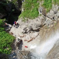
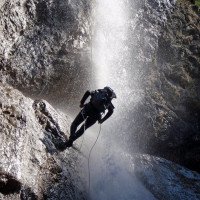
Zu Beginn wechseln Hatscher im breiten Kiesbett ab mit längeren Abseilern. Nach dem 6. Abseiler erreichen wir den 90m-Wasserfall. Früher hat man orograf. links des Falls abgeseilt, wobei der Zwischenstand etwa auf halber Strecke zu finden war. Nun sollte der 90m-Fall am besten von orograf. rechts angegangen werden. Der Zwischenstand ist dann nach etwa 30m (30m/60m). Achtung: Oben hört man ein eventuelles Pfeifsignal nicht, auch nicht mit der sehr lauten Tornado!
Dann geht es über kleinere Stufen abwärts, bis man die Tour mit zwei höheren Stufen (30m u. 40m) abschließt.
Vorsicht: Immer wieder werden militärische Blindgänger gefunden!
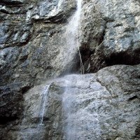
At the beginning, hacks in the wide gravel bed alternate with longer rappels. After the 6th rappel we reach the 90m waterfall. In the past, one rappelled orographic. to the right of the fall, with the intermediate belay point about halfway up. Now the 90m fall should be approached best from orographic. left, because after about 45m you come directly to the intermediate belaystation (chain anchor + several glued anchors) on a small platform. Attention: At the top you will not hear a possible whistle signal, even with the very loud Tornado! Orographically on the right there is also a chain anchor to cope with the 90m fall, but here the intermediate belay is said to be not good (not verified). Since the left variant is perfectly secured and problem-free, you should prefer it.
Then it goes down over smaller steps until you finish the tour with two higher steps (30m u. 40m).
Caution: Again and again military duds are found!
Retour (20 min):
traduction alternative
➜
Langue originale
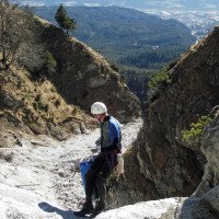
Aus dem Kiesbett rechts hinaus nehmen wir den deutlichen Pfad. Er bringt uns zu einem Forstweg, den wir abwärts gehen bis zum Parkplatz.
Out of the gravel bed on the right we take the clear path. It brings us to a forest road, which we go down to the parking lot.
Coordonnées:
Départ du Canyon
47.3256°, 11.5293°
↓↑
DMS: 47° 19" 32.16', 11° 31" 45.48'
DM: 47° 19.536", 11° 31.758"
Google Maps
Autriche Topographique
DMS: 47° 19" 32.16', 11° 31" 45.48'
DM: 47° 19.536", 11° 31.758"
Google Maps
Autriche Topographique
Fin du Canyon
47.3222°, 11.5302°
↓↑
DMS: 47° 19" 19.92', 11° 31" 48.72'
DM: 47° 19.332", 11° 31.812"
Google Maps
Autriche Topographique
DMS: 47° 19" 19.92', 11° 31" 48.72'
DM: 47° 19.332", 11° 31.812"
Google Maps
Autriche Topographique
Parking à l'entrée et à la sortie
47.31208°, 11.53164°
↓↑
DMS: 47° 18" 43.49', 11° 31" 53.9'
DM: 47° 18.725", 11° 31.898"
Google Maps
Autriche Topographique
DMS: 47° 18" 43.49', 11° 31" 53.9'
DM: 47° 18.725", 11° 31.898"
Google Maps
Autriche Topographique
Littérature:
Carte
Carte
Carte
1:50000
Livre Canyoning
Werner Baumgarten
2013
Livre Canyoning
Alexander Riml / Gunnar Amor
2012
Livre Canyoning
Werner Baumgarten
2010
Info canyon Cwiki
Info canyon Descente
Info canyon Ropewiki
14.04.2025
Jeroen Kirchner
⭐
★★★★★
📖
★★★
⚓
★★★
💧
Faible
Terminé ✔
pas de traduction disponible
D'autres utilisateurs ont été: Manuel Reindl
Sequence of open waterfalls. C(+-)90: started rightbank-diagonal across the flow- to left bank on very solid handrails & belay stations. We used 60m ropes. The new anchors are nice, though some added redundancy for some would be better.
D'autres utilisateurs ont été: Manuel Reindl
28.02.2025
Tobias Beiser
⭐
★★★★★
📖
★★★
⚓
★★★
💧
Faible
Terminé ✔
traduction alternative
➜
Langue originale
Zustieg komplett frei von Schnee und Eis. Im Canyon selbst auch kein Eis vorhanden, Haken alle soweit OK.
Im Becken vom C90 liegt noch eine Menge Schnee
Access completely free of snow and ice. No ice in the canyon itself, anchors all OK so far.
There is still a lot of snow in the basin of the C90
15.11.2024
Clarissa Linder
⭐
★★★★★
📖
★★★
⚓
★★★
💧
Faible
Terminé ✔
traduction alternative
➜
Langue originale
D'autres utilisateurs ont été: Peter Lampacher
Durch die offene Ausrichtung eignet sich der Fallbach auch ideal für eine Vollmond-Tour.
Thanks to its open orientation, the Fallbach is also ideal for a full moon tour.
D'autres utilisateurs ont été: Peter Lampacher
27.10.2024
Gregor Bernsteiner
⭐
★★★★★
📖
★★★
⚓
★★★
💧
Normale
Terminé ✔
traduction alternative
➜
Langue originale
Alle Stände OK.
Wir sind beim 90m Abseiler rechts abgeseilt. Zwischenstand bei 25m dann min. 65m weiter (ACHTUNG die 60m in der Beschreibung passt nicht!!!!!!)
All belays OK.
We rappelled right at the 90m rappel. Intermediate stand at 25m then min. 65m further (ATTENTION the 60m in the description does not fit!!!!!!)
15.08.2024
Clarissa Linder
⭐
★★★★★
📖
★★★
⚓
★★★
💧
Normale
Terminé ✔
traduction alternative
➜
Langue originale
D'autres utilisateurs ont été: Maik Plank
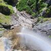
2 neue Haken gebohrt. 90m Wasserfall links in einem Stück abgeseilt. Zur Mittagszeit Sonnenstand perfekt, Regenbögen bei jedem Abseiler.
2 new anchors drilled. 90m waterfall left rappel in one piece. Perfect sun position at midday, rainbows on every rappel.
D'autres utilisateurs ont été: Maik Plank
04.08.2024
Patrick Summerer
⭐
★★★★★
📖
★★★
⚓
★★★
💧
Normale
Terminé ✔
traduction alternative
➜
Langue originale
D'autres utilisateurs ont été: Clarissa Linder Maik Plank
Alles OK. Den 90m Wasserfall haben wir diesmal auf der rechten Seite ohne Zwischenstand abgeseilt, aber rechts ist eine scharfe Kante, die das Seil aufraut.
Everything is OK. This time we rappelled the 90m waterfall on the right side without an intermediate belay, but there is a sharp edge on the right that roughens the rope.
D'autres utilisateurs ont été: Clarissa Linder Maik Plank
03.08.2024
fiumicicolibernotom
⭐
★★★★★
📖
★★★
⚓
★★★
💧
Normale
Terminé ✔
pas de traduction disponible
Automatisch importiert von Descente-Canyon.com für Canyon Fallbach
Très belle descente. Le relais RG de la grande cascade est mieux placé pour prendre le relais intermédiaire.
(Quelle: https://www.descente-canyon.com/canyoning/canyon-debit/21636/observations.html)
03.08.2024
fiumicicoli
⭐
★★★★★
📖
★★★
⚓
★★★
💧
Normale
Terminé ✔
pas de traduction disponible
Automatisch importiert von Descente-Canyon.com für Canyon Fallbach
Enchaînement très sympa, croiser la gerbe au milieu de la c90 pour chopper le relai était intéressant avec le debit du jour mais tout a fait faisable : le depart en rive gauche est plus adapté pour arriver direct sur le relai
(Quelle: https://www.descente-canyon.com/canyoning/canyon-debit/21636/observations.html)
21.07.2024
Clarissa Linder
⭐
★★★★★
📖
★★★
⚓
★★★
💧
Haut
Terminé ?
traduction alternative
➜
Langue originale
D'autres utilisateurs ont été: Maik Plank
Kurz vor 90m-Wasserfall orografisch rechts bei Gewitter den Notausstieg genommen (trotz kleinem Einzugsgebiet in Sekunden plötzlich deutliche Zunahme des Wasserstands).
Steiler Hang ca 50m nach oben - am Weg steht ein Pfosten mit Haken, von welchem bei Bedarf auch nachgesichert werden kann.
Haken bis dorthin ok.
Handy-Empfang in der Schlucht vorhanden.
Shortly before the 90m waterfall, orographic right, take the emergency exit during a thunderstorm (despite the small catchment area, the water level suddenly increases significantly within seconds).
Steep slope approx. 50m upwards - there is a post with anchors on the way, from which you can also belay if necessary.
Anchors up to there ok.
Cell phone reception available in the canyon.
D'autres utilisateurs ont été: Maik Plank
14.10.2023
Gregor Bernsteiner
⭐
★★★★★
📖
★★★
⚓
★★★
💧
Faible
Terminé ✔
traduction alternative
➜
Langue originale
Alle Stände in Ordnung
All stands in order
21.05.2023
Tobi
⭐
★★★★★
📖
★★★
⚓
★★★
💧
Normale
Terminé ✔
traduction alternative
➜
Langue originale
Alle Stände in Ordnung, großteils nur 1 Haken.
Großer Baum im zweiten Wasserfall.
All stands in order, largely only 1 hook.
Large tree in the second waterfall.
09.03.2023
System User
⭐
★★★★★
📖
★★★
⚓
★★★
pas de traduction disponible
Info: Teile der Canyonbeschreibung wurden automatisiert übernommen. Konkret die Felder Weblinks, Koordinaten, Rating, Länge des Canyon, Einfachseil Mindestens von https://www.descente-canyon.com/canyoning/canyon/21636
09.03.2023
System User
⭐
★★★★★
📖
★★★
⚓
★★★
pas de traduction disponible
Daten importiert von https://canyon.carto.net/cwiki/bin/view/Canyons/FallbachbeiHallinTirolCanyon.html
Nouveau rapport
Veuillez décrire brièvement et de manière concise les informations les plus importantes de la dernière visite ou les informations actuelles importantes sur le canyon. Si nécessaire avec des liens vers des vidéos, photos, etc.
*
*
*
Esc
Del
Hydrologie:
